INSEE UAV at Drone Tech Asia 2024: Showcasing Advanced UAV & LiDAR Solutions
- INSEE UAV

- Mar 17, 2025
- 2 min read
INSEE UAV at DronTech Asia 2024: Showcasing Advanced UAV & LiDAR Solutions
📍 Location: Bangkok, Thailand
📅 Date: November 25-27, 2024
The DronTech Asia 2024 exhibition was a major highlight in the UAV and geospatial technology industry, bringing together experts, innovators, and industry leaders from across the region. INSEE UAV was honored to participate in this prestigious event, showcasing our flagship product, the INSEE-250 UAV, alongside the advanced YellowScan LiDAR system. This event provided the perfect opportunity to introduce our cutting-edge drone solutions to professionals in surveying, mapping, infrastructure inspection, and environmental monitoring.

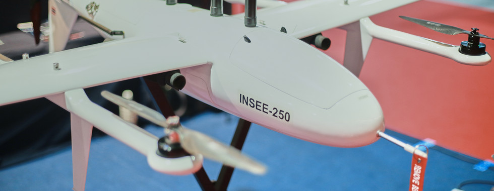
INSEE-250 UAV: A Game-Changer in Aerial Surveying
At DronTech Asia 2024, we brought the INSEE-250 UAV for live demonstrations and detailed presentations. Attendees had the chance to see firsthand how our high-performance VTOL UAV is revolutionizing aerial mapping and industrial applications.
🔹 VTOL Design: Combines fixed-wing endurance with multirotor flexibility
🔹 Extended Flight Time: Maximizes efficiency for large-area surveys
🔹 High Payload Capacity: Compatible with LiDAR, RGB, and multispectral sensors
🔹 Intelligent Flight Control: Powered by our in-house INSEE Pilot software and Ground Station
The INSEE-250 UAV is designed for high-precision surveying, infrastructure monitoring, and emergency response, delivering unparalleled performance and reliability.
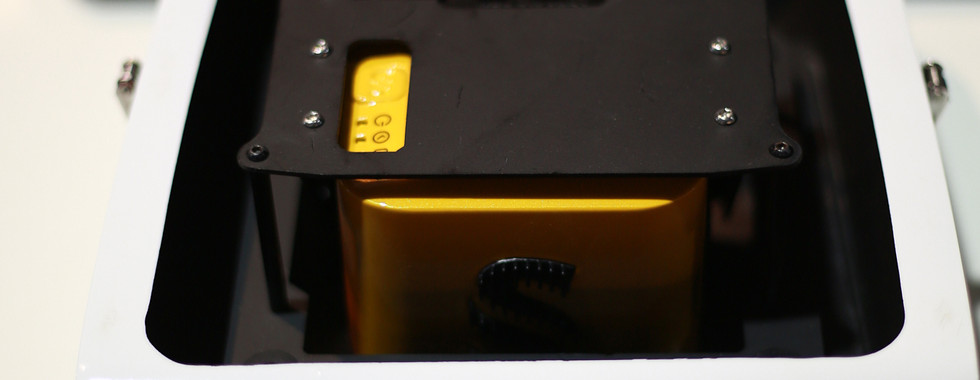
Unlocking the Power of YellowScan LiDAR
One of the key highlights of our showcase was the integration of YellowScan LiDAR with INSEE-250 UAV. Our team demonstrated how this combination enables high-resolution 3D mapping, providing exceptional accuracy for industries such as:
📍 Forestry & Environmental Monitoring – Precise vegetation analysis and terrain modeling
📍 Infrastructure Inspection – Power lines, bridges, and roads
📍 Construction & Mining – Volume calculations and topographic mapping
Visitors explored real-world LiDAR data outputs, showcasing the superior accuracy and efficiency of our UAV-LiDAR integration.
Engaging with Industry Leaders
DronTech Asia 2024 was an excellent platform for networking and collaboration. Our booth attracted professionals from diverse industries, including government agencies, private enterprises, and research institutions. Many attendees were particularly interested in:
✅ How INSEE-250 UAV enhances efficiency in surveying projects
✅ The accuracy and precision of YellowScan LiDAR for geospatial applications
✅ Real-world use cases of our UAV in large-scale operations
We were excited to discuss custom UAV solutions, explore new partnerships, and share insights on the future of drone technology.


Looking Forward
The overwhelming interest at DronTech Asia 2024 reaffirms our mission to drive innovation in UAV technology. We are committed to expanding our solutions and continuing to support professionals in geospatial surveying, infrastructure development, and environmental monitoring.
📌 Want to learn more about INSEE-250 UAV? Contact us today for more information on how our UAV technology can elevate your operations.
📧 Email: info@thaiskyvision.com
📞 Phone: +668-1402-5355
Thank you to everyone who visited our booth—see you at the next industry event! 🚀

Comments