INSEE UAV at INTERGEO 2024: Showcasing Cutting-Edge UAV & LiDAR Solutions
- INSEE UAV

- Mar 17, 2025
- 2 min read
INSEE UAV at INTERGEO 2024: Showcasing Cutting-Edge UAV & LiDAR Solutions

📍 Location: Stuttgart, Germany
📅 Date: September 24-26, 2024
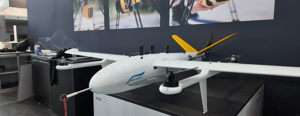
The INTERGEO 2024 exhibition in Stuttgart brought together the world’s leading experts in geospatial technology, and INSEE UAV was proud to be part of this prestigious event. This year, we showcased our INSEE-250 UAV, a high-performance VTOL drone designed for mapping, surveying, and various industrial applications. Alongside our UAV, we also presented the advanced YellowScan LiDAR solutions, demonstrating the power of integrated drone-based LiDAR mapping.

Bringing INSEE-250 UAV to the Global Stage
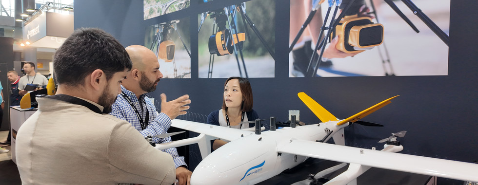
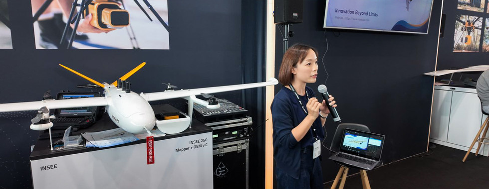
At our booth, visitors had the exclusive opportunity to experience the INSEE-250 UAV up close. Designed for long-endurance missions, high-precision mapping, and seamless VTOL operation, the INSEE-250 is a game-changer in aerial surveying. Our team conducted live presentations, explaining how our in-house INSEE Pilot software and Ground Station make UAV operations intuitive and efficient.
Key Features of INSEE-250 UAV:
✅ VTOL Capability – Combines the advantages of fixed-wing endurance and multirotor flexibility
✅ High Payload Capacity – Supports LiDAR, multispectral, and RGB cameras
✅ Long Flight Time – Maximizes efficiency for large-area surveys
✅ User-Friendly Ground Station – Developed for seamless mission control


YellowScan LiDAR Integration for Enhanced Mapping
One of the highlights of our showcase was the integration of YellowScan LiDAR with INSEE-250. Visitors saw firsthand how this combination provides high-precision terrain mapping, vegetation analysis, and infrastructure inspection. Our team demonstrated:
🔹 High-accuracy point cloud data acquisition
🔹 Rapid LiDAR data processing for topographic mapping
🔹 Use cases in forestry, mining, and construction
The synergy between INSEE UAV and YellowScan allows surveyors and geospatial professionals to capture accurate data more efficiently than ever before.
Engaging with Industry Experts at INTERGEO
Beyond our booth presentations, the INSEE UAV team engaged with professionals from surveying, construction, infrastructure, and environmental monitoring industries. The event provided an excellent platform to exchange ideas, discuss industry challenges, and explore new collaborations.
We were thrilled to receive great feedback from attendees who recognized INSEE-250 UAV as an innovative and reliable solution for geospatial applications. Many visitors were particularly interested in how our UAV’s VTOL design and extended flight endurance can optimize their field operations.
Looking Ahead
The success of INTERGEO 2024 reaffirms our commitment to advancing UAV technology for geospatial professionals. We look forward to continuing collaborations with partners worldwide and bringing our cutting-edge UAV solutions to more industries.
📌 Missed INTERGEO 2024? Contact us to learn about INSEE-250 UAV and how it can elevate your aerial surveying projects.
📧 Email: info@thaiskyvision.com
📞 Phone: +66-1402-5355
Stay tuned for our next exhibition—see you at the next global geospatial event! 🚀

Comments