360° Surveying
& Mapping
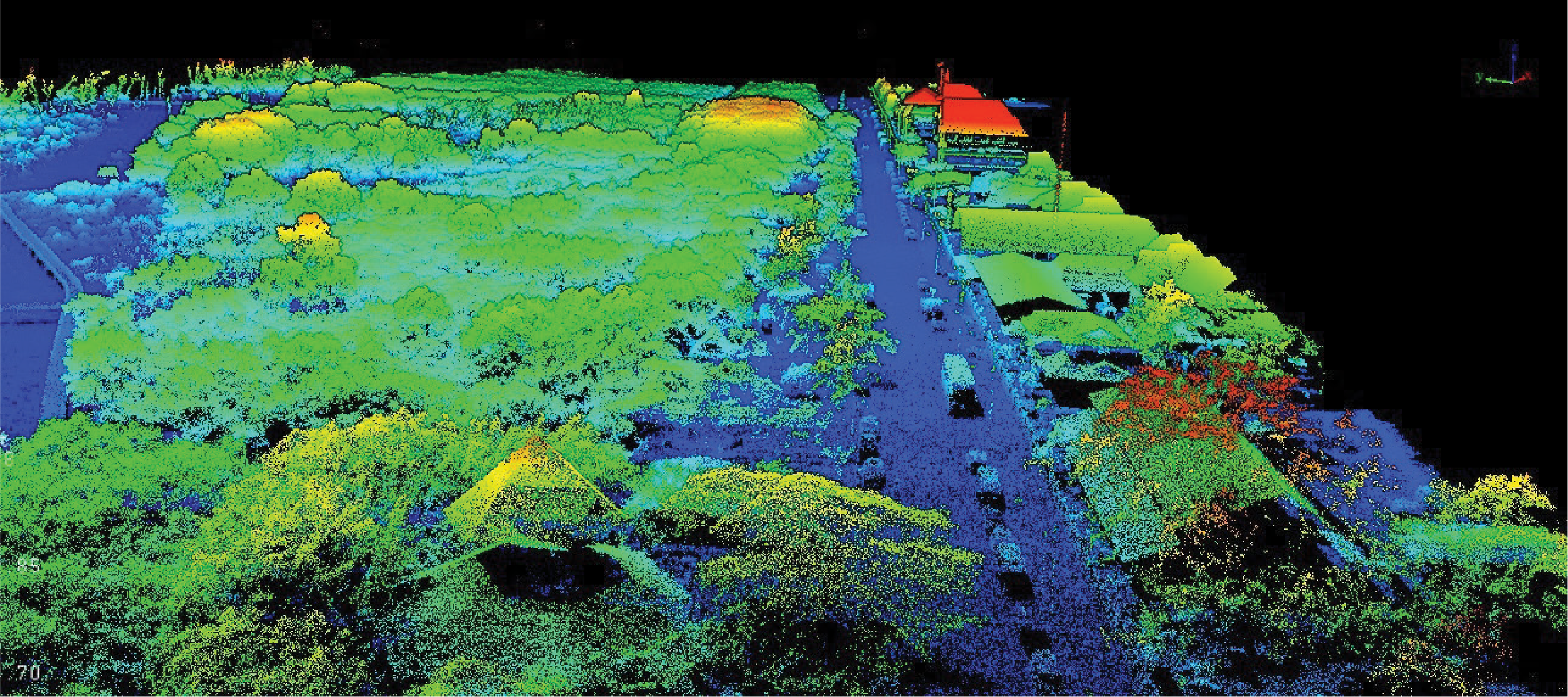
Long-range 360° laser scanner เก็บข้อมูลรอบทิศ — ครอบคลุมพื้นที่กว้างได้ในเที่ยวบินเดียว เหมาะกับงาน Corridor Mapping, Powerline และ Mining Surveying
Powerful
& Lightweight
น้ำหนัก 1.80 kg (ไม่รวมแบตเตอรี่) — รองรับ Multirotor, VTOL, Single-rotor UAV รวมถึง Light Crewed Aircraft และ Fly & Drive
Long Operational Range
ระยะยิงเลเซอร์ไกลถึง 300 m แนะนำให้บินที่ AGL 120 m — Precision 2 cm และ Accuracy 2 cm พร้อม GNSS-Inertial SBG Quanta Micro
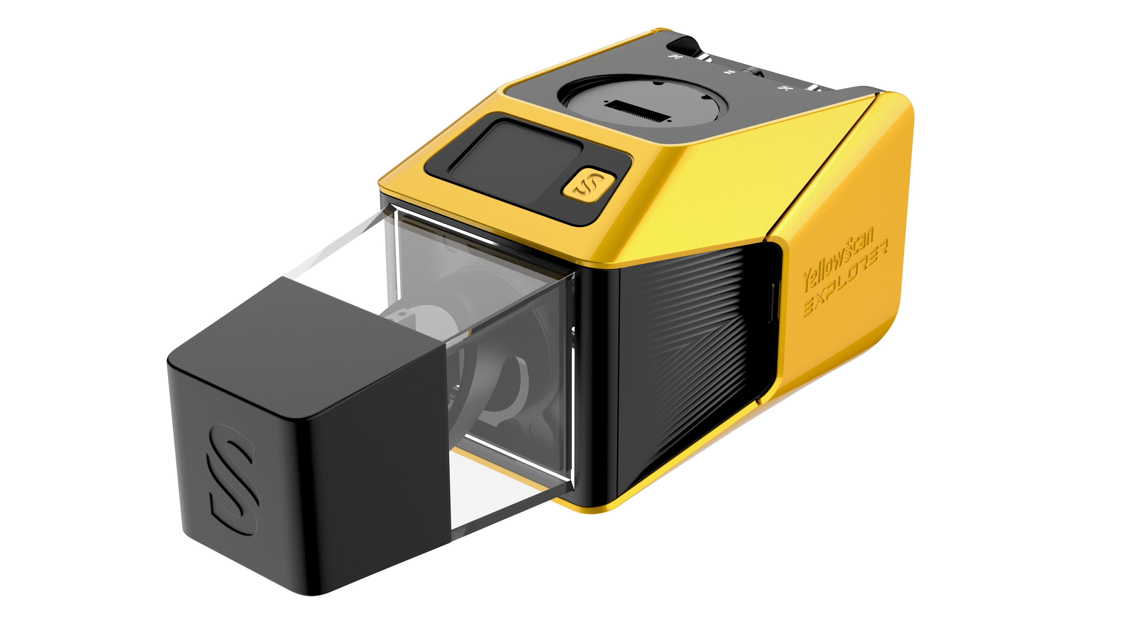
Hotswappable Batteries
แบตเตอรี่แบบ Hotswappable 2 × 2 ก้อน เปลี่ยนกลางสนามได้ทันที — บินภารกิจต่อเนื่องโดยไม่ต้องปิดเครื่อง พร้อม Integrated Camera Global Shutter 2MP สำหรับ Colorization
Technical Specifications.
System Components.
Laser Scanner
GNSS-Inertial & Camera
Hardware
- YellowScan Explorer unit
- 2 × 2 Batteries (Hotswappable)
- UAV GNSS Antenna และ Cable
- USB Flash Drives 2 ชิ้น
- Rugged Pelicase
- เอกสาร Documentation
- Compatible Platform: INSEE-250
Services
- รับประกัน 1 ปี + Technical Support ไม่จำกัด
- Training แบบ In-person หรือ Online
- Boresight Calibration Certificate
- Local Support โดย Thai Sky Vision ตัวแทนอย่างเป็นทางการในไทย
Software
- YellowScan CloudStation — Generate, Visualize, Adjust Strips, Classify, Colorize และ Export Point Cloud
- SBG Qinertia — Post-process GNSS-Inertial data
- Optional: LiveStation, CloudStation Strip Adjustment / Terrain / Colorization Modules
CloudStation
Visualize, Inspect, Colorize จาก Orthophotos และ Export ข้อมูลพร้อมใช้งาน — รวมอยู่ในแพ็กเกจแล้ว
CloudStation
เพิ่ม Data Quality Refinement, Classification, Color Enrichment และ Export Features ขั้นสูง
CloudStation
ครบทุกฟีเจอร์ — รวม Orthophoto Generation และ Command Line (ytk) สำหรับ Automation & Batch Processing
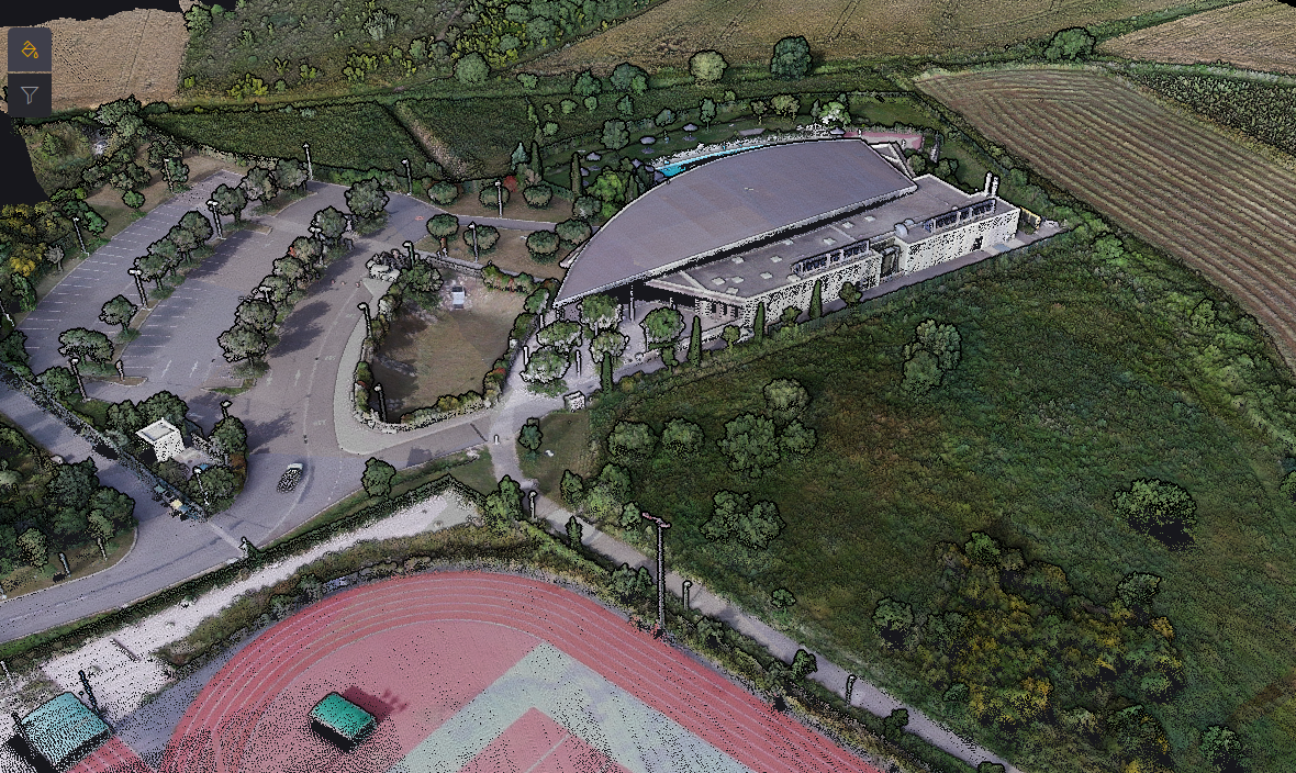
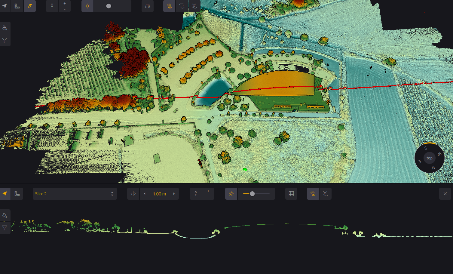
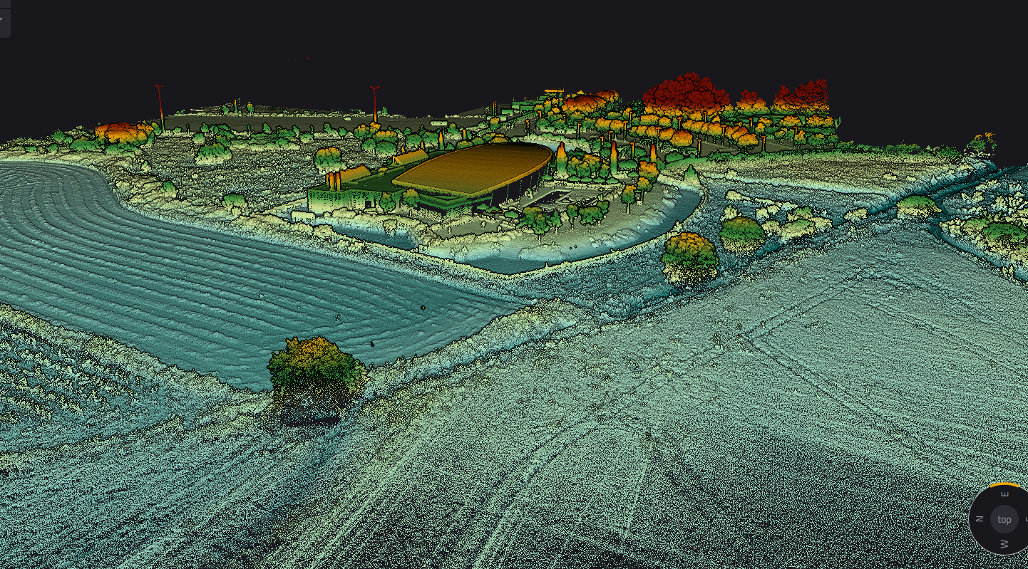
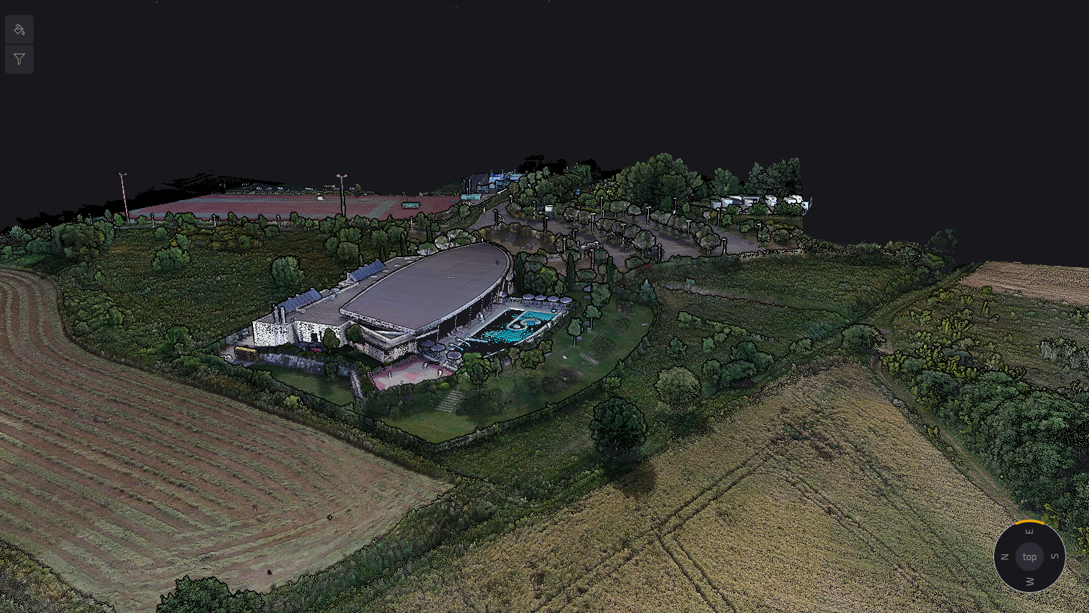
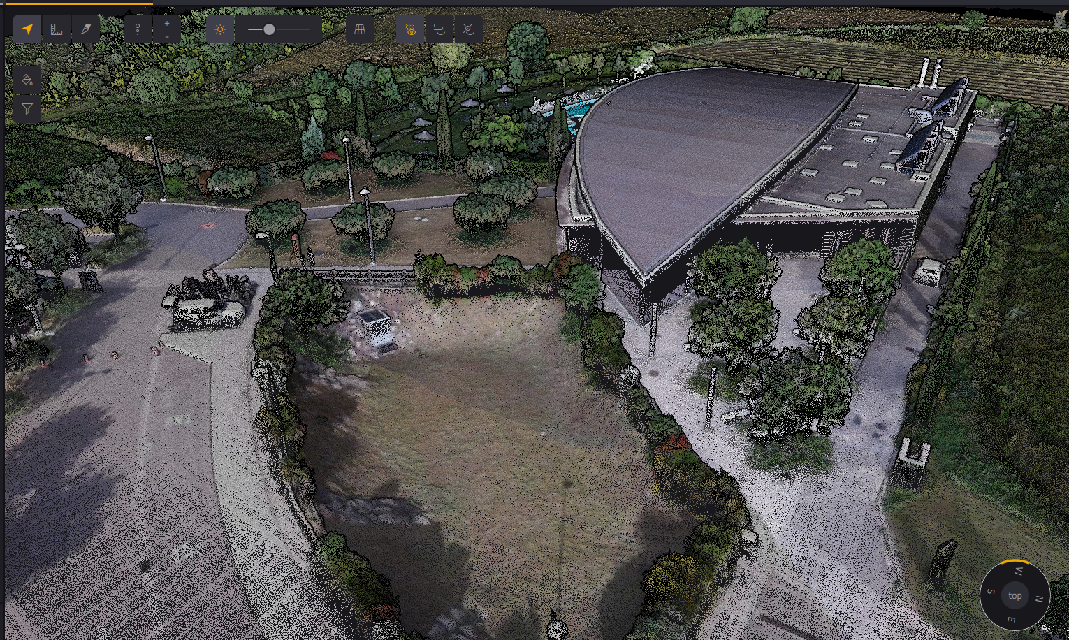
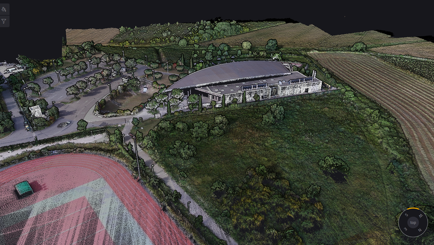
หมายเหตุ: ภาพตัวอย่างเหล่านี้เป็นผลงาน Reference จาก YellowScan ทั่วโลก ไม่ใช่ผลงานของ INSEE UAV — แสดงศักยภาพของ Sensor เท่านั้น
พร้อมขยายขีดความสามารถงานสำรวจ
ด้วย Explorer แล้วหรือยัง?
ติดต่อ Thai Sky Vision ตัวแทนจำหน่าย YellowScan อย่างเป็นทางการในประเทศไทย — รับคำปรึกษาเรื่อง Integration บน INSEE-250 และ After-Sales Support ครบวงจร
Thai Sky Vision Co., Ltd. — Official YellowScan Distributor in Thailand