
7 Echoes Per Shot
See Through Vegetation
Multi-echo technology บันทึก return ได้ถึง 7 ระดับต่อ shot — ทะลุเรือนยอดป่าได้คมชัด ดึงข้อมูลพื้นดินจากใต้พุ่มไม้ เหมาะสำหรับงานสำรวจป่าและพื้นที่ปกคลุมหนา
Long Range
640m Laser Reach
ระยะวัดสูงสุด 640 เมตร รองรับการบินสูงถึง 240m AGL — บินสูง = ครอบคลุมพื้นที่กว้างกว่าในเที่ยวเดียว ลดจำนวน flight line ในงาน corridor และพื้นที่ขนาดใหญ่
Fast Coverage
3.5M Points/sec
ยิงเลเซอร์ได้ 500,000 shots/sec สร้าง point cloud สูงสุด 3.5 ล้านจุดต่อวินาที — ครอบคลุมพื้นที่กว้างไว ลด flight time
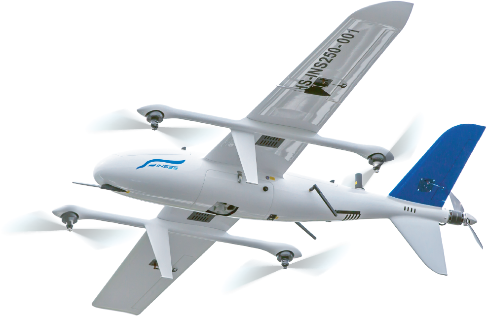
Multi-Platform
Built for Any UAV
รองรับทั้ง Multi-rotor, Single-rotor, VTOL Fixed-wing และ Fixed-wing UAV — น้ำหนัก 1,950g ทำงานได้บนหลายแพลตฟอร์ม เหมาะกับ INSEE-350 สำหรับ Long-Range Mission
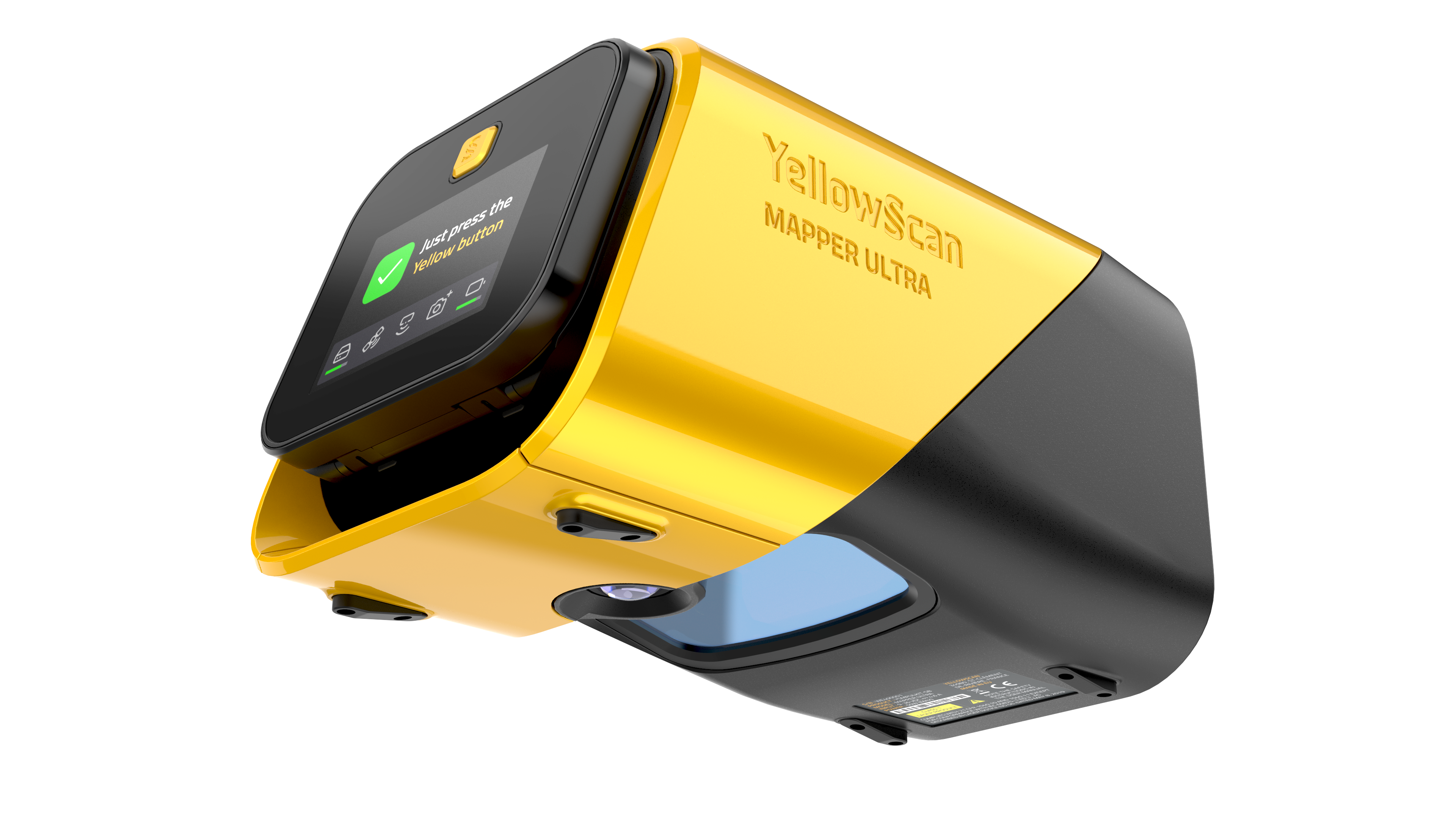
Technical Specifications.
System Components.
Laser Scanner
GNSS / INS & Imaging
Operational Parameters.
| Parameter | Value |
|---|---|
| Typ. Flight Speed | 10 m/s |
| Typ. Flying Height | 120 m AGL |
| Max Rec. Flying Height | 240 m AGL (@ 100 kHz PRR) |
| Point Density | 300 pts/m² @ 50m AGL, 10 m/s |
| High-density (30m, 10 m/s) | 1,086 pts/m² @ 500 kHz PRR |
| Fast Coverage (70m, 30 m/s) | 155 pts/m² @ 500 kHz PRR |
| Operating Temp. | -10°C to +40°C |
* Point density is theoretical maximum with all shots yielding max echoes. May vary depending on flight conditions, terrain, and survey environment. Maximum flight height varies depending on selected PRR.
Hardware
- YellowScan Mapper Ultra unit
- แบตเตอรี่ 2 ก้อน
- กล่อง Rugged Pelicase
- GNSS Antenna + Cable
- CF Express cards 2 ใบ
- เอกสารคู่มือการใช้งาน
Services
- รับประกัน 1 ปี + Technical Support ไม่จำกัด
- Training แบบ In-person หรือ Online
- Boresight Calibration Certificate
- Local Support โดย Thai Sky Vision ตัวแทนอย่างเป็นทางการในไทย
Software
- SBG Qinertia — Post-process GNSS & inertial data
- CloudStation Essential — Visualize, inspect, colorize & export
- อัปเกรดได้เป็น CloudStation Pro / Ultimate
- Optional: LiveStation (real-time in-flight monitoring)
Extend Your Capabilities.
Mounting & Hardware
Software & Real-time
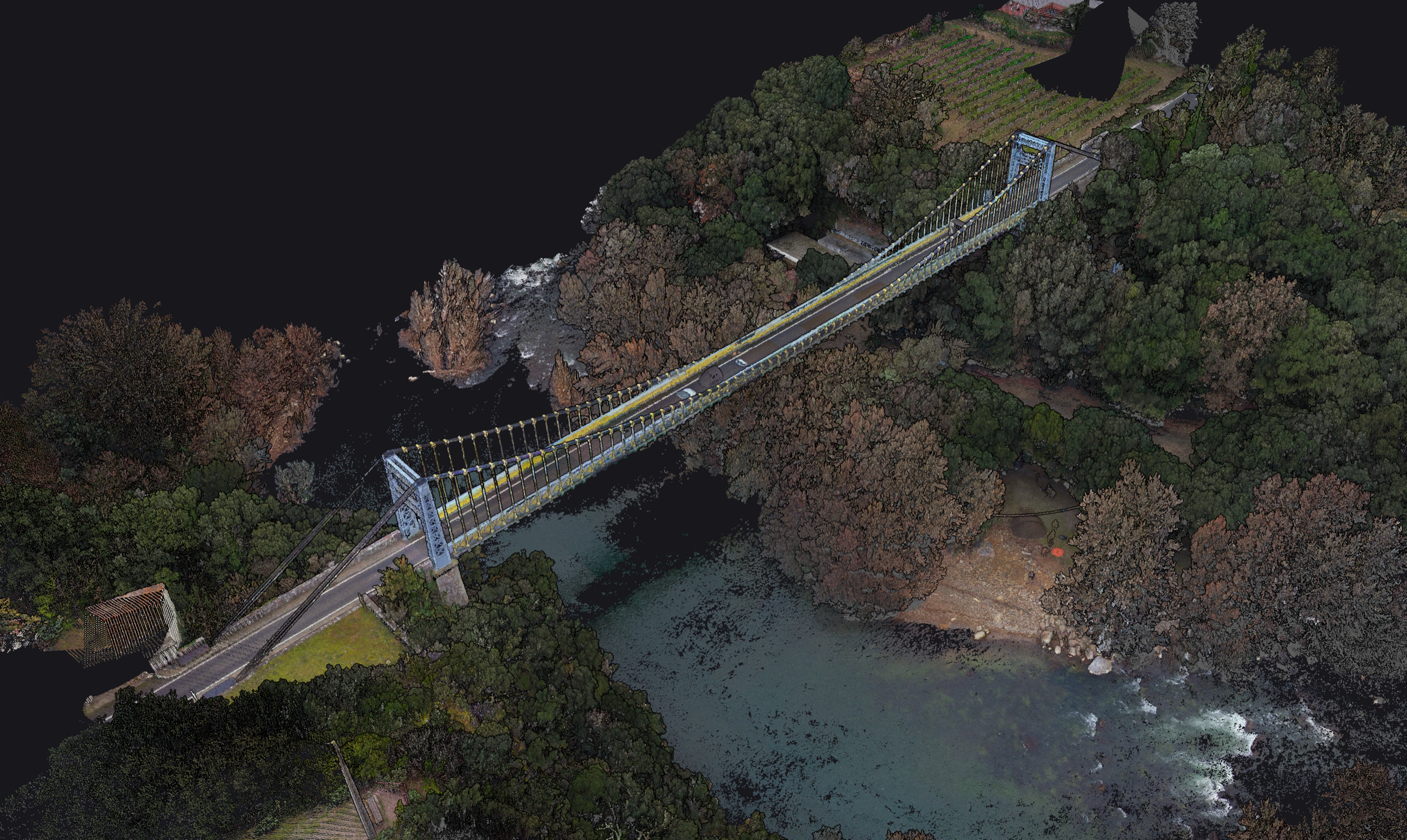
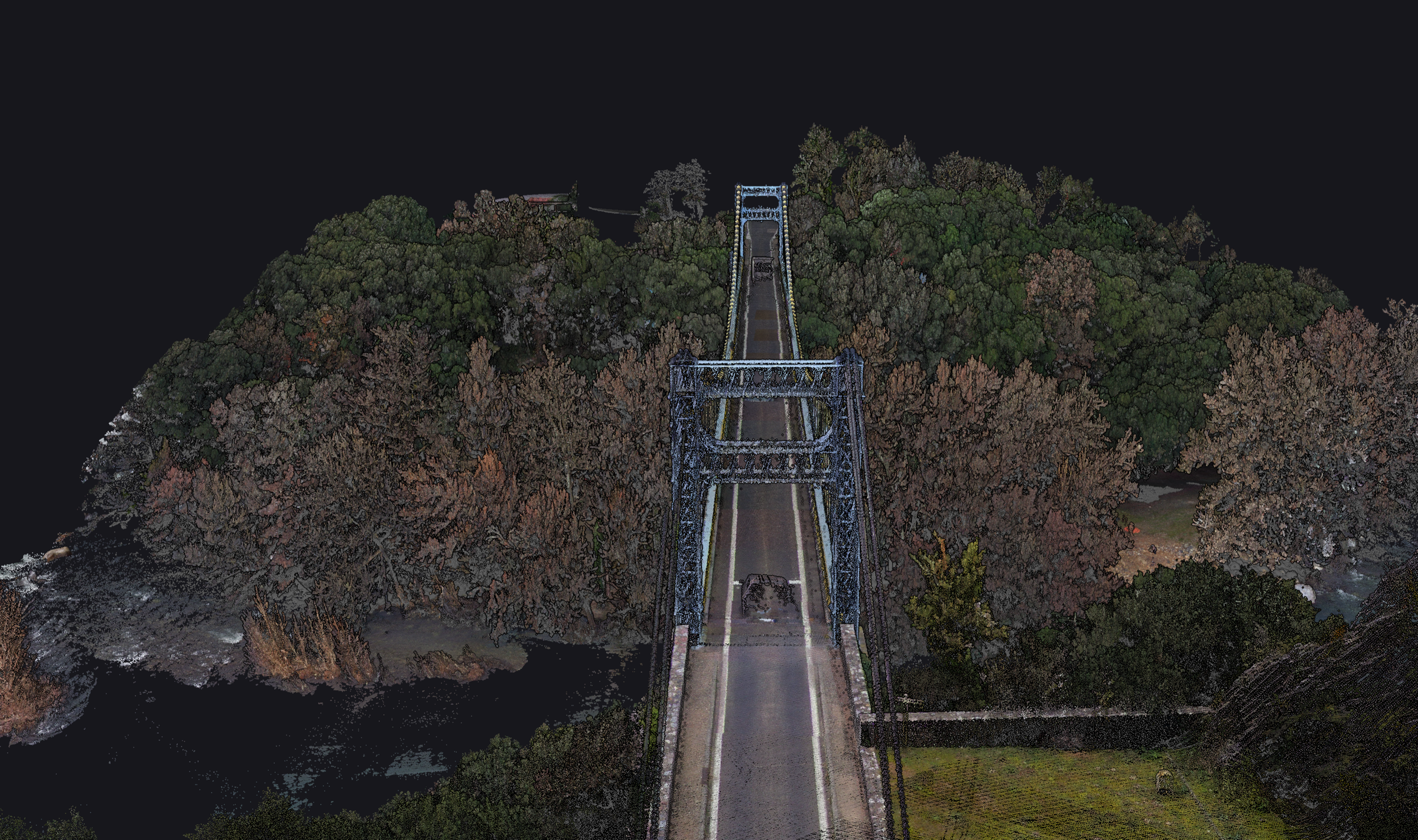
Point Cloud Use Cases.
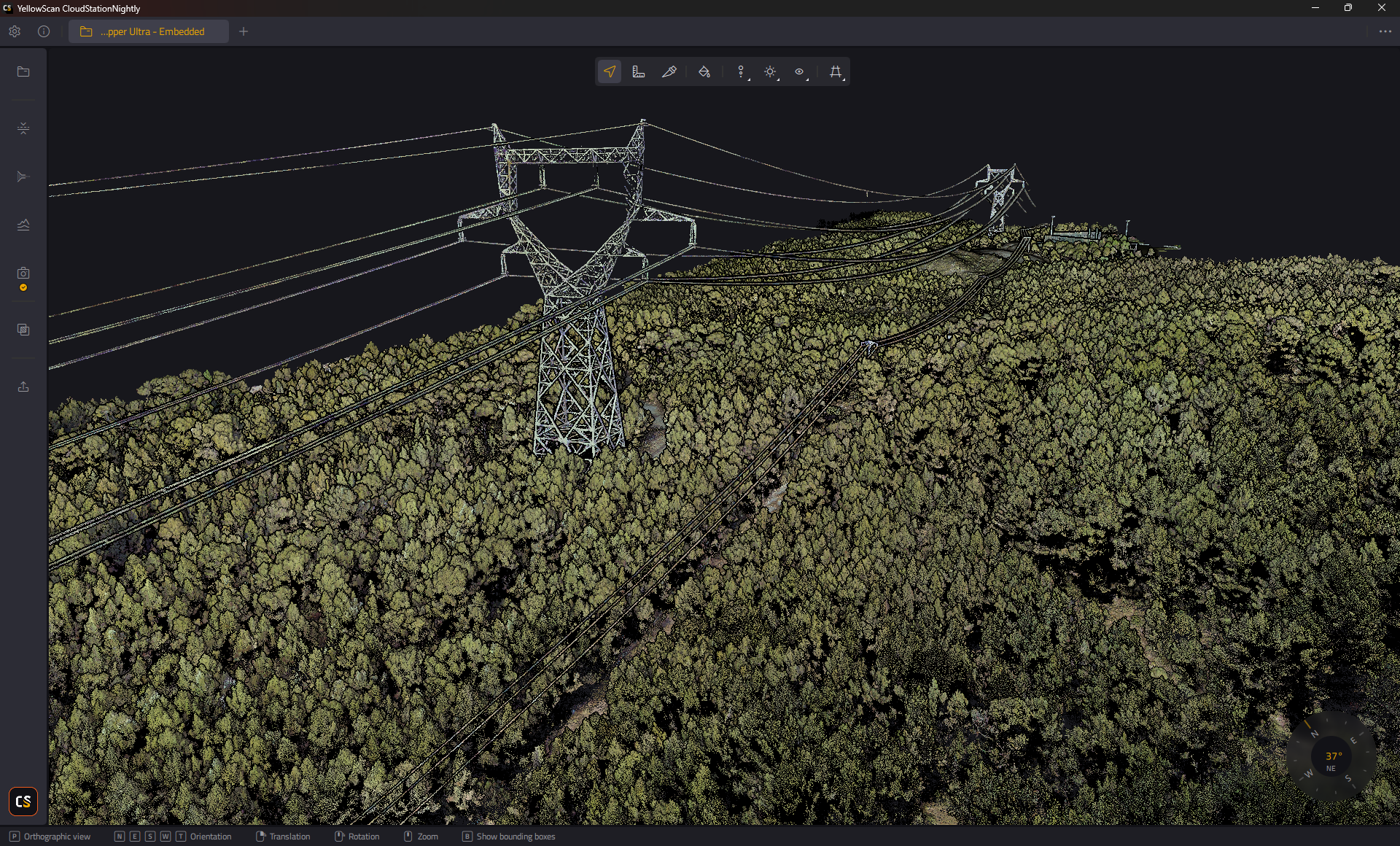


หมายเหตุ: ภาพ Point Cloud ในส่วนนี้เป็น Reference Material จาก YellowScan แสดง use cases ของ Mapper Ultra ในงานหลากหลายรูปแบบ — ไม่ใช่ผลงานที่บันทึกด้วย INSEE UAV โดยตรง
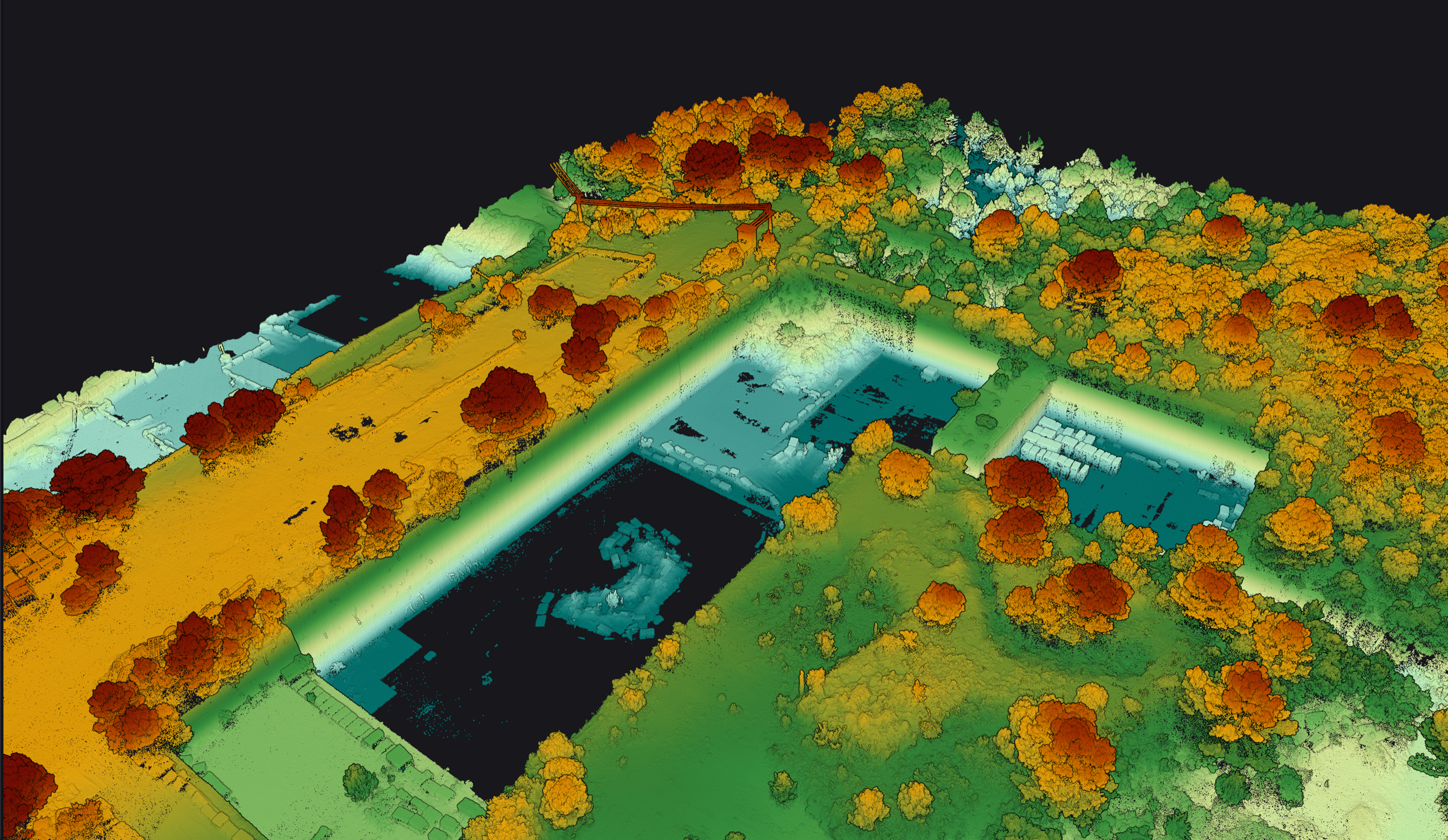
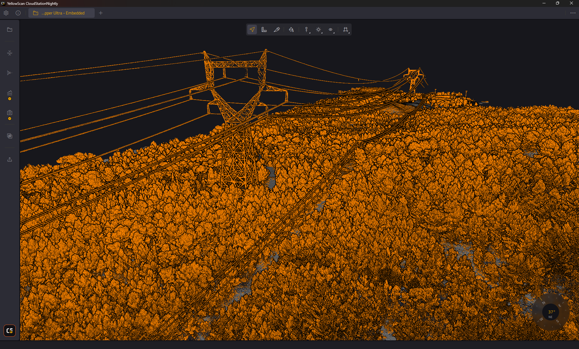

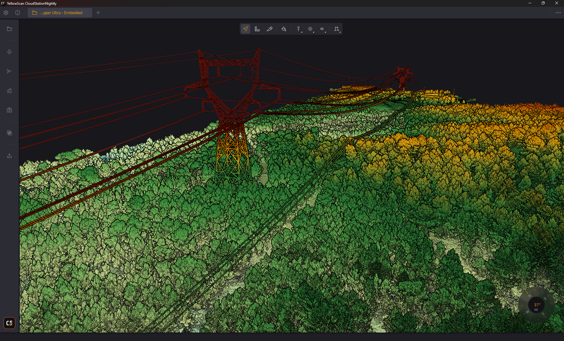
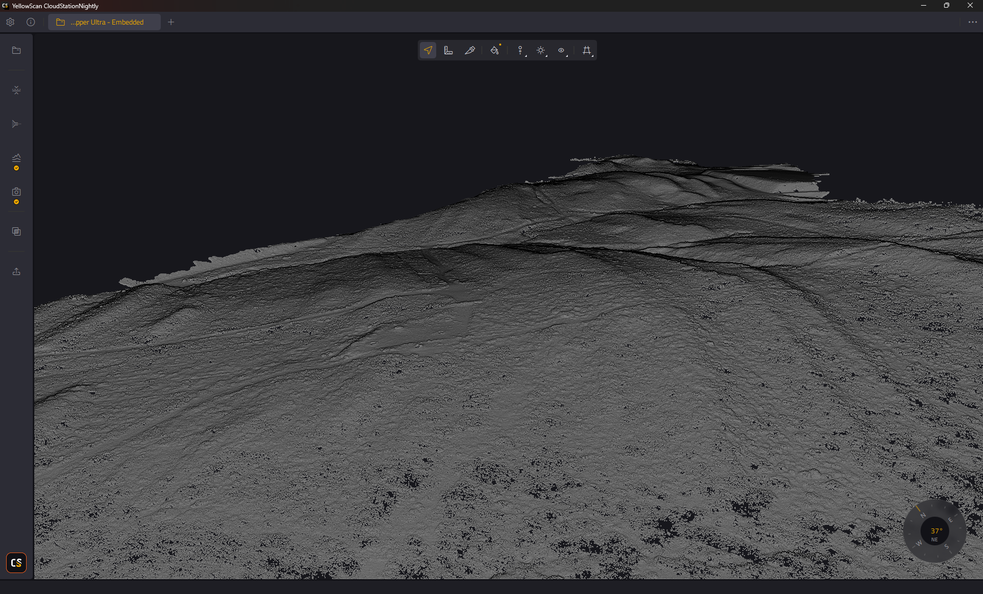

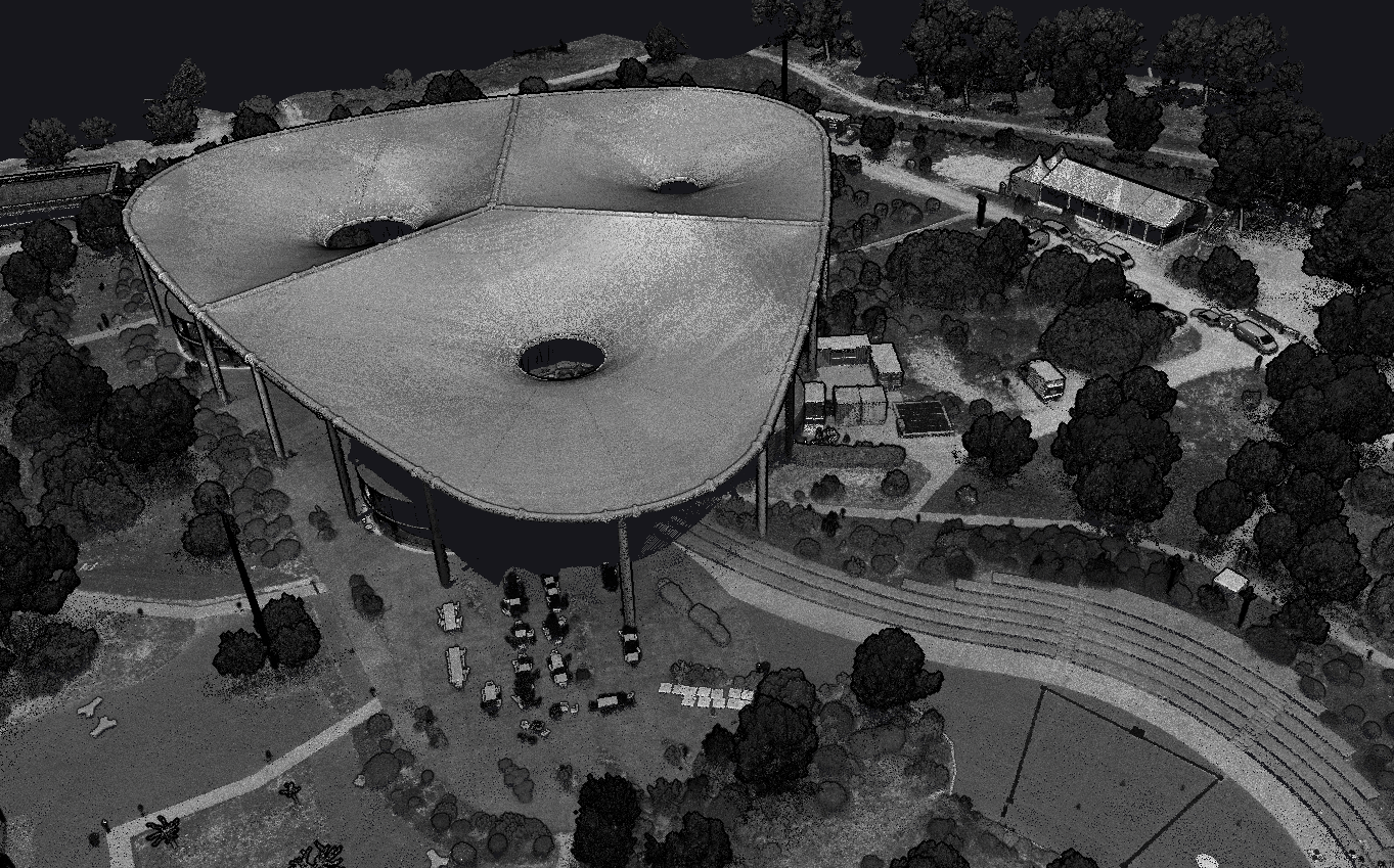
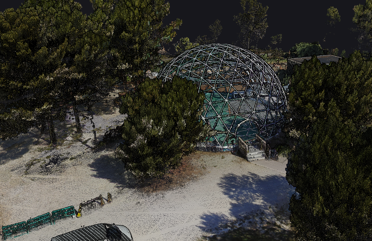
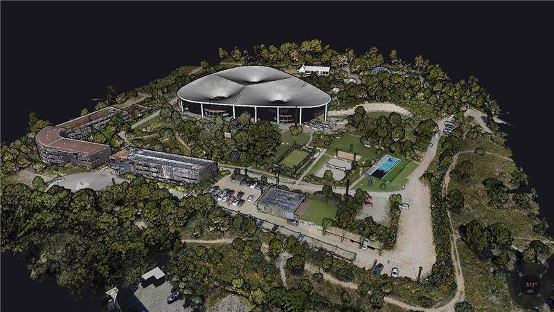
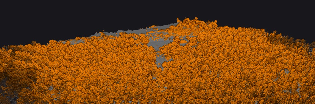
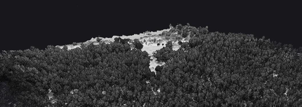
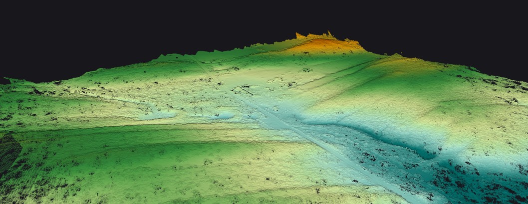

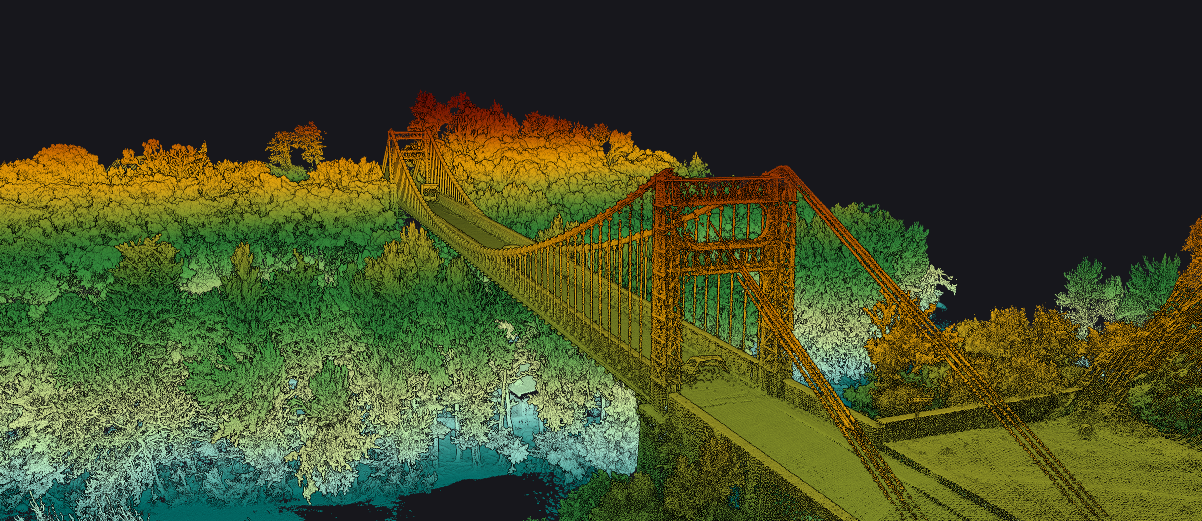
หมายเหตุ: ภาพตัวอย่างเหล่านี้เป็นผลงาน Reference จาก YellowScan ทั่วโลก ไม่ใช่ผลงานของ INSEE UAV — แสดงศักยภาพของ Sensor เท่านั้น
พร้อมบินไกล สแกนคมชัด
กับ Mapper Ultra แล้วหรือยัง?
ติดต่อ Thai Sky Vision ตัวแทนจำหน่าย YellowScan อย่างเป็นทางการในประเทศไทย — รับคำปรึกษา สาธิตระบบ Long-Range LiDAR และ After-Sales Support ครบวงจร
Thai Sky Vision Co., Ltd. — Official YellowScan Distributor in Thailand