Topography &
Water Mapping
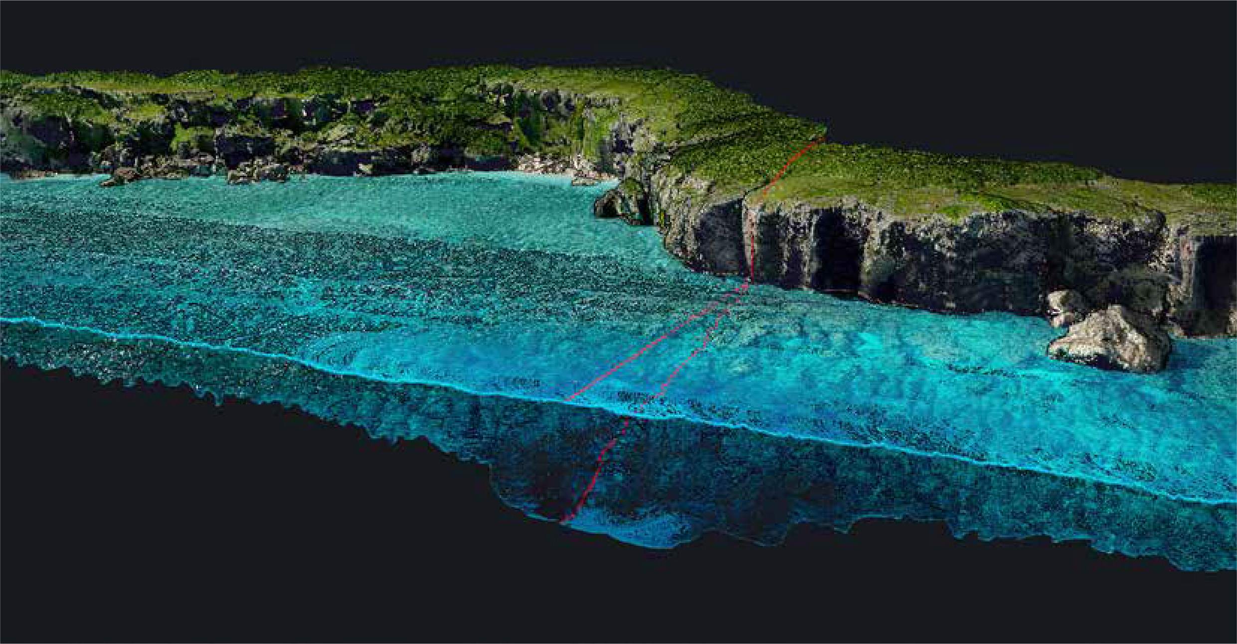
สำรวจพื้นผิวบนบกและใต้น้ำพร้อมกันในเที่ยวบินเดียว ด้วย Green Laser 532 nm ที่ทะลุผิวน้ำได้ — ลดเวลาและค่าใช้จ่ายในการสำรวจชายฝั่ง แม่น้ำ และอ่างเก็บน้ำ
Easy to Use
and Process
เปิดระบบด้วย ปุ่มเดียว (Single-Button Operation) ทำงานง่าย ไม่ซับซ้อน พร้อมซอฟต์แวร์ CloudStation สำหรับ Post-Processing ข้อมูลอย่างรวดเร็ว
Built-in 2MP
Global Shutter Camera
กล้อง RGB ในตัวแบบ Global Shutter สำหรับ Colorize Point Cloud ได้ทันที ให้ภาพสีคมชัดแม้บินเร็ว โดยไม่ต้องพกกล้องเพิ่ม
Safe Operational
Range
ออกแบบให้ใช้งานได้อย่างปลอดภัยในระดับ Laser Class 3B พร้อมอุปกรณ์ป้องกัน Laser Safety Goggles ในชุดจัดส่ง — มั่นใจในทุกภารกิจ
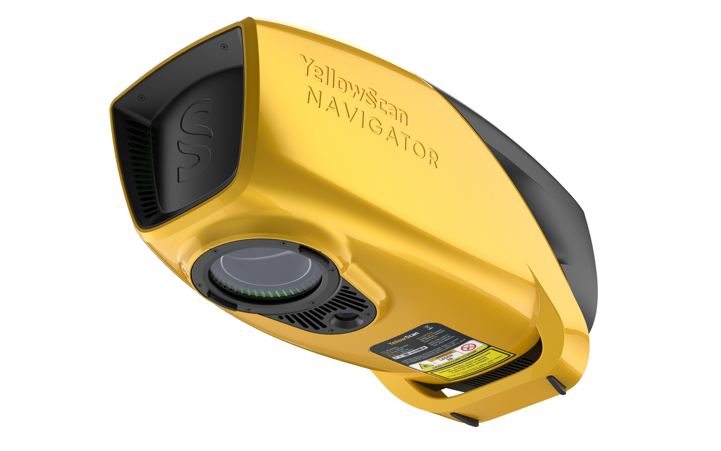
Technical Specifications.
System Components.
Laser Scanner
GNSS / INS
Operational Parameters.
| Parameter | Value |
|---|---|
| Typ. Flight Speed | 5 m/s |
| Typ. Flying Height | 80 m AGL |
| Max Rec. Flying Height | 100 m AGL |
| Point Density | 20 pts/m² @ 80m AGL, 5 m/s |
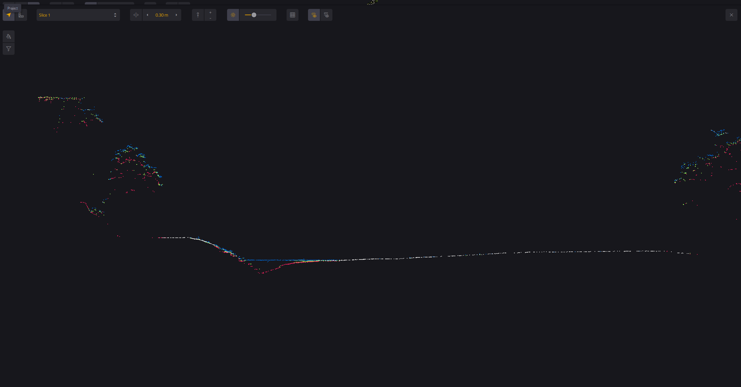
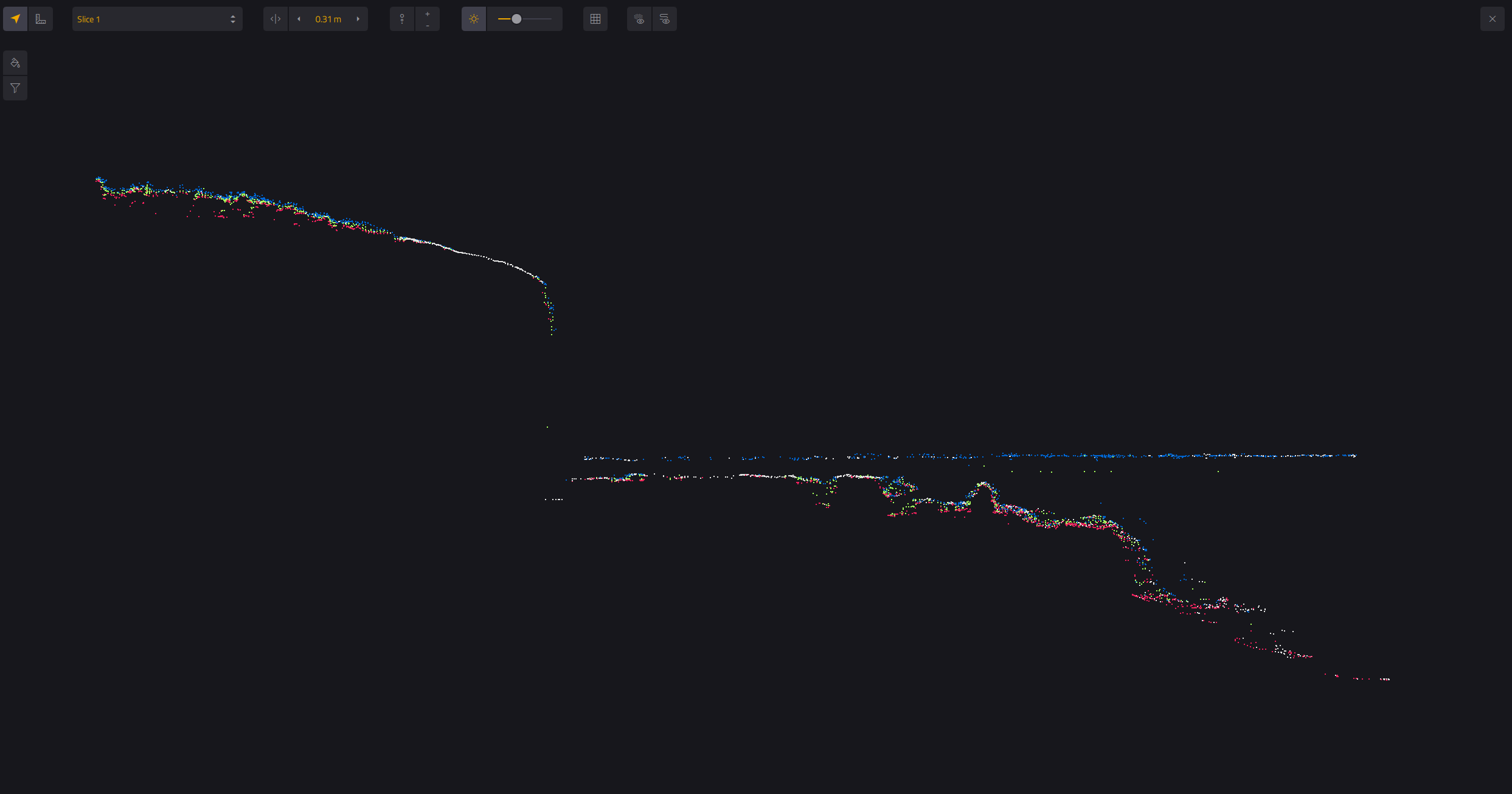
| Min. Depth | 0.30 m |
| Max. Depth | 2 Secchi |
| Laser Class | Class 3B — Avoid direct exposure to beam |
| Operating Temp. | 0°C to +40°C |
* Point density is theoretical maximum with all shots yielding max echoes. May vary depending on flight and survey conditions, and surveyed environment. Underwater precision and accuracy may vary.
Hardware
- YellowScan Navigator unit
- แบตเตอรี่ 2 ก้อน
- กล่อง Rugged Pelicase
- UAV GNSS Antenna + Cable
- USB Flash Drives 2 ชิ้น
- เอกสารคู่มือการใช้งาน
- Laser Safety Goggles
Services
- รับประกัน 1 ปี + Technical Support ไม่จำกัด
- Training แบบ In-person
- Boresight Calibration Certificate
- Local Support โดย Thai Sky Vision ตัวแทนอย่างเป็นทางการในไทย
Software
- SBG Qinertia — Post-process GNSS & inertial data (integrated in CloudStation)
- CloudStation Essential — Generate, visualize, inspect & export data
- อัปเกรดได้เป็น Pro (Classification & Color Enrichment)
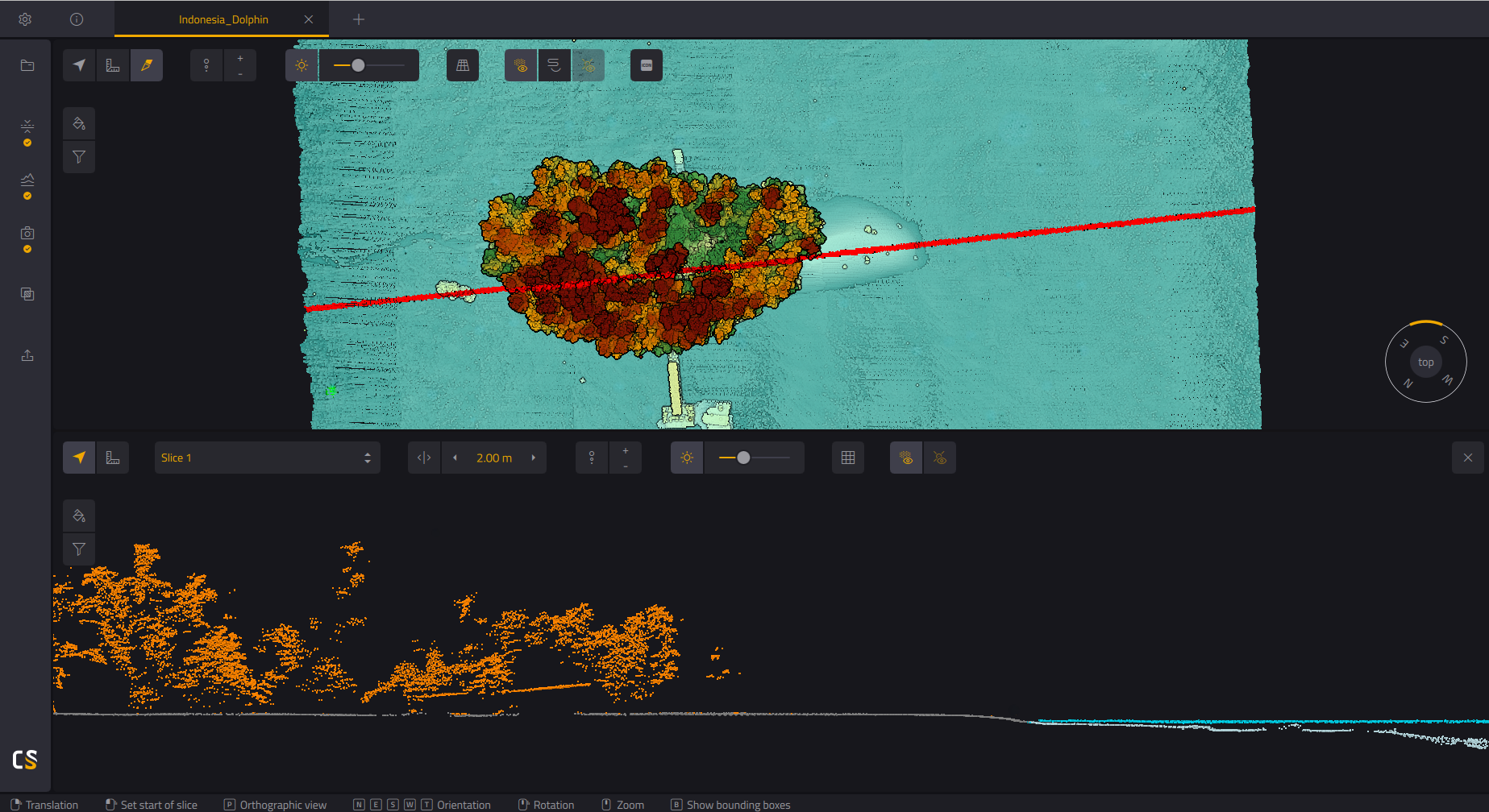
CloudStation
Generate, Visualize, Inspect และ Export ข้อมูล Point Cloud พร้อมใช้งาน — รวมอยู่ในแพ็กเกจแล้ว รวม SBG Qinertia สำหรับ GNSS/INS Post-Processing
CloudStation
เพิ่ม Refined Levels, Classification, Colorized Point Cloud และ Advanced Export — เหมาะสำหรับงานที่ต้องการผลลัพธ์ขั้นสูง
CloudStation
ครบทุกฟีเจอร์ — รวม Orthophoto Generation และ Command Line (ytk) สำหรับ Automation & Batch Processing
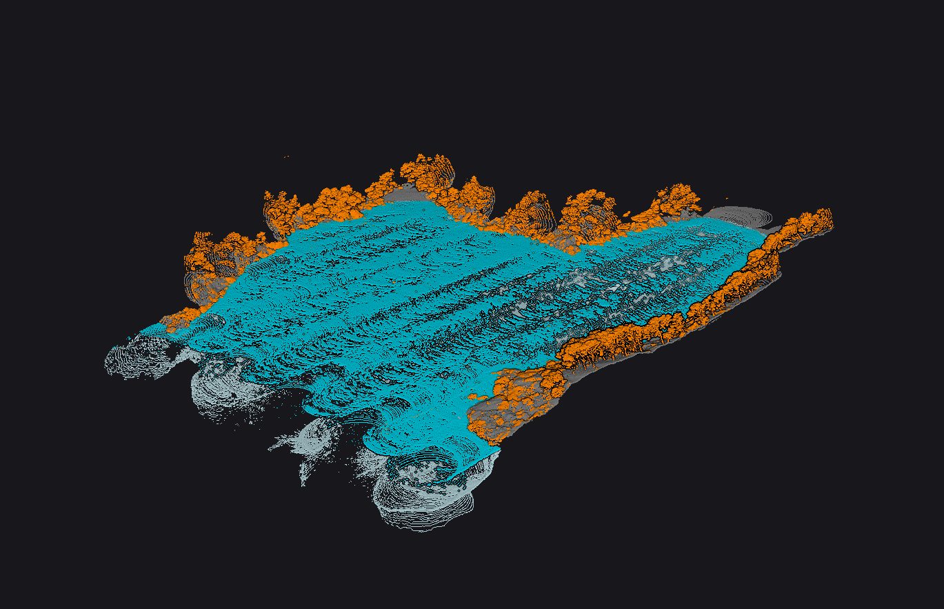
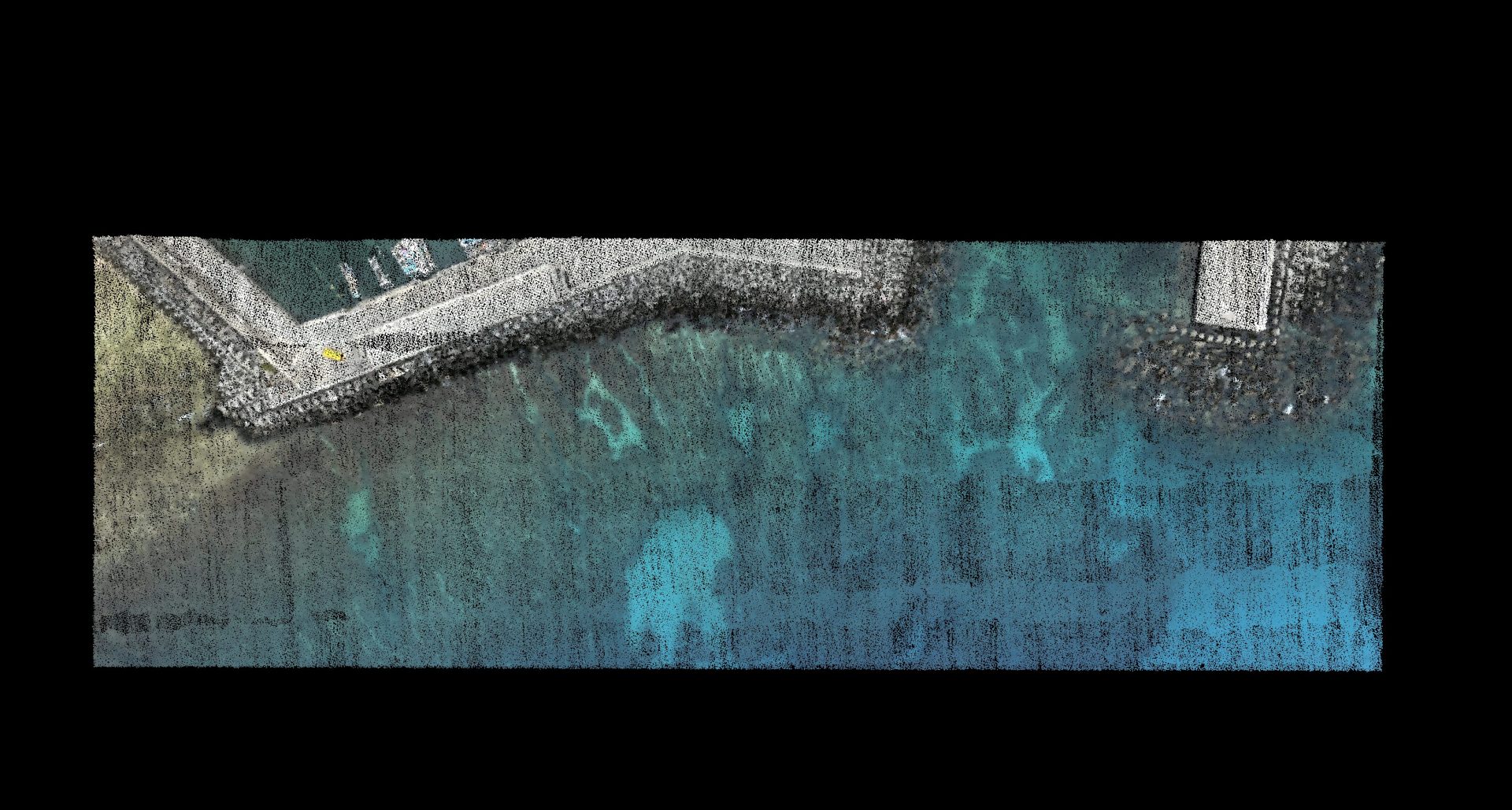
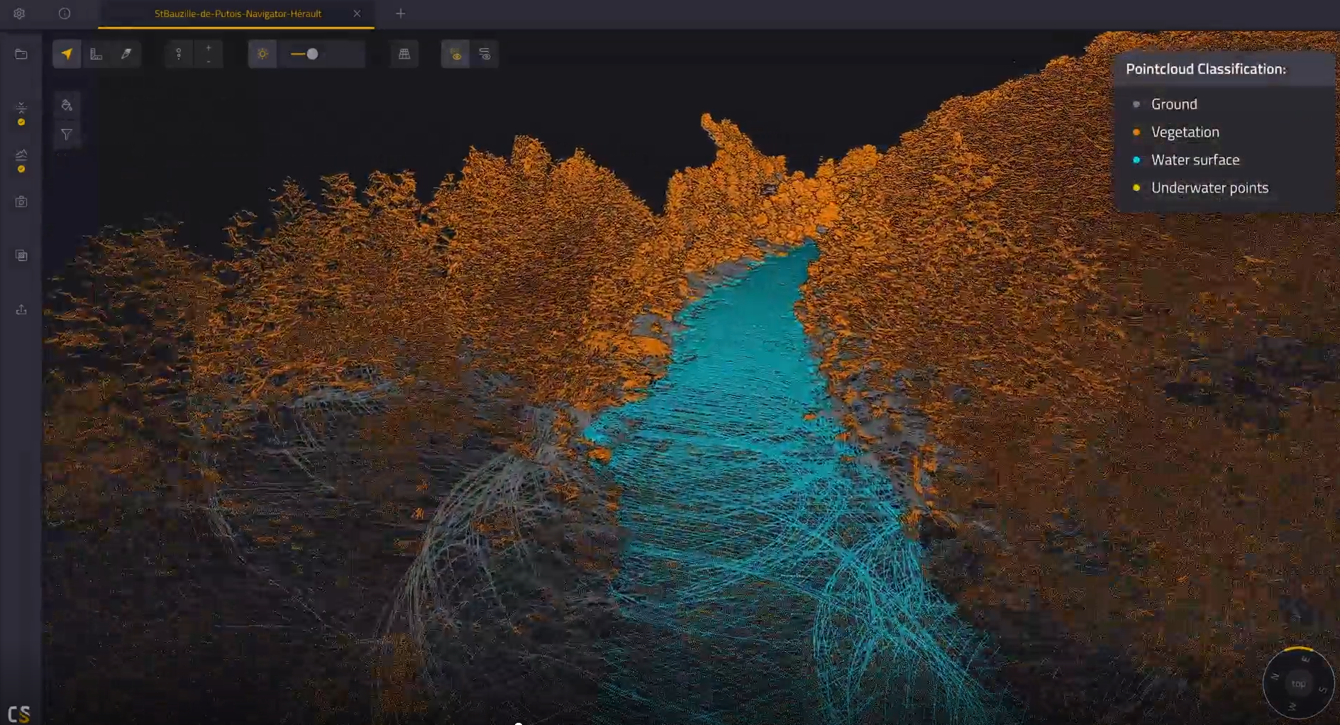
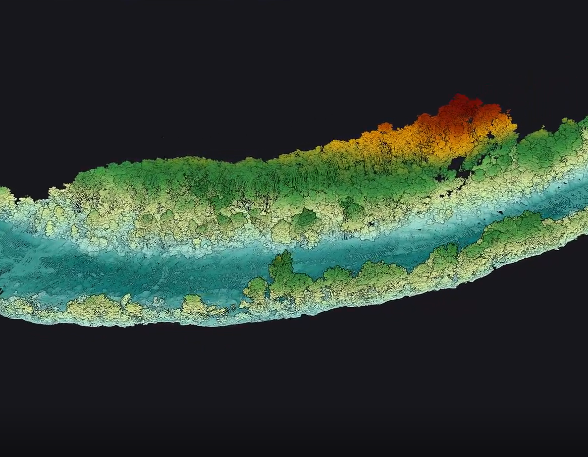
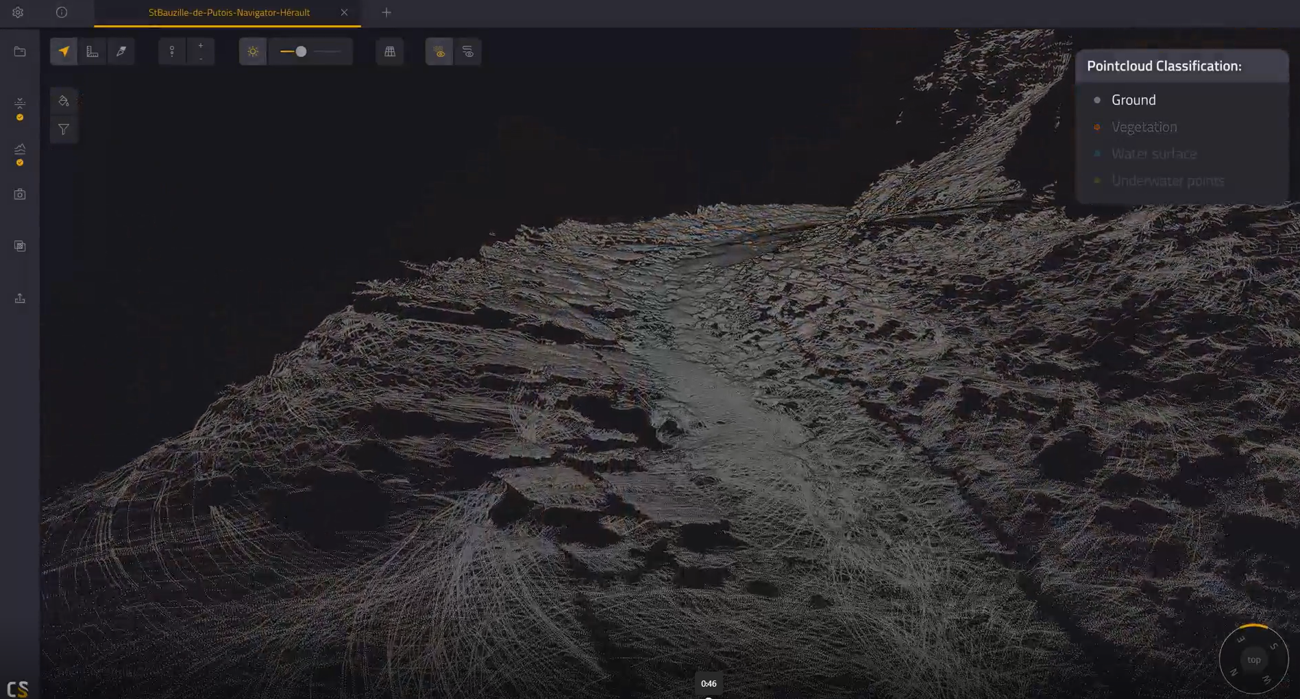
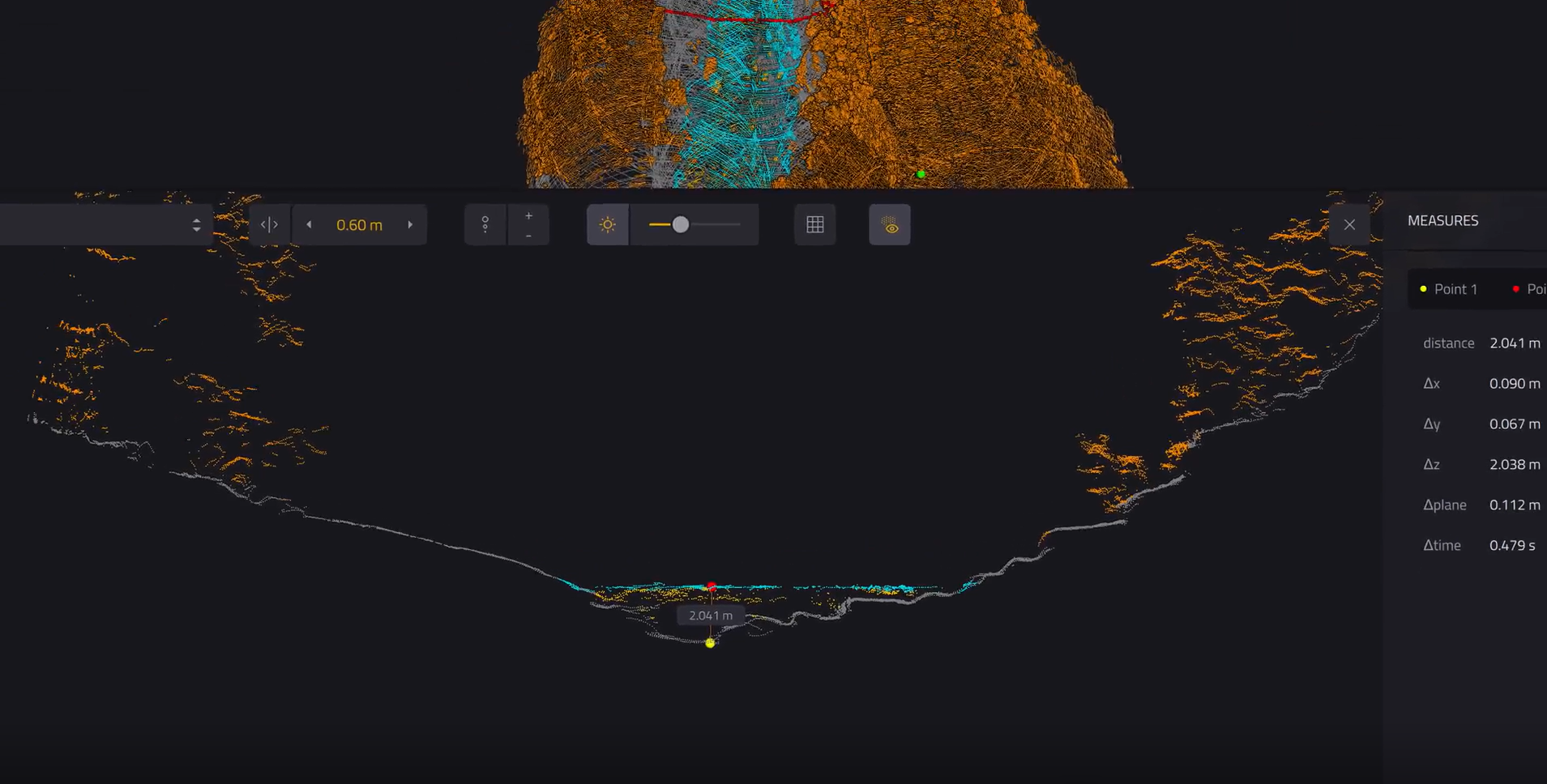
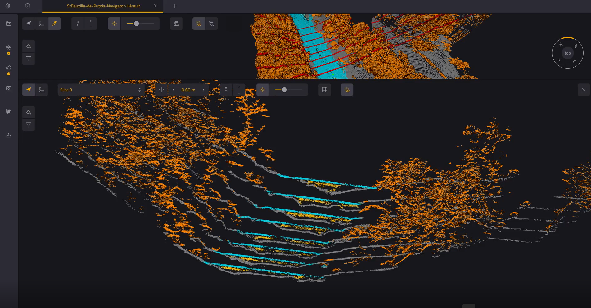
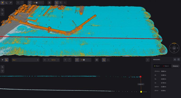
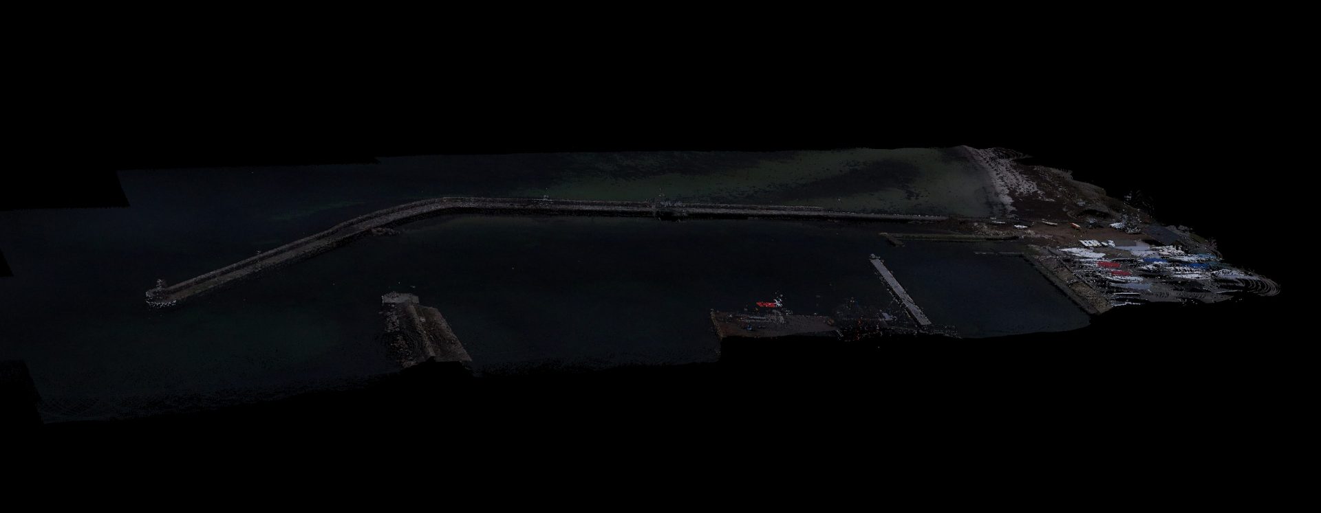

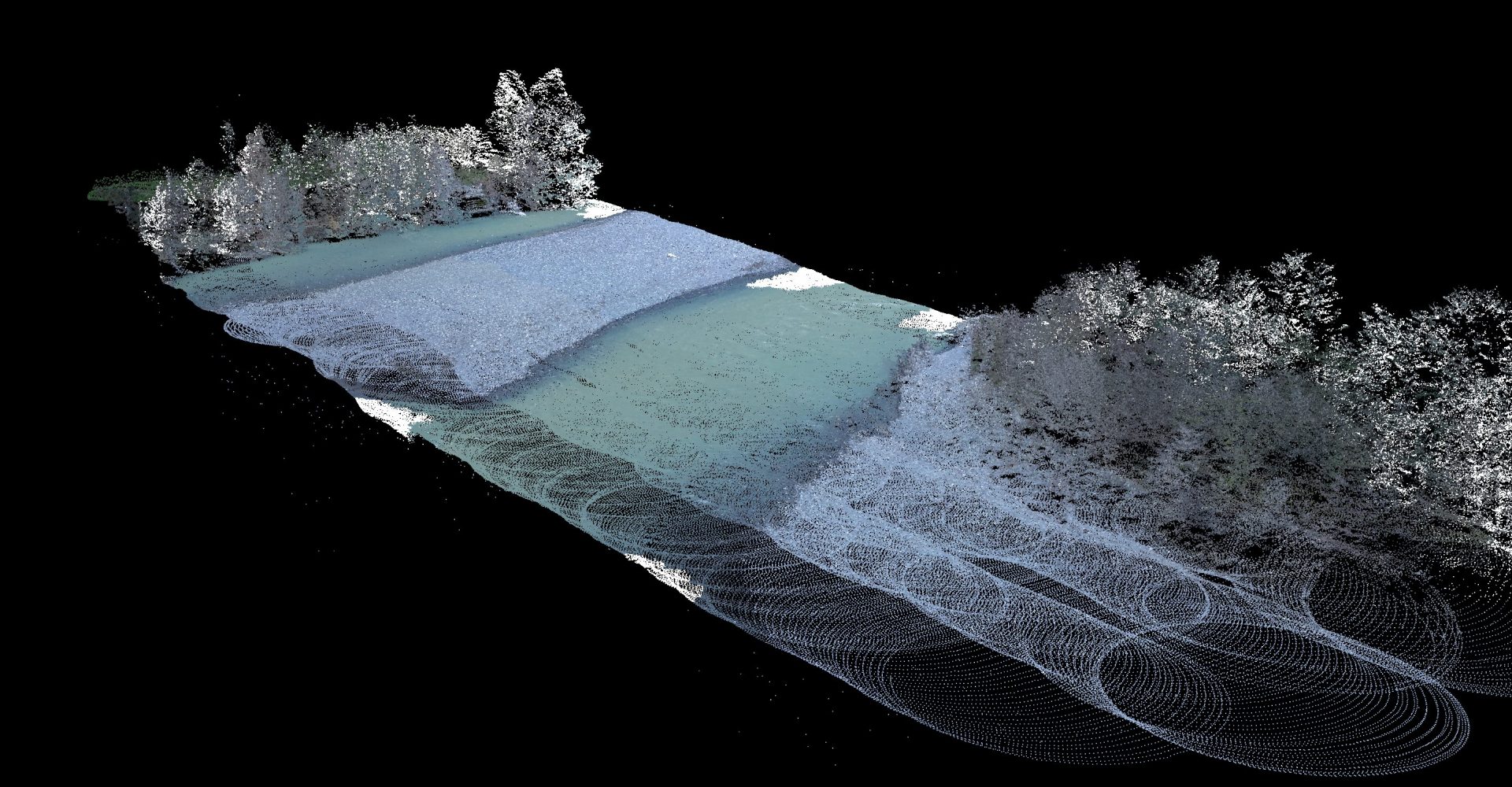
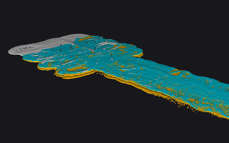
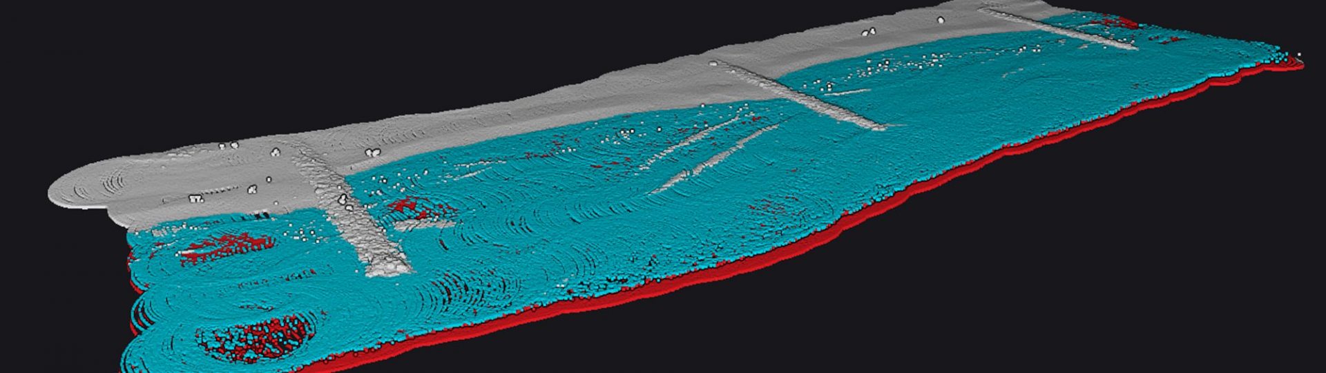
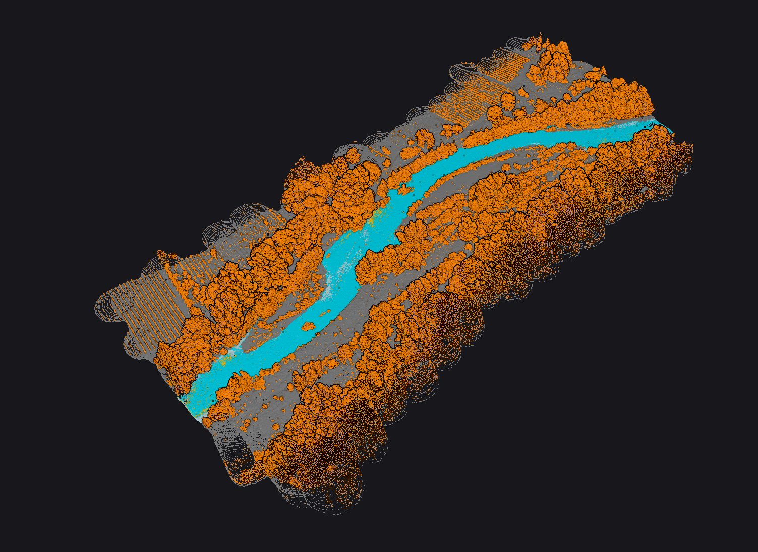
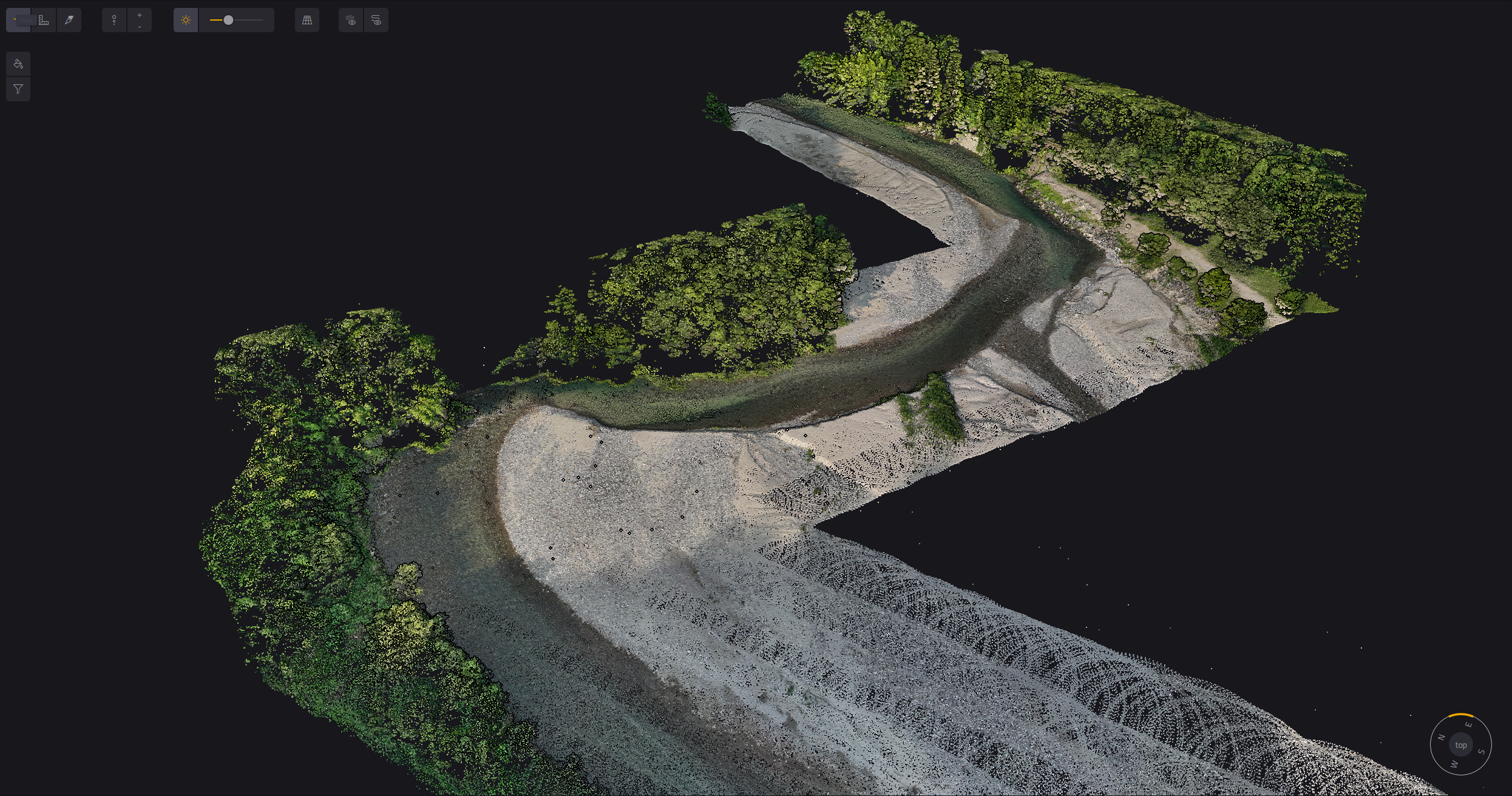
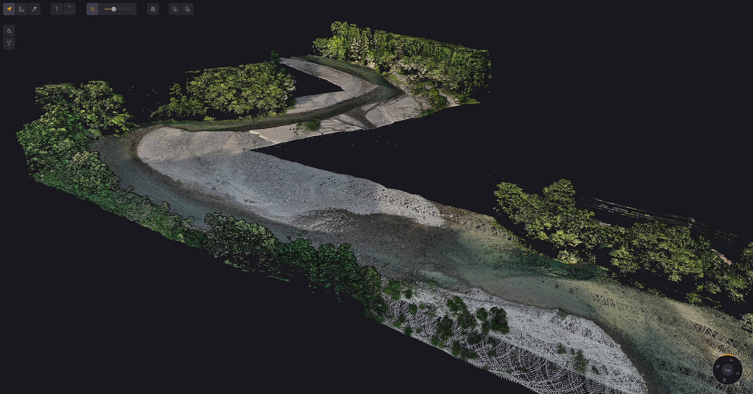
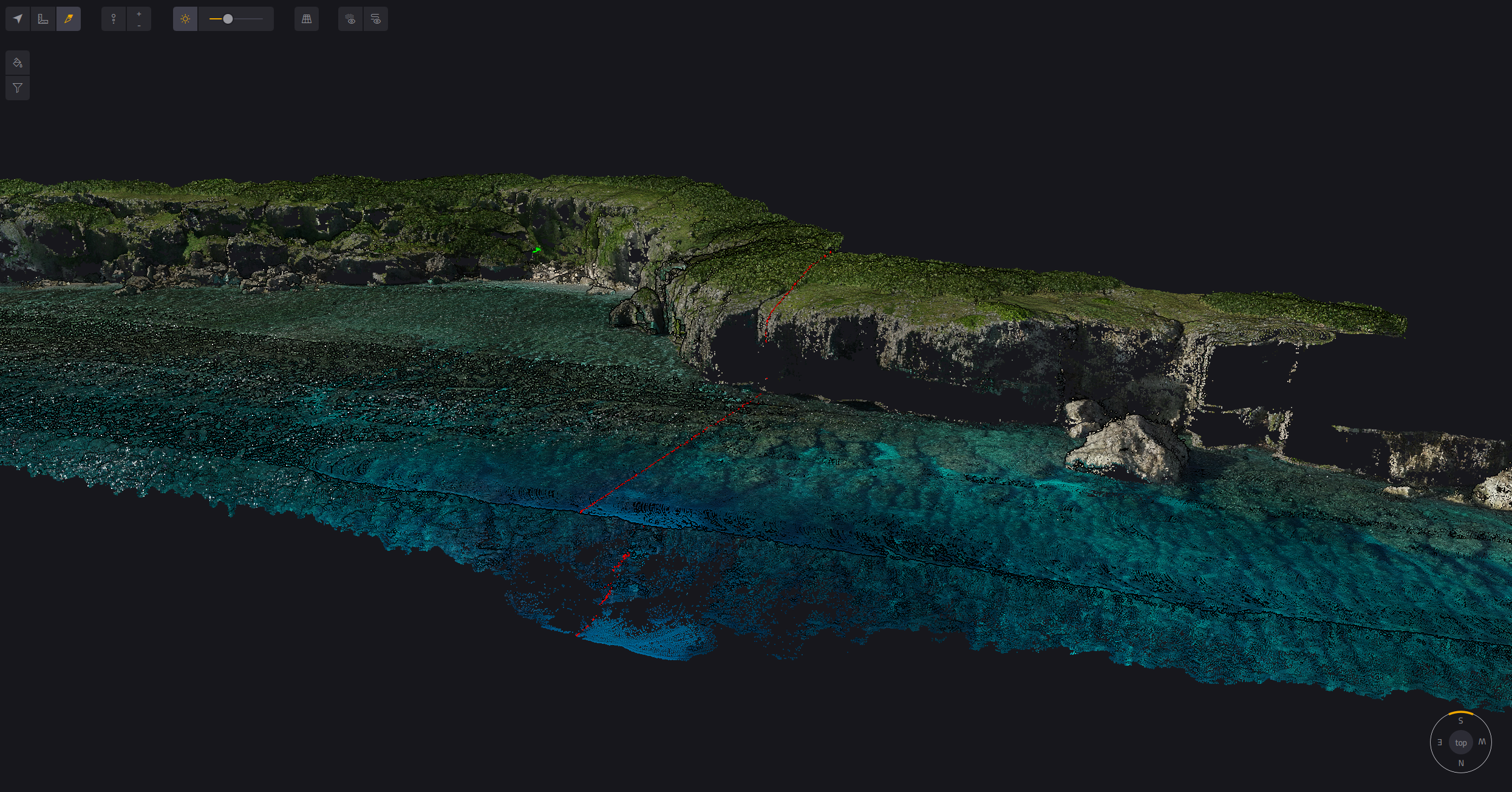
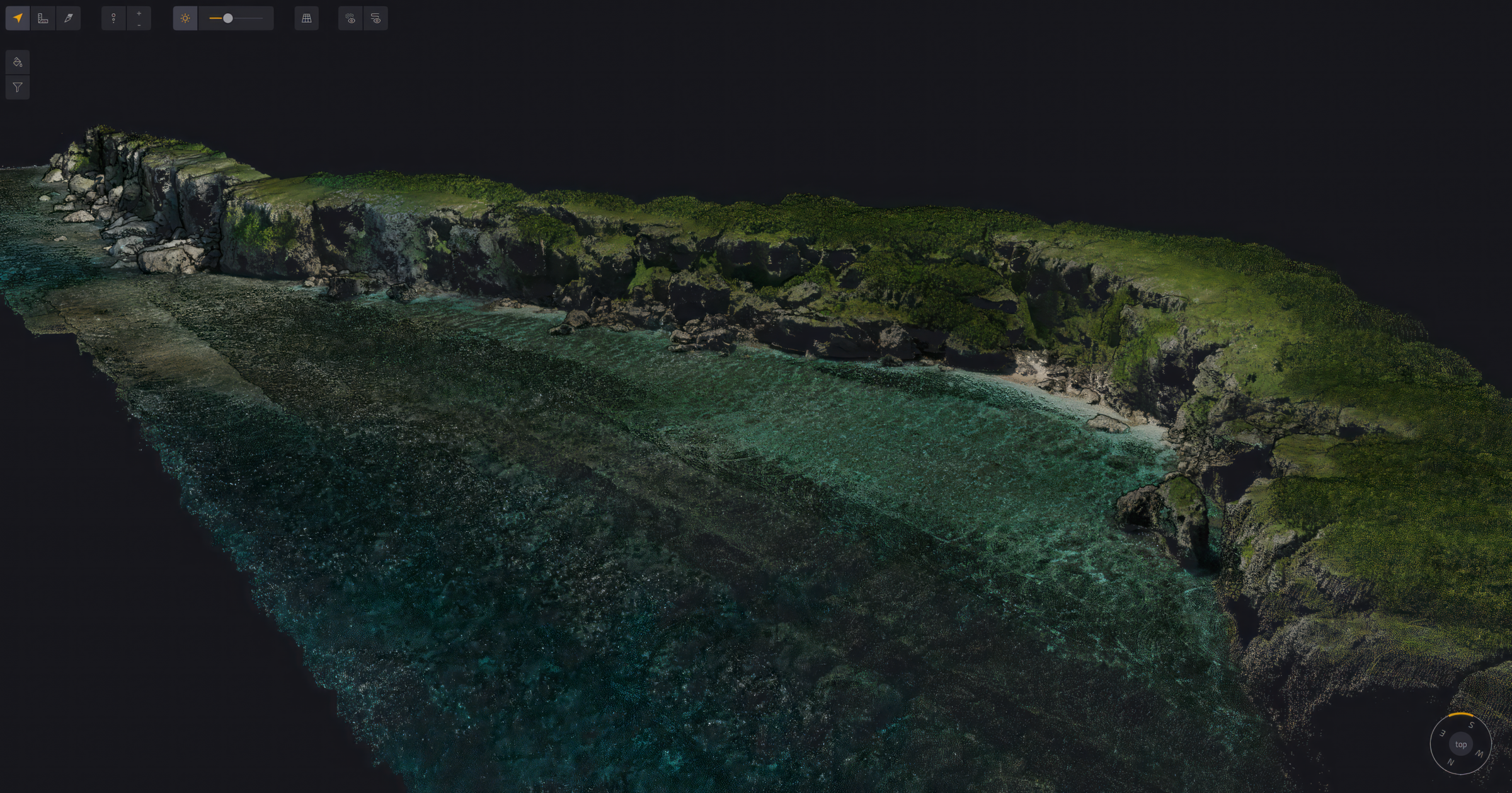
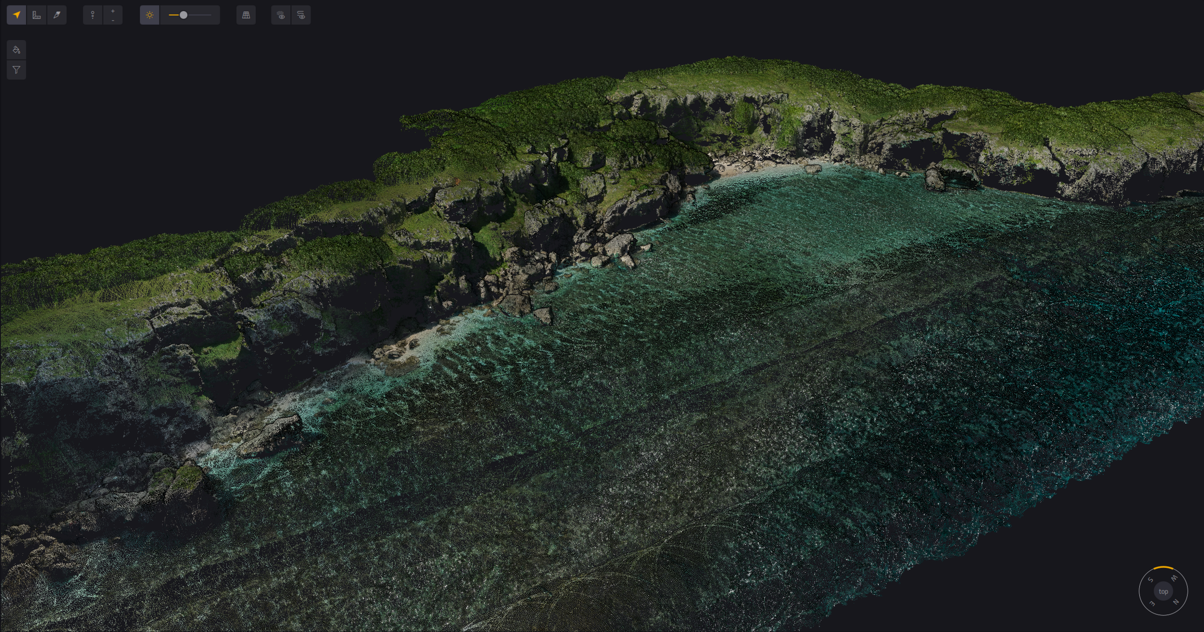
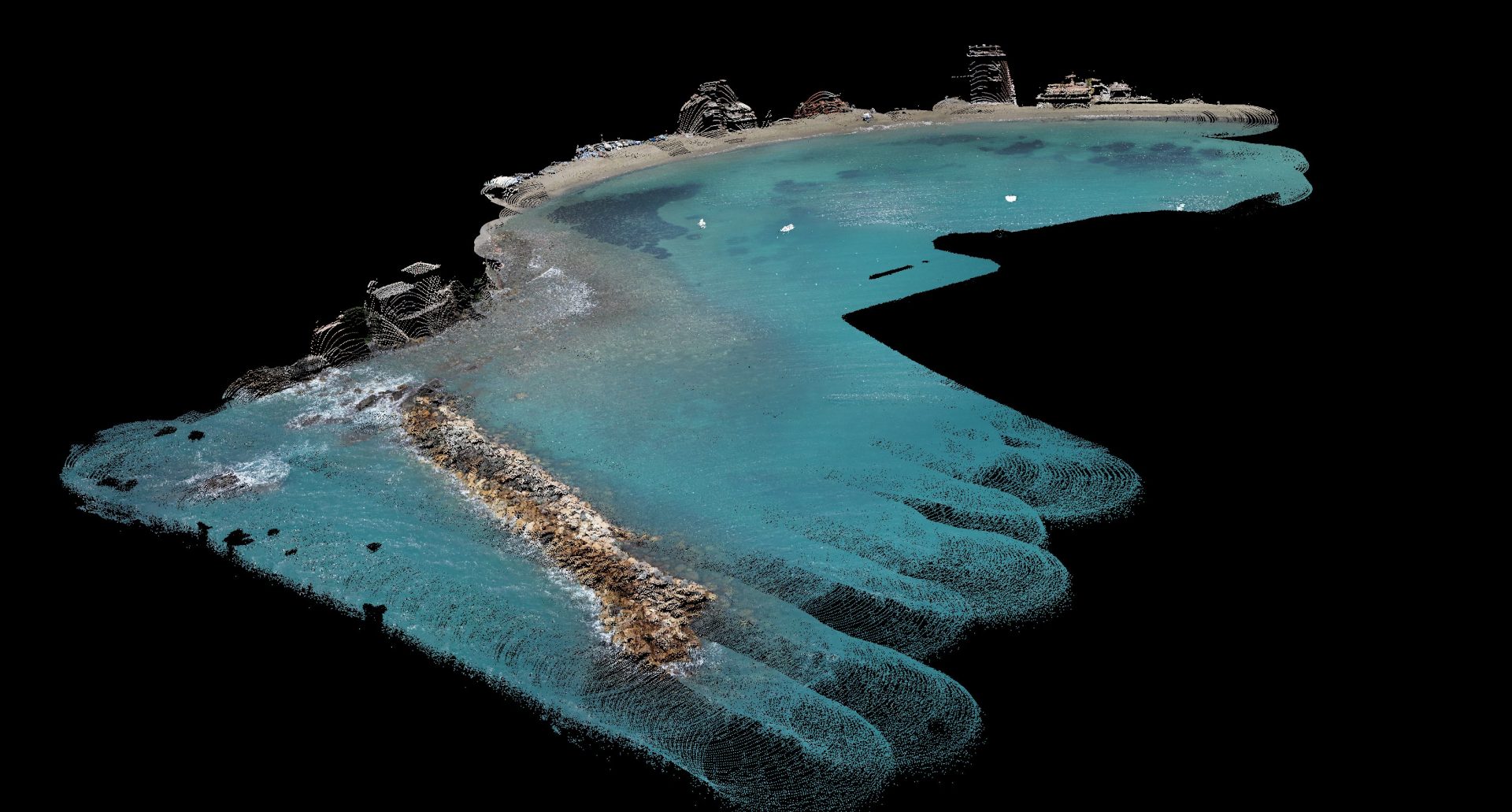
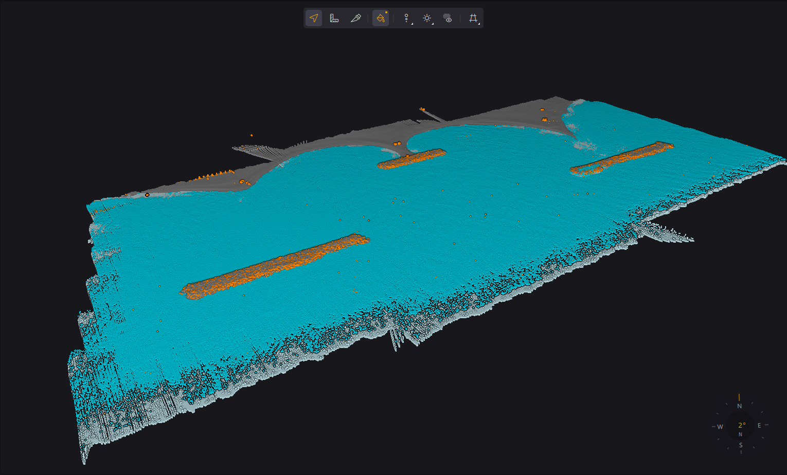
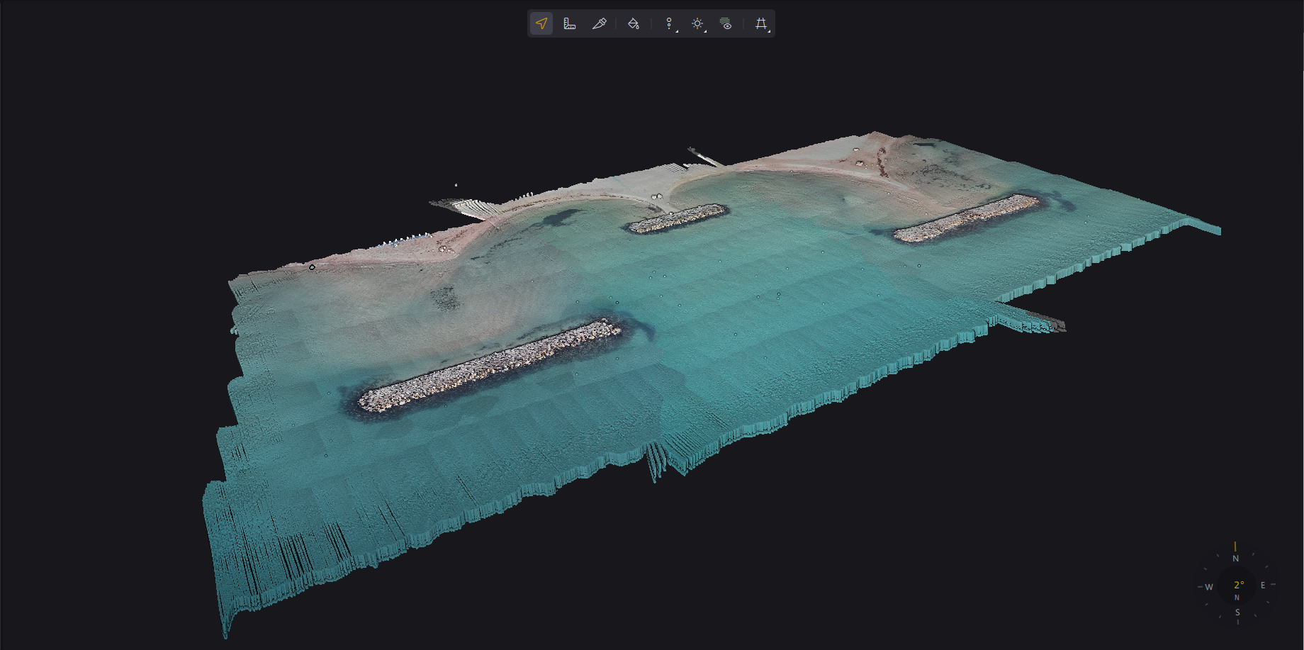

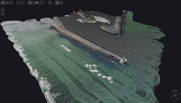
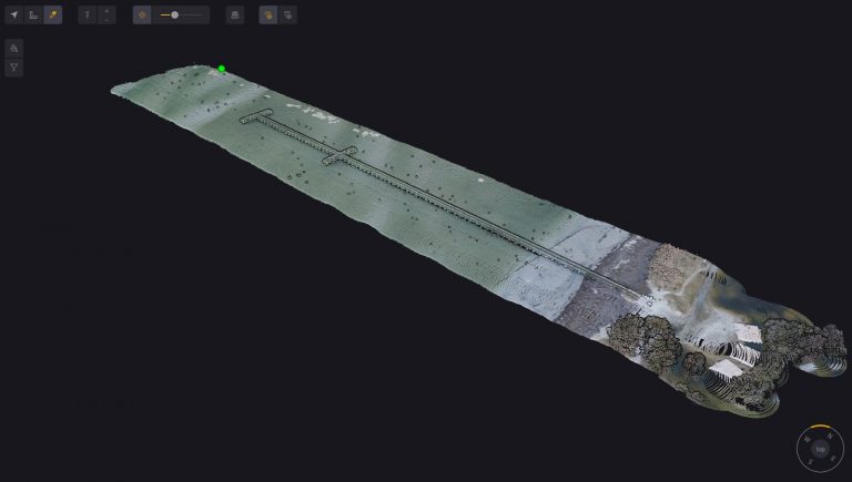
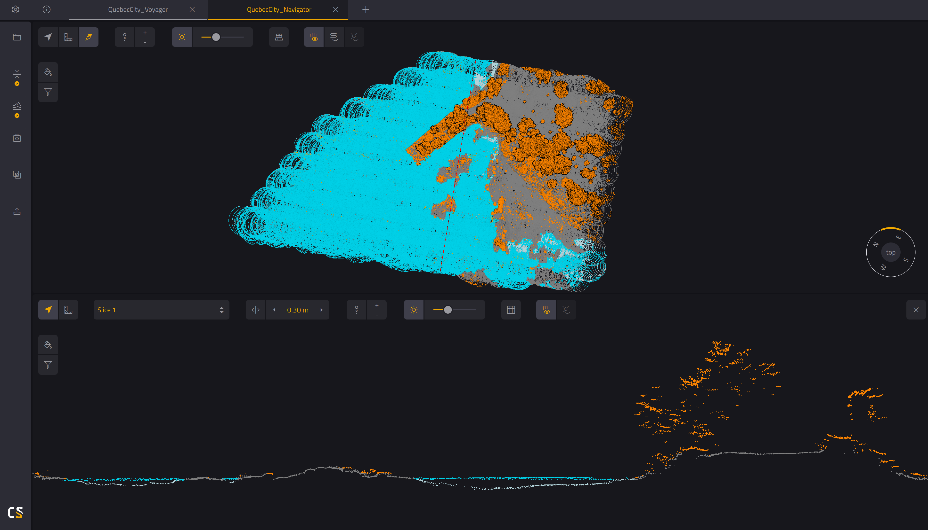
หมายเหตุ: ภาพตัวอย่างเหล่านี้เป็นผลงาน Reference จาก YellowScan ทั่วโลก ไม่ใช่ผลงานของ INSEE UAV — แสดงศักยภาพของ Sensor เท่านั้น
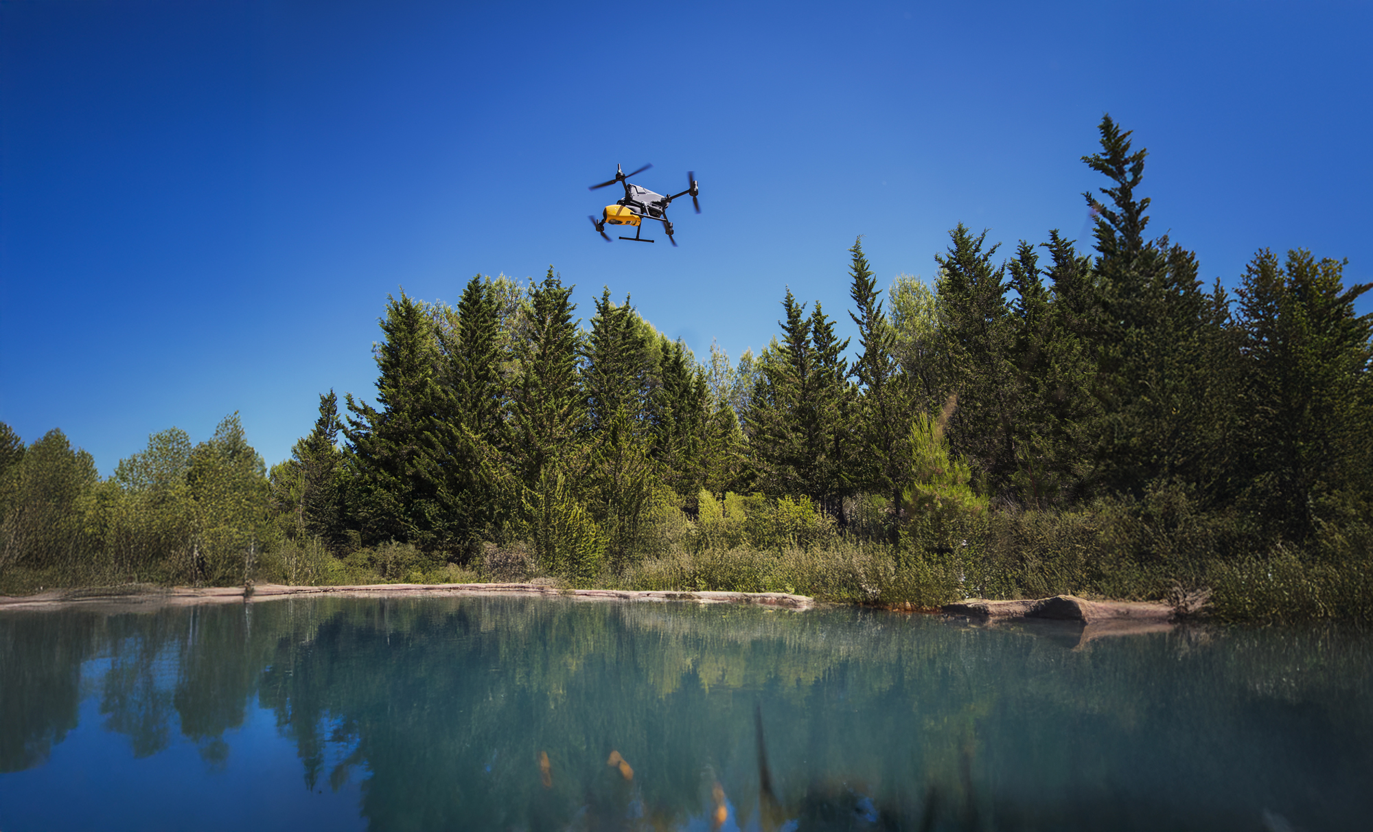
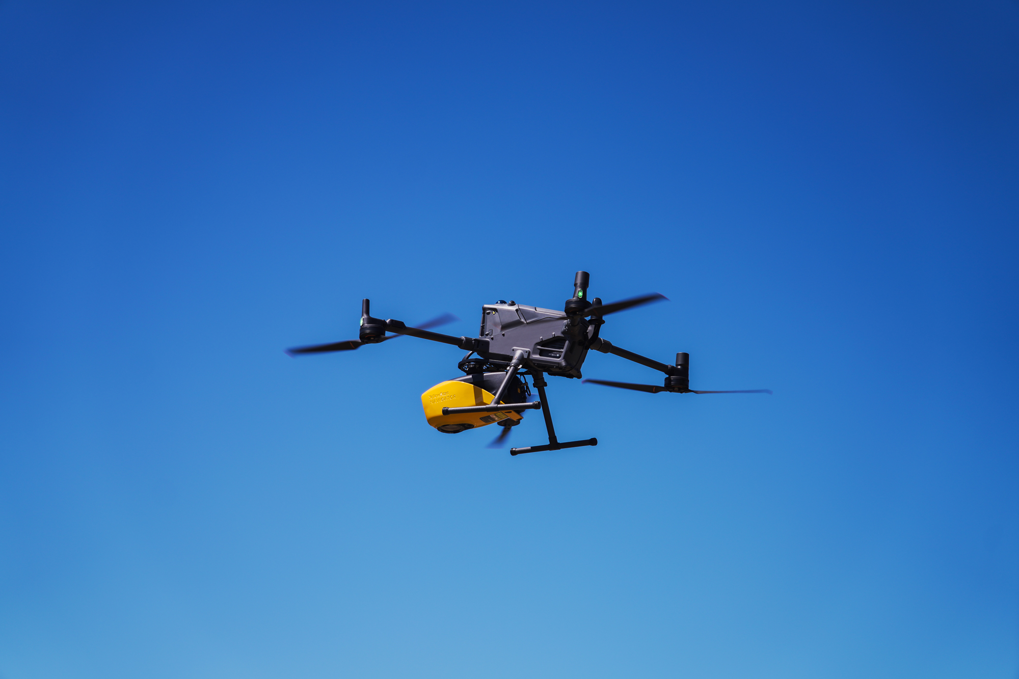
YellowScan Navigator on DJI Matrice 400.
ภาพการติดตั้ง YellowScan Navigator Bathymetric LiDAR บน DJI Matrice 400 พร้อม Mounting Bracket สำหรับงานสำรวจน้ำตื้นและพื้นที่ชายฝั่ง
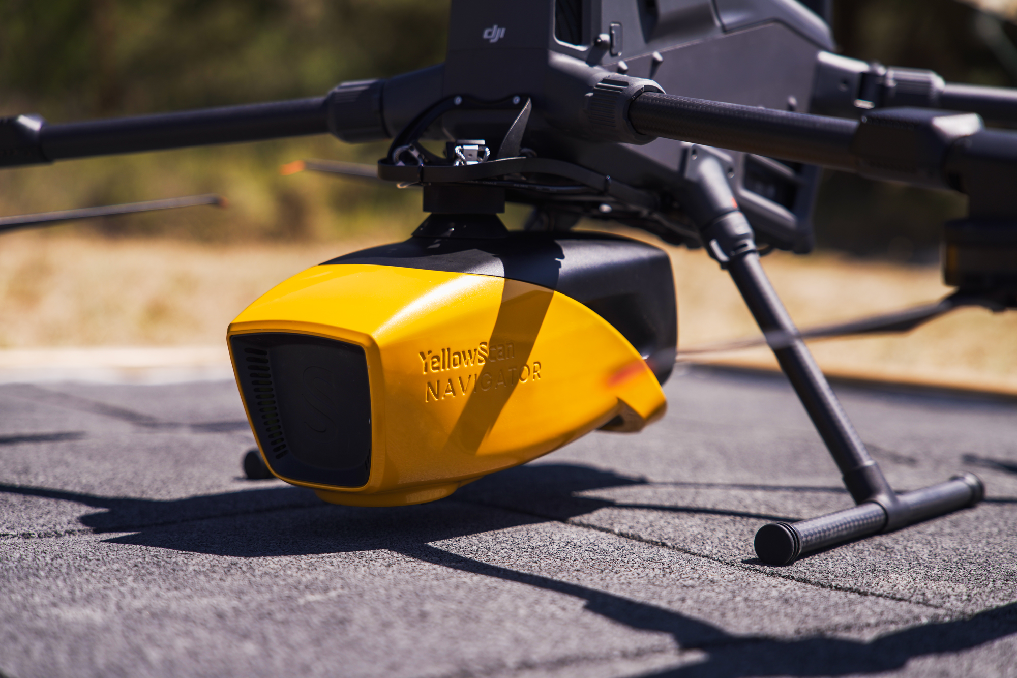
รายละเอียดการติดตั้ง
Mounting Bracket ออกแบบเฉพาะ
ออกแบบและรับรองให้เข้ากับ DJI Matrice 400 — มีระบบลดแรงสั่นและจัดสมดุล สำหรับการสแกน Bathymetric เหนือผิวน้ำได้นิ่งและแม่นยำ
พร้อมสำรวจใต้น้ำจากท้องฟ้า
ด้วย Navigator แล้วหรือยัง?
ติดต่อ Thai Sky Vision ตัวแทนจำหน่าย YellowScan อย่างเป็นทางการในประเทศไทย — รับคำปรึกษา สาธิตระบบ Bathymetric LiDAR และ After-Sales Support ครบวงจร
Thai Sky Vision Co., Ltd. — Official YellowScan Distributor in Thailand