High Point Density
Livox AVIA scanner ยิงเลเซอร์ 240,000 shots/sec รองรับสูงสุด 3 echoes ต่อ shot — เก็บรายละเอียดได้ครบถ้วน ที่ระดับบิน 100m ทั่วไปเป็นค่ามาตรฐาน
Lightweight
1.3 kg w/ battery
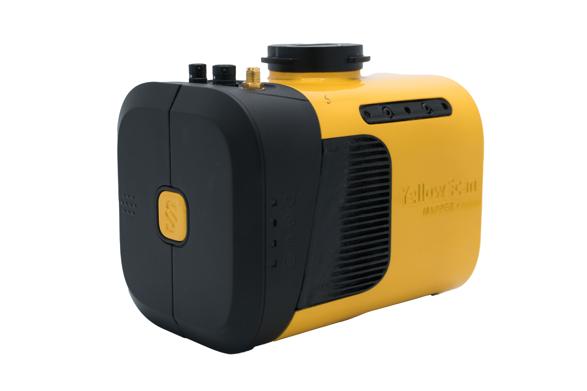
น้ำหนักเพียง 1.1 kg (ไม่รวมแบตเตอรี่) หรือ 1.3 kg พร้อมแบตเตอรี่ — ออกแบบให้พกพาและติดตั้งบน UAV ได้ง่าย
Proven Accuracy
Precision 2.5 cm และ Accuracy 3.0 cm พร้อม GNSS-Inertial Applanix APX-15 UAV — ผลลัพธ์ที่เชื่อถือได้ครอบคลุมการใช้งานหลากหลายรูปแบบ
Multi-Platform
Integrations
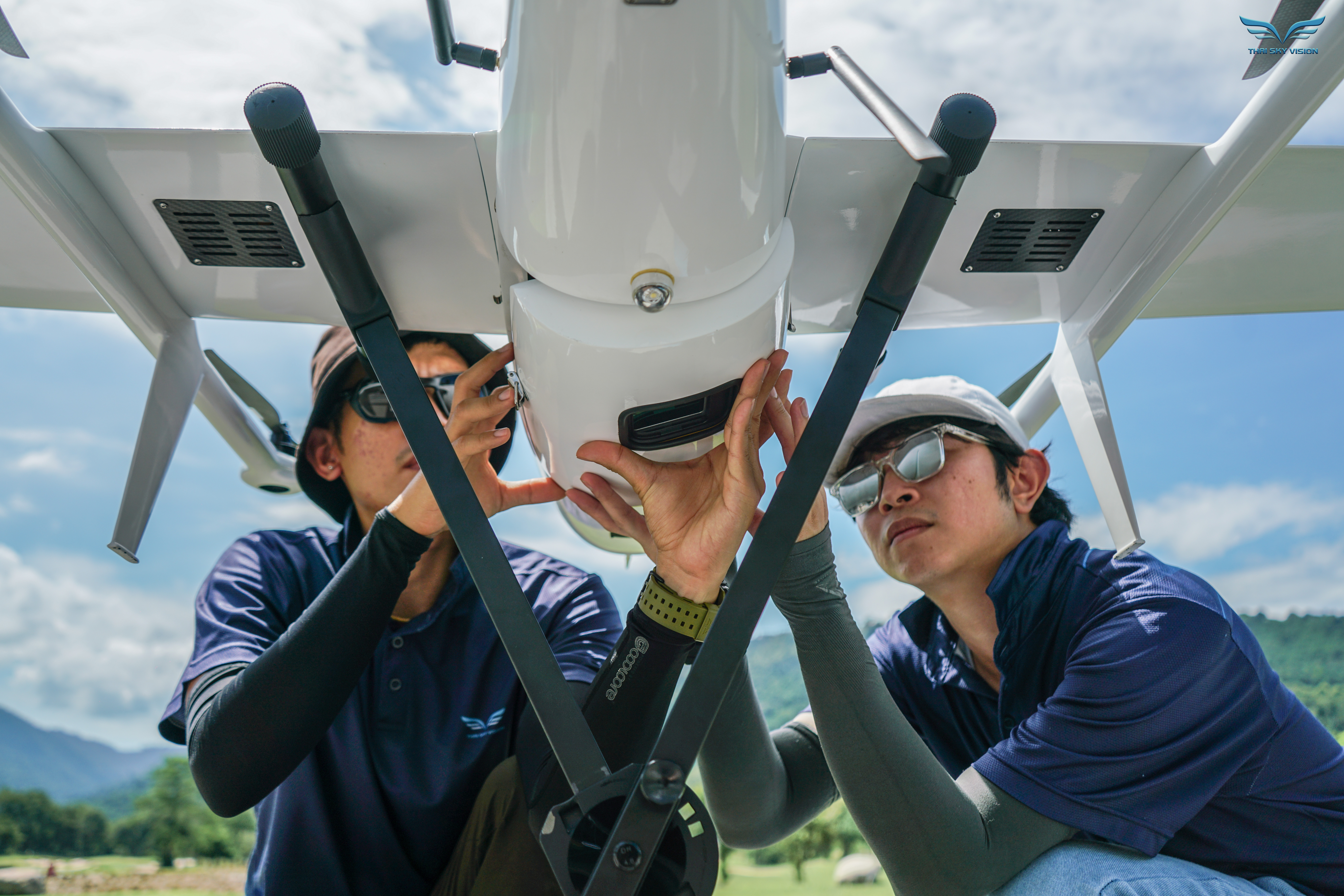
รองรับ Multirotor, Helicopter UAV และ Fixed-Wing — ใช้งานได้บนแพลตฟอร์มหลายรูปแบบ พร้อม Quick Release Adapter สำหรับ DJI Skyport หรือ Gremsy
Technical Specifications.
System Components.
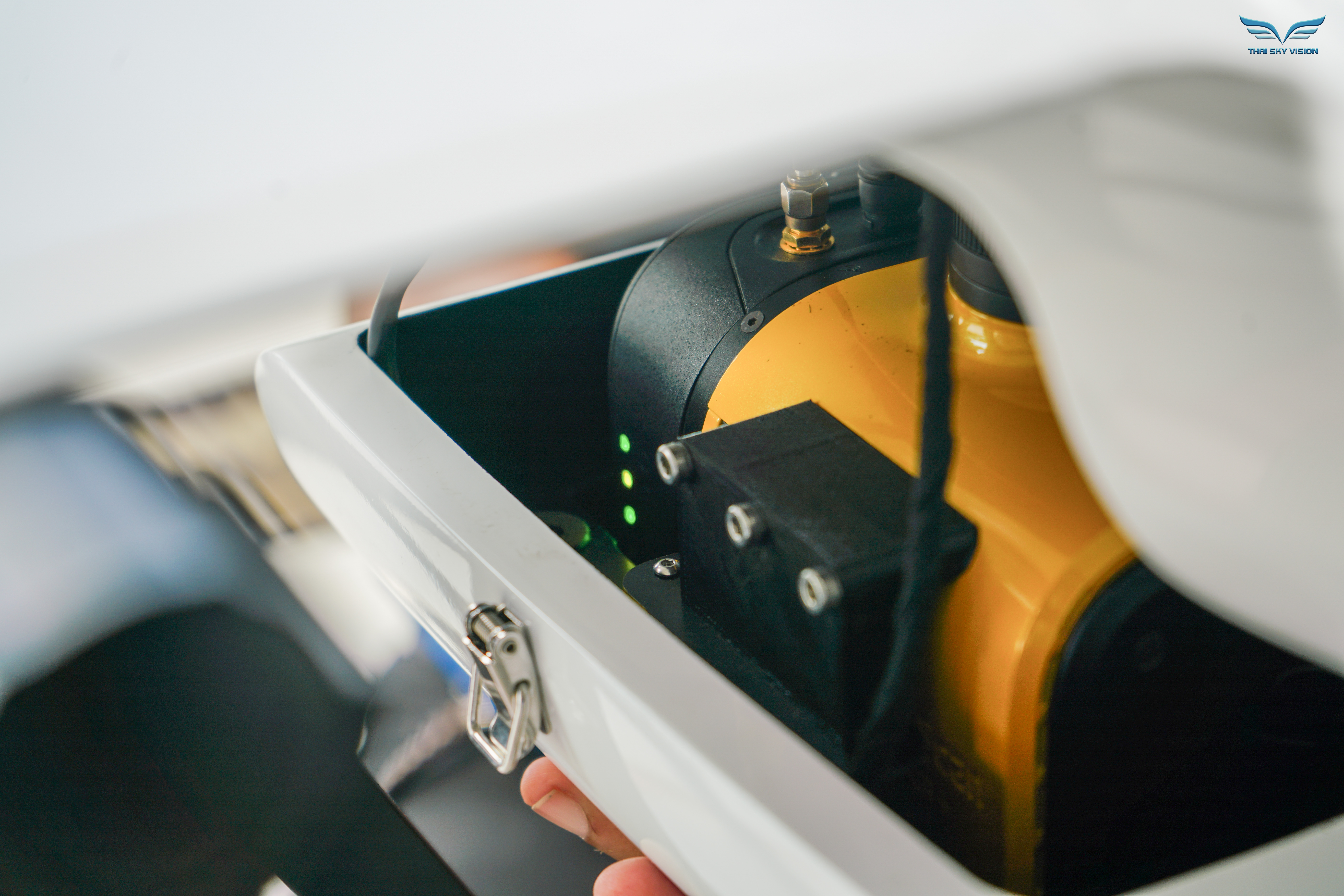
Laser Scanner
GNSS / INS
Mission Parameters.
| Parameter | Value |
|---|---|
| 5 m/s @ 100 m | 340 pts/m² |
| 10 m/s @ 100 m | 170 pts/m² |
| 20 m/s @ 100 m | 90 pts/m² |
| Typ. Flying Height | 100 m AGL |
| Weight (w/ battery) | 1.3 kg |
| Operating Temp. | -20°C to +40°C |
* Point density theoretical max. May vary depending on flight conditions.
Hardware
- YellowScan Mapper+ unit
- Quick Release Adapter (DJI Skyport หรือ Gremsy)
- Charger และแบตเตอรี่ 2 ก้อน
- GNSS Antenna + Cable
- USB Flash Drives 2 ชิ้น
- กระเป๋าเป้ Rugged Backpack
Services
- รับประกัน 1 ปี + Technical Support ไม่จำกัด
- Training แบบ In-person หรือ Online
- Camera & Boresight Calibration
- Local Support โดย Thai Sky Vision ตัวแทนอย่างเป็นทางการในไทย
Software
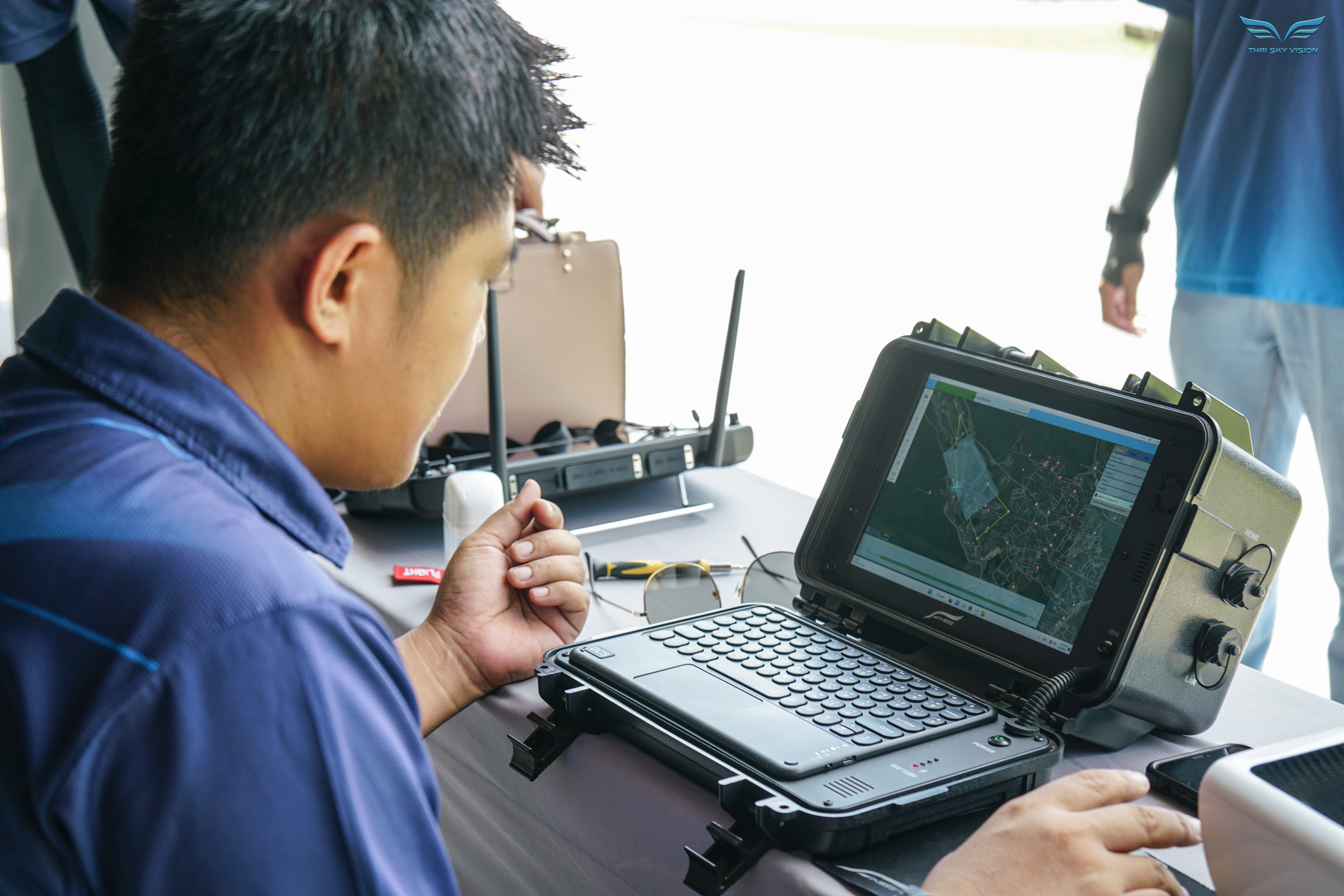
- Applanix POSPac UAV — Post-process GNSS/INS data
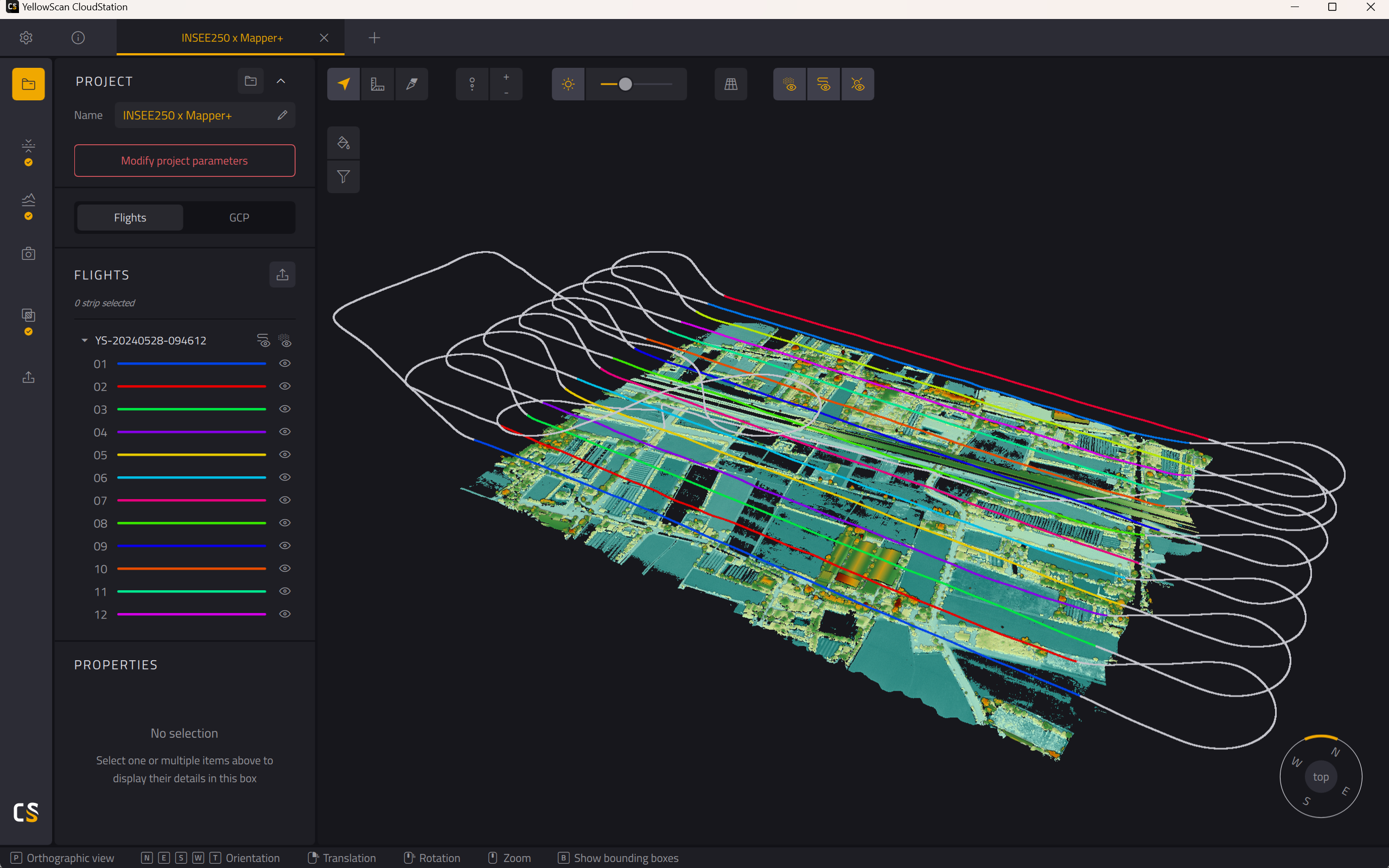
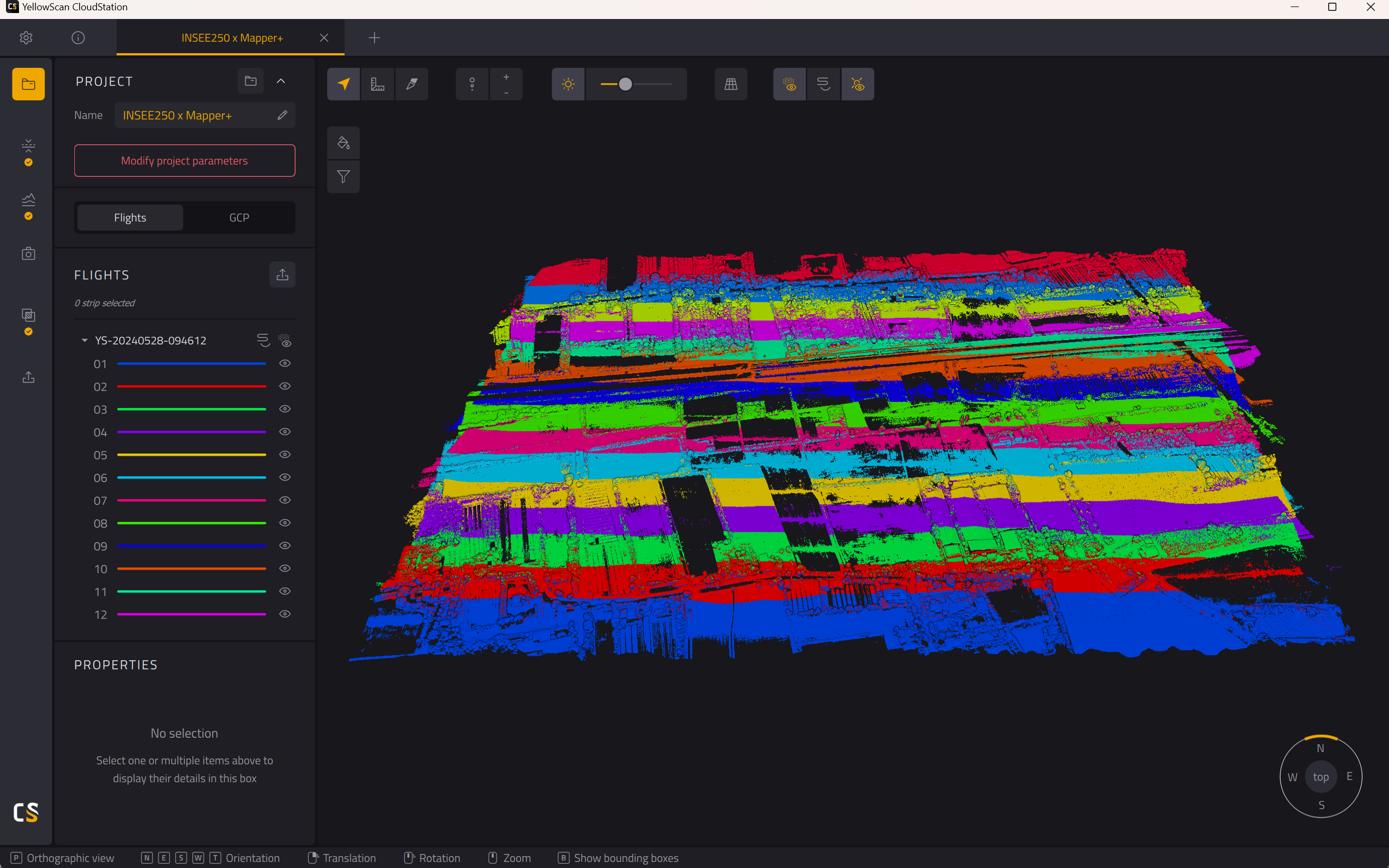
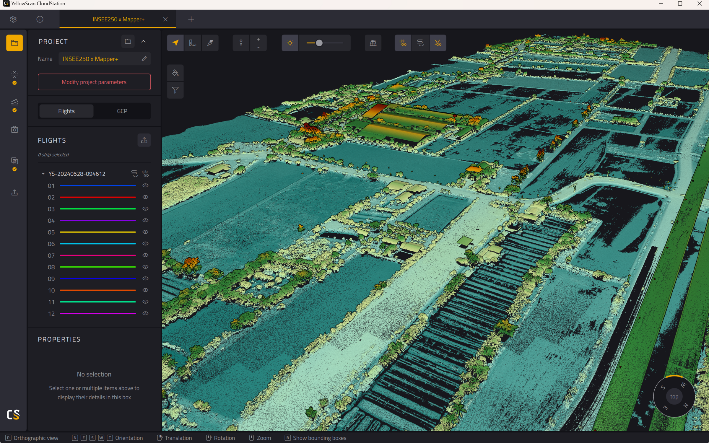
- YellowScan CloudStation — Generate, visualize, adjust strips, classify, colorize และ Export point cloud
CloudStation
Visualize, Inspect, Colorize จาก Orthophotos และ Export ข้อมูลพร้อมใช้งาน — รวมอยู่ในแพ็กเกจแล้ว
CloudStation
เพิ่ม Data Quality Refinement, Classification, Color Enrichment และ Export Features ขั้นสูง
CloudStation
ครบทุกฟีเจอร์ — รวม Orthophoto Generation และ Command Line (ytk) สำหรับ Automation & Batch Processing
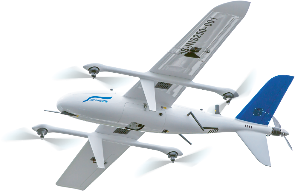
Mapper+ on INSEE-250.
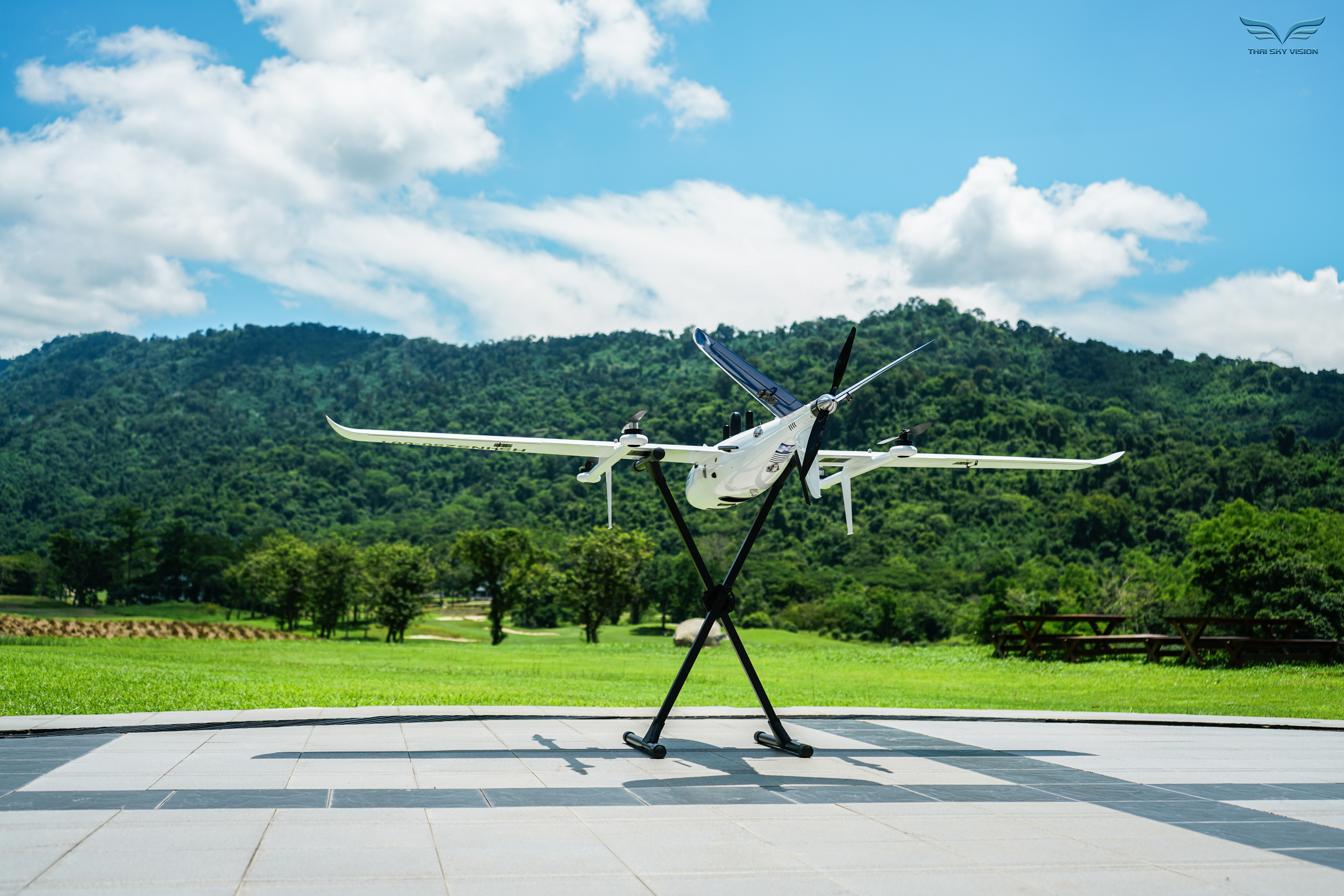
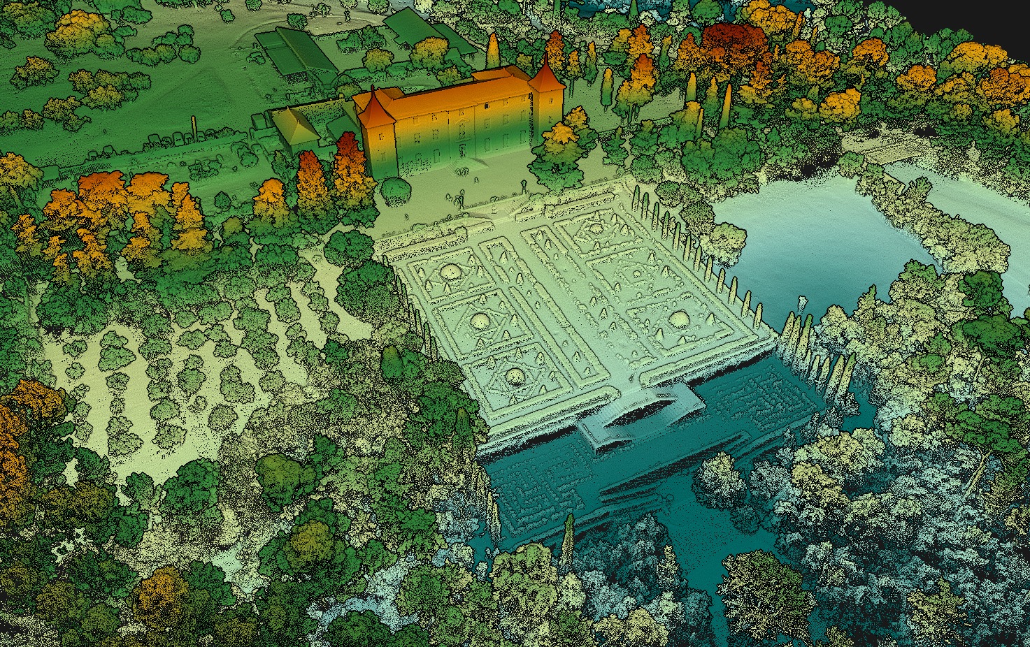
รูปจริง: ผลงานเหล่านี้เก็บข้อมูลด้วย YellowScan Mapper+ (รุ่นก่อน OEM) ติดตั้งบน INSEE-250 — ปัจจุบัน Mapper+ ใช้ Sensor core เดียวกัน ออกแบบมาเพื่อ Fixed-Wing UAV โดยเฉพาะ
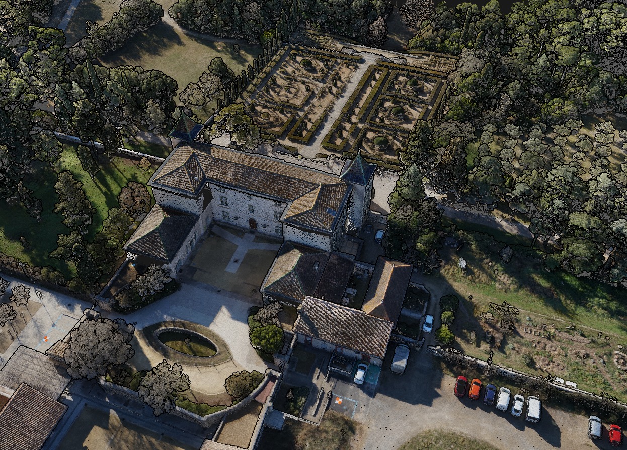
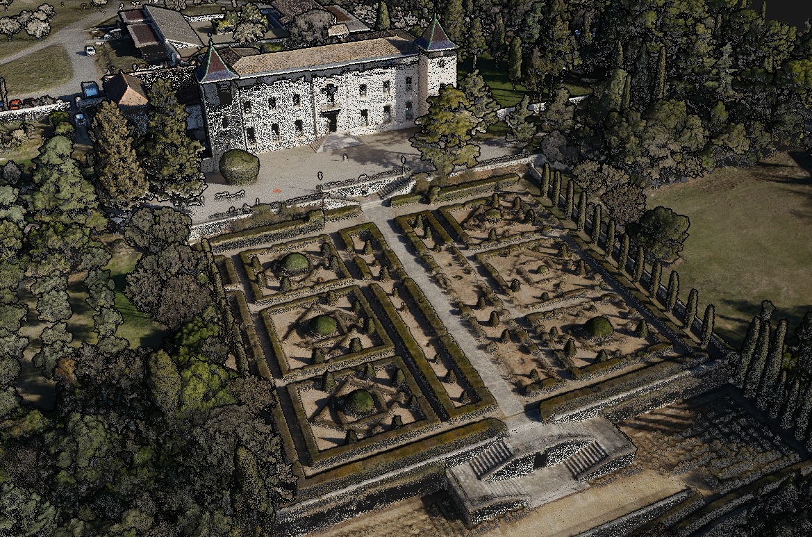

หมายเหตุ: ภาพตัวอย่างเหล่านี้เป็นผลงาน Reference จาก YellowScan ทั่วโลก ไม่ใช่ผลงานของ INSEE UAV — แสดงศักยภาพของ Sensor เท่านั้น
พร้อมยกระดับ Fixed-Wing UAV ของคุณ
ด้วย Mapper+ แล้วหรือยัง?
ติดต่อ Thai Sky Vision ตัวแทนจำหน่าย YellowScan อย่างเป็นทางการในประเทศไทย — รับคำปรึกษา OEM Integration และ After-Sales Support ครบวงจร
Thai Sky Vision Co., Ltd. — Official YellowScan Distributor in Thailand