2.4M Shots/sec
Ultra-Fast Acquisition
อัตราการยิงเลเซอร์สูงถึง 2.4 ล้านครั้งต่อวินาที สร้าง Point Cloud ได้ถึง 12 ล้านจุดต่อวินาที — เก็บข้อมูลได้เร็วที่สุดในกลุ่ม UAV LiDAR
Sub-cm Precision
0.5 cm @ 1σ
ความแม่นยำระดับ Sub-centimeter ด้วย Precision 0.5 cm และ Accuracy 1 cm — เหมาะสำหรับงาน Engineering Survey และ Infrastructure Inspection ที่ต้องการความละเอียดสูงสุด
100° FOV
Wide Coverage
มุมมองกว้างถึง 100° × 20° ครอบคลุมพื้นที่ได้มากในแต่ละแนวบิน — ลดจำนวน Flight Lines และเวลาในการสำรวจ เหมาะสำหรับ Corridor Mapping
Multi-Platform
UAV & Crewed Aircraft
รองรับทั้ง Multi-rotor, VTOL UAV และเครื่องบินขนาดเล็ก — บินได้สูงถึง 440m ระยะสแกนไกล 1,250m เหมาะสำหรับโปรเจกต์ขนาดใหญ่
Technical Specifications.
System Components.
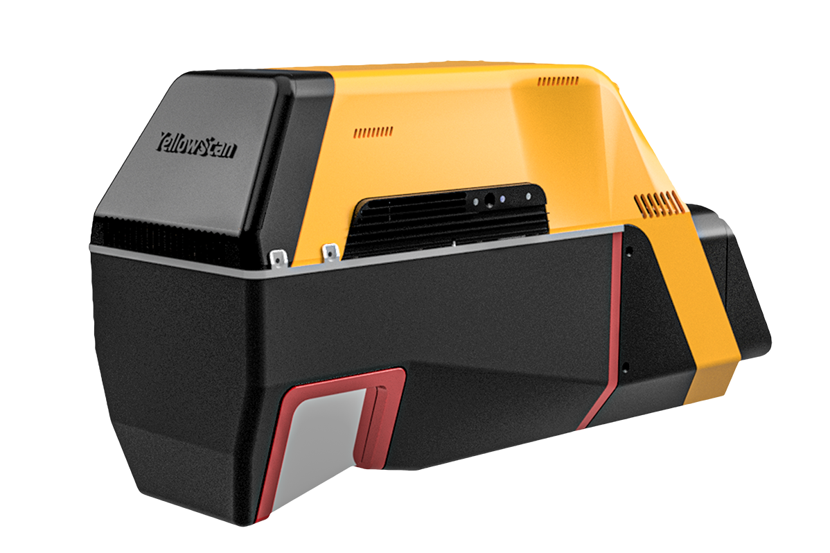
Laser Scanner
GNSS / INS
Point Density — UAV (PRR 1800 kHz).
| Flight Speed | 50 m AGL | 80 m AGL | 150 m AGL |
|---|---|---|---|
| 5 m/s | 2,517 pts/m² | 1,573 pts/m² | 839 pts/m² |
| 10 m/s | 1,259 pts/m² | 787 pts/m² | 420 pts/m² |
| 20 m/s | 629 pts/m² | 393 pts/m² | 210 pts/m² |
Point Density — Manned Aircraft (PRR 600 kHz).
| Flight Speed | 150 m AGL | 300 m AGL | 400 m AGL |
|---|---|---|---|
| 20 m/s | 70 pts/m² | 35 pts/m² | 26 pts/m² |
| 30 m/s | 47 pts/m² | 23 pts/m² | 17 pts/m² |
| 35 m/s | 40 pts/m² | 20 pts/m² | 15 pts/m² |
* PRR 1800 kHz for UAV, 600 kHz for manned aircraft — Max recommended height 440m
Hardware
- YellowScan Voyager (AP+ 30 Air or AP+ 50 Air IMU option)
- กล่อง Rugged Pelicase
- แบตเตอรี่ 2 ก้อน
- GNSS Antenna + Cable
- USB Flash Drives 2 ชิ้น
- เอกสารคู่มือการใช้งาน
Services
- รับประกัน 1 ปี + Technical Support ไม่จำกัด
- Training แบบ In-person หรือ Online
- Boresight Calibration Certificate
- Local Support โดย Thai Sky Vision ตัวแทนอย่างเป็นทางการในไทย
Software
- Applanix POSPac — Post-process GNSS/INS data
- CloudStation Essential — Visualize, inspect, colorize & export
- อัปเกรดได้เป็น Pro หรือ Ultimate
CloudStation
Visualize, Inspect, Colorize จาก Orthophotos และ Export ข้อมูลพร้อมใช้งาน — รวมอยู่ในแพ็กเกจแล้ว
CloudStation
เพิ่ม Data Quality Refinement, Classification, Color Enrichment และ Export Features ขั้นสูง
CloudStation
ครบทุกฟีเจอร์ — รวม Orthophoto Generation และ Command Line (ytk) สำหรับ Automation & Batch Processing
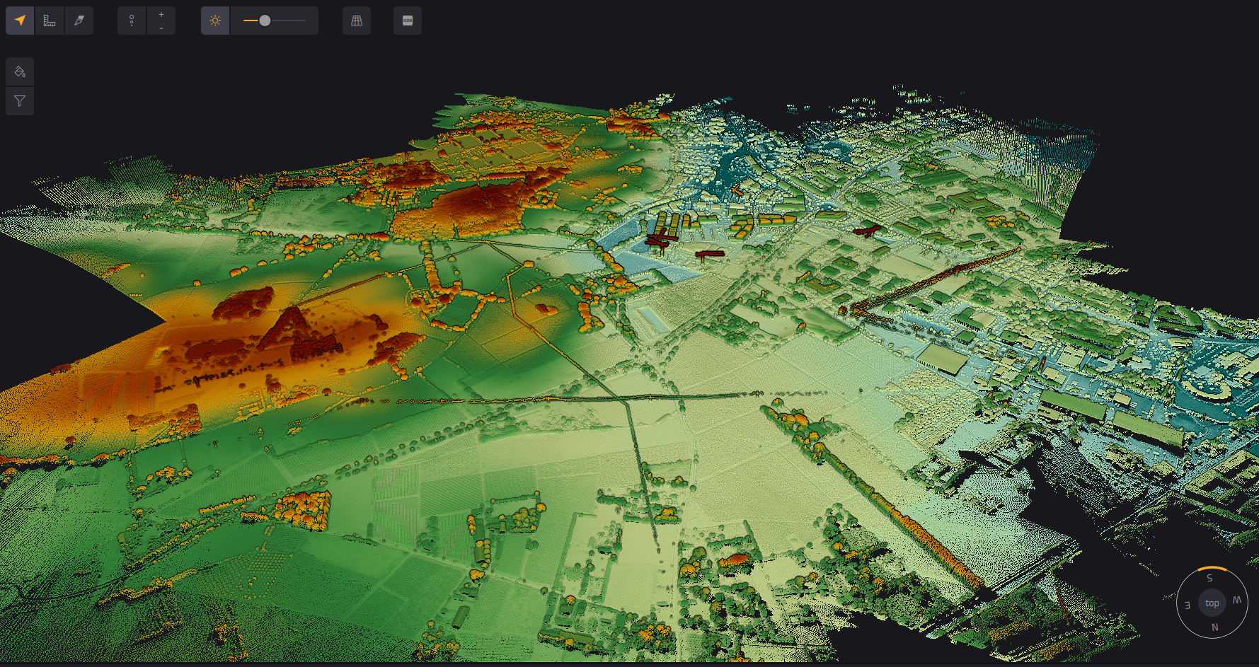
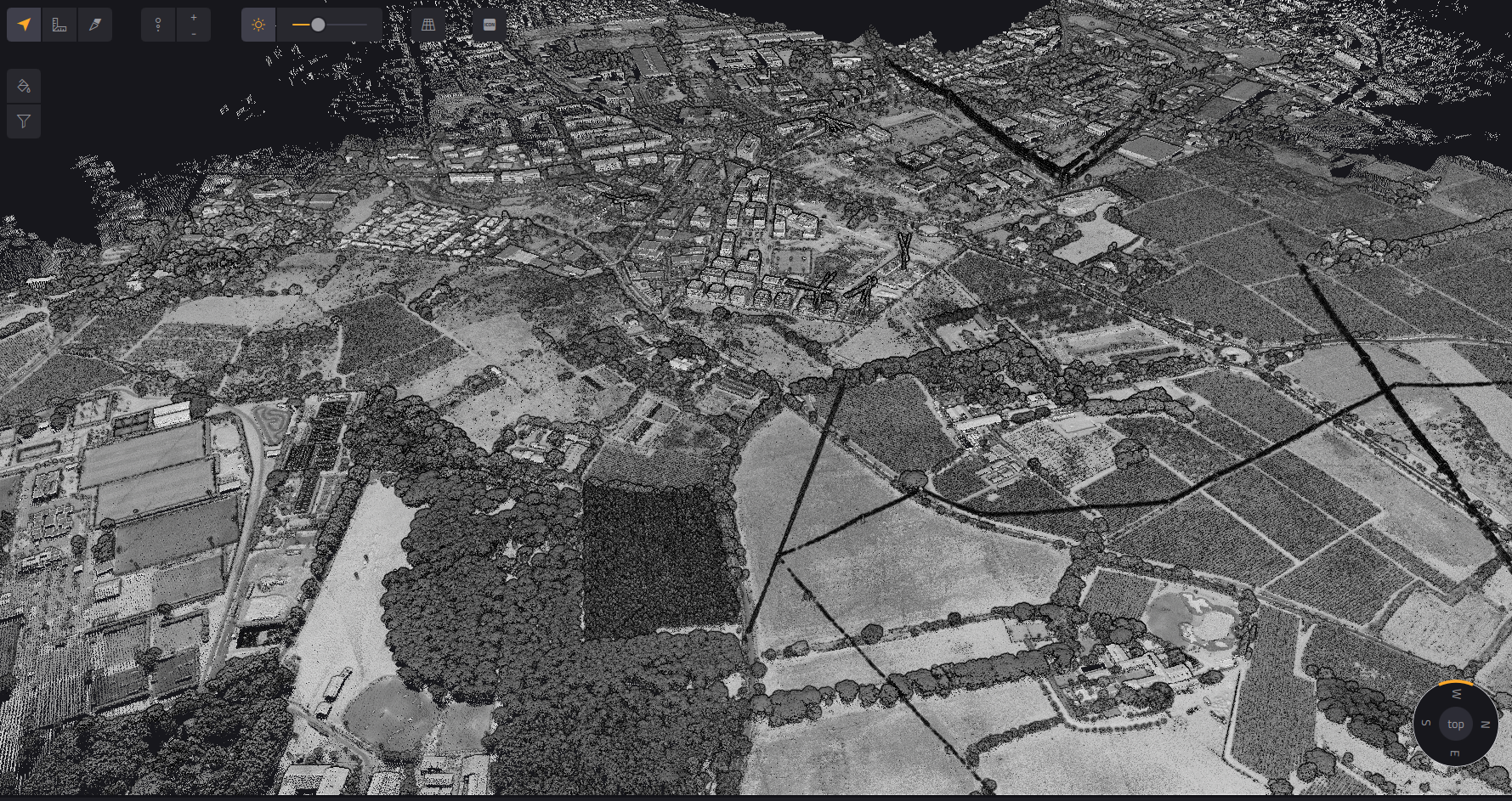
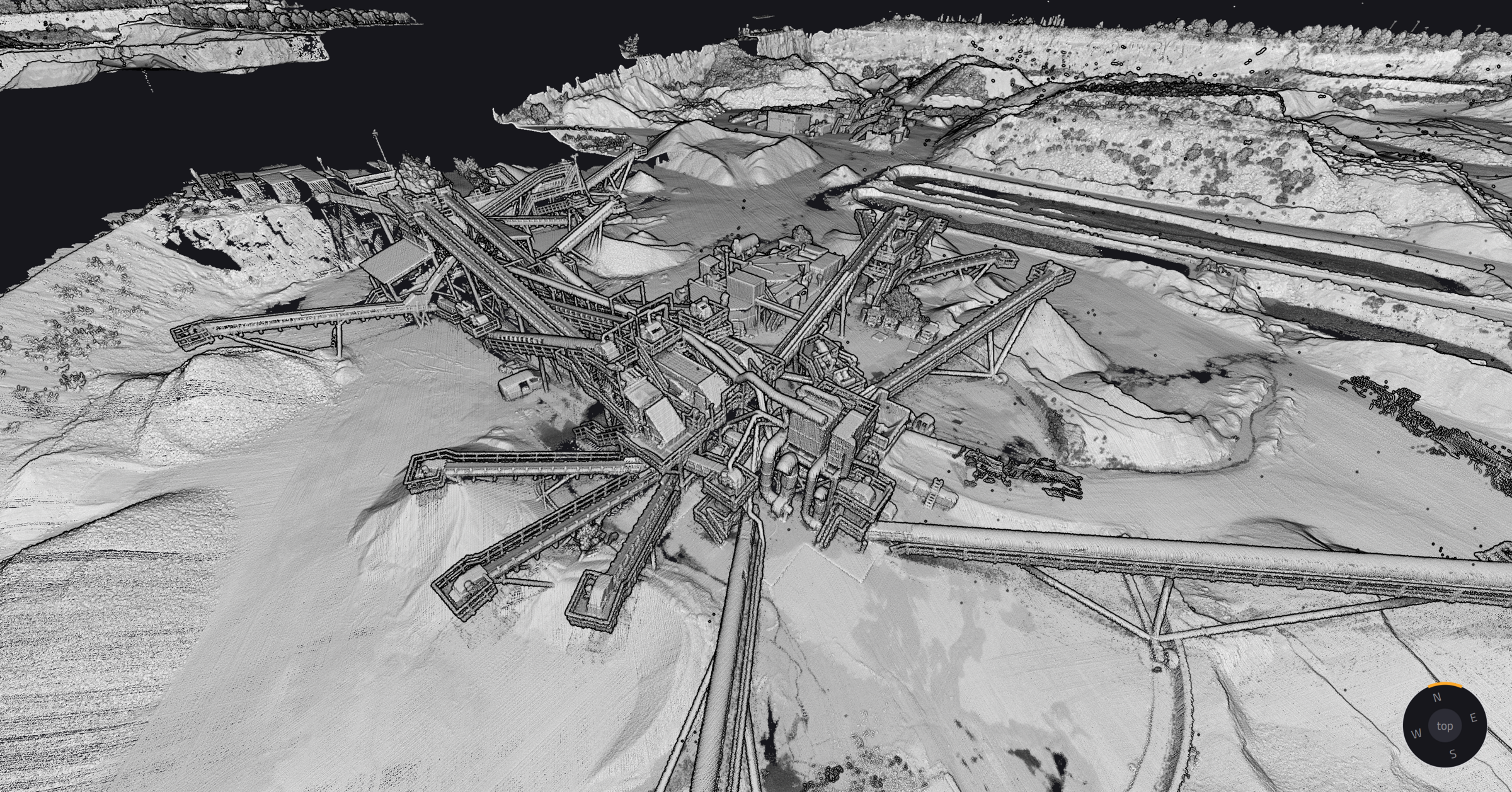
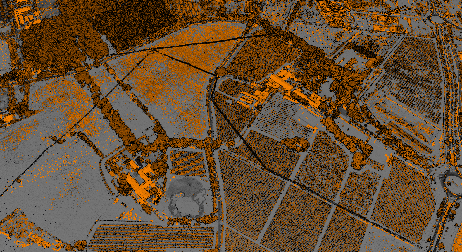
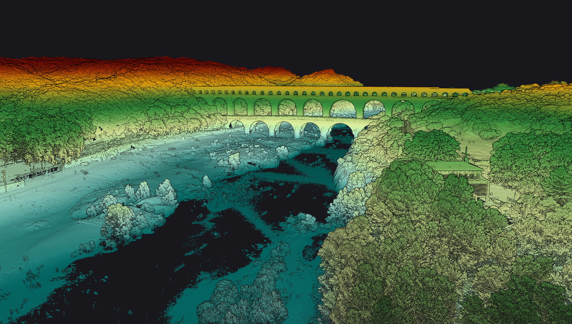
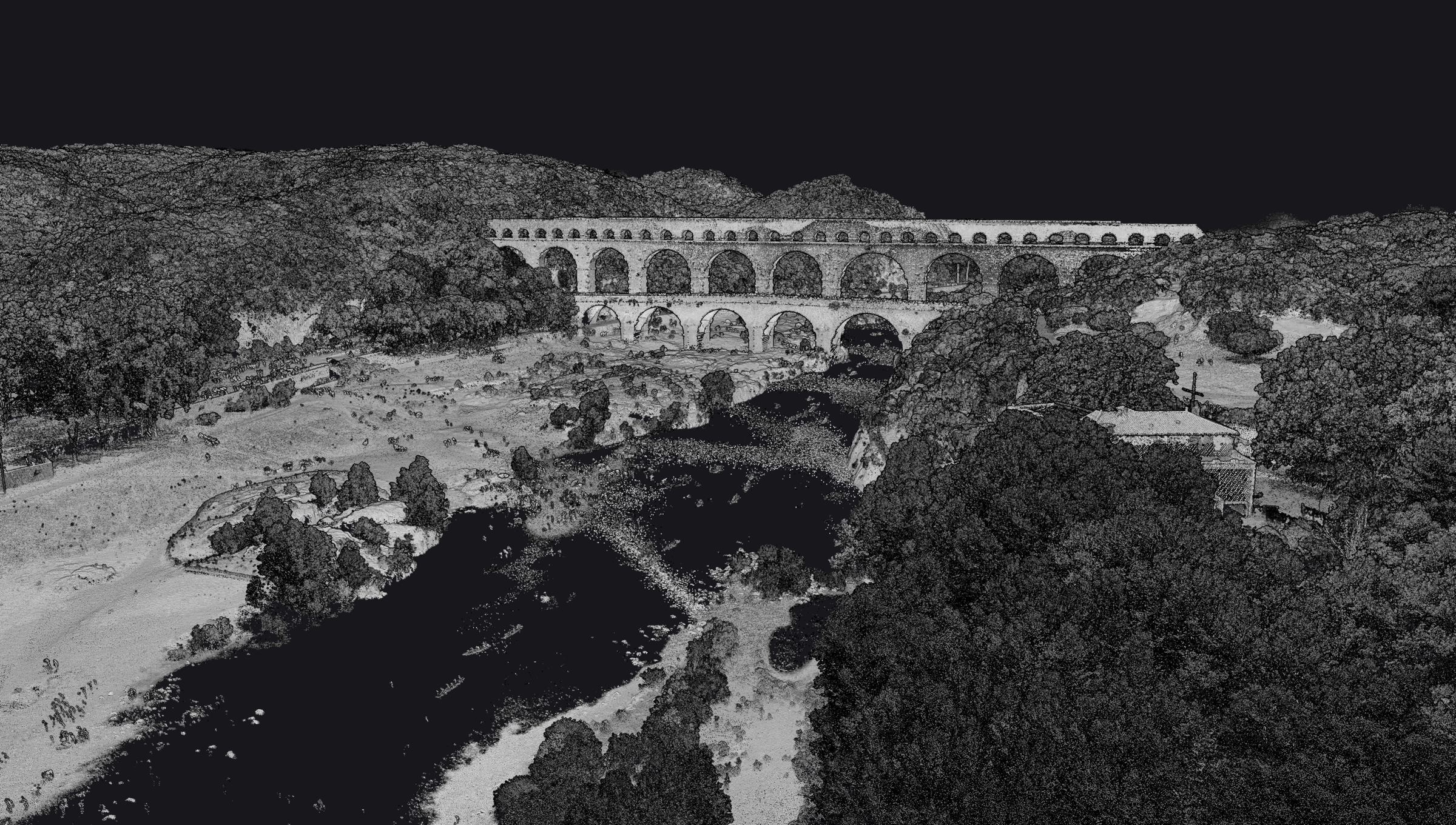
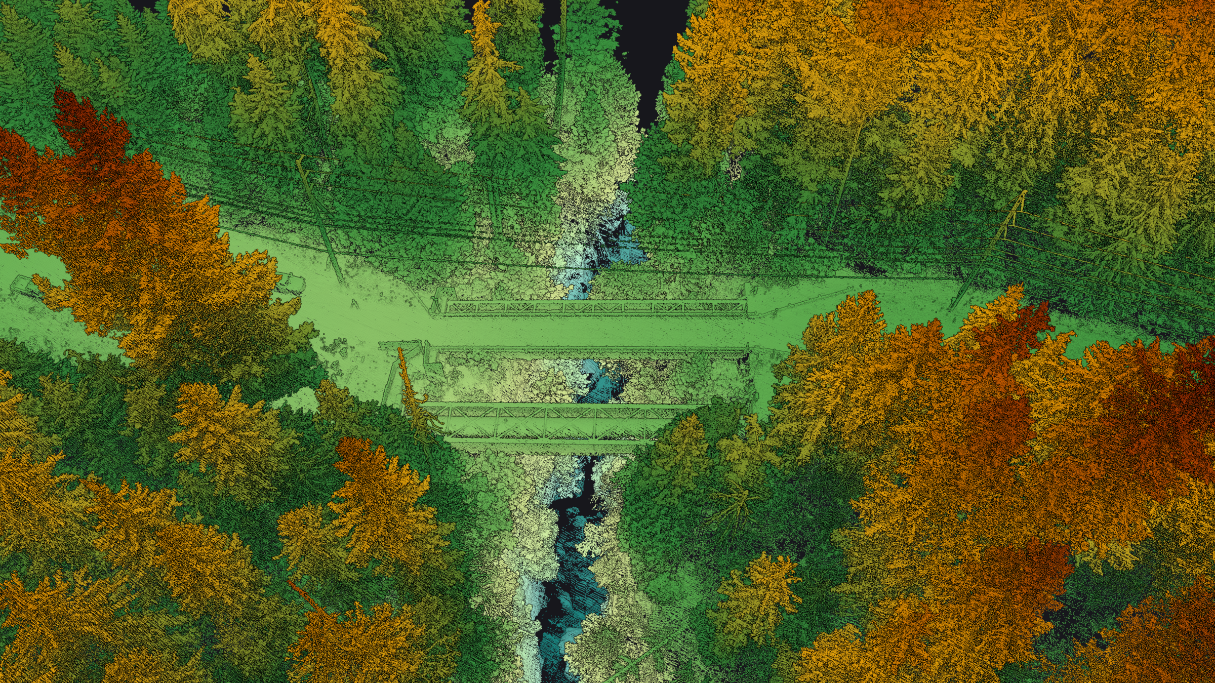
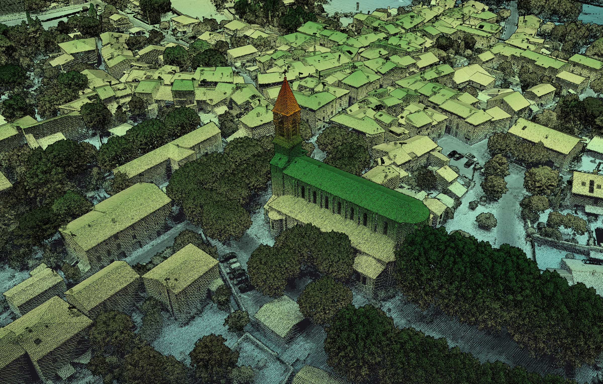
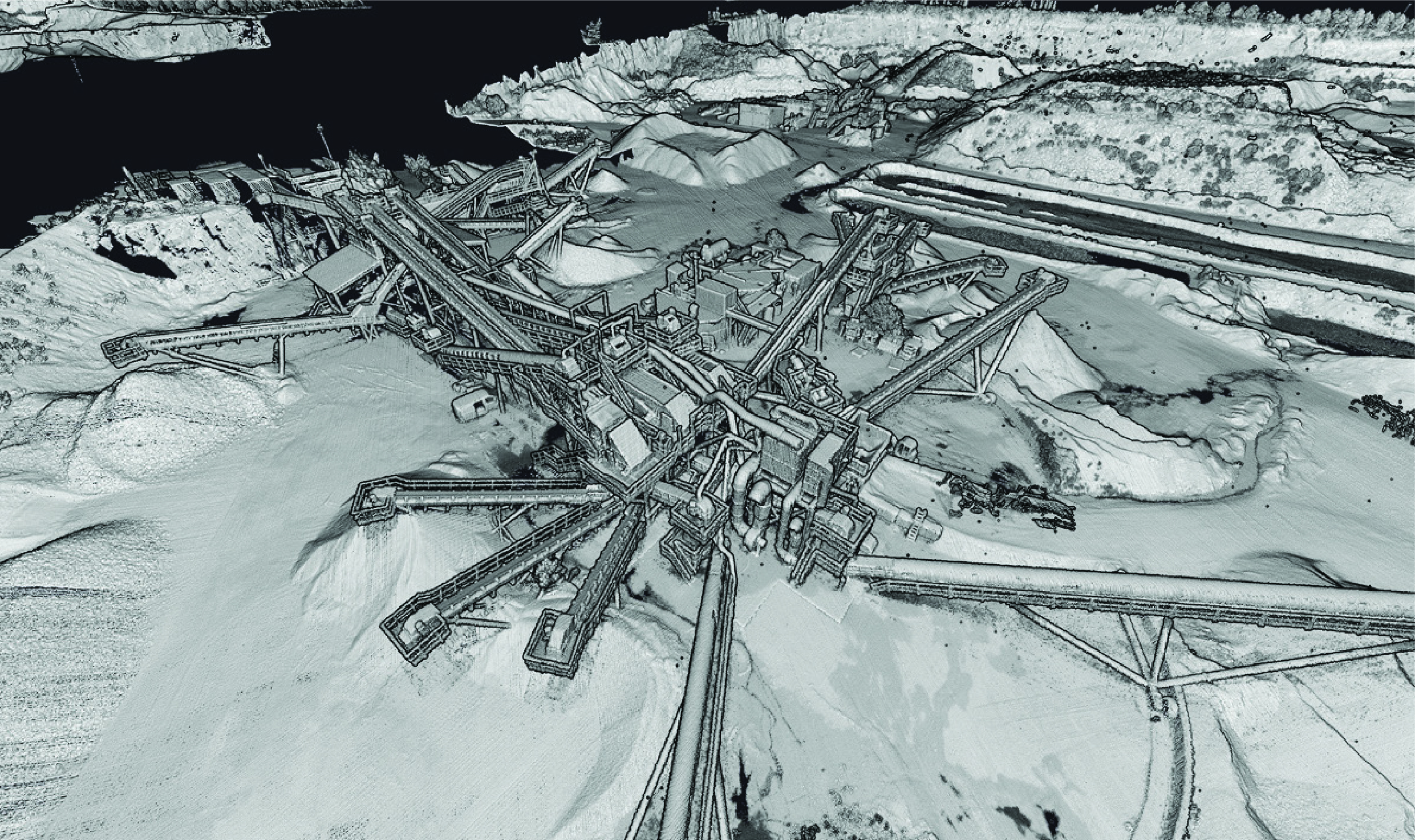
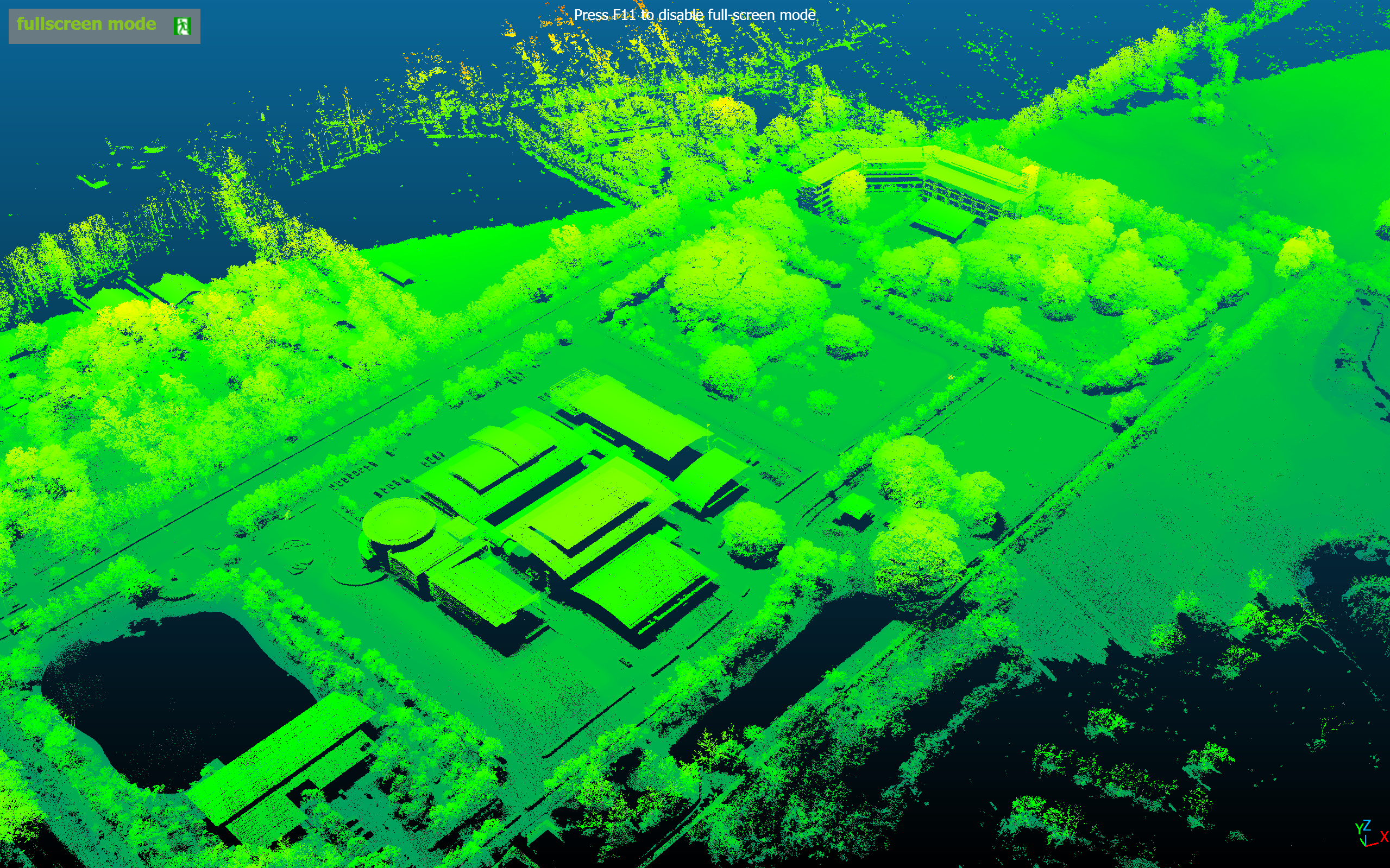
หมายเหตุ: ภาพตัวอย่างเหล่านี้เป็นผลงาน Reference จาก YellowScan ทั่วโลก ไม่ใช่ผลงานของ INSEE UAV — แสดงศักยภาพของ Sensor เท่านั้น
Voyager on INSEE-350.
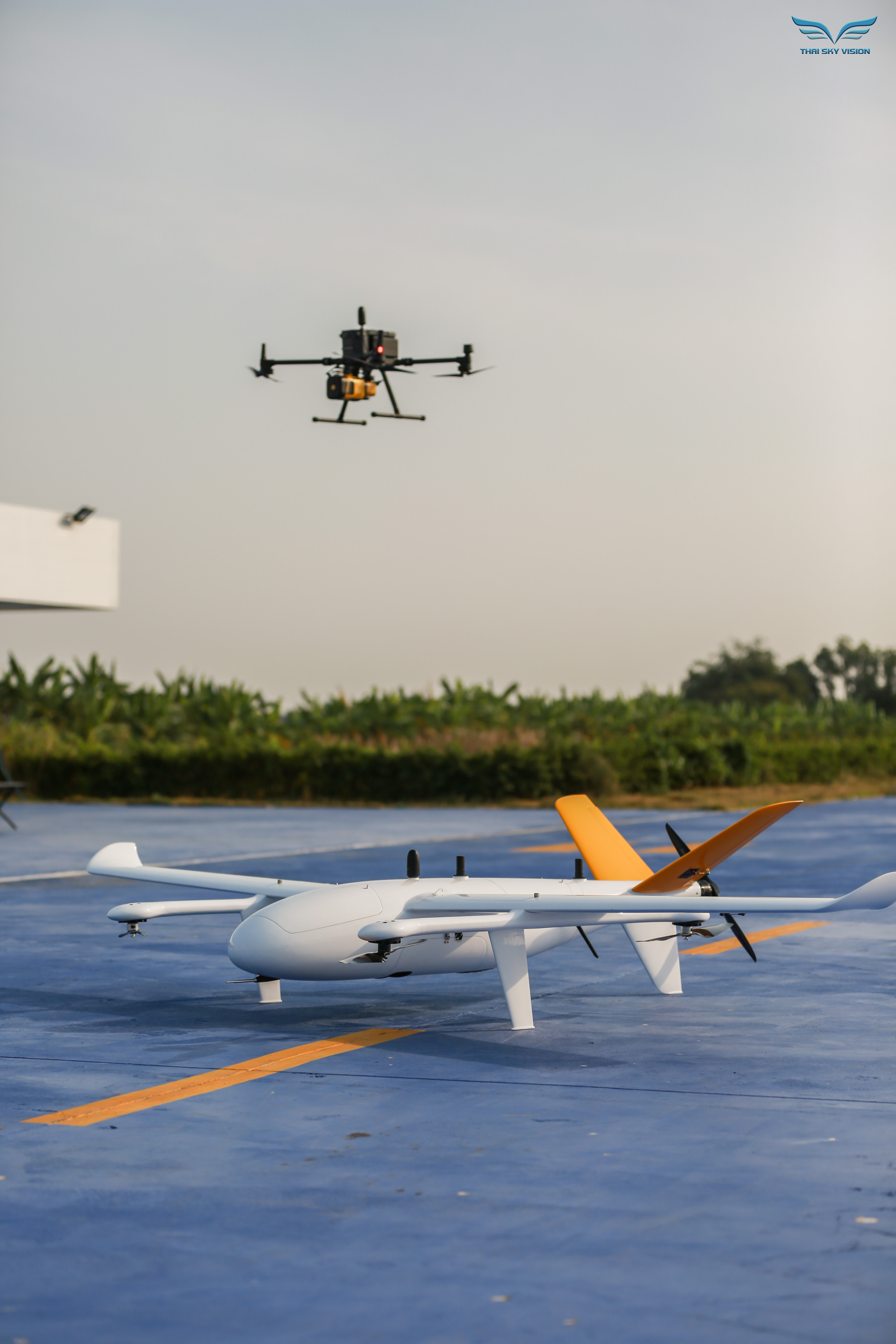
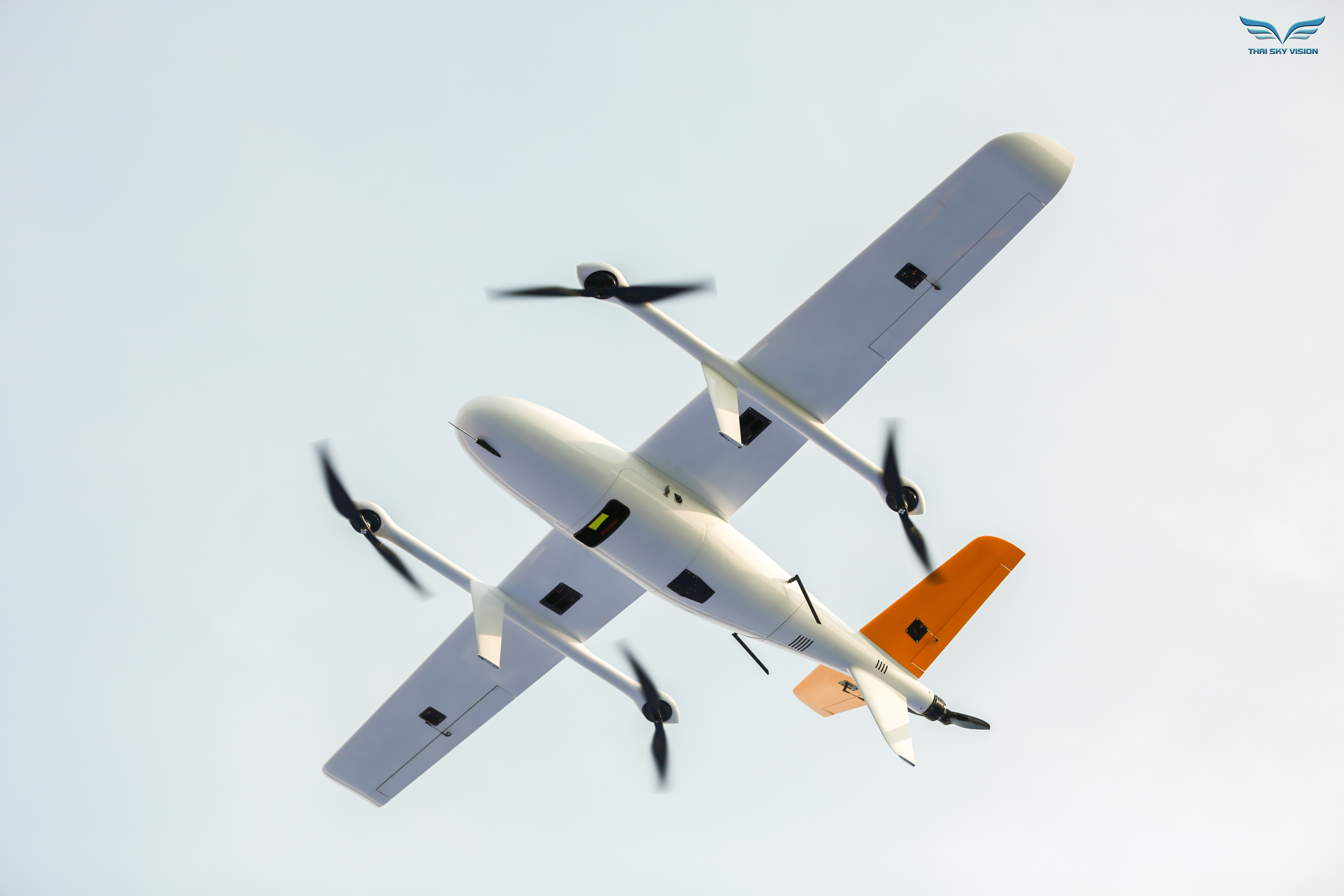
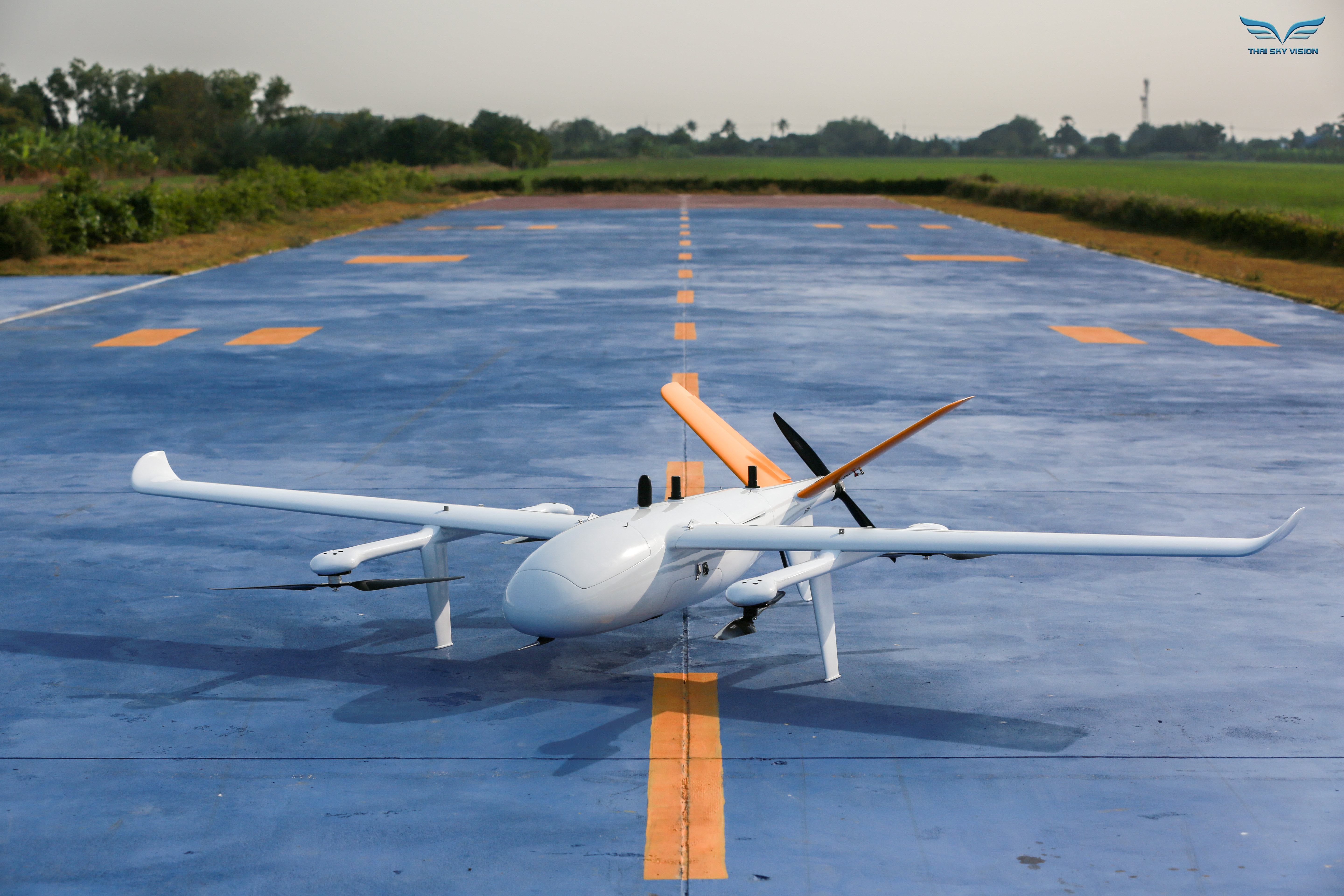
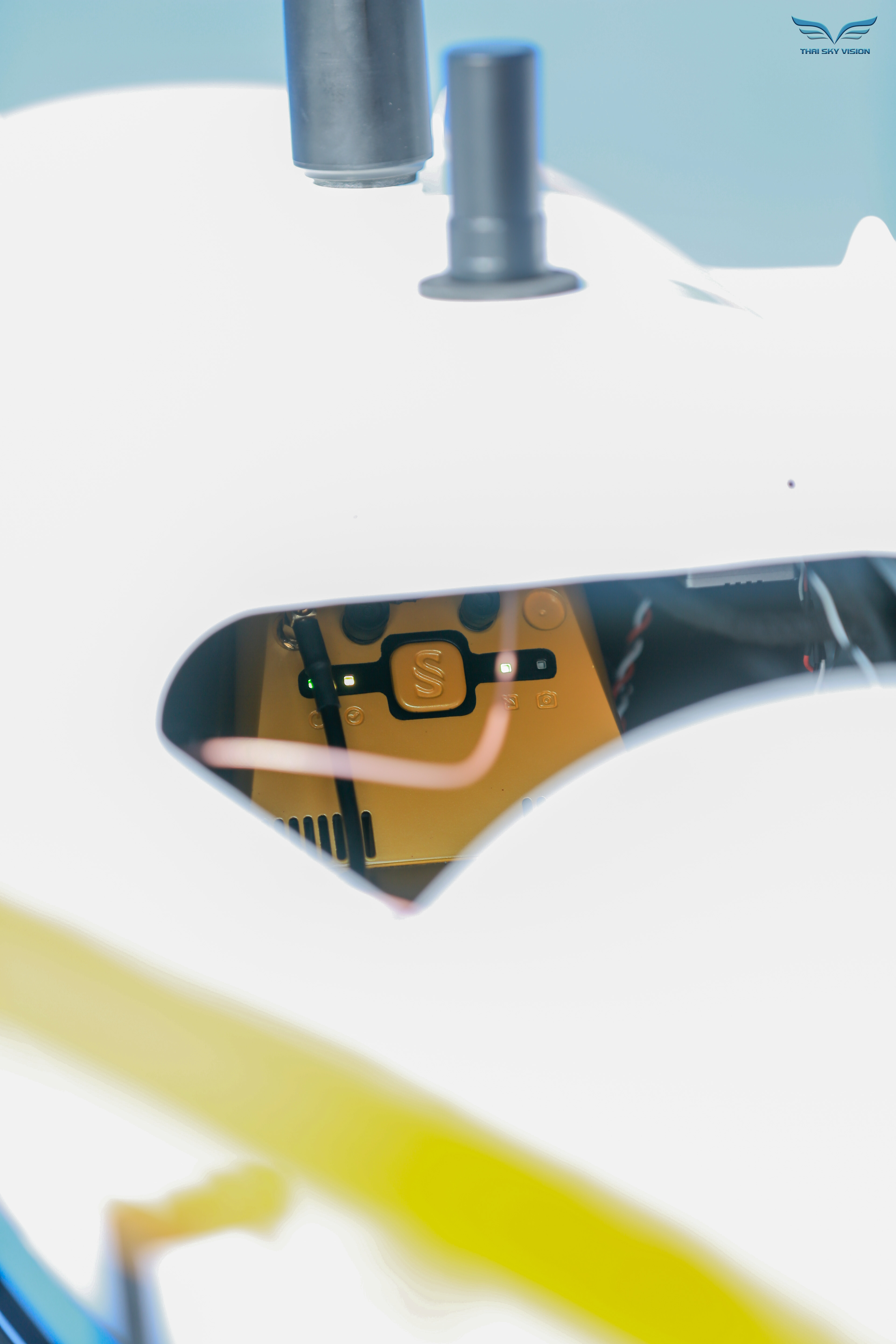
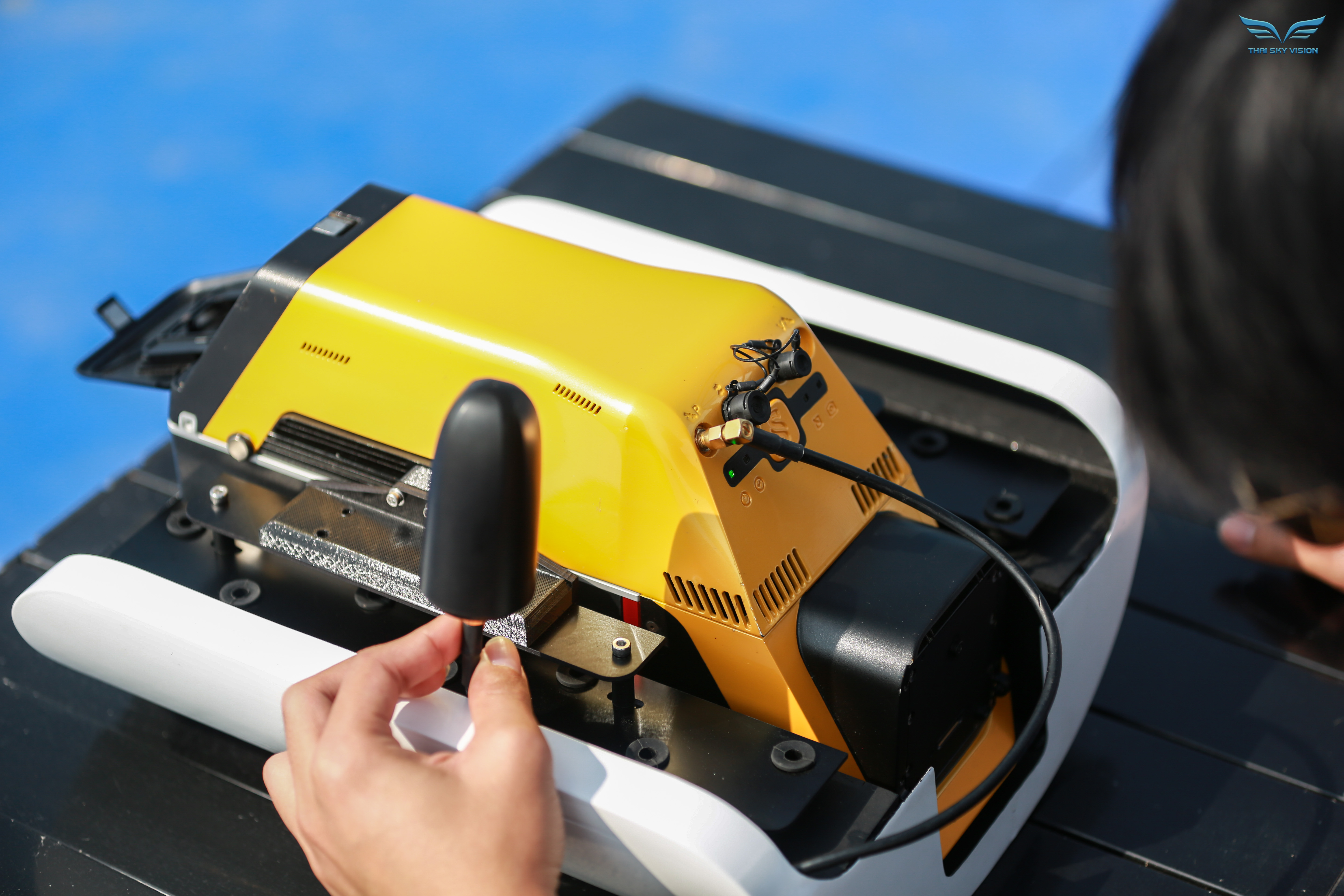
รูปจริง: ภาพถ่ายติดตั้งและปฏิบัติงานจริงของ INSEE-350 + YellowScan Voyager
พร้อมสำรวจแบบไร้ขีดจำกัด
ด้วย Voyager แล้วหรือยัง?
ติดต่อ Thai Sky Vision ตัวแทนจำหน่าย YellowScan อย่างเป็นทางการในประเทศไทย — รับคำปรึกษา สาธิตระบบ Long-Range LiDAR และ After-Sales Support ครบวงจร
Thai Sky Vision Co., Ltd. — Official YellowScan Distributor in Thailand