
7 Echoes Per Shot
See Through Vegetation
Multi-echo technology records up to 7 returns per shot — cleanly penetrating forest canopy to extract ground data beneath dense vegetation, ideal for forestry and heavily covered terrain.
Long Range
640m Laser Reach
Maximum range of 640 m supports flights up to 240 m AGL — higher altitude means wider single-sortie coverage and fewer flight lines for corridor and large-area work.
Fast Coverage
3.5M Points/sec
Fires at 500,000 shots/sec, producing up to 3.5 million points per second — covering more ground faster and cutting flight time.
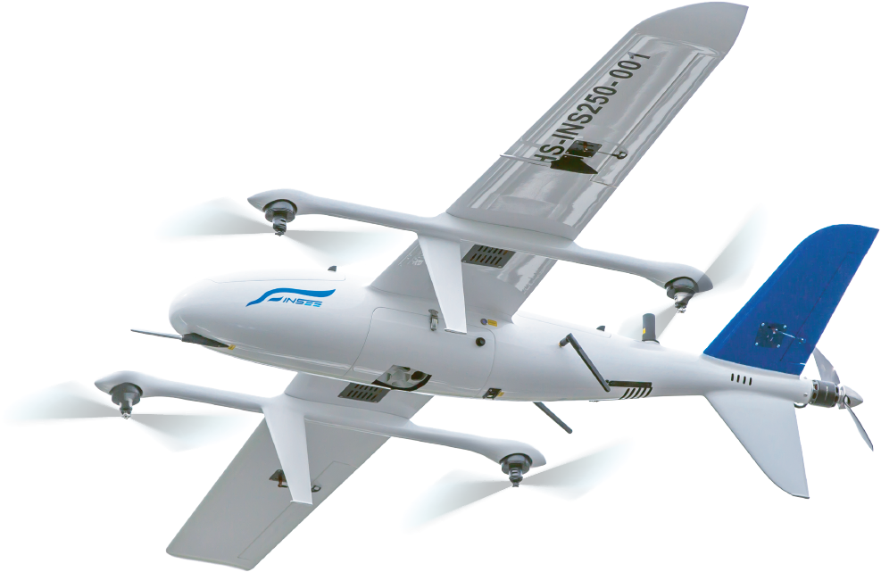
Multi-Platform
Built for Any UAV
Compatible with multi-rotor, single-rotor, VTOL fixed-wing and fixed-wing UAVs — 1,950 g and platform-agnostic, ideally paired with INSEE-350 for Long-Range Missions.
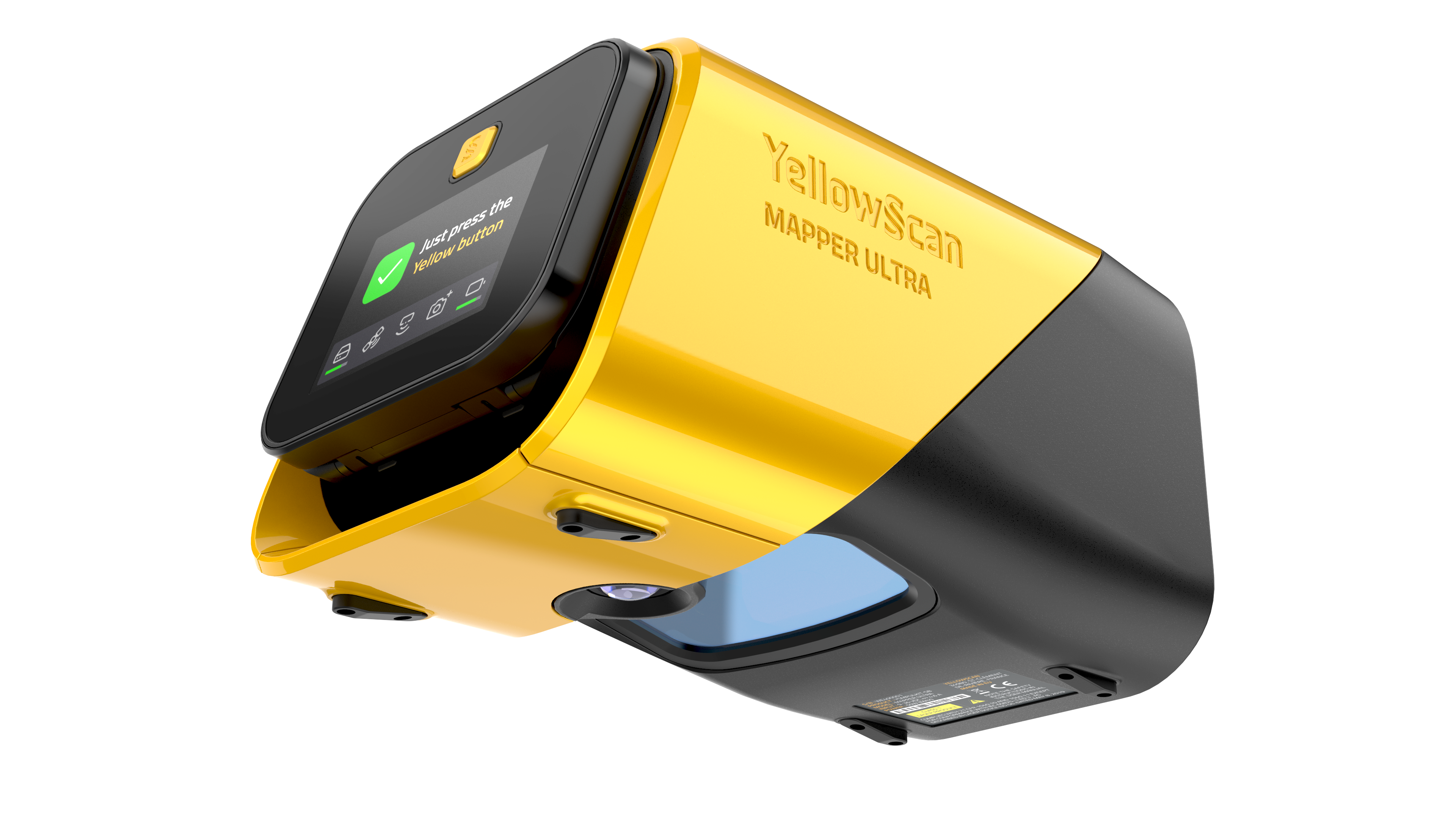
Technical Specifications.
System Components.
Laser Scanner
GNSS / INS & Imaging
Operational Parameters.
| Parameter | Value |
|---|---|
| Typ. Flight Speed | 10 m/s |
| Typ. Flying Height | 120 m AGL |
| Max Rec. Flying Height | 240 m AGL (@ 100 kHz PRR) |
| Point Density | 300 pts/m² @ 50m AGL, 10 m/s |
| High-density (30m, 10 m/s) | 1,086 pts/m² @ 500 kHz PRR |
| Fast Coverage (70m, 30 m/s) | 155 pts/m² @ 500 kHz PRR |
| Operating Temp. | -10°C to +40°C |
* Point density is theoretical maximum with all shots yielding max echoes. May vary depending on flight conditions, terrain, and survey environment. Maximum flight height varies depending on selected PRR.
Hardware
- YellowScan Mapper Ultra unit
- 2 batteries
- Rugged Pelicase carry case
- GNSS Antenna + Cable
- 2 CF Express cards
- User documentation
Services
- 1-year warranty + unlimited Technical Support
- In-person or online Training
- Boresight Calibration Certificate
- Local Support by Thai Sky Vision, Official Distributor in Thailand
Software
- SBG Qinertia — Post-process GNSS & inertial data
- CloudStation Essential — Visualize, inspect, colorize & export
- Upgradeable to CloudStation Pro / Ultimate
- Optional: LiveStation (real-time in-flight monitoring)
Extend Your Capabilities.
Mounting & Hardware
Software & Real-time
Point Cloud Use Cases.
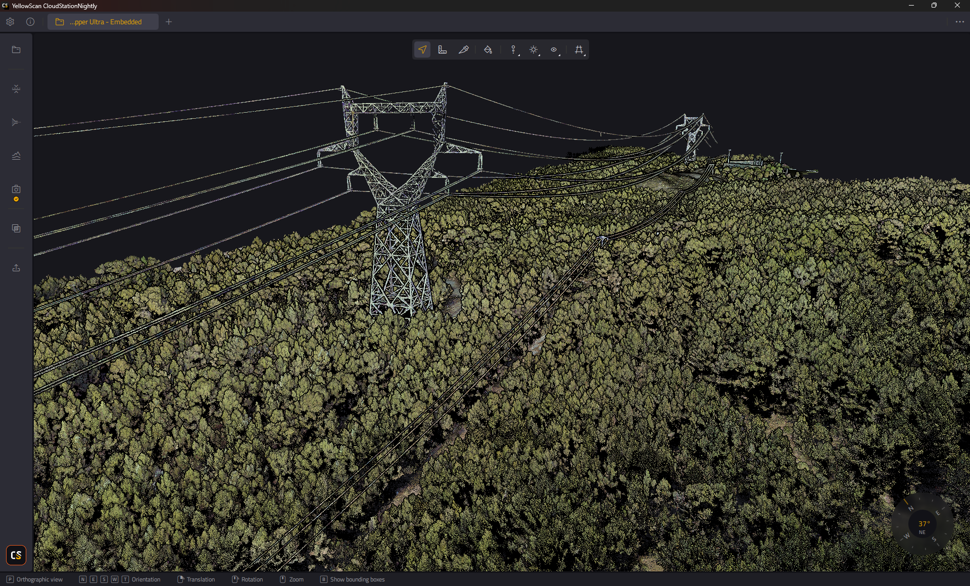


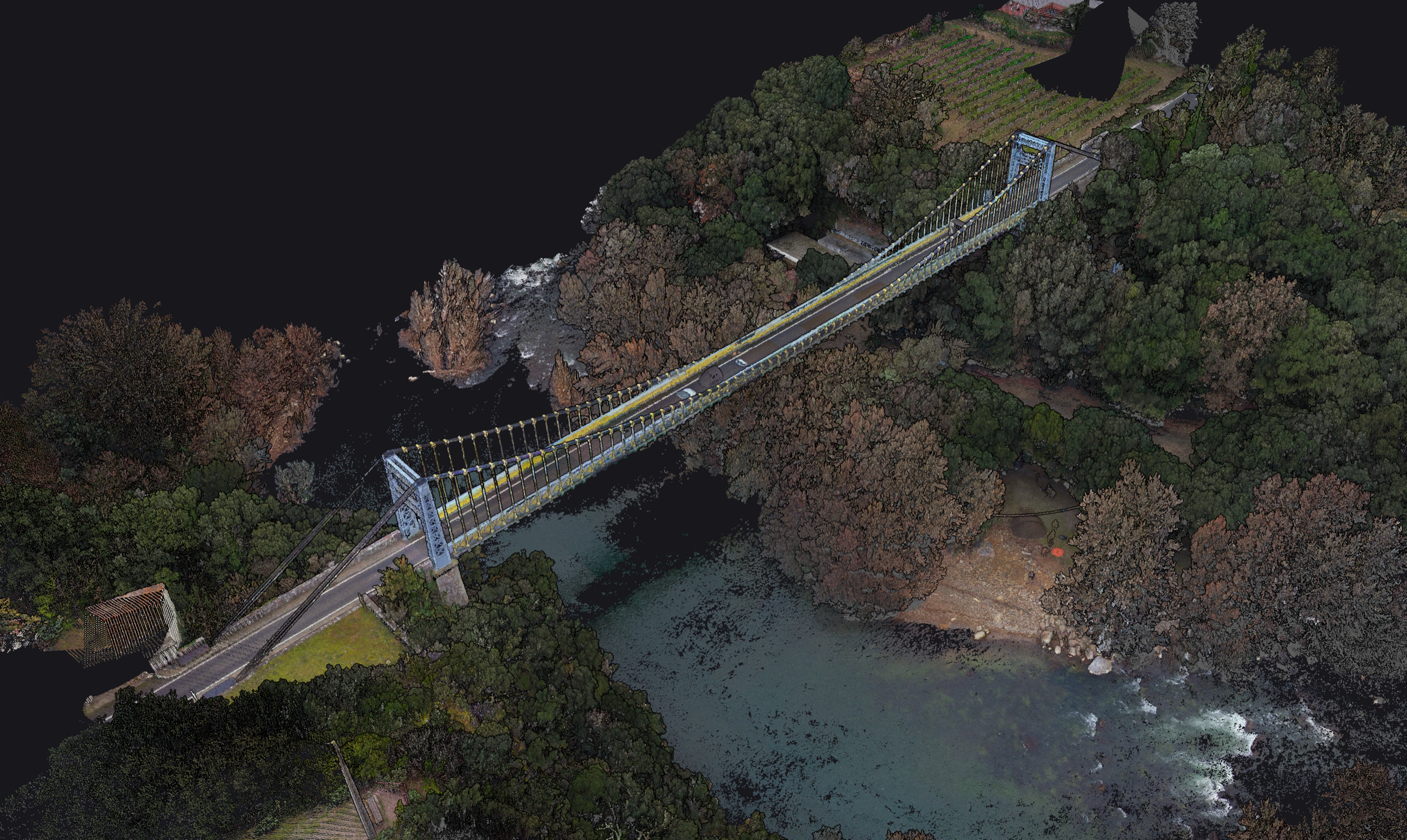
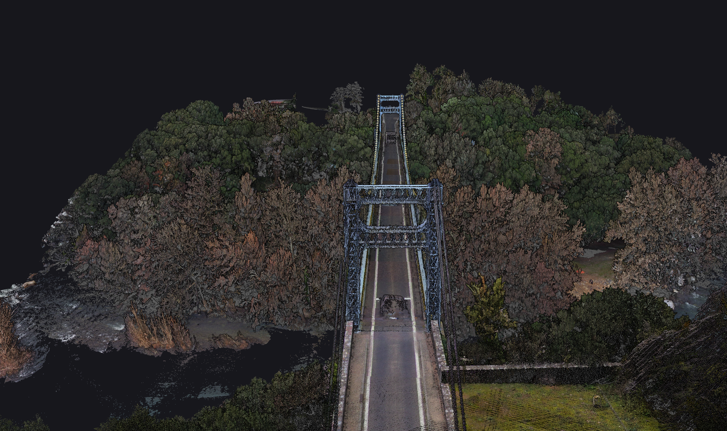


Note: Point Cloud imagery in this section is Reference Material from YellowScan, illustrating Mapper Ultra use cases — not work captured by INSEE UAV directly.
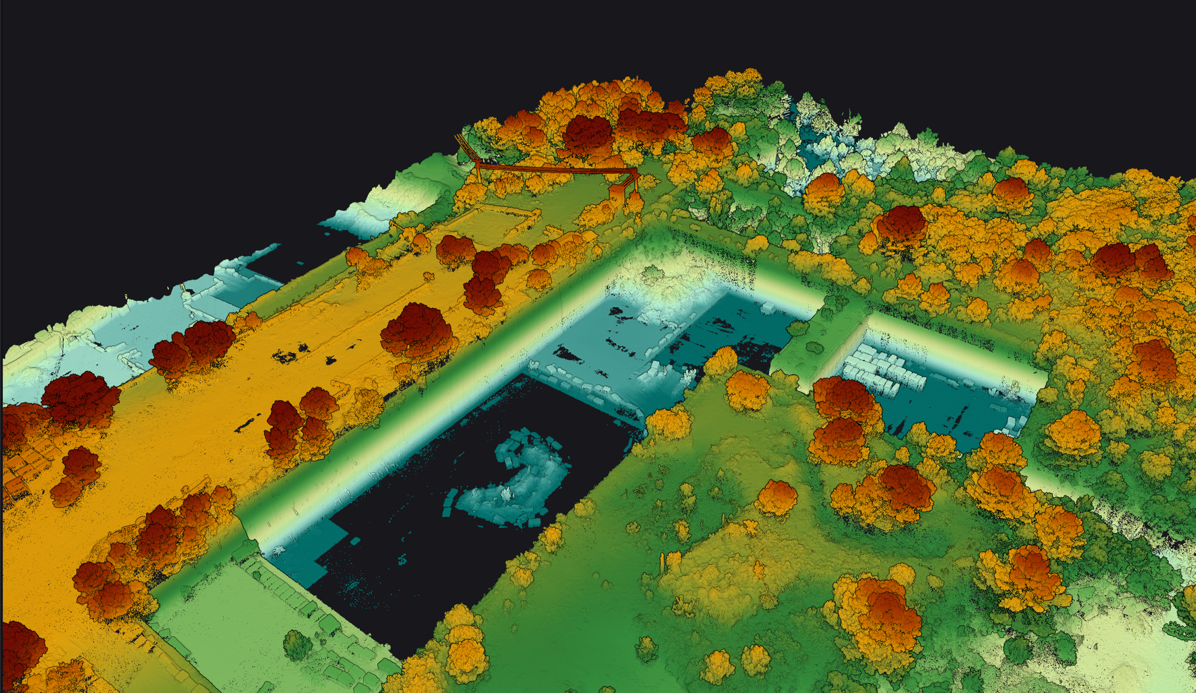
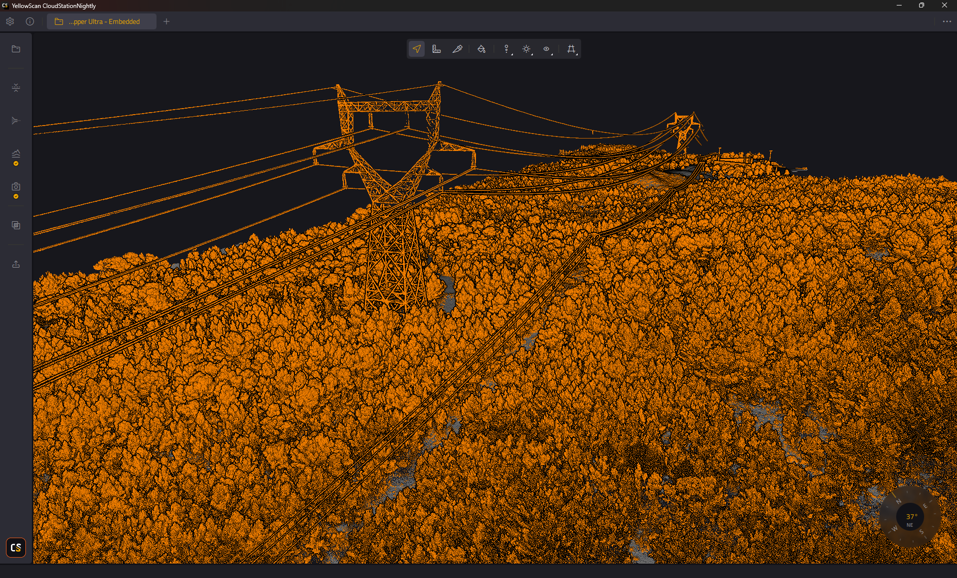

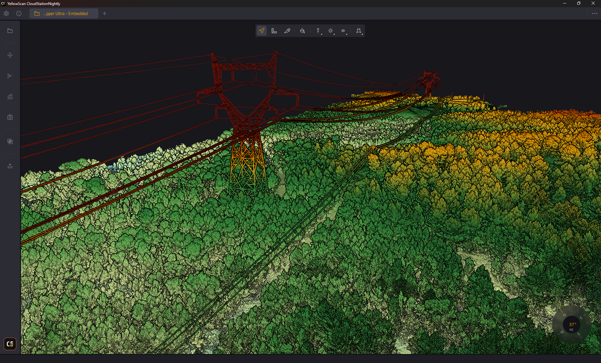
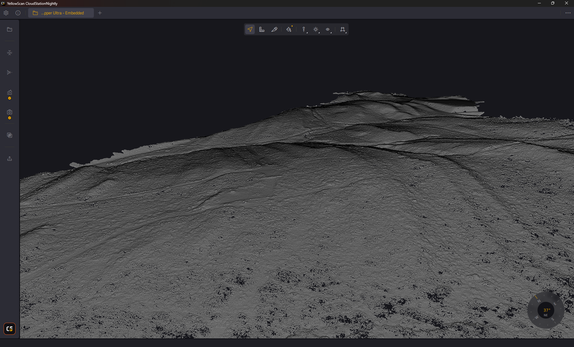

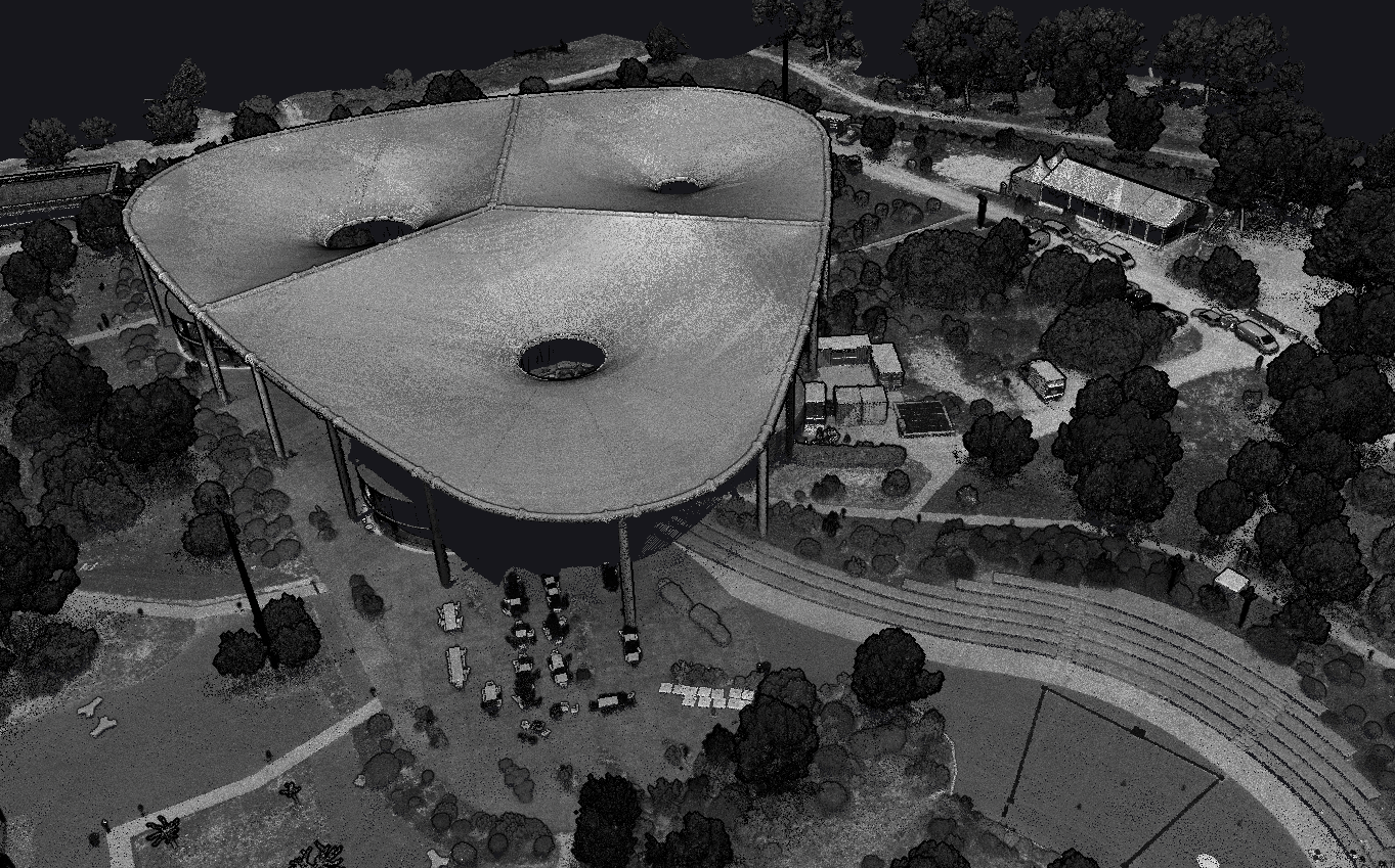
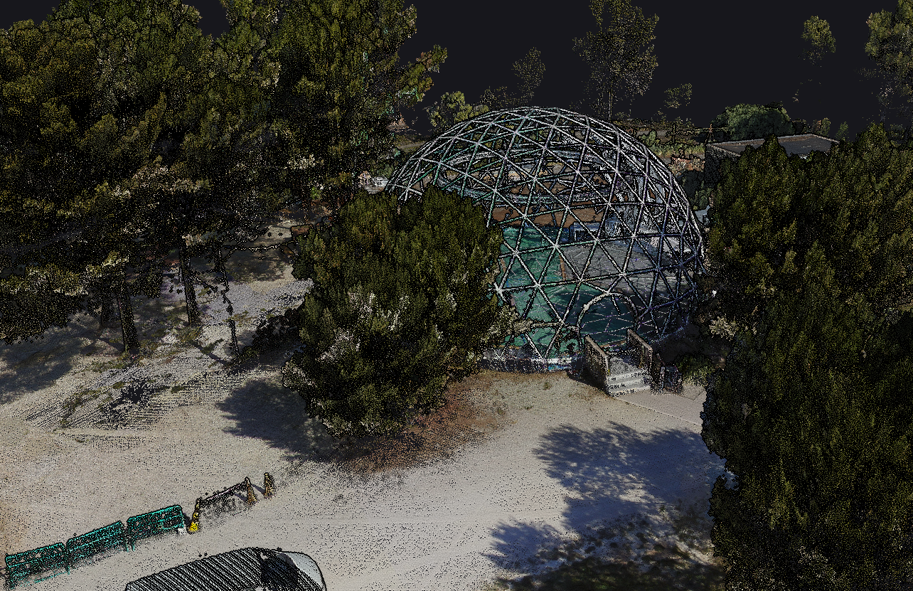
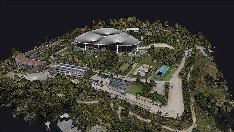
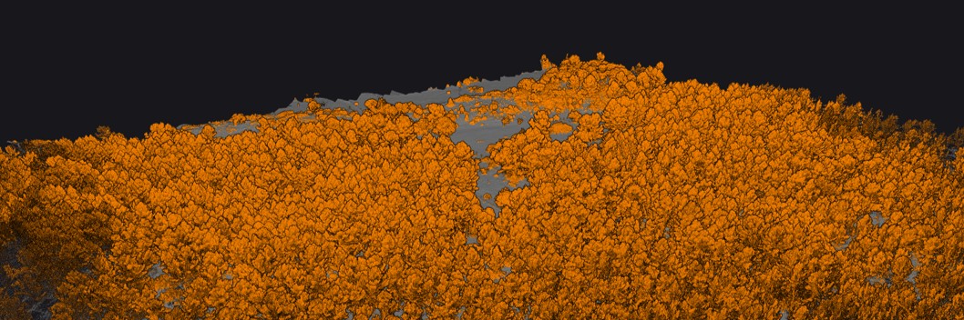
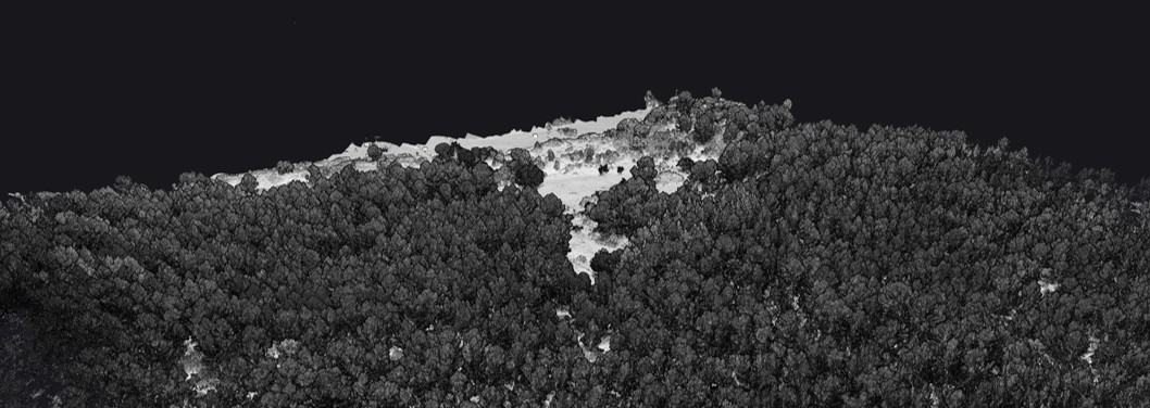
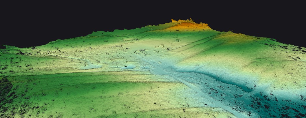

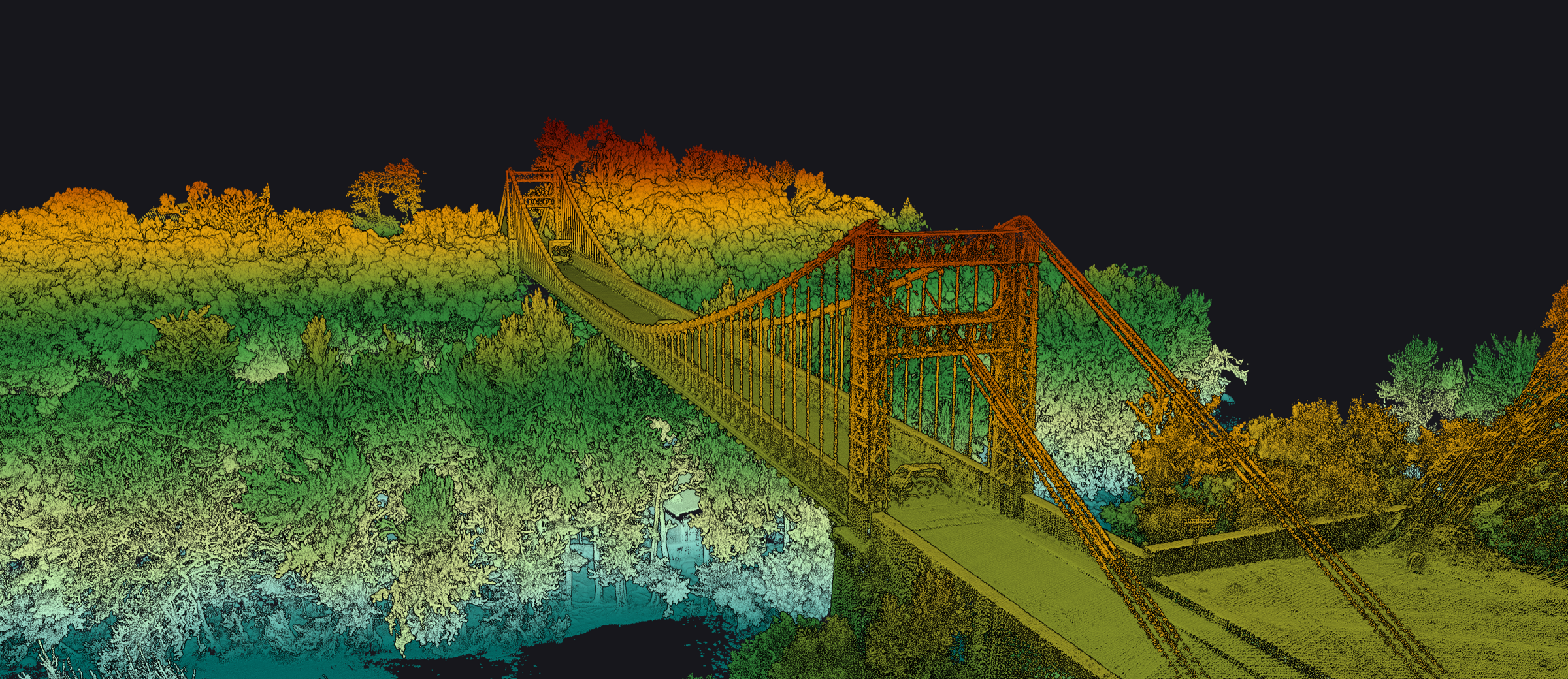
Note: These reference images are from YellowScan global portfolio — not from INSEE UAV missions — shown to demonstrate sensor capability.
Ready to fly farther and scan sharper
with Mapper Ultra?
Contact Thai Sky Vision, Official YellowScan Distributor in Thailand — for consultation, Long-Range LiDAR demos, and full After-Sales Support.
Thai Sky Vision Co., Ltd. — Official YellowScan Distributor in Thailand