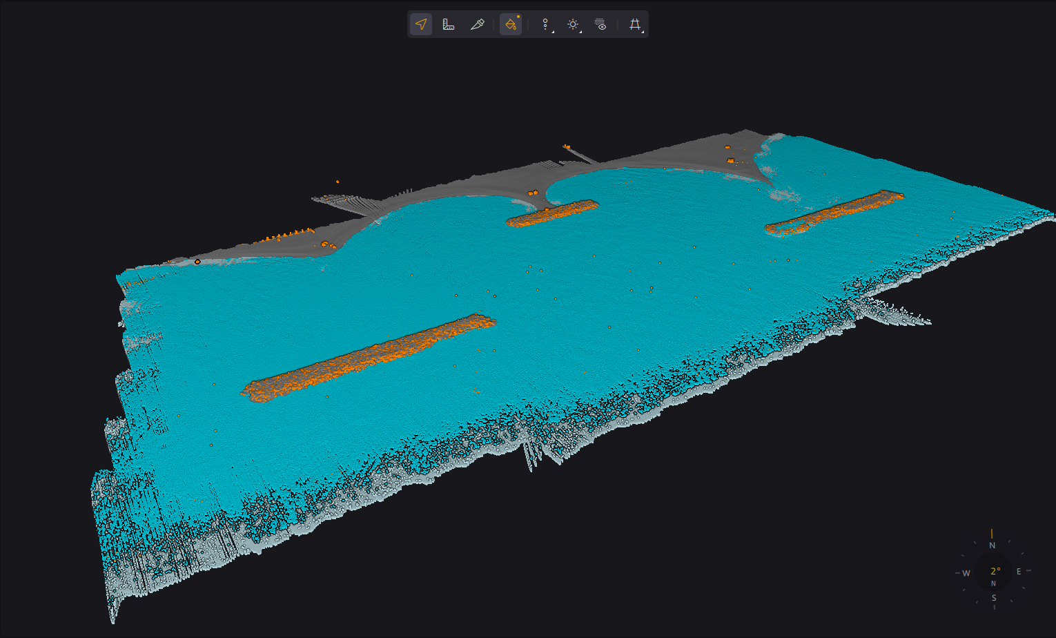
Topography &
Water Mapping
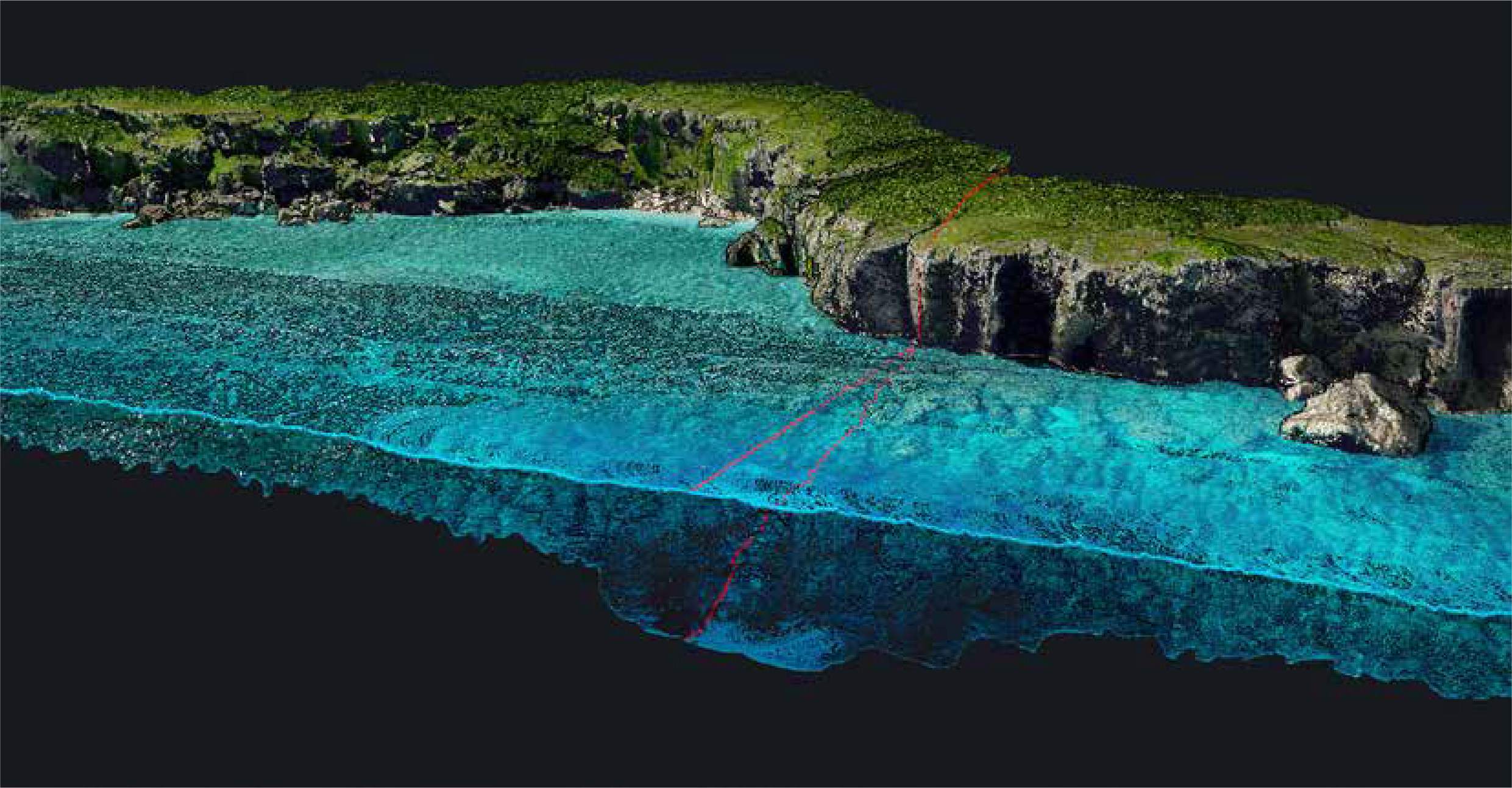
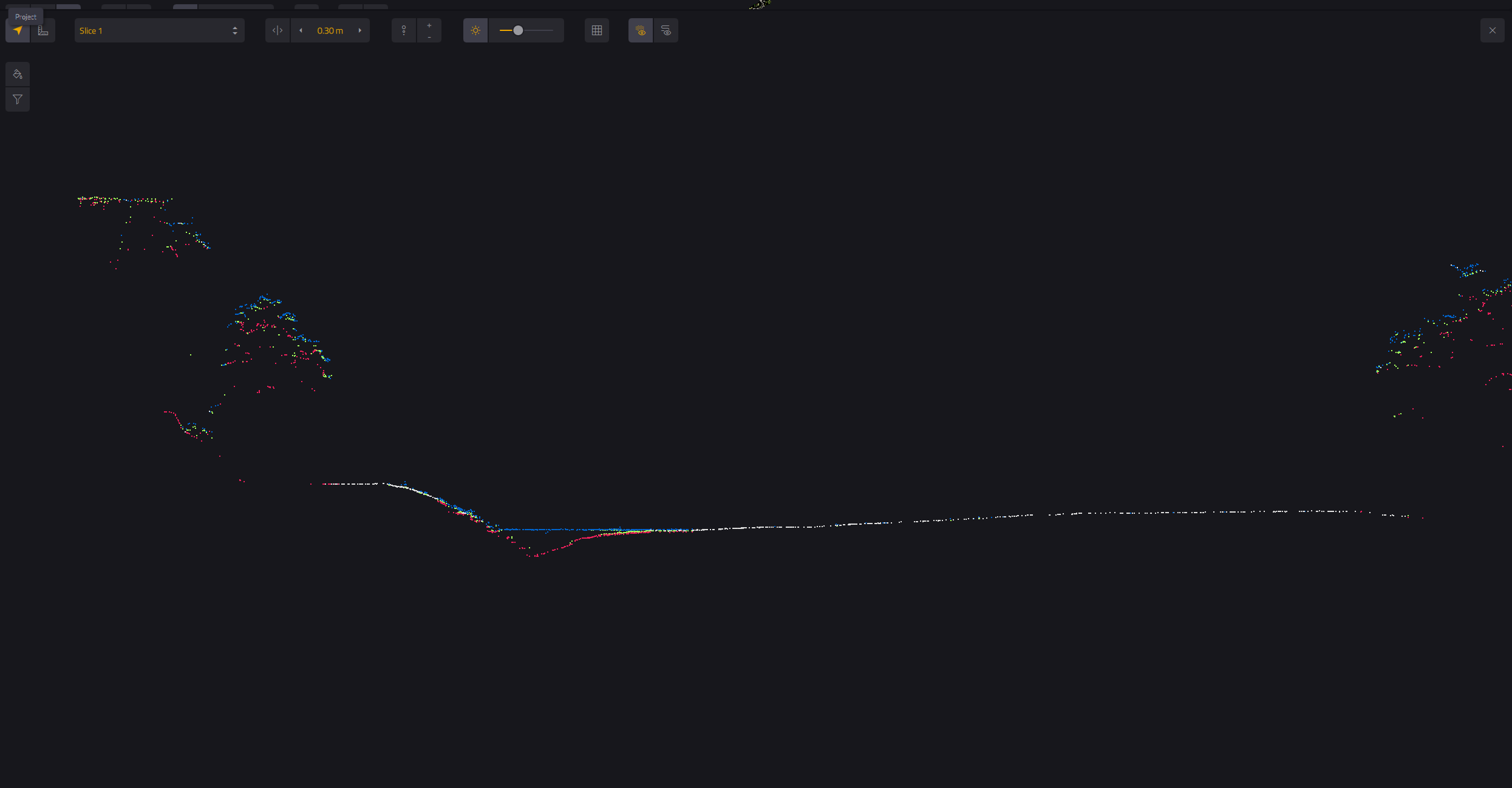
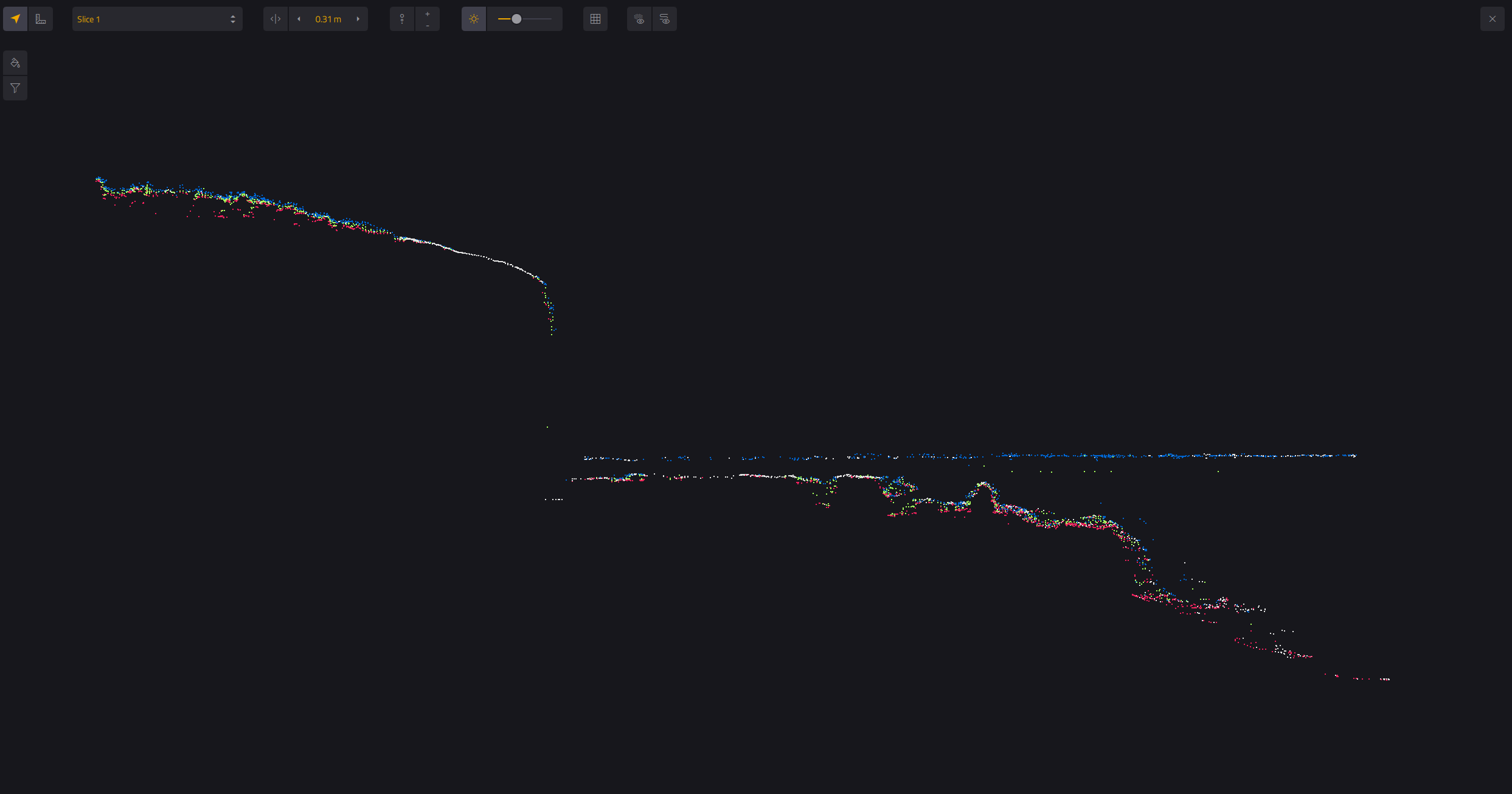
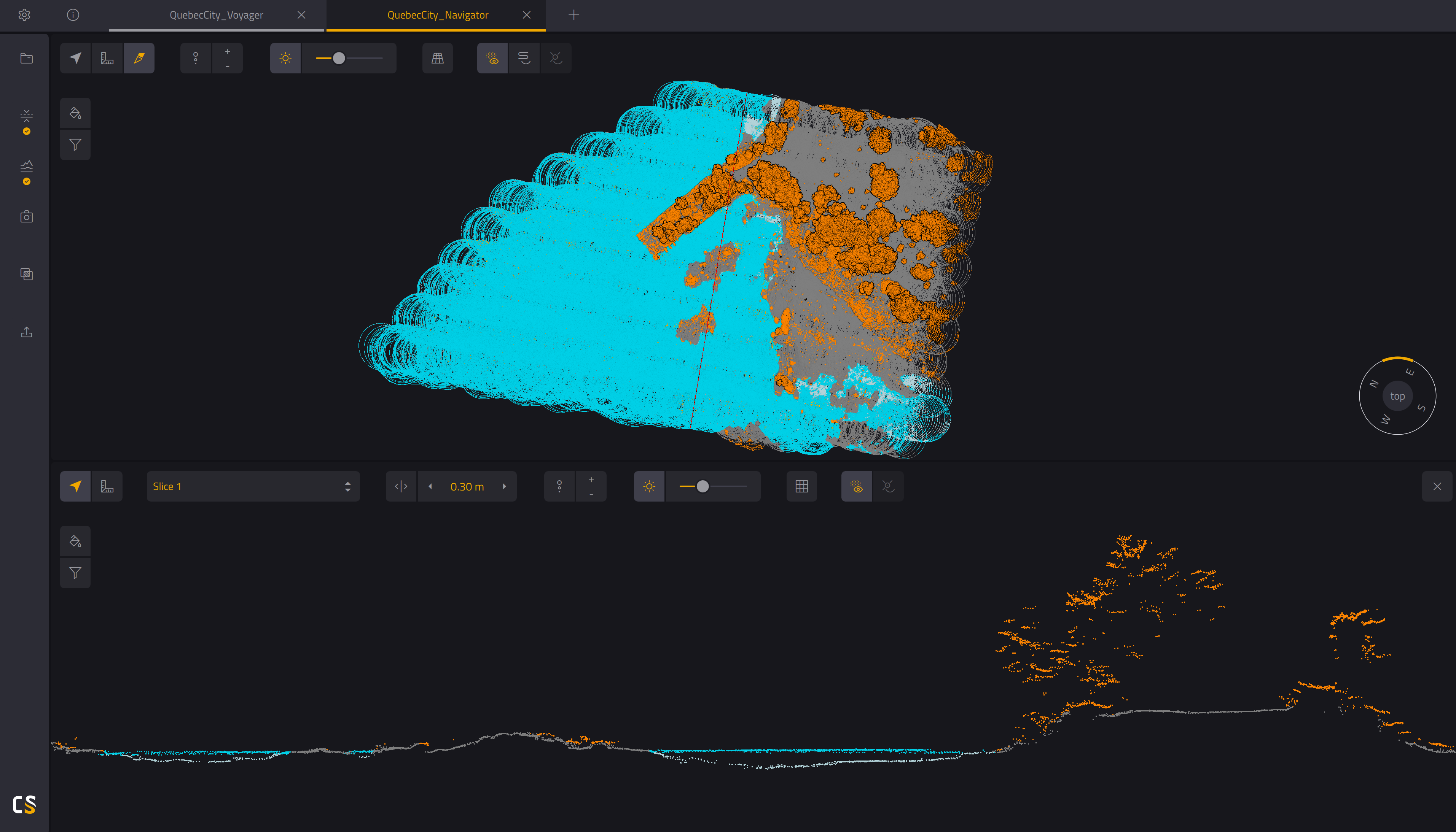
Surveys land and submerged surfaces simultaneously in a single sortie, with a 532 nm Green Laser that penetrates the water surface — cutting time and cost across coastal, river, and reservoir surveys.
Easy to Use
and Process
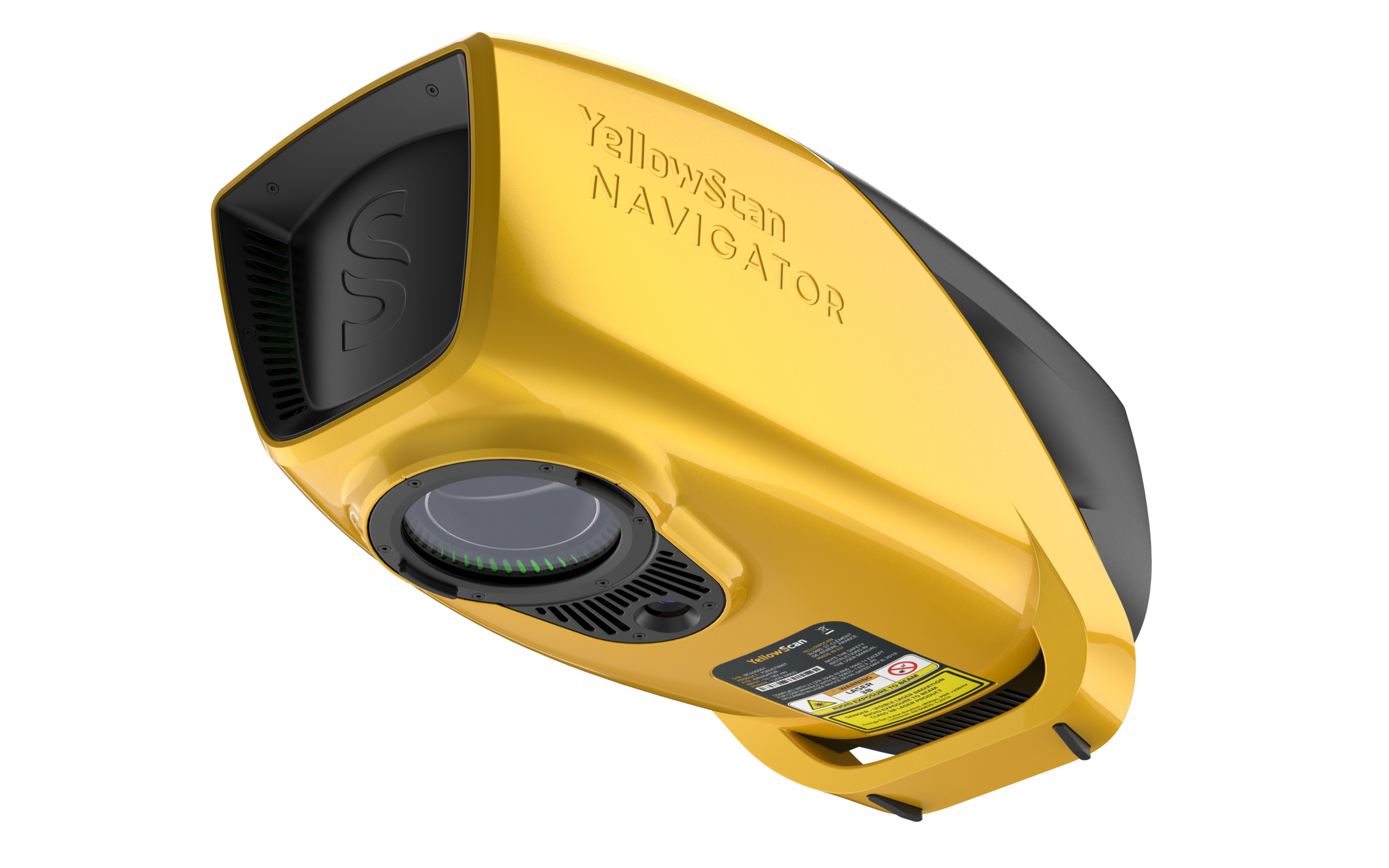
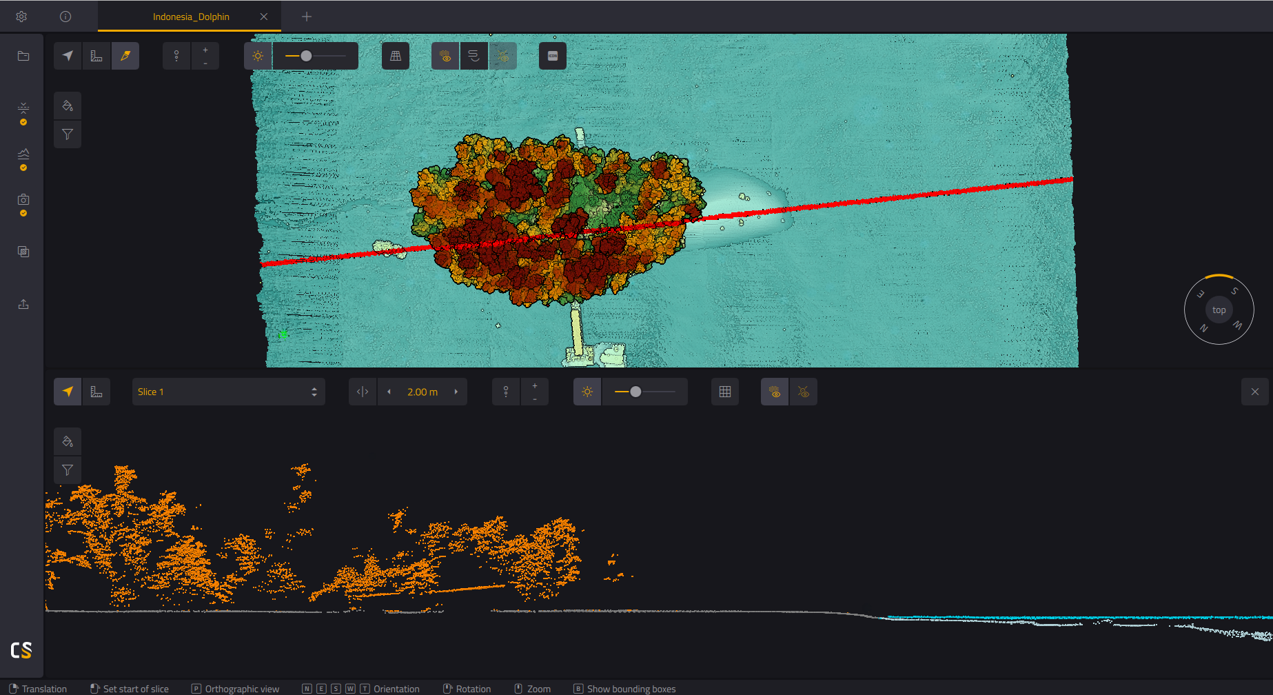
Power up with Single-Button Operation — simple, fuss-free workflow, paired with CloudStation software for fast post-processing.
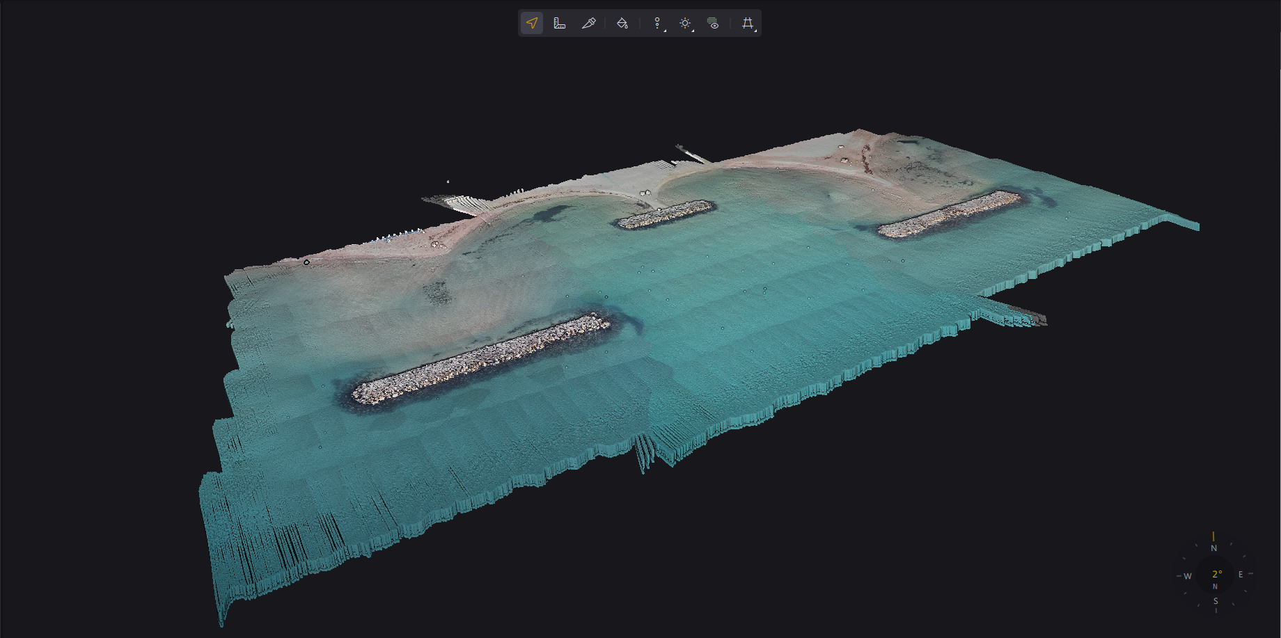
Built-in 2MP
Global Shutter Camera
A built-in Global Shutter RGB camera colorizes the point cloud on the spot — crisp color even at speed, with no extra camera to carry.
Safe Operational
Range
Designed for safe operation at Laser Class 3B — Laser Safety Goggles are included so every mission stays protected.
Technical Specifications.
System Components.
Laser Scanner
GNSS / INS
Operational Parameters.
| Parameter | Value |
|---|---|
| Typ. Flight Speed | 5 m/s |
| Typ. Flying Height | 80 m AGL |
| Max Rec. Flying Height | 100 m AGL |
| Point Density | 20 pts/m² @ 80m AGL, 5 m/s |
| Min. Depth | 0.30 m |
| Max. Depth | 2 Secchi |
| Laser Class | Class 3B — Avoid direct exposure to beam |
| Operating Temp. | 0°C to +40°C |
* Point density is theoretical maximum with all shots yielding max echoes. May vary depending on flight and survey conditions, and surveyed environment. Underwater precision and accuracy may vary.
Hardware
- YellowScan Navigator unit
- 2 batteries
- Rugged Pelicase carry case
- UAV GNSS Antenna + Cable
- 2 USB Flash Drives
- User documentation
- Laser Safety Goggles
Services
- 1-year warranty + unlimited Technical Support
- In-person Training
- Boresight Calibration Certificate
- Local Support by Thai Sky Vision, Official Distributor in Thailand
Software
- SBG Qinertia — Post-process GNSS & inertial data (integrated in CloudStation)
- CloudStation Essential — Generate, visualize, inspect & export data
- Upgradeable to Pro (Classification & Color Enrichment)
CloudStation
Generate, visualize, inspect, and export ready-to-use Point Cloud data — included in the package, along with SBG Qinertia for GNSS/INS post-processing.
CloudStation
Adds Refined Levels, Classification, Colorized Point Cloud, and Advanced Export — for work that demands premium results.
CloudStation
Every feature included — Orthophoto Generation and Command Line (ytk) for automation and batch processing.
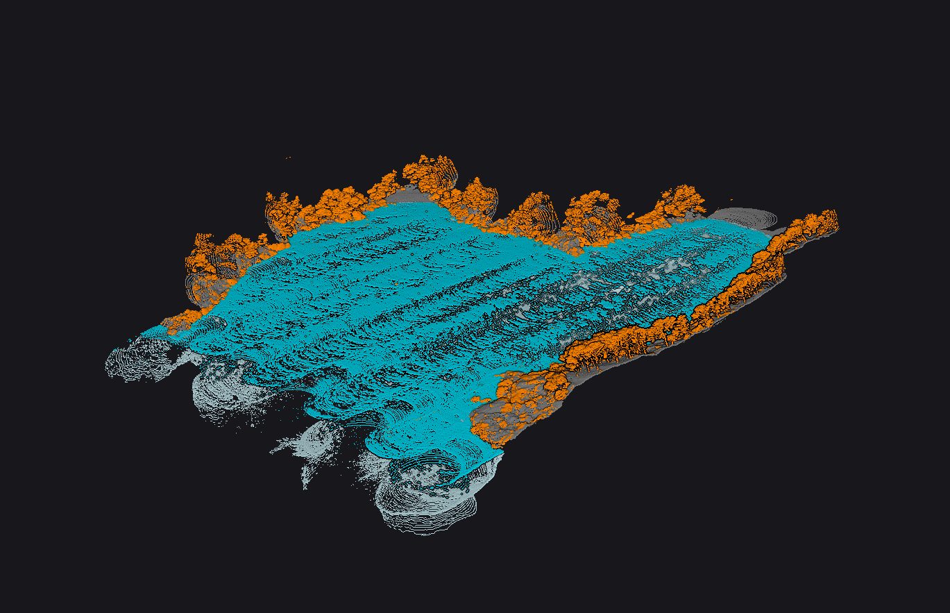
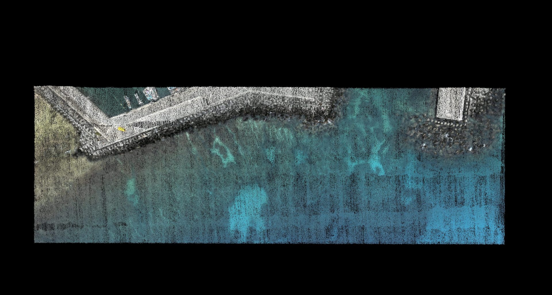
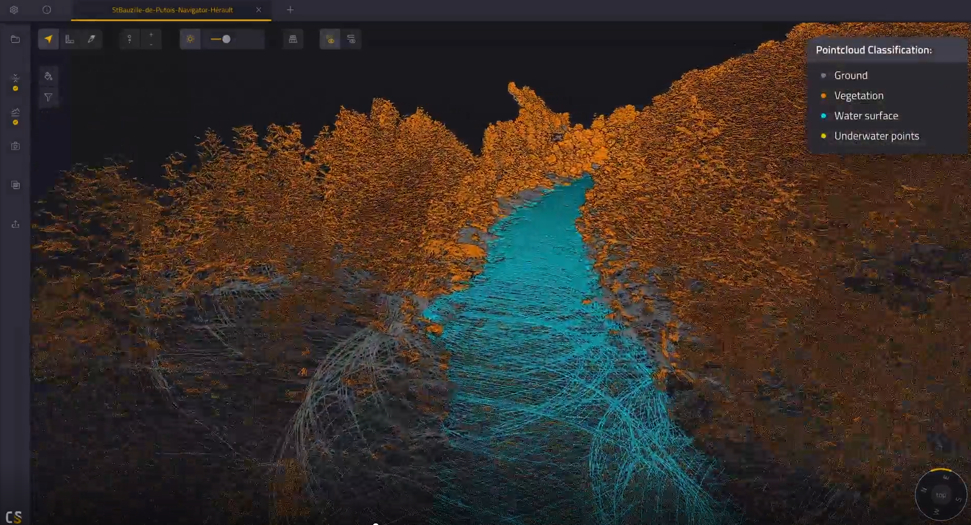
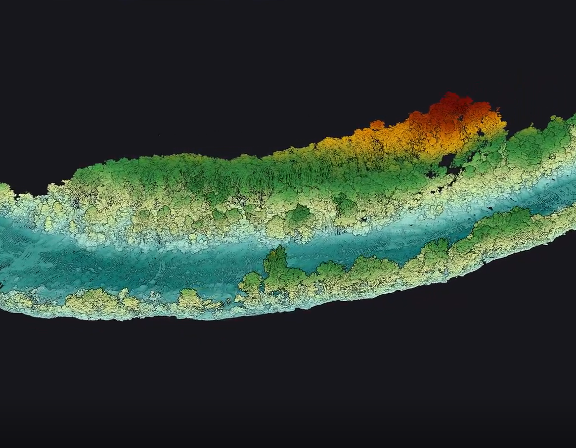
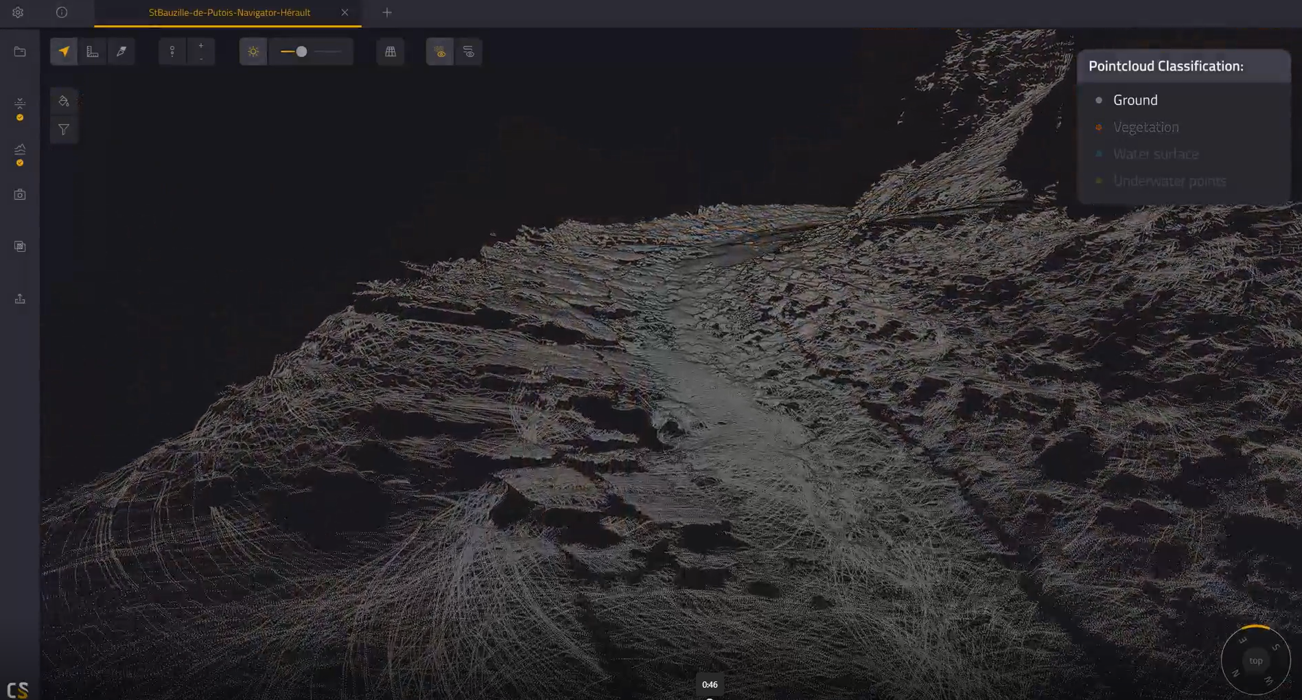
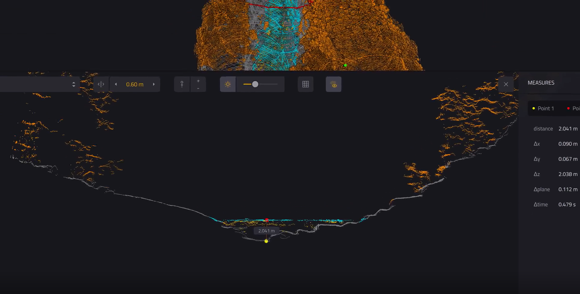
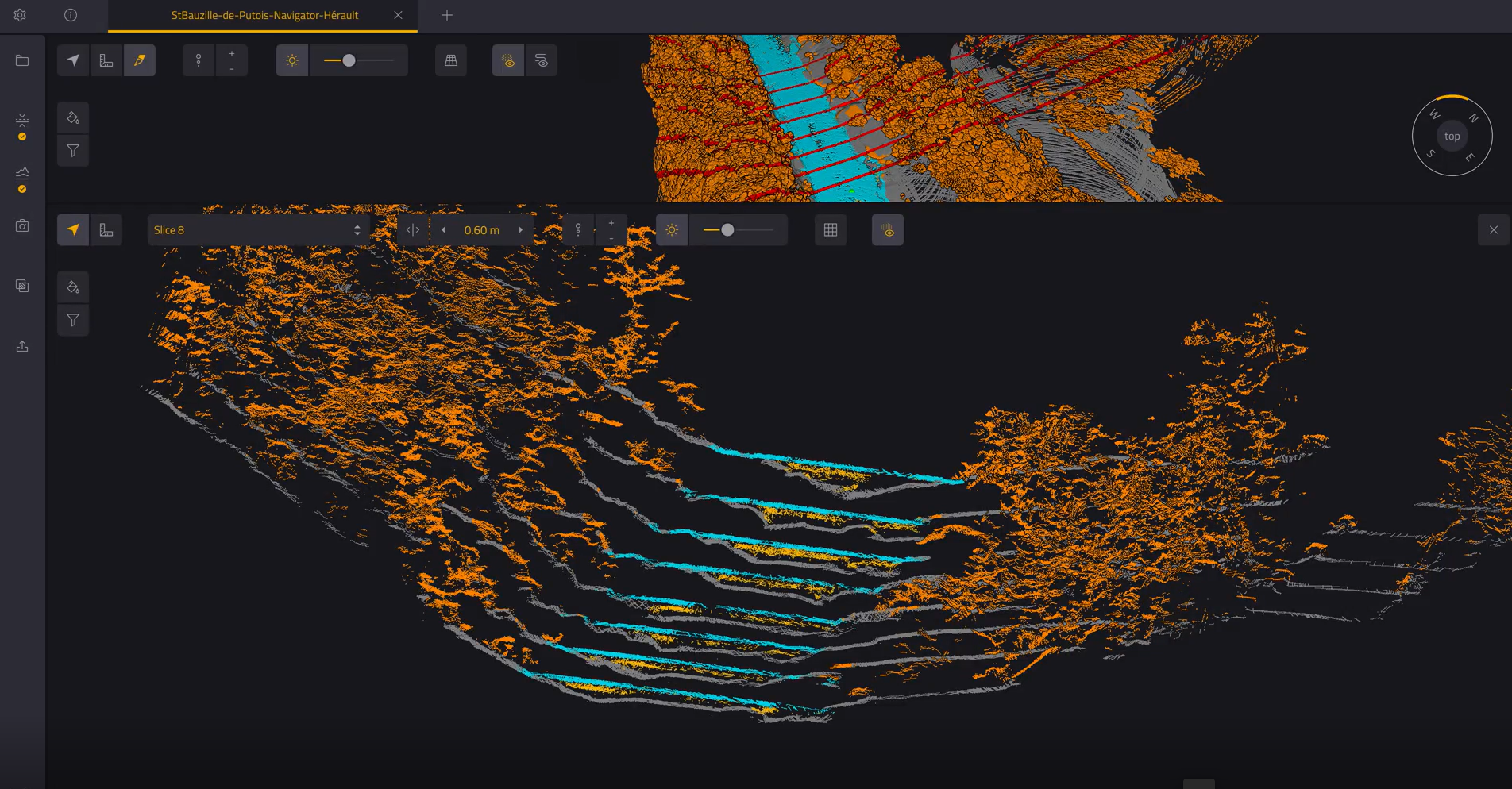
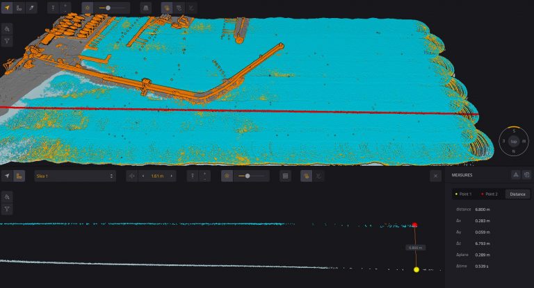
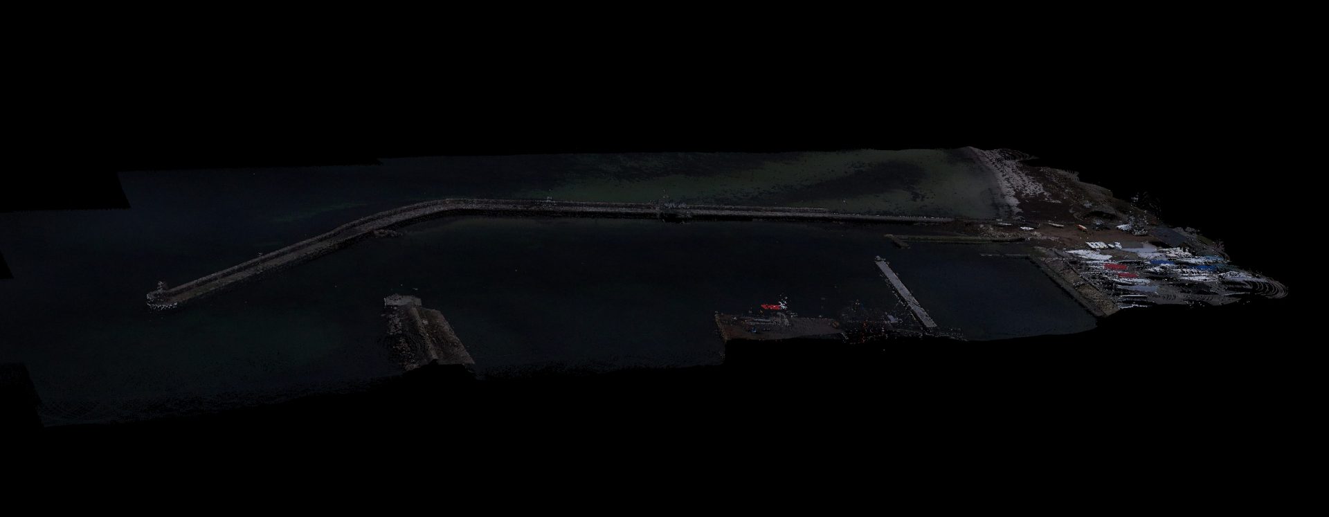

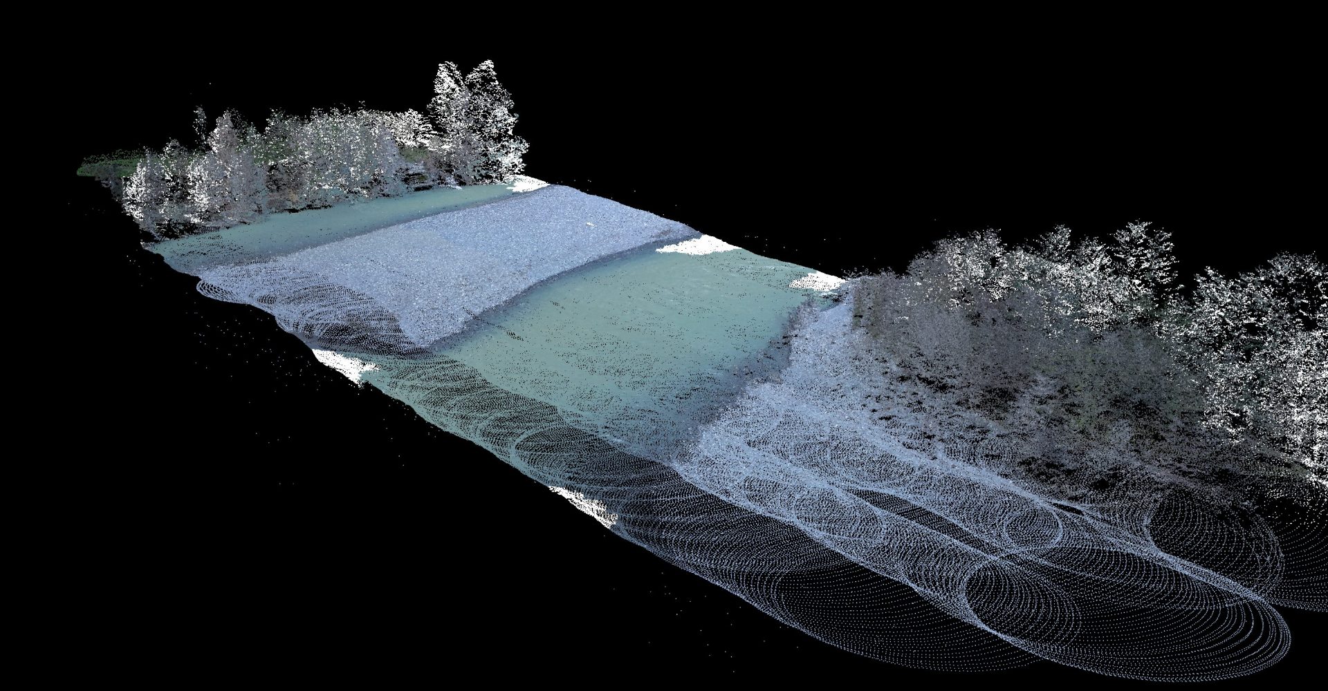
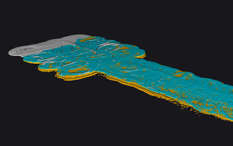
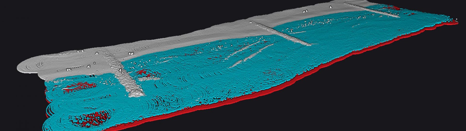
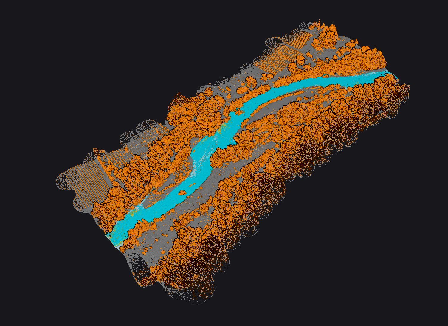
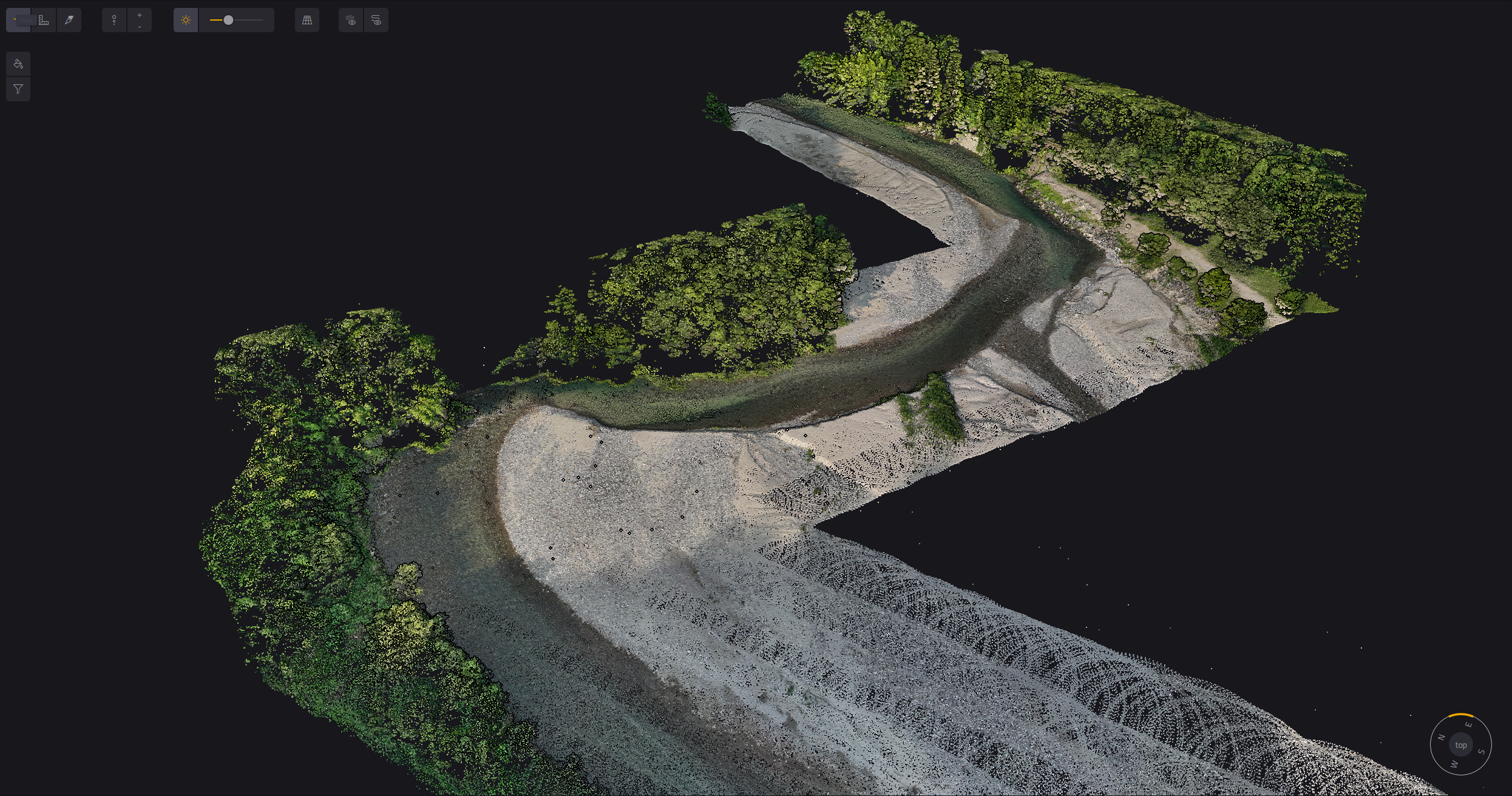
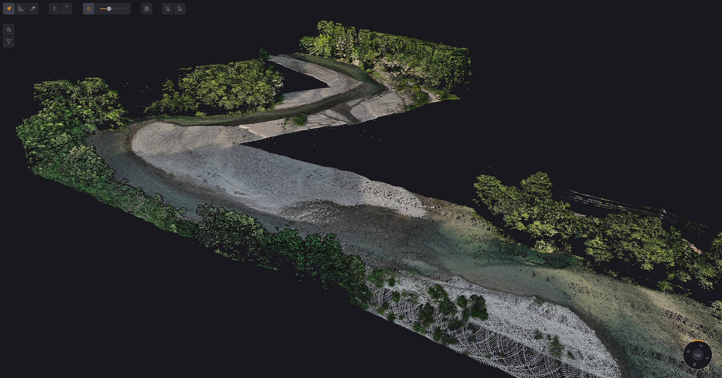
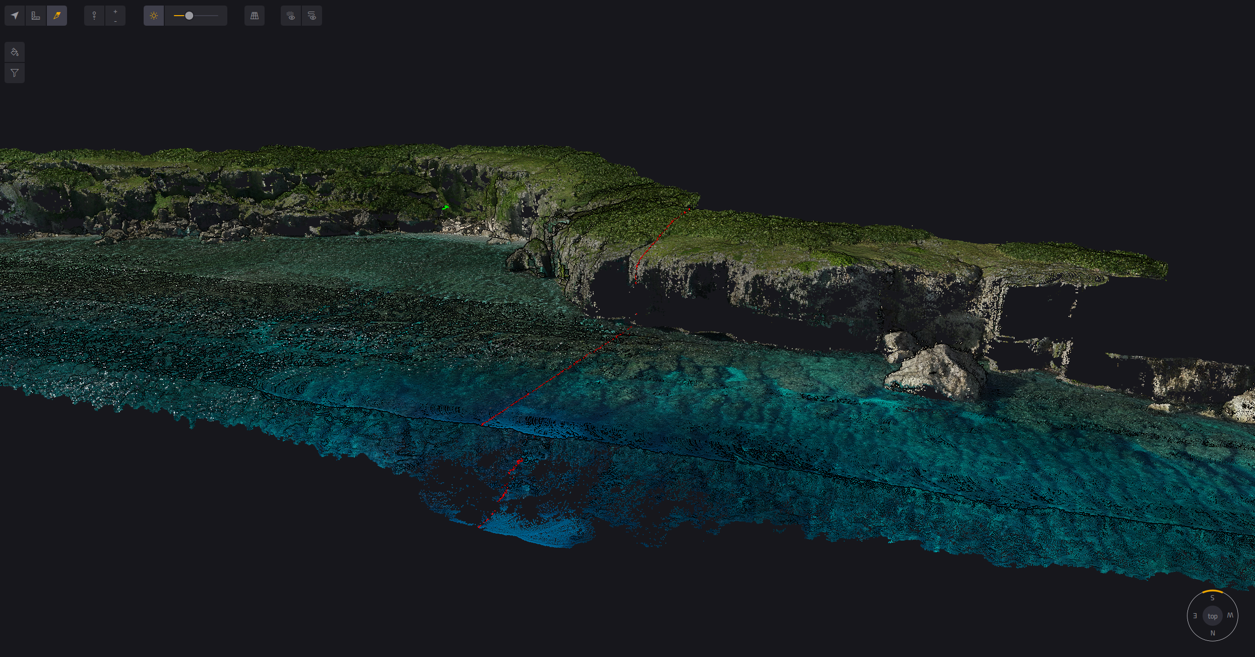
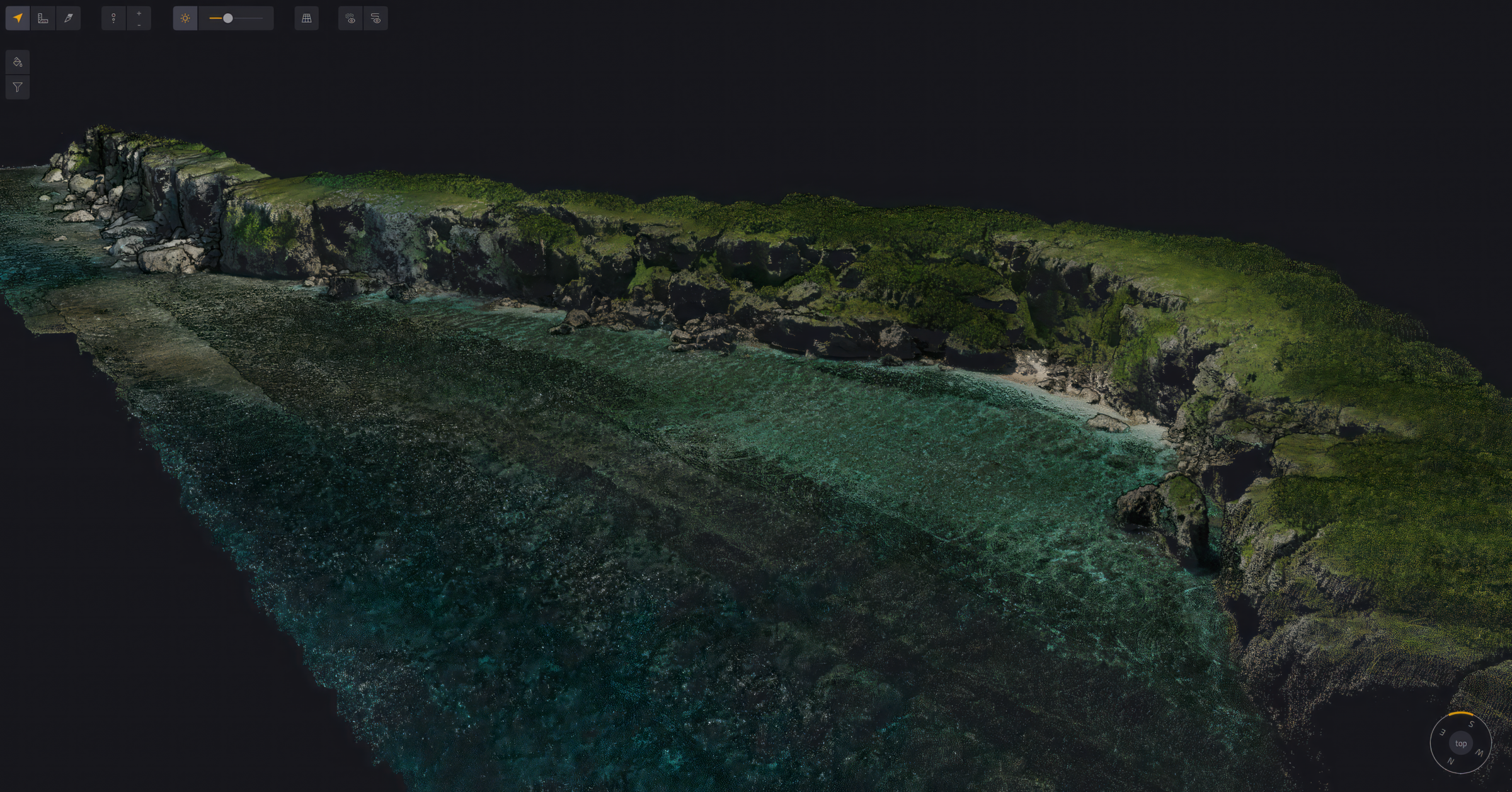
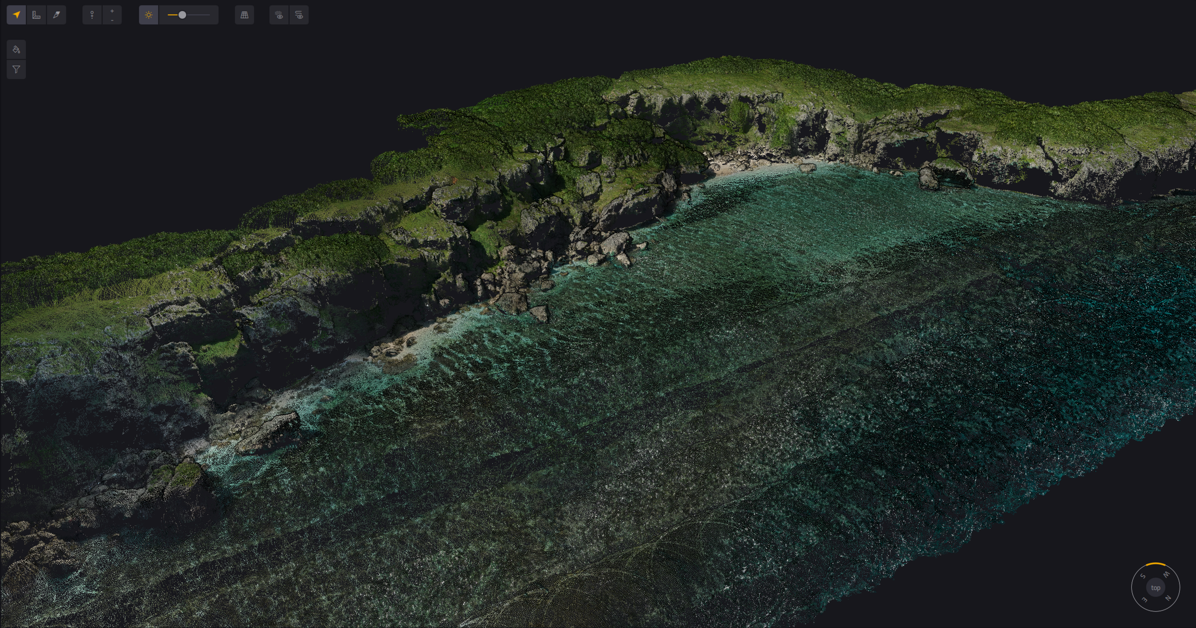
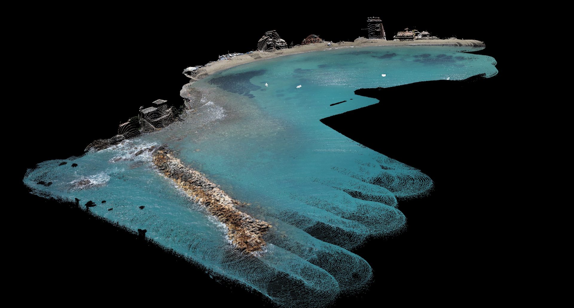

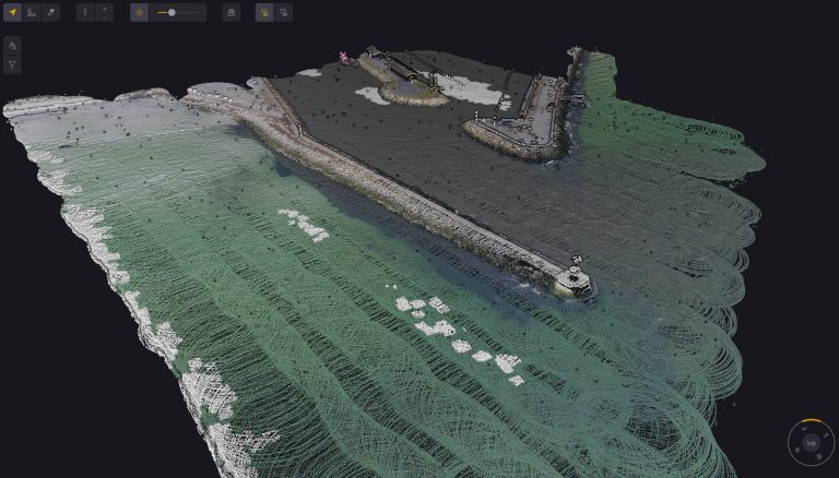
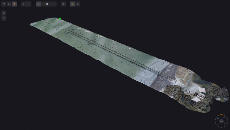
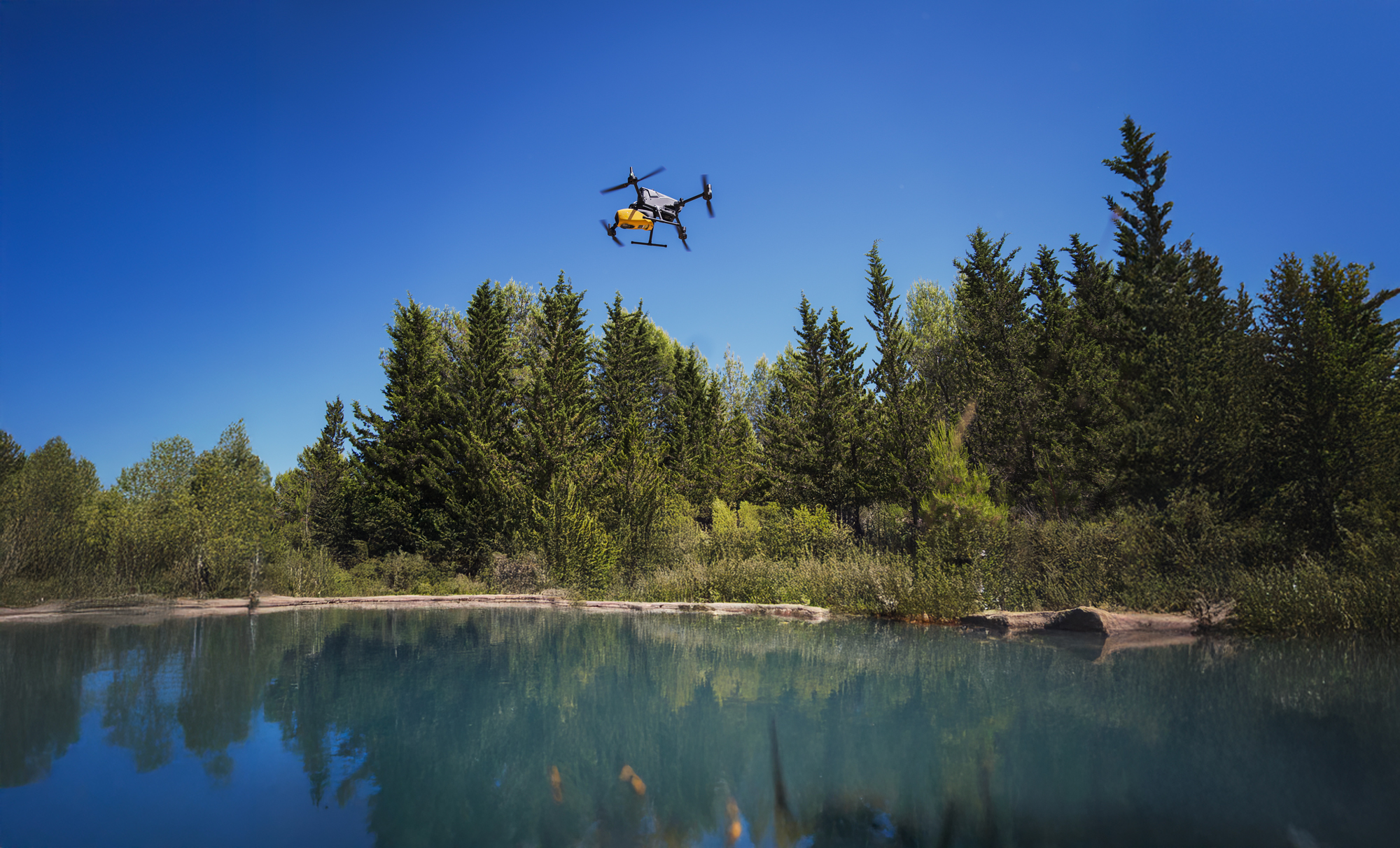
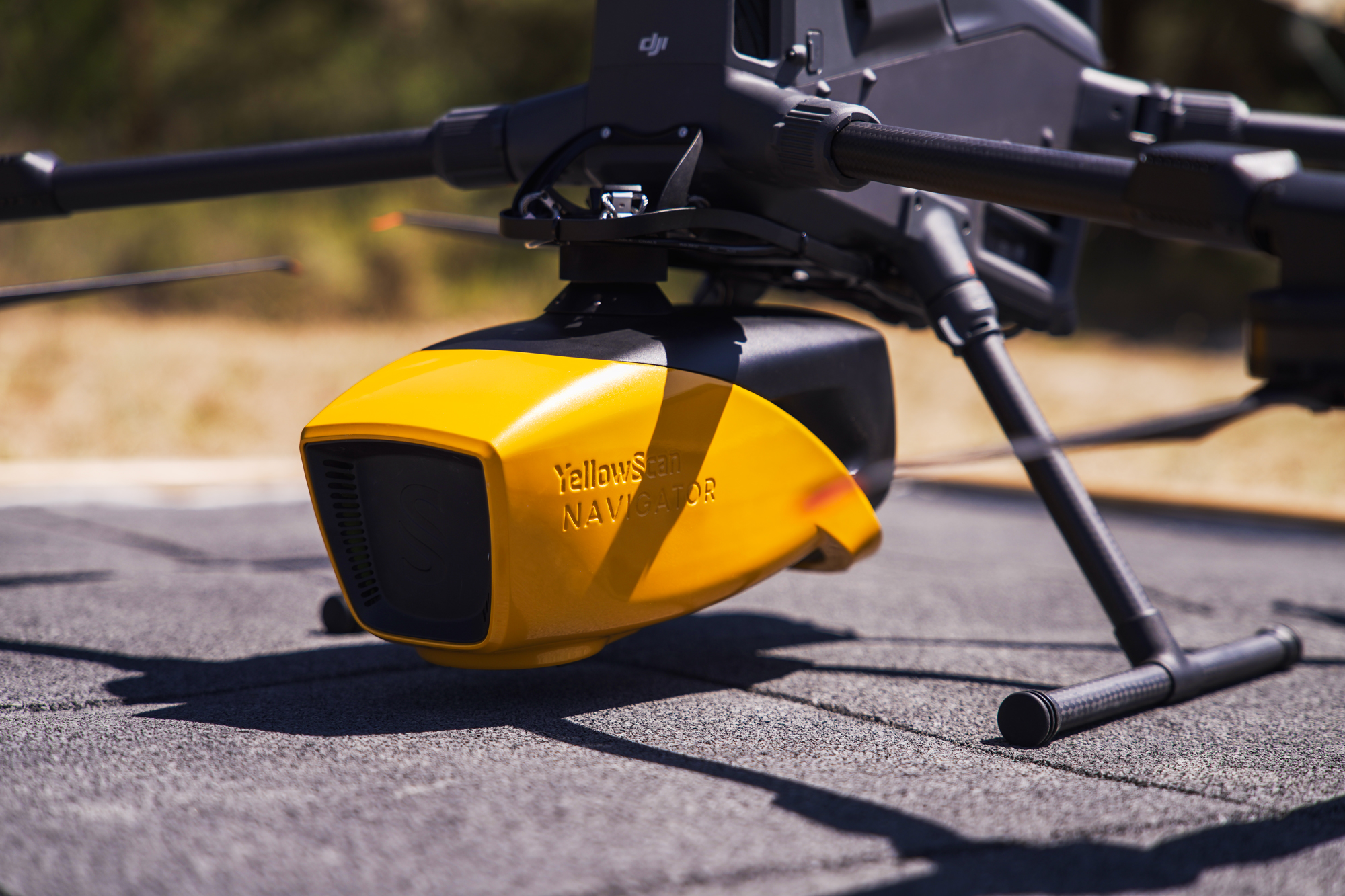
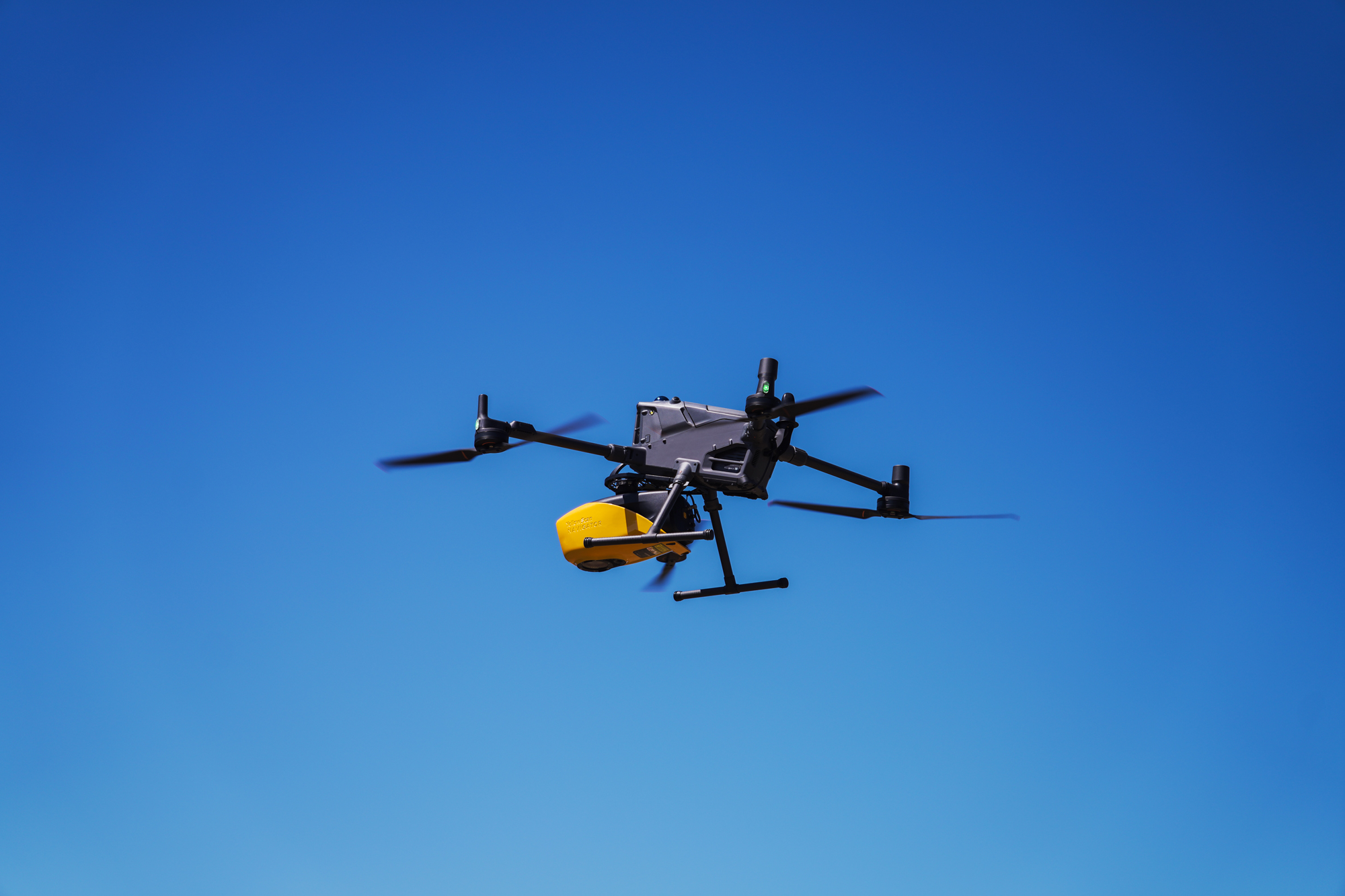
Note: These reference images are from YellowScan global portfolio — not from INSEE UAV missions — shown to demonstrate sensor capability.
YellowScan Navigator on DJI Matrice 400.
YellowScan Navigator Bathymetric LiDAR mounted on DJI Matrice 400 with Mounting Bracket — purpose-built for shallow-water and coastal bathymetric surveys.
INTEGRATION DETAIL
Purpose-built Mounting Bracket
Designed and certified for seamless integration with DJI Matrice 400 — vibration-dampened, balanced for stable bathymetric scanning over water surfaces.
Ready to survey underwater from the sky
with Navigator?
Contact Thai Sky Vision, Official YellowScan Distributor in Thailand — for consultation, Bathymetric LiDAR demos, and full After-Sales Support.
Thai Sky Vision Co., Ltd. — Official YellowScan Distributor in Thailand