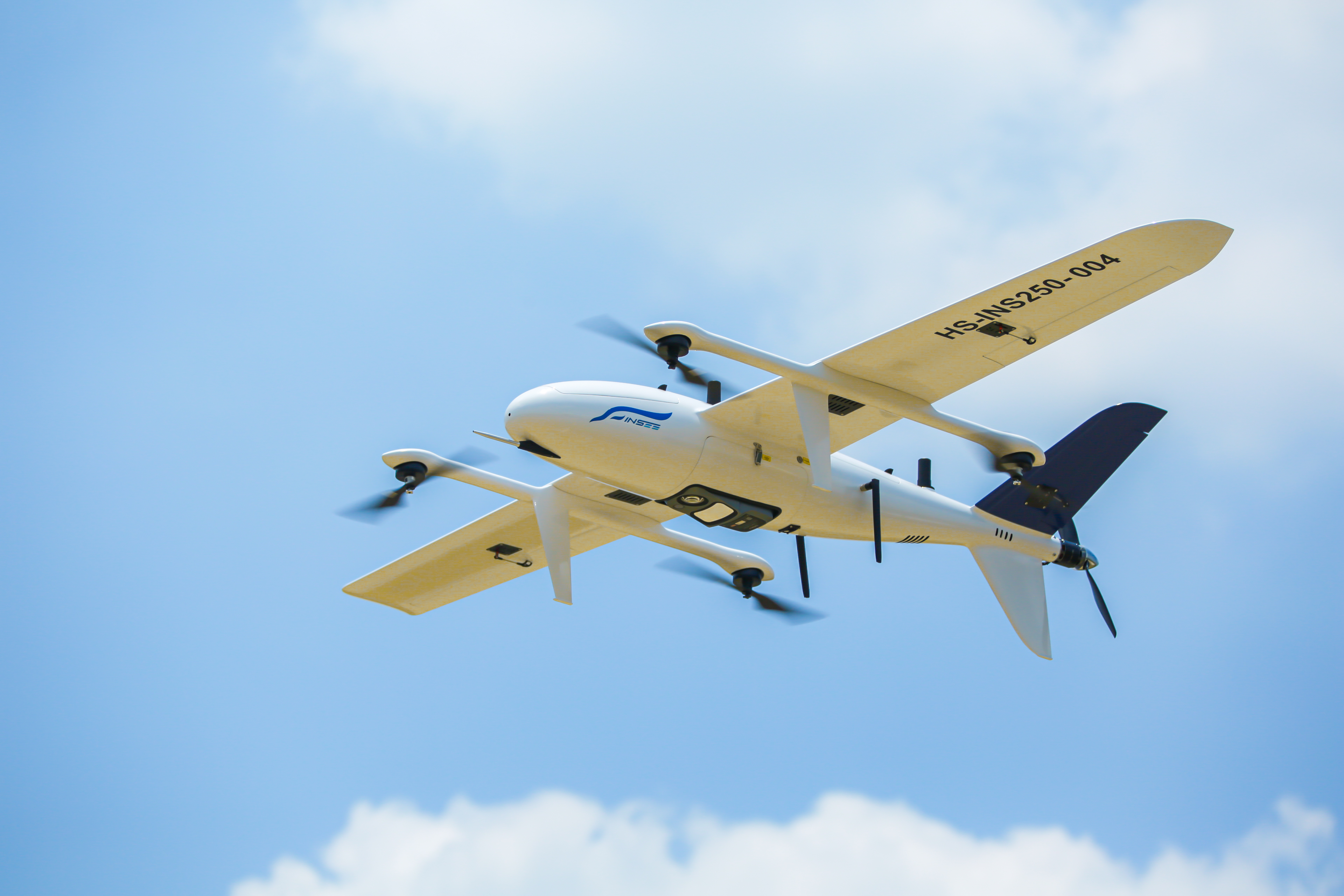
INSEE UAV — Platform
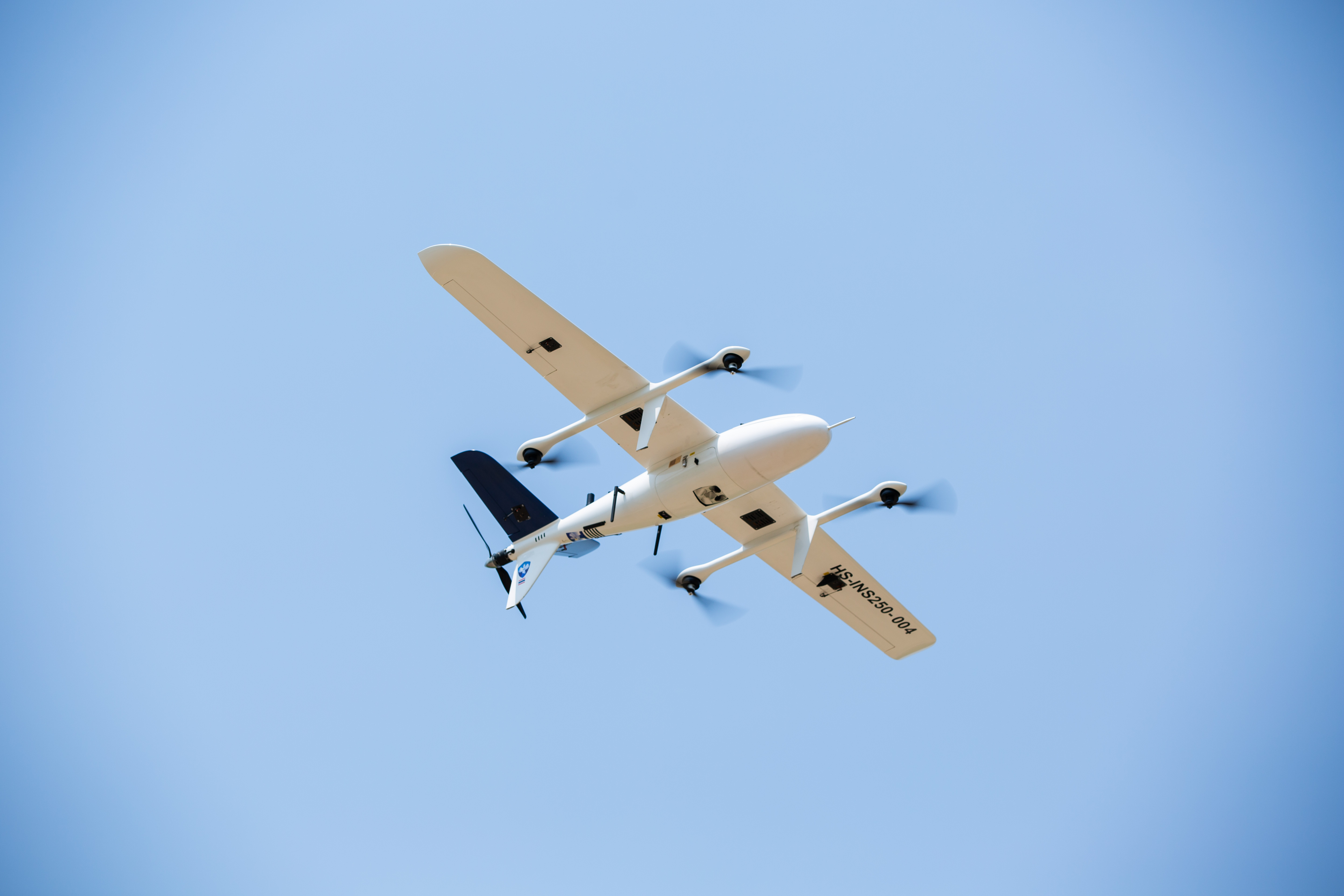
INSEE-250
INNOVATE BEYOND LIMITS
E-VTOL Fixed-Wing UAV with a 2.5m wingspan — up to 2.5 hours per flight with a 1kg payload, covering wide areas in a single mission. Field-proven for Mapping, LiDAR Survey and Multi-sensor Payload missions across Thailand.
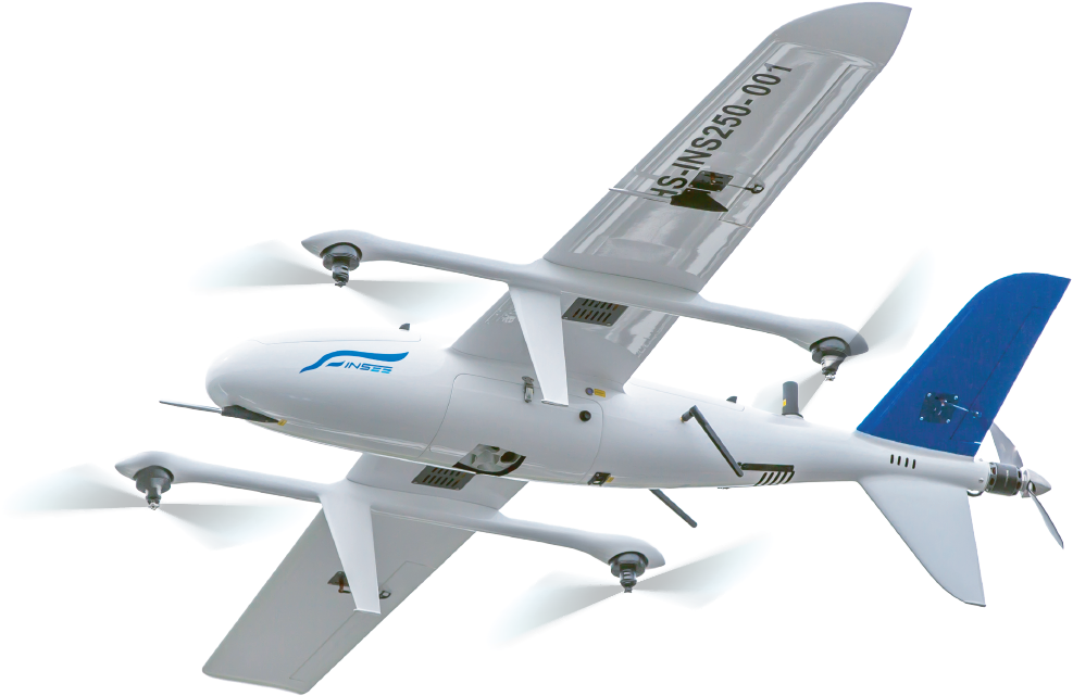
E-VTOL Fixed-Wing
Vertical take-off and landing like a multirotor, but cruises like a fixed-wing — long range, long endurance, no runway required.
Long Endurance
Up to 2.5 hours per flight with 1kg payload (3 hours without payload) — covers wide areas in a single mission.
Multi-Payload Compatible
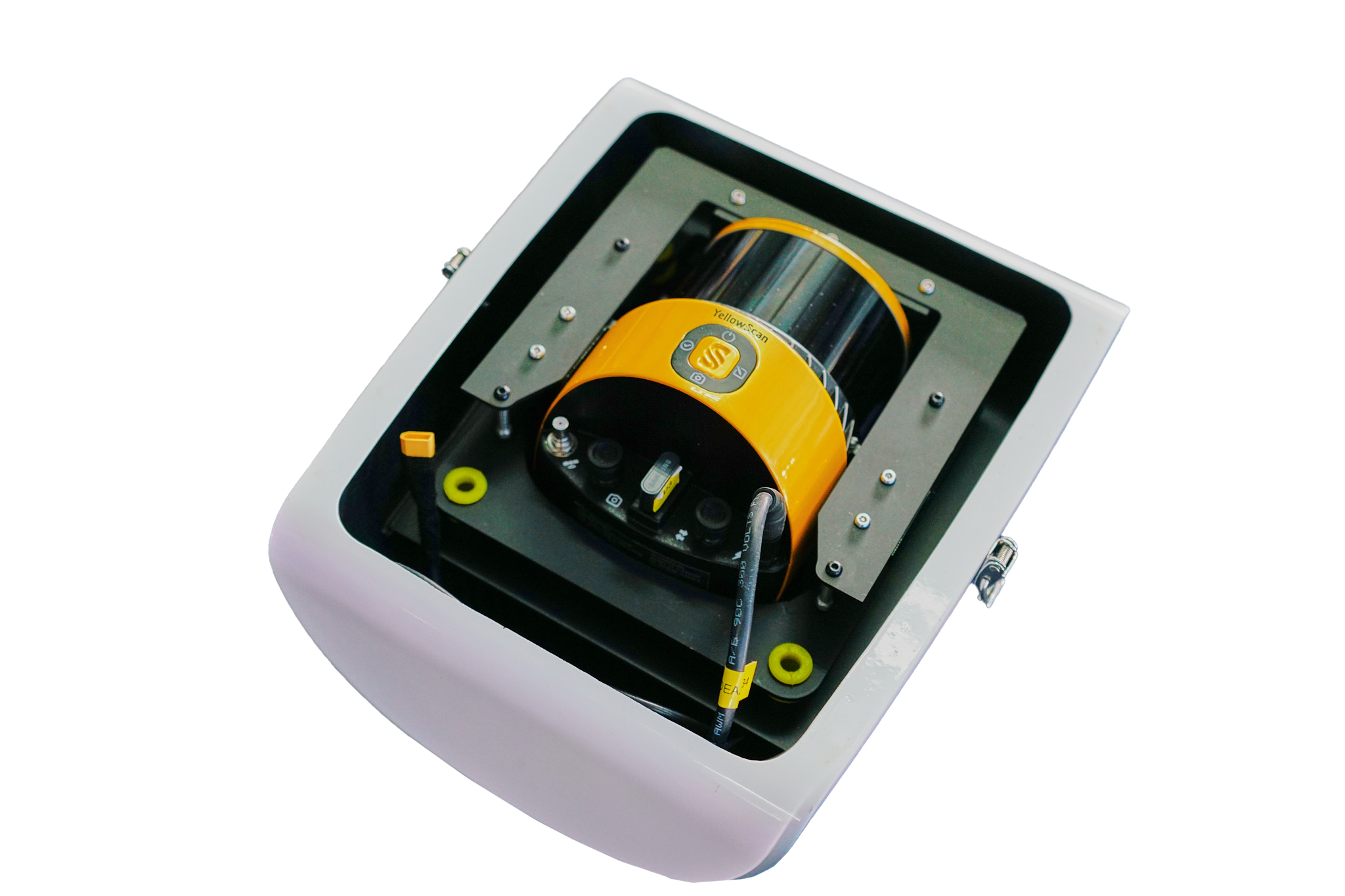
Supports a wide payload ecosystem — LiDAR (YellowScan, CHCNav, GVI), Oblique camera (Riebo), Full-Frame RGB (Sony), Multispectral.
Built for Reliability
Carbon Fiber + Fiberglass airframe, operating temperature -20°C to 60°C, wind resistance up to 14 m/s, IP45 rating — built for real field operations.
Stall Protection
The forward-mounted Pitot tube measures airspeed in real time — when a stall condition is detected, all four motors automatically engage to maintain altitude while the tail motor accelerates to recover speed — no pilot intervention required.
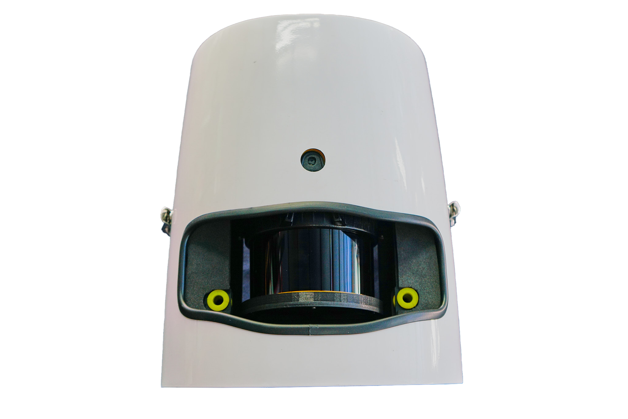
Laser Range Finder
Mounted beneath the fuselage, the Laser Range Finder accurately measures ground distance up to 190 m — used for ultra-smooth take-off and landing, and enables Terrain Follow Flight without relying on a temperature-sensitive barometer.
Dual RTK Receivers
Two RTK receivers on top of the fuselage — synchronize GNSS data from two sources for ultimate positioning accuracy, and compute heading directly instead of relying on a digital compass — eliminating frequent compass calibration and electromagnetic interference issues.
Transponder Receiver
Detects nearby manned aircraft up to 200 km away — displays position, altitude and heading on the GCS in real time for Situational Awareness in shared airspace operations.
Specifications.
INSEE-250 Product Brochure
Full specifications, technical details and capabilities of the INSEE-250 in a single PDF — preview below or download a copy for later reference.
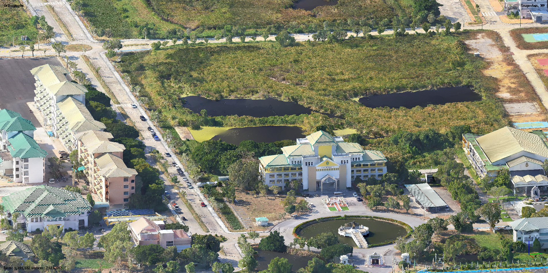
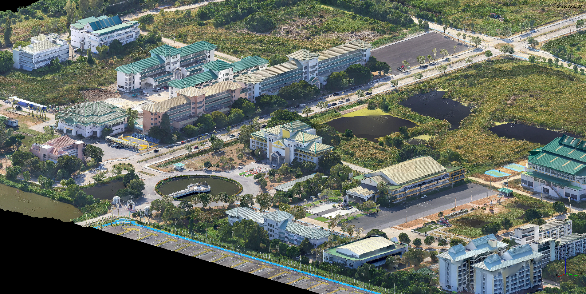
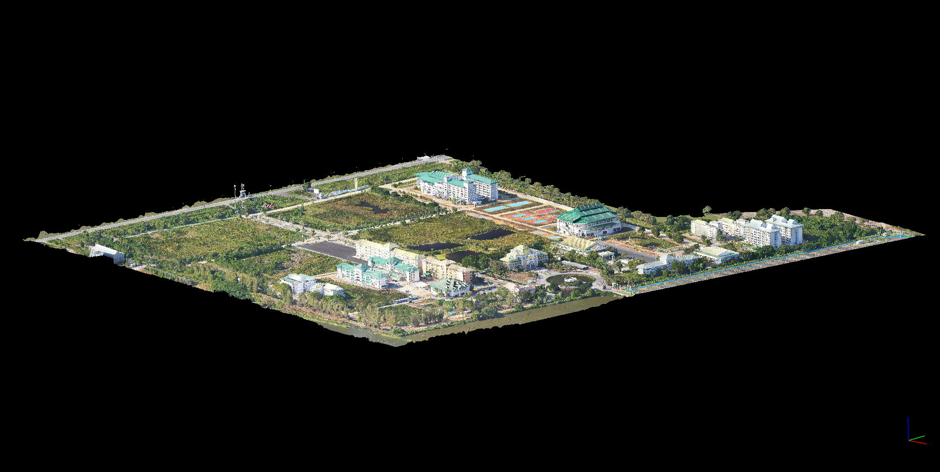
Oblique Photogrammetry
INSEE-250 + Riebo D2M
Oblique Camera 130MP, 5 lenses — generates 3D models with cadastral-grade accuracy, no GCPs required.
Performance Data
Detailed mission data — coverage area, GSD, accuracy and flight parameters — will be published as documentation progresses.
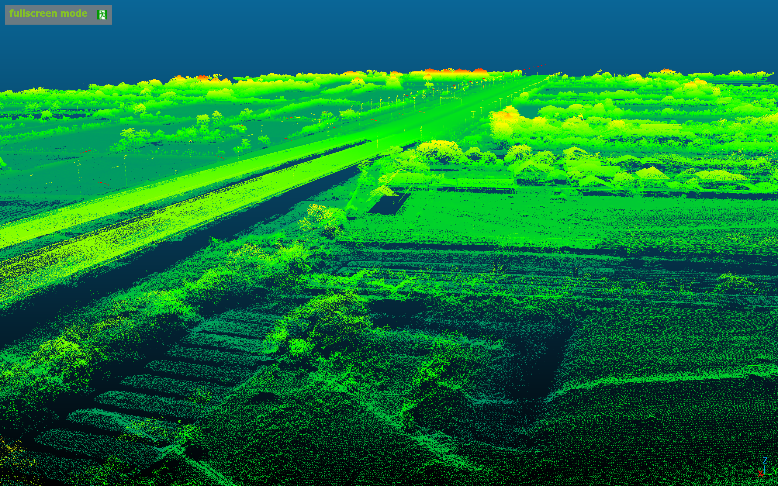
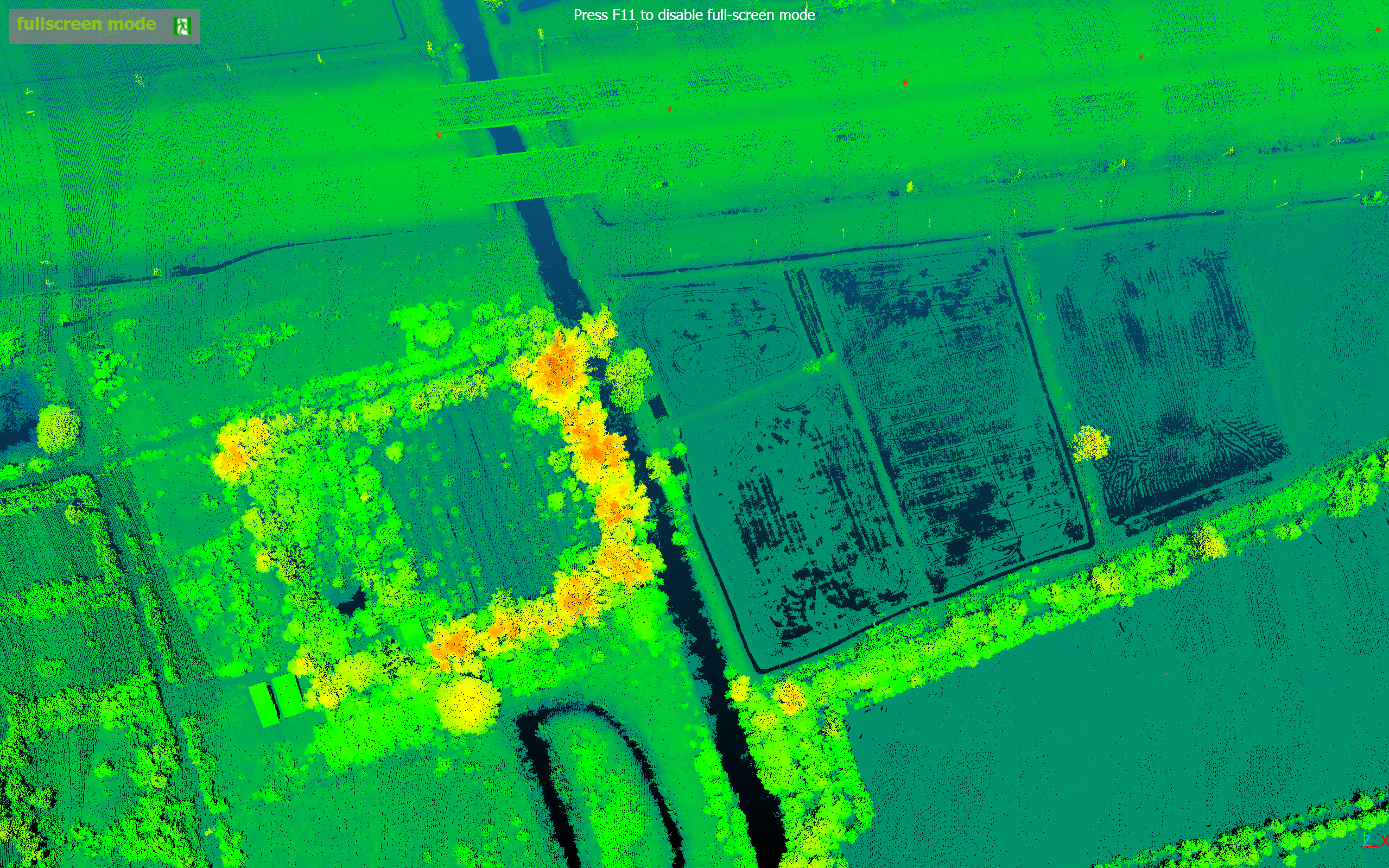
LiDAR + RGB Survey
INSEE-250 + CHCNav AlphaAir 10
All-in-one LiDAR + RGB 45MP weighing 1.55kg — 2–5cm accuracy, 500K pts/s, 8 returns to penetrate dense canopy.
Performance Data
Detailed mission data — coverage area, GSD, accuracy and flight parameters — will be published as documentation progresses.
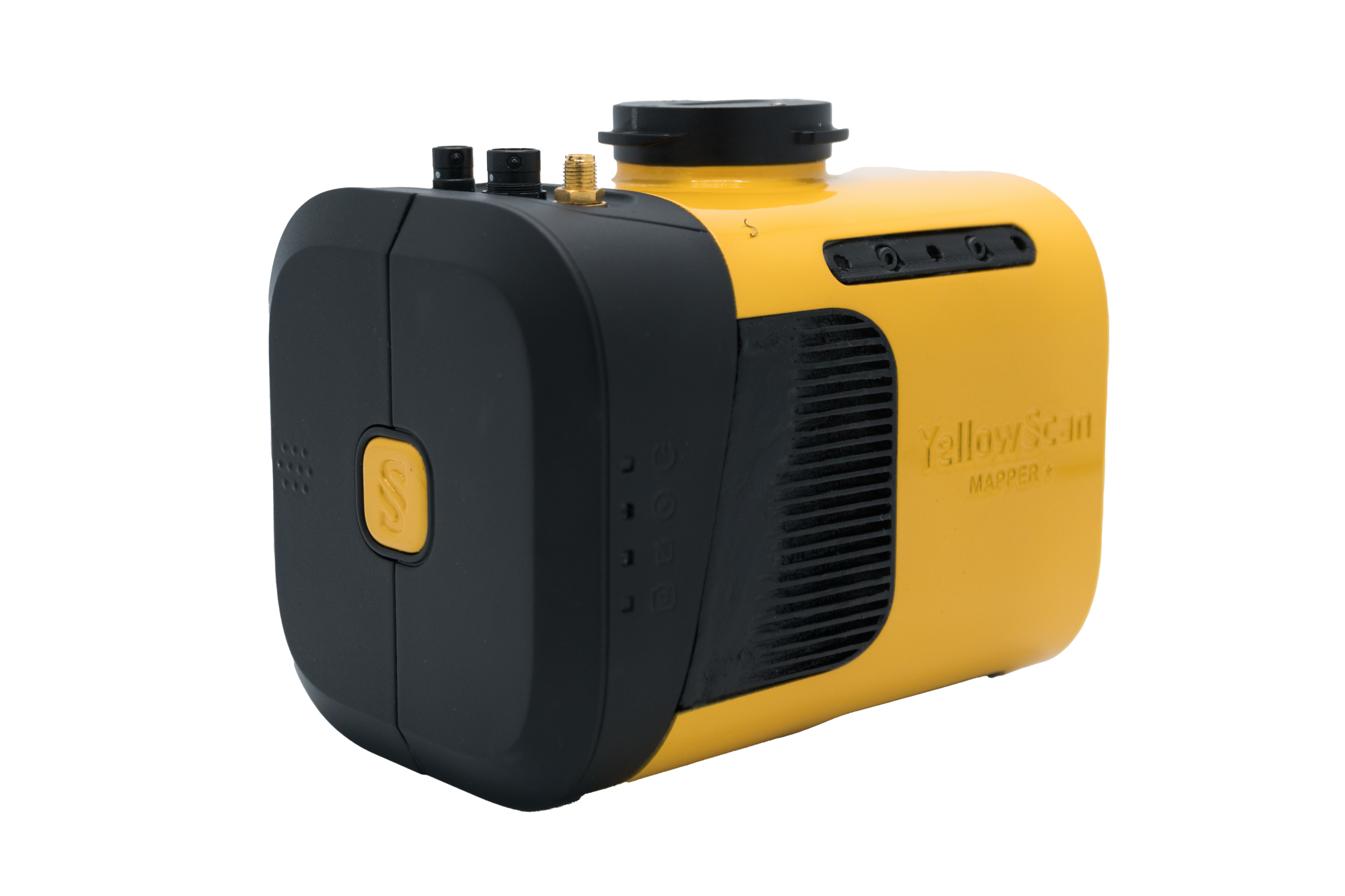
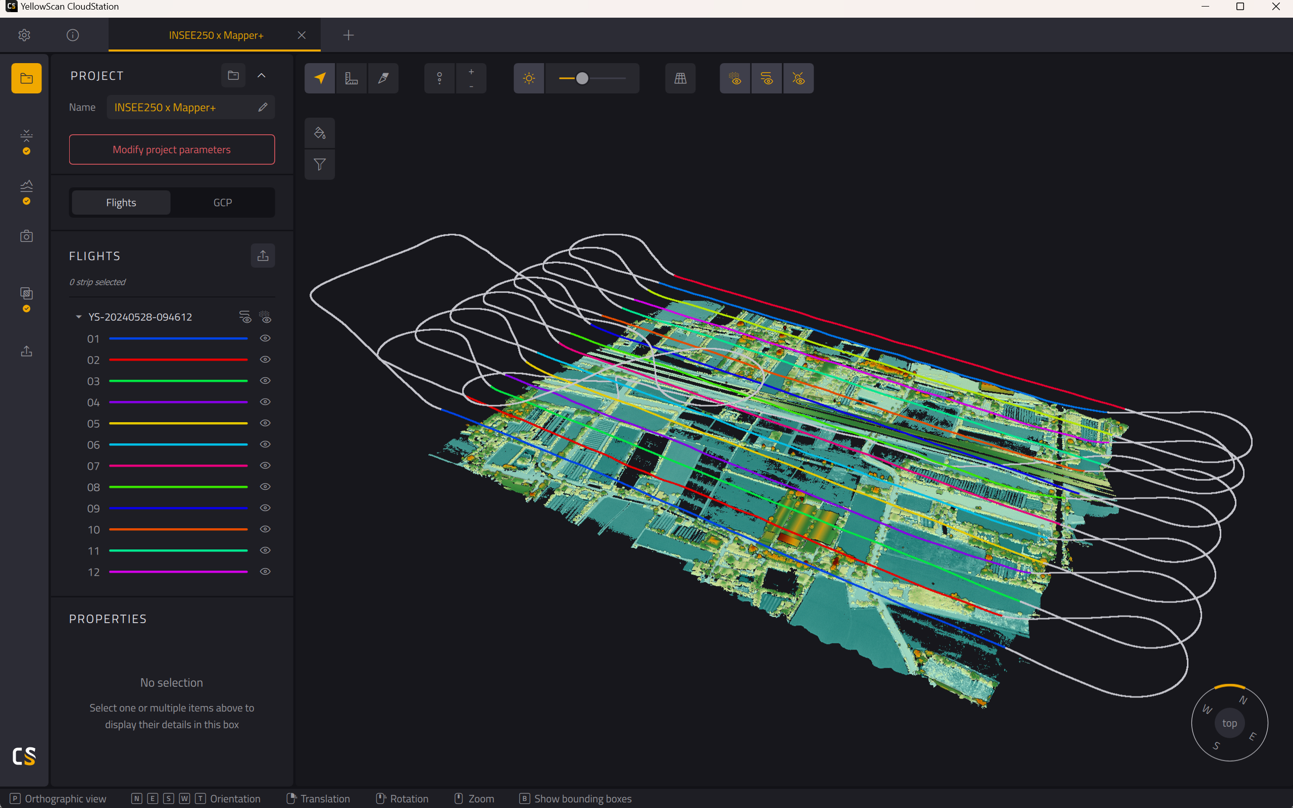
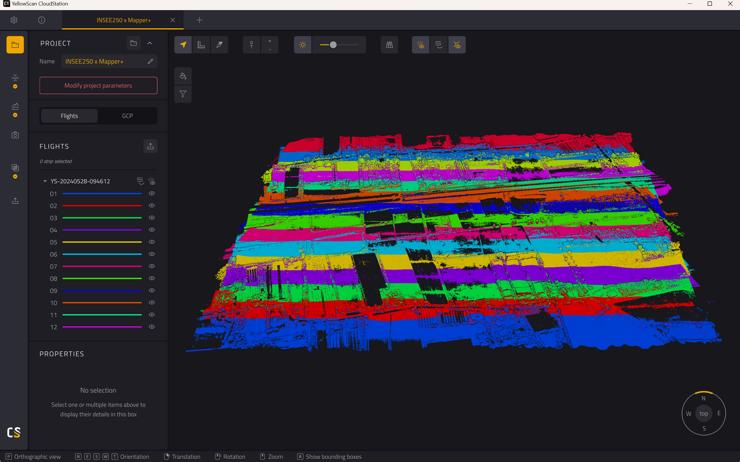
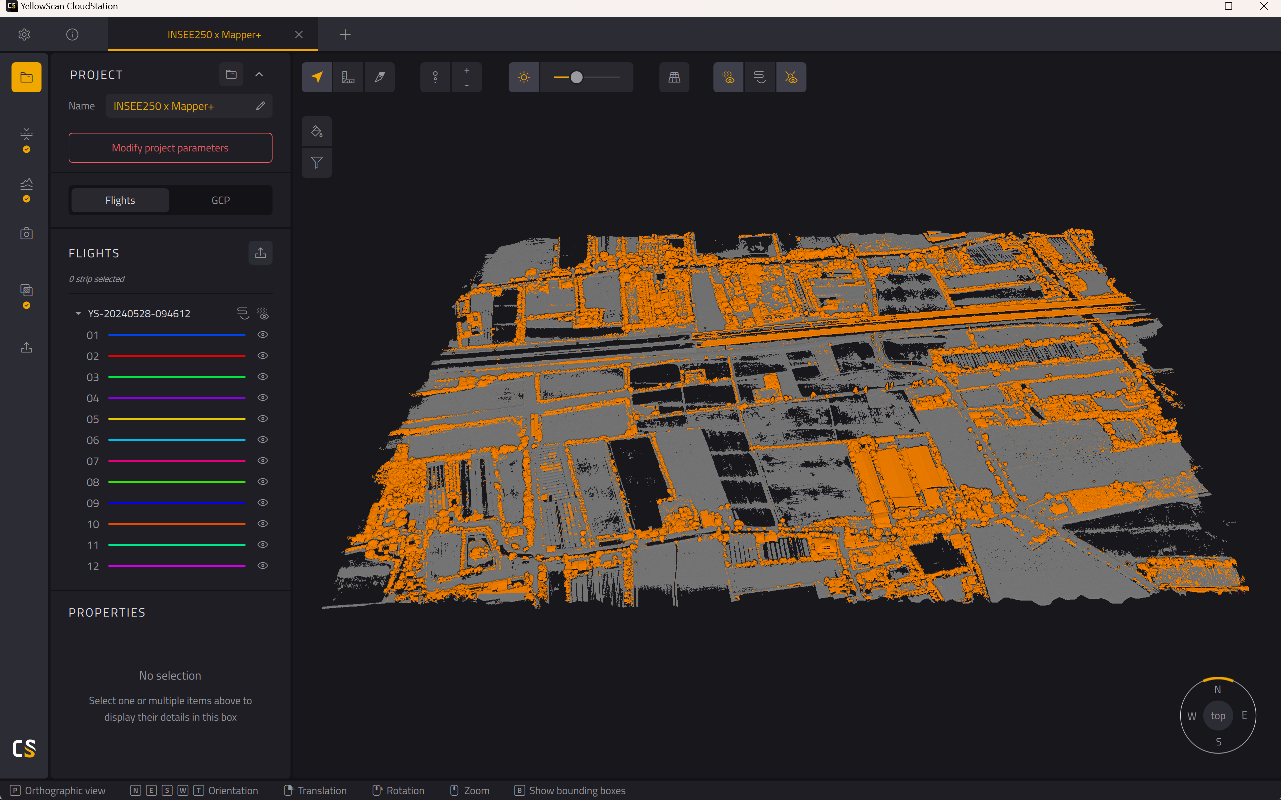
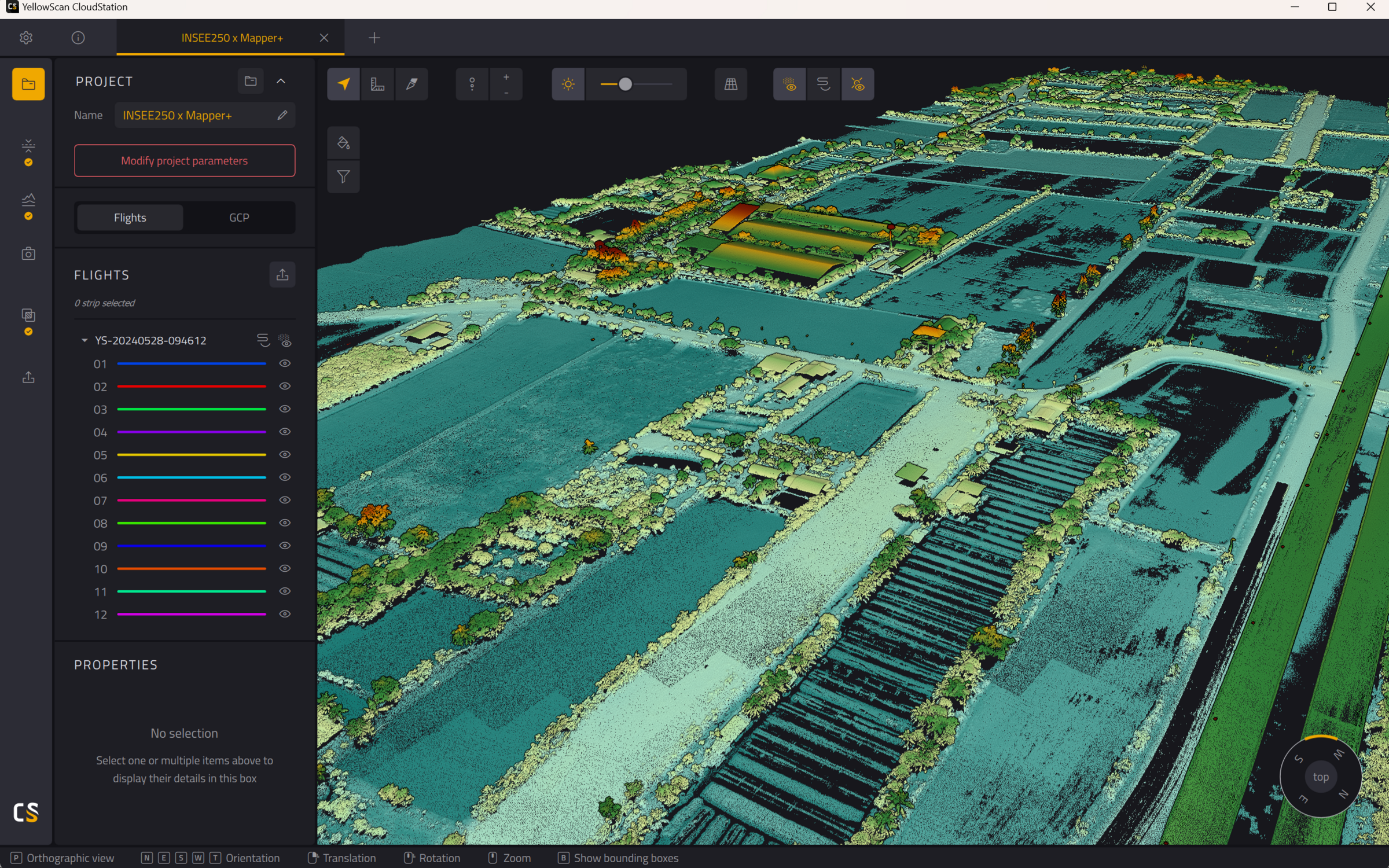
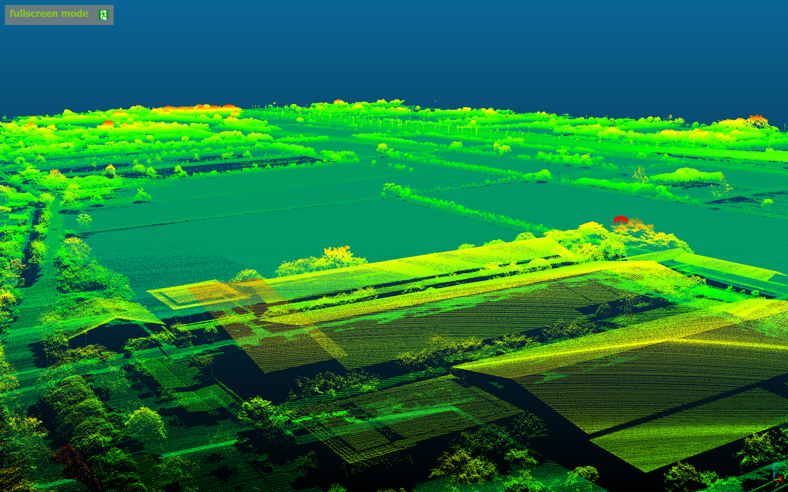
Long-Range LiDAR
INSEE-250 + YS Mapper+
Compact OEM LiDAR built for Fixed-Wing UAVs — corridor mapping and large-scale terrain survey.
Performance Data · FOV 70.4° × 4.5°
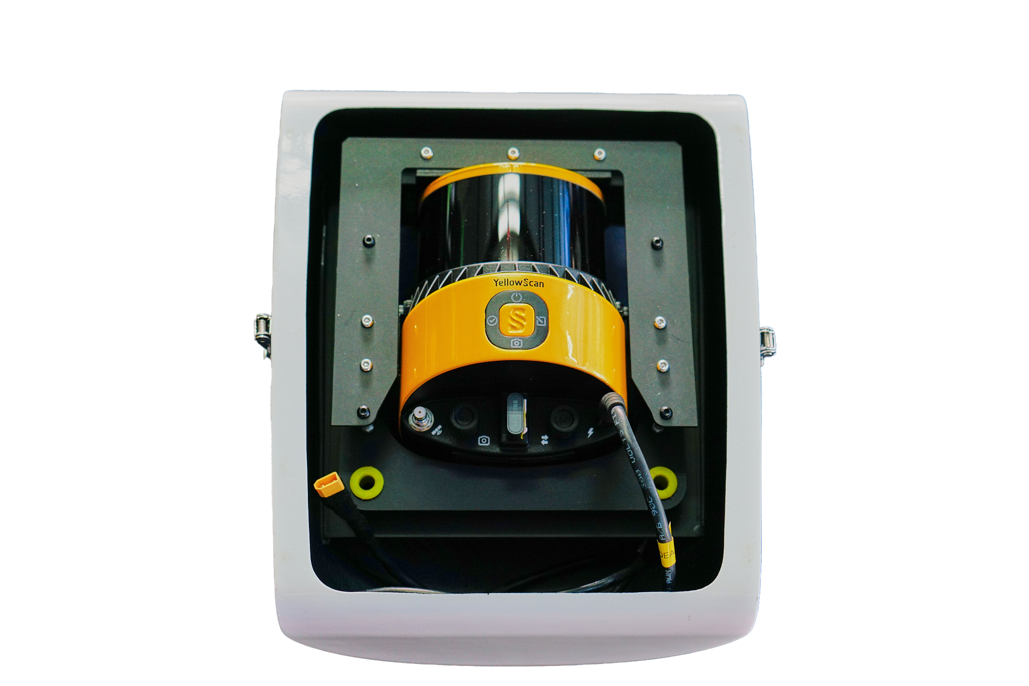
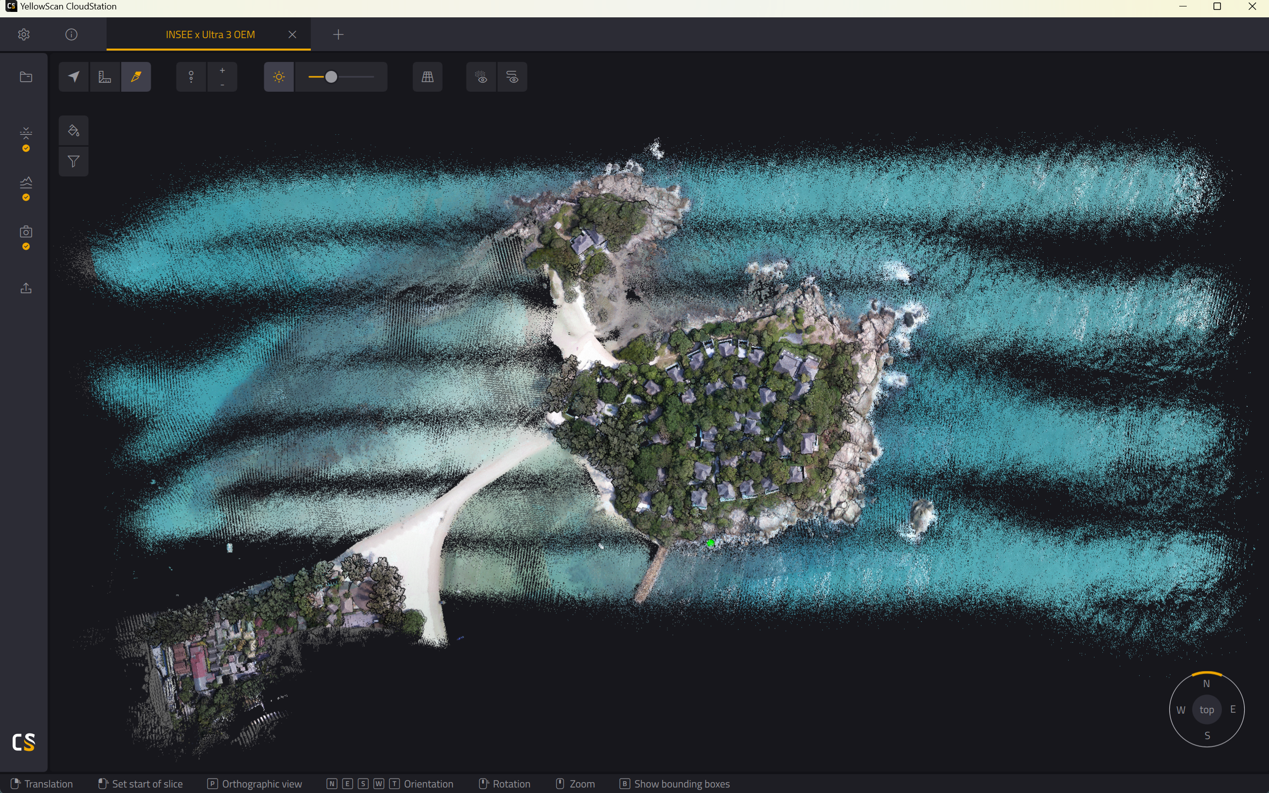
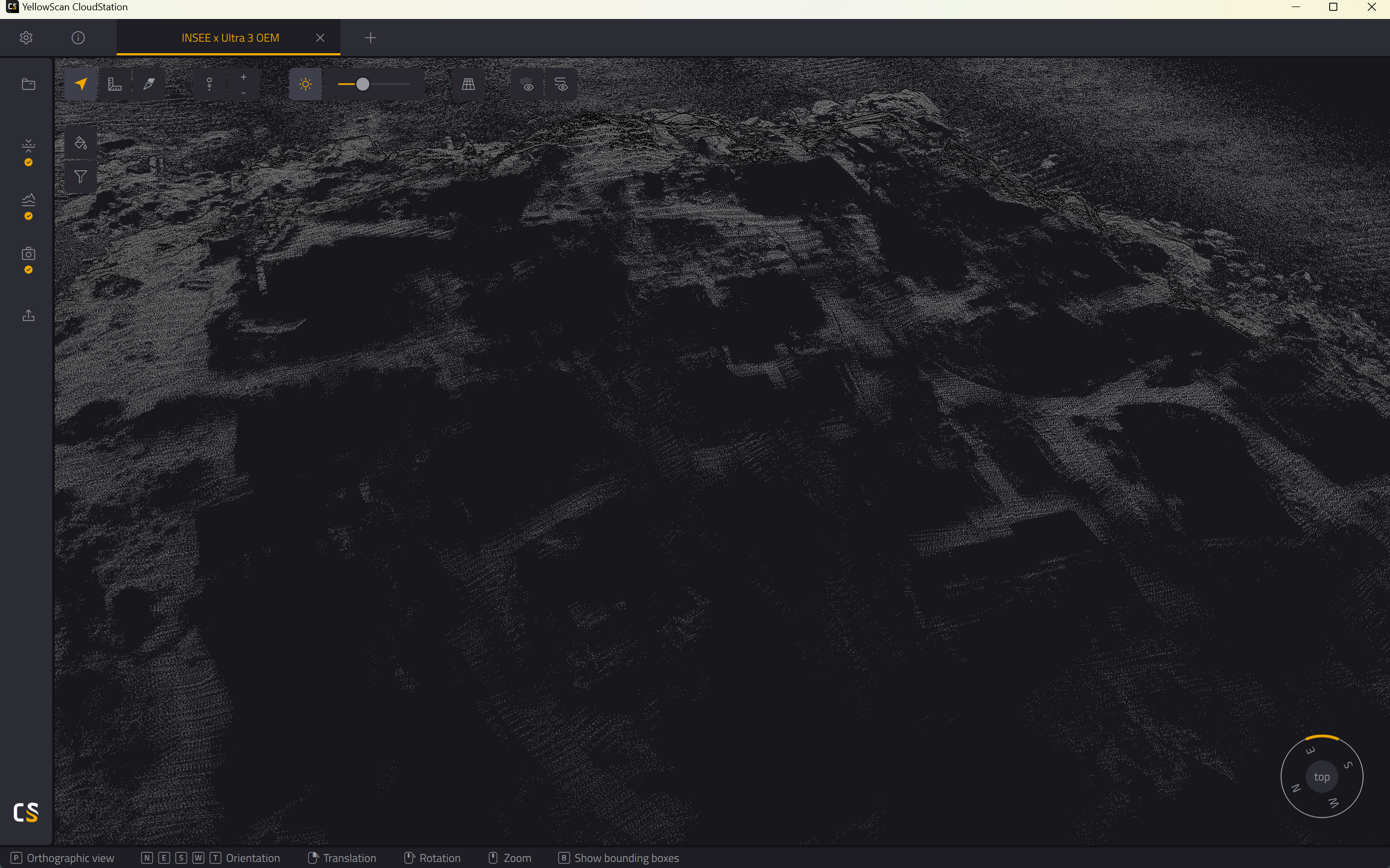
360° LiDAR · Lightweight OEM
INSEE-250 + YS Surveyor Ultra 3 OEM
Lightweight 360° LiDAR at just 800g — wide field of view, ideal for urban and forest surveys.
Performance Data · FOV 120° × 40.3°
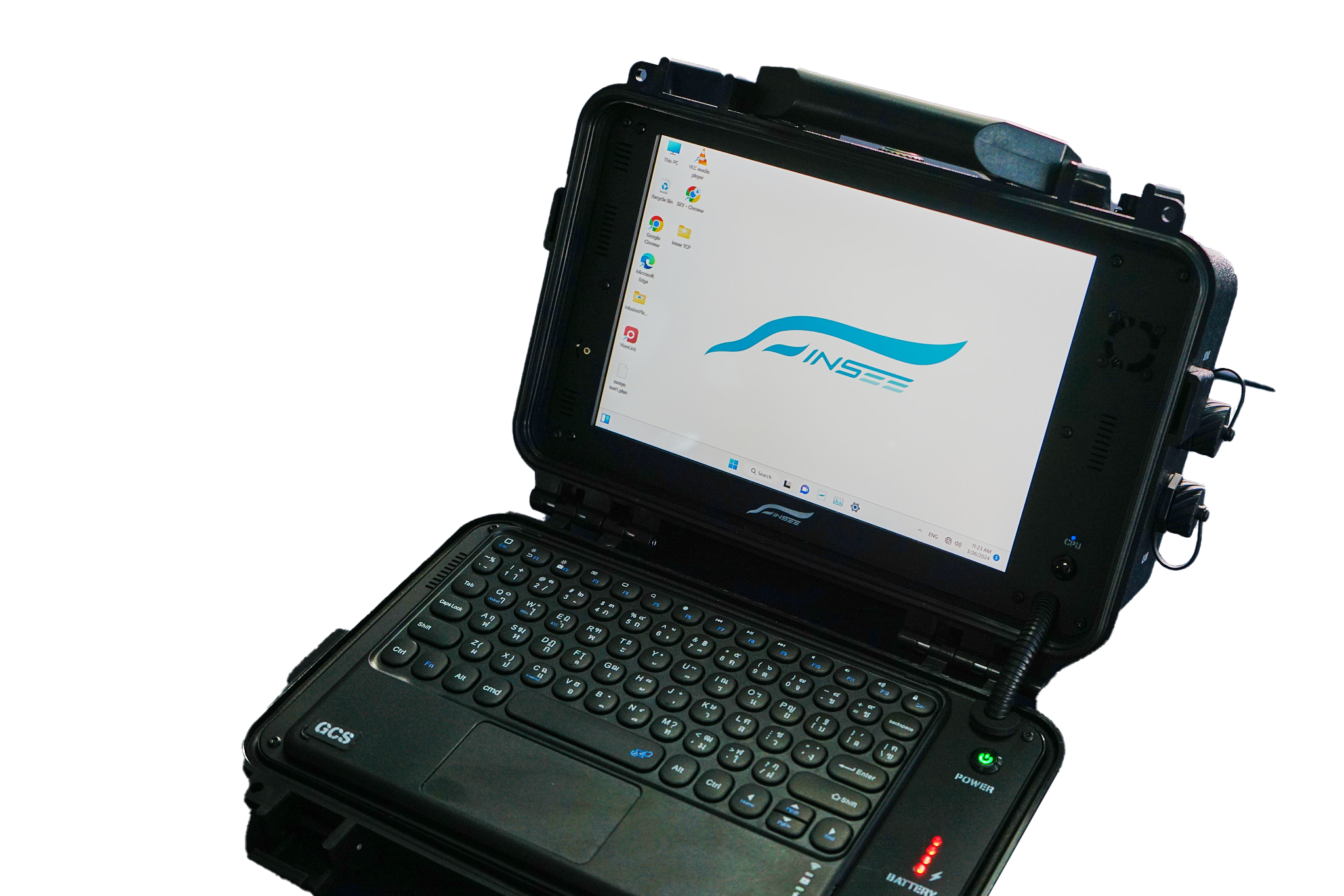
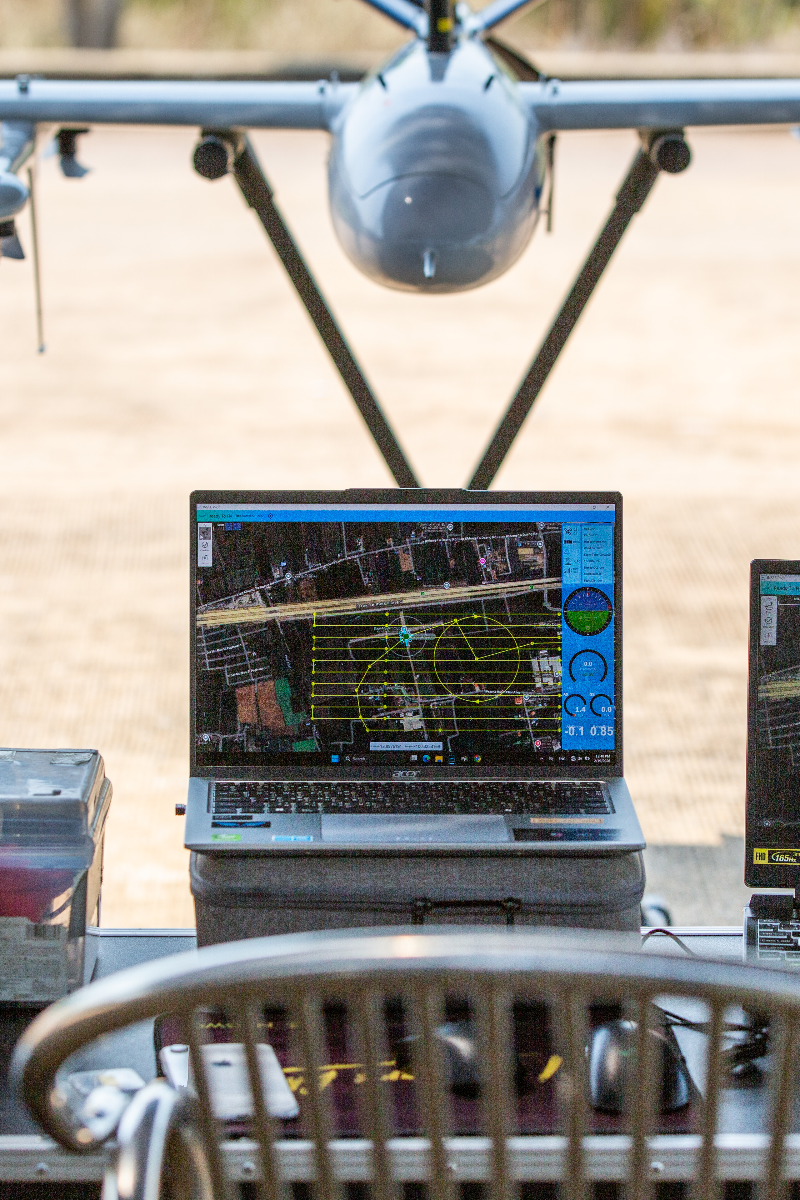
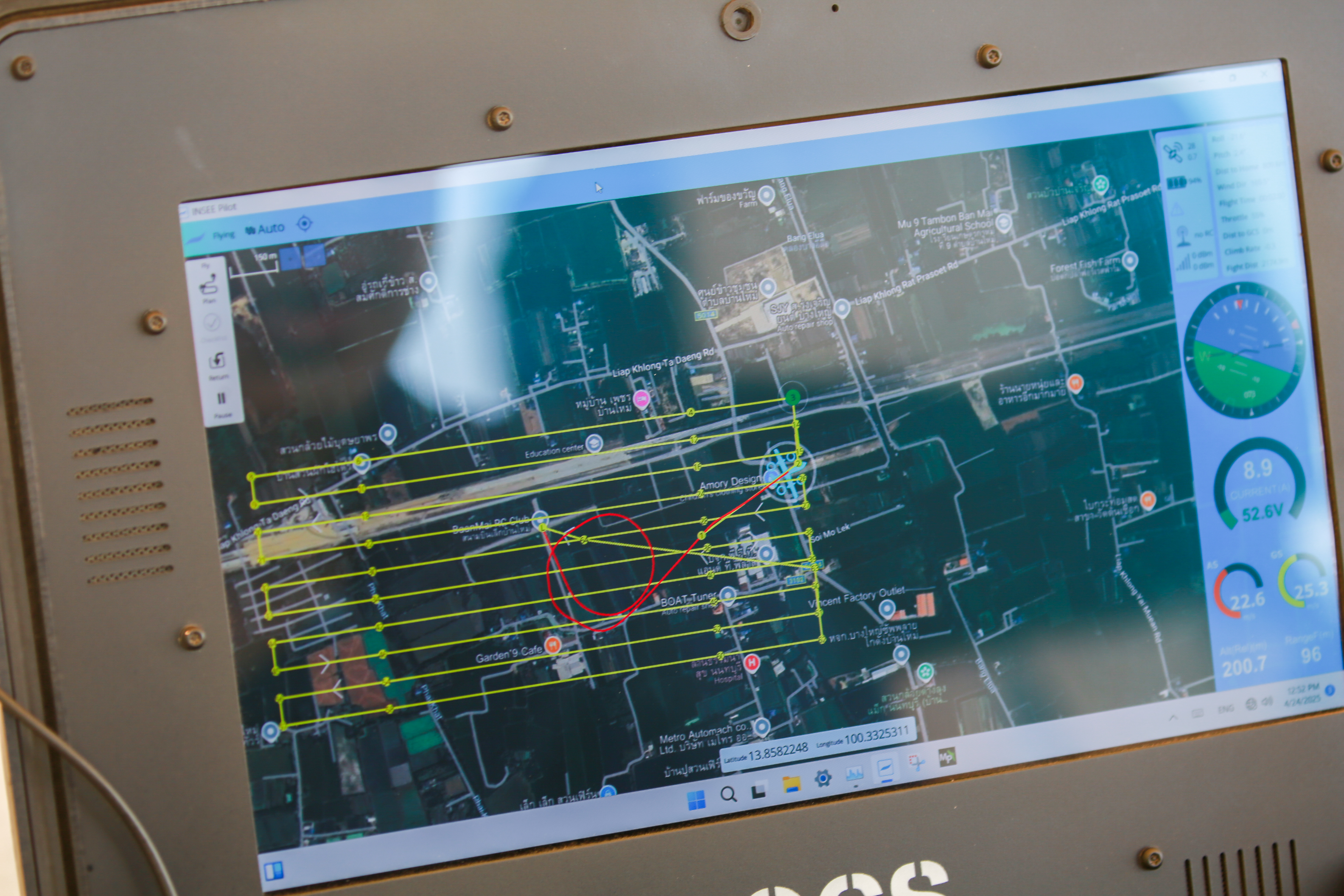
INSEE-GCS-01
INSEE Pilot Ground Station
Ground Station configurable for your mission — supports 10–15" display, Intel Core i5/i7, up to 16GB RAM, up to 10-hour battery life with INSEE Pilot software and ADS-B for situational awareness.
Ready to level up your survey work
with the INSEE-250?
Contact the INSEE UAV team — get expert advice, a live flight demo, and end-to-end solutions for Mapping, LiDAR Survey and Multi-sensor Payload missions.
INSEE UAV — Engineered in Thailand · Operated by Thai Sky Vision Co., Ltd.