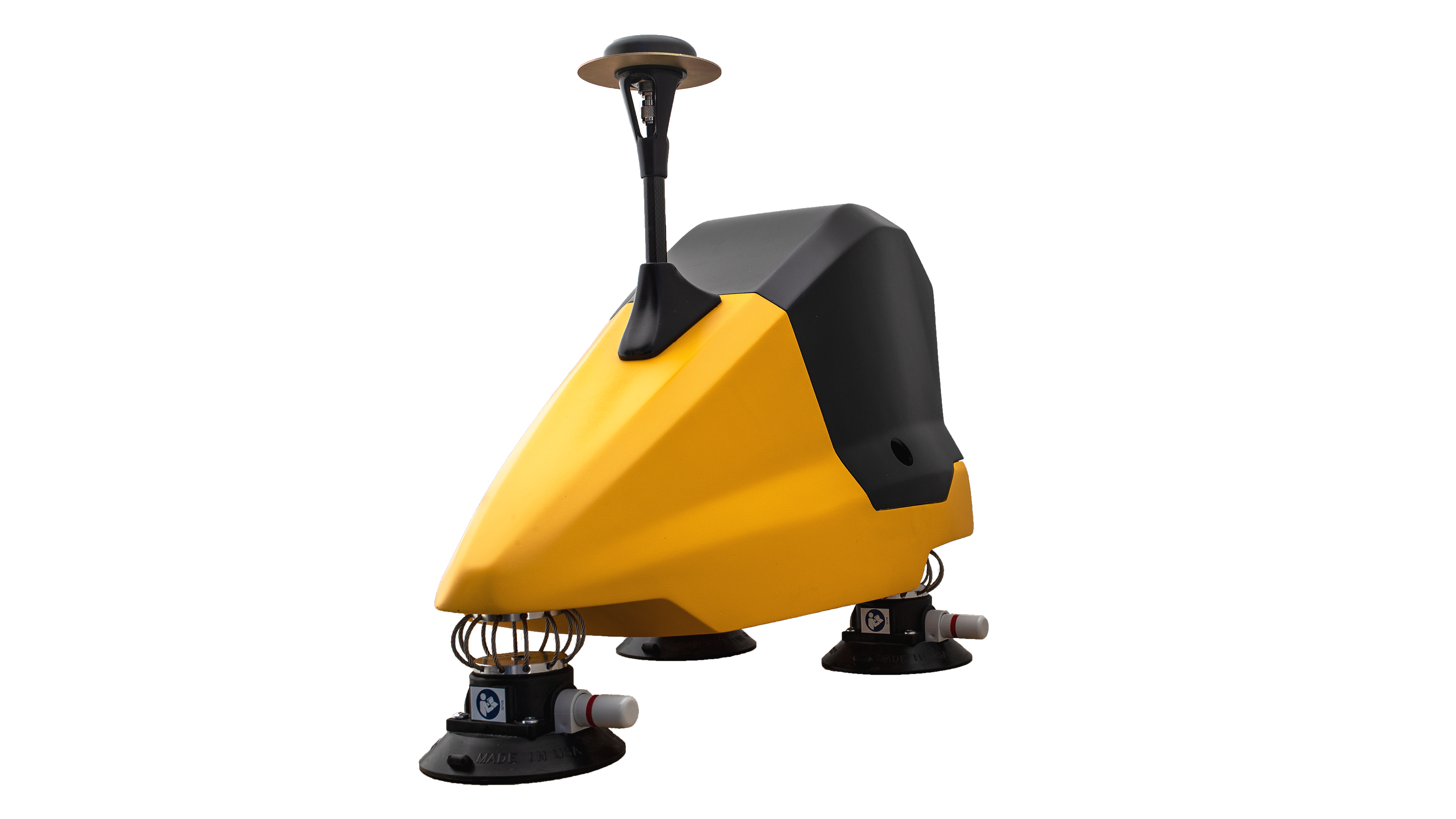
INSEE UAV Logo
EN TH
verified Official YellowScan Distributor in Thailand · Operated by Thai Sky Vision
DUAL-MODE UAV + VEHICLE 360° Scan
YellowScan
YellowScan
Fly&Drive.
Fly when you can, Drive when you must.

A versatile LiDAR solution that combines airborne UAV mapping with land-vehicle mobile mapping in one system. Built around the YellowScan Surveyor Ultra LiDAR and an Applanix APX-15 GNSS-Inertial — collect geo-referenced point clouds from the air or the road, across a wide range of applications.

YellowScan Fly&Drive
swap_horiz

Multi-Purpose
Air + Ground

Operates in both Airborne (UAV-mounted) and Mobile (vehicle-mounted) modes — capture aerial or ground data with a single set of equipment.

my_location

Precision
Positioning

High-end GNSS and IMU coupled system based on the Applanix APX-15 — supports both Airborne and Mobile mapping dynamic models out of the box.

bolt

Easy to Use
Lightweight

Simple to operate, lightweight and low power — 1.18 kg in airborne config and 5.6 kg in mobile config (battery included), keeping installation and operation straightforward.

flight

Universal
Integration

Mounts on a wide range of UAVs (multirotor, fixed-wing) and on land vehicles. Includes a mounting bracket for DJI M300 / M600 and a roof-mount car pod with suction cups.

Technical Specifications.

3 cm
Precision
3 cm
Accuracy
360°
Scanner Field of View
140 m
Max Range
640K
Shots per Second
25 km/h
Typ. Driving Speed
1.18 kg
Airborne Weight
5.6 kg
Mobile Weight
APX-15
GNSS-Inertial

System Components.

LiDAR Unit

LiDAR SystemYellowScan Surveyor Ultra
ScannerHesai XT32M2X
Precision2 cm
Accuracy3 cm
Field of View360°
Maximum Range140 m
Shots/sec640,000
Typ. Driving Speed25 km/h

IMU / GNSS

GNSS-InertialApplanix APX-15
Multi-ConstellationGPS, GLONASS, GALILEO, BEIDOU
Dual Dynamic ModelAirborne / Mobile mapping
AntennaGNSS L1/L2 survey grade

* Post-processed solution, without GNSS outage.

flight_takeoff
1.18 kg
Airborne (w/ battery)
directions_car
5.6 kg
Mobile (w/ battery)
square_foot
16 × 10.5 × 14 cm
Airborne Dimensions
square_foot
57.4 × 31.5 × 44.3 cm
Mobile Dimensions
landscape
Open Air

For open-area scenarios

Ideally suited for mobile scanning in open-air areas with strong GNSS reception and unobstructed terrain.

  • YellowScan Surveyor Ultra LiDAR unit
  • Mounting bracket for DJI M300 / M600
  • Car Pod with suction cups
  • Roofbars adaptor for Fly&Drive Pod
  • Software: CloudStation, Strip Adjustment
  • Software: POSPac UAV, POSPac MMS
  • LiDAR MMS APX-15 firmware
  • Odometer (DMI): Optional
apartment
Canyon

For urban & GNSS-critical areas

Optimized for urban areas with GNSS canyoning, including tall buildings, tunnels and other GNSS-restricted environments.

  • YellowScan Surveyor Ultra LiDAR unit
  • Mounting bracket for DJI M300 / M600
  • Car Pod with suction cups
  • Odometer (DMI) — included in package
  • Roofbars adaptor for Fly&Drive Pod
  • Software: CloudStation, Strip Adjustment
  • Software: LiveStation, Terrasolid TerraScan + TerraMatch
  • Software: POSPac UAV, POSPac MMS
  • LiDAR MMS APX-15 firmware

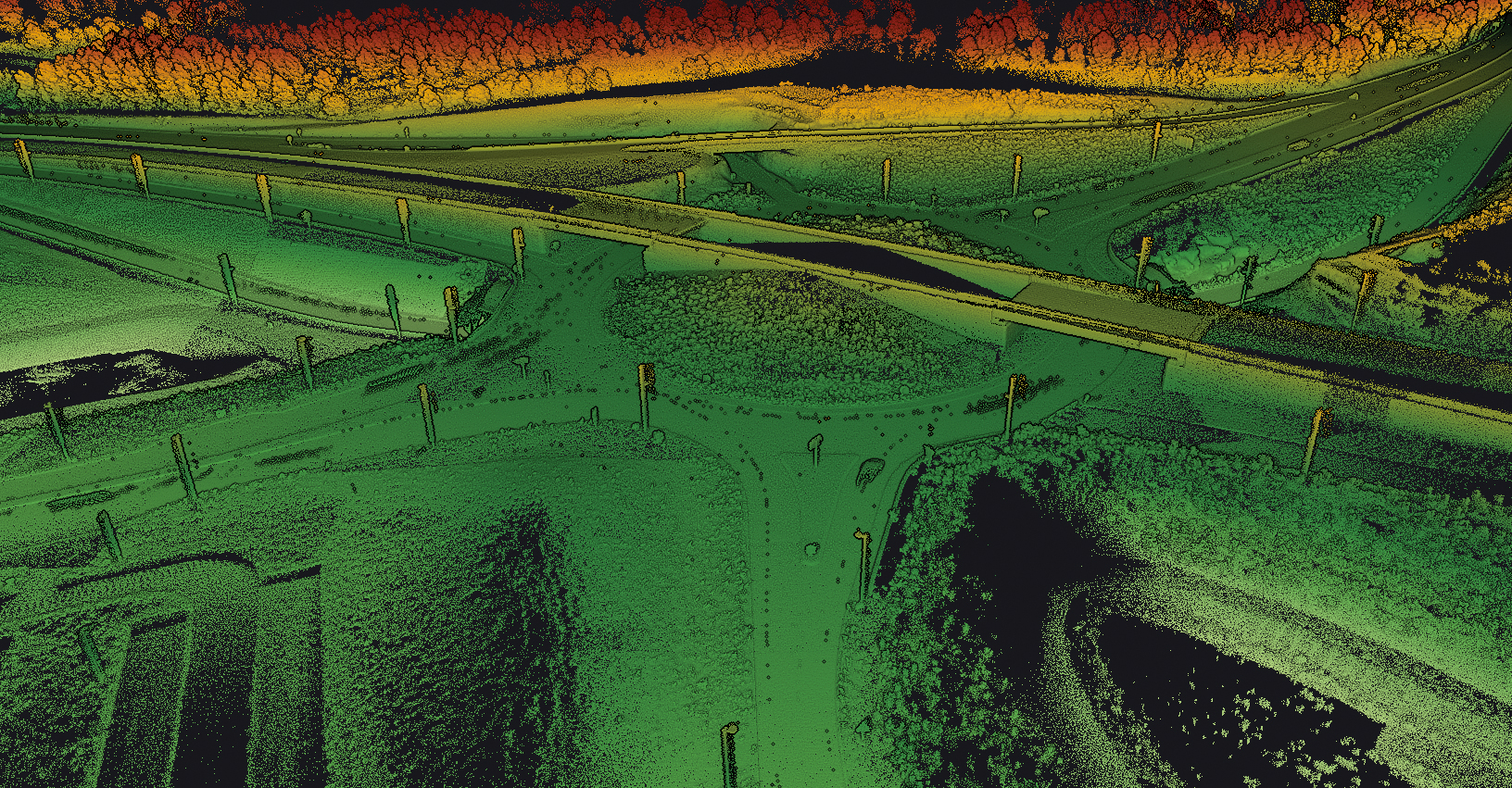
Application Scenarios.

Open Air

Mobile ScanningBasic open area
Airborne UAV MappingDJI M300 / M600

Canyon

Urban AreaGNSS canyoning
Stop and GoTraffic lights
TunnelsGNSS-denied, by car
CoverageUp to 100 m

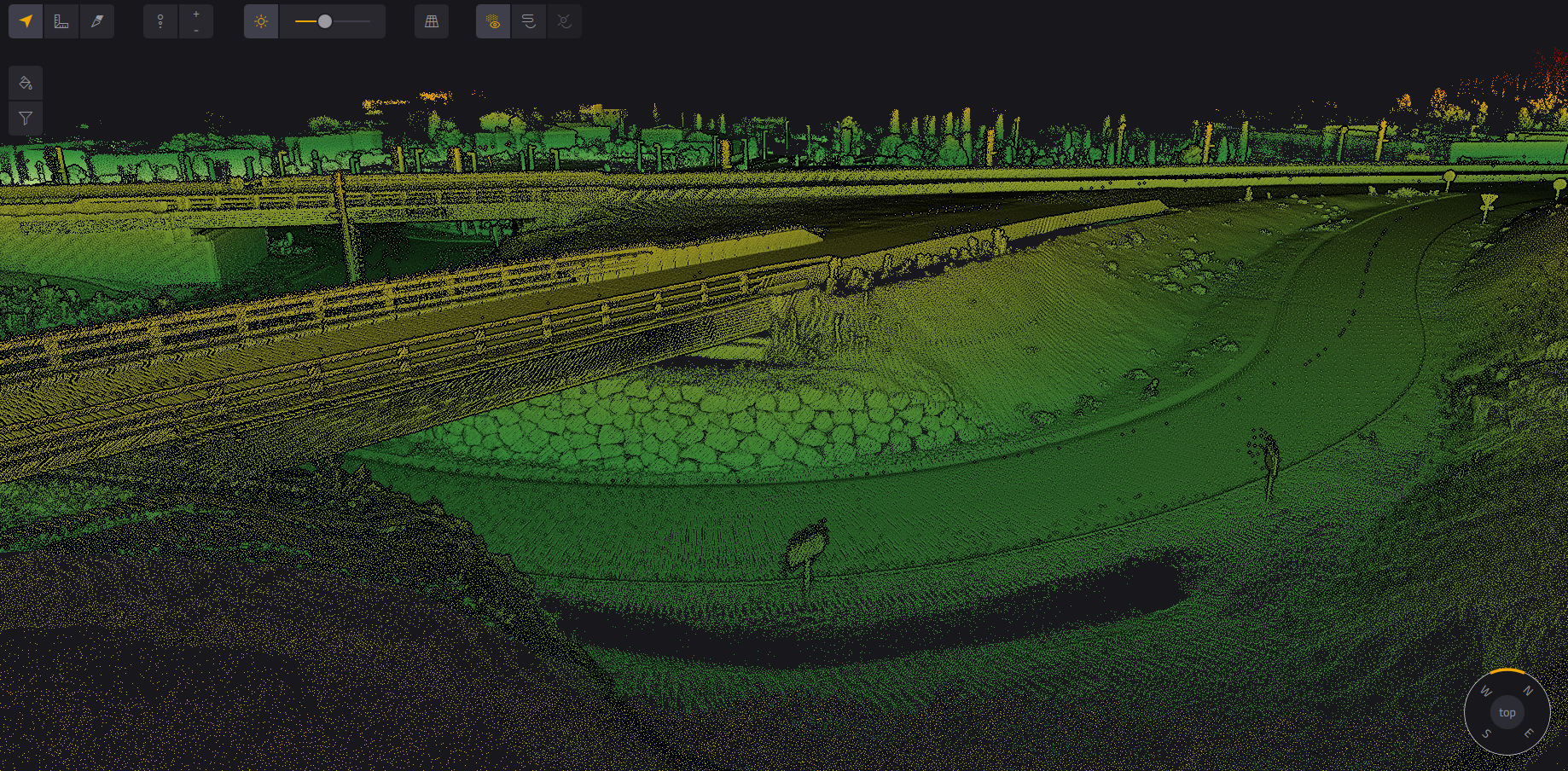
Note: These reference images are from YellowScan global portfolio — not from INSEE UAV missions — shown to demonstrate sensor capability.

flight Airborne Mode

UAV Platforms

Mounts on a wide range of UAVs via a quick-mount bracket — supports DJI M300 / M600, plus other multirotor and fixed-wing platforms.

Drone

DJI M300

Drone

DJI M600

Weight

1.18 kg

Integration

Multirotor / Fixed-Wing

directions_car Mobile Mode

Roof-Mounted Vehicle

Roof-mounts on a vehicle via the Car Pod with suction cups or roofbars adaptor — ideal for mobile mapping and areas a UAV cannot reach.

Mount

Car Pod

Material

Aluminum + Fiberglass

Weight

5.6 kg

Driving Speed

25 km/h typ.

YellowScan × INSEE UAV

Ready to capture data from the air
and the road with Fly&Drive?

Contact Thai Sky Vision, Official YellowScan Distributor in Thailand — for consultation, dual-mode LiDAR demos, and full after-sales support.

www.inseeuav.com

Thai Sky Vision Co., Ltd. — Official YellowScan Distributor in Thailand

#INSEEUAV #YellowScan #FlyAndDrive #LiDAR #MobileMapping #UAVMapping #ThaiSkyVision #UAVSurvey

handshakeRequest Demo