360° Surveying
& Mapping
A 360° × 40.3° all-around scan captures every direction — ideal for Topographic Surveys, Forestry, and Urban Mapping that demand full-coverage data.
Easy to Use
and Process
Easy operation through YellowScan Command Center over Ethernet — paired with CloudStation for fast post-processing, and SBG Qinertia for GNSS/INS processing.
Ultra-Light
< 800g
Just 754 g with a built-in RGB camera — the lightest in the 360° LiDAR class, perfect for VTOL and Fixed-Wing UAVs running lightweight payloads.
Built-in RGB
Camera
A built-in RGB camera colorizes the point cloud on the spot — no extra payload to carry, reducing weight and installation complexity.
Technical Specifications.
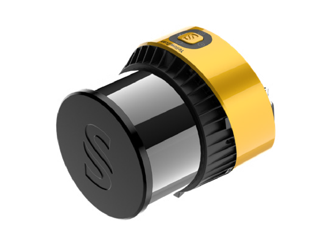
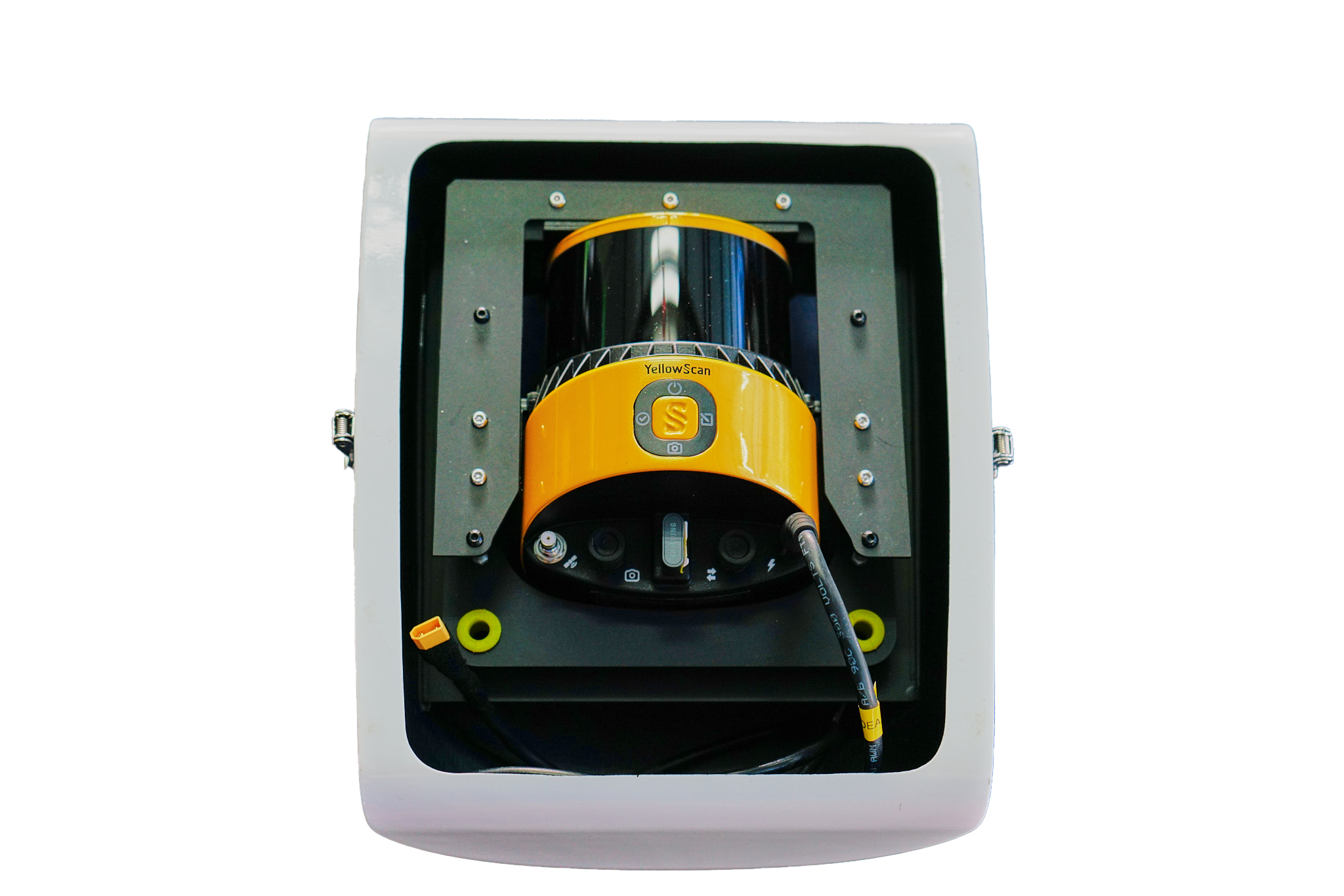
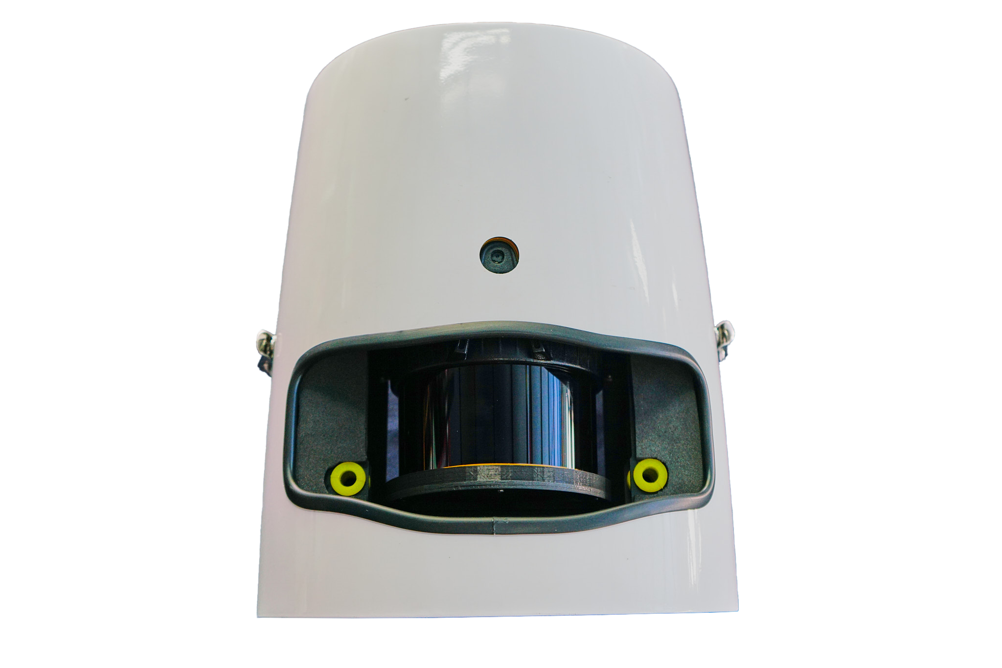
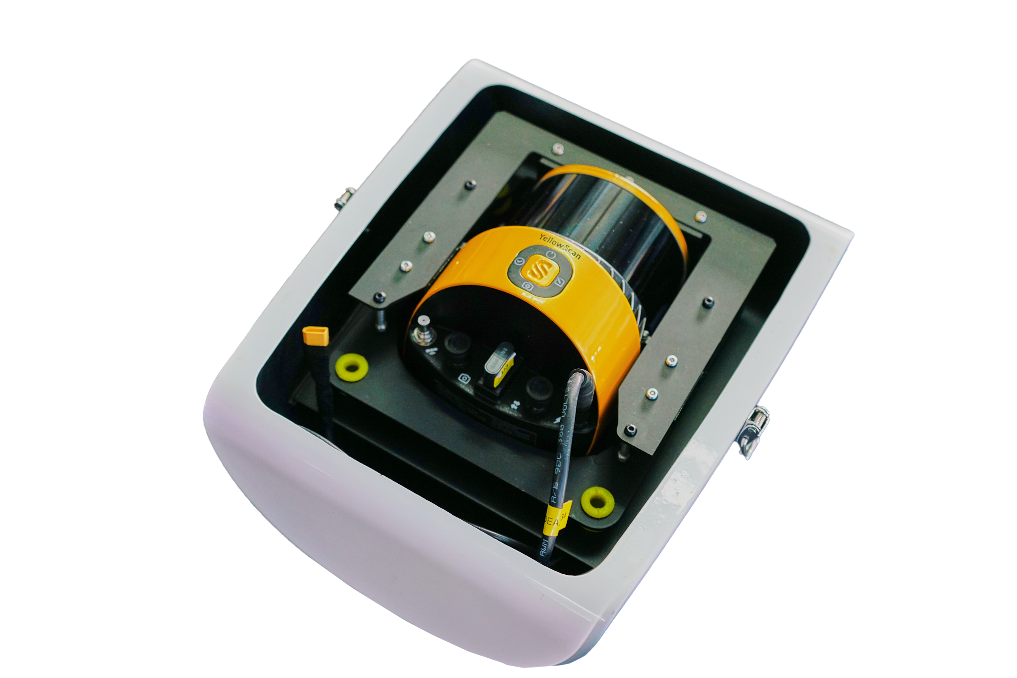
System Components.
Laser Scanner
GNSS / INS
Point Density Table.
| Parameter | Value |
|---|---|
| Typ. Flight Speed | 18 m/s |
| Typ. Flying Height | 100 m AGL |
| Max Rec. Flying Height | 120 m AGL |
| Point Density | 34 pts/m² @ 100m AGL, 18 m/s |
| Weight | 0.754 kg (incl. RGB camera) |
| Operating Temp. | -10°C to +40°C |
* Point density theoretical max. May vary depending on flight and survey conditions.
Hardware
- YellowScan Surveyor Ultra OEM unit
- Rugged Pelicase carry case
- UAV GNSS Antenna + Cable
- 2 USB Flash Drives
- User documentation
Services
- 1-year warranty + unlimited Technical Support
- Boresight Calibration Certificate
- Local Support by Thai Sky Vision, Official Distributor in Thailand
Software
- YellowScan Command Center — Configure & Monitor via Ethernet
- SBG Qinertia — Post-process GNSS & inertial data
- CloudStation Essential — Visualize, inspect, colorize & export
CloudStation
Visualize, inspect, and colorize from orthophotos, then export ready-to-use data — included in the package.
CloudStation
Adds Data Quality Refinement, Classification, Color Enrichment and advanced export features.
CloudStation
Every feature included — Orthophoto Generation and Command Line (ytk) for automation and batch processing.
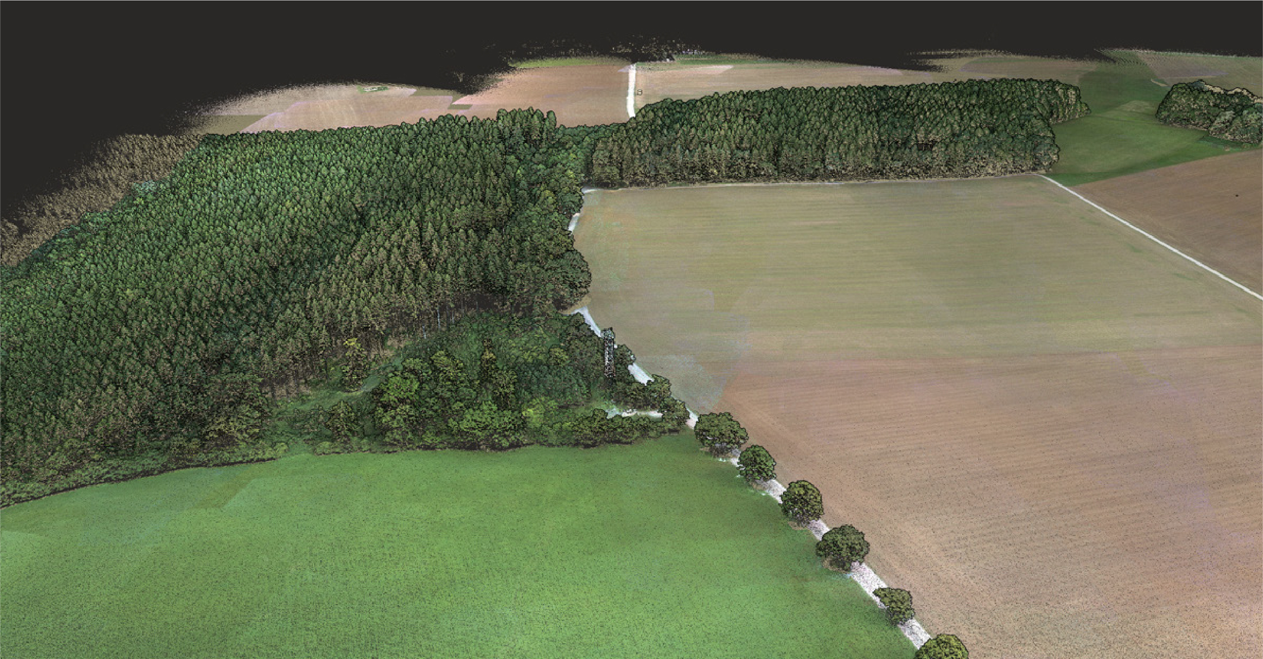
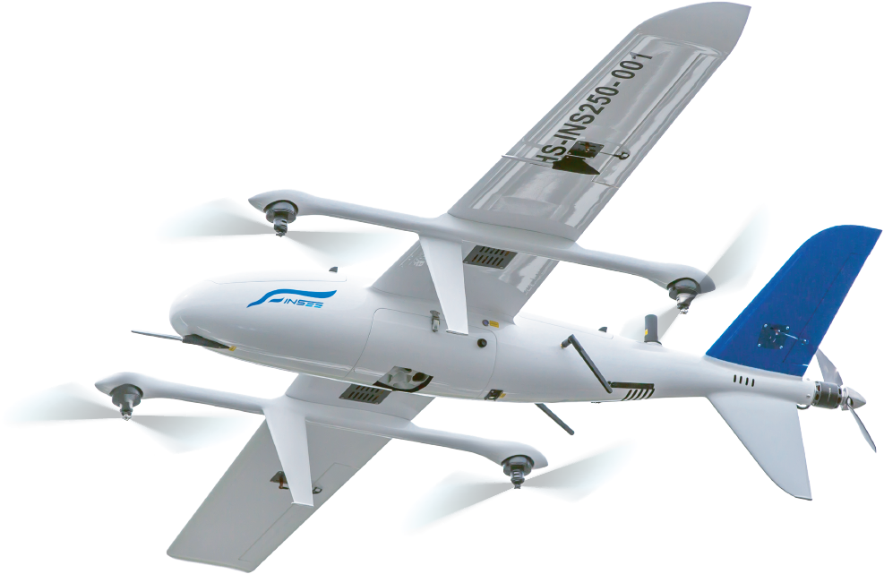
Surveyor Ultra III OEM on INSEE-250.
Real photos: Real installation and field operation imagery of INSEE-250 + YellowScan Surveyor Ultra III OEM.
INSEE-250 + Surveyor Ultra III OEM
— Koh Samui
YellowScan Surveyor Ultra 3 OEM
(FOV 120° × 40.3°)| Speed | Altitude | Point Density |
|---|---|---|
| 23 m/s | 100 m AGL | 27 pts/m² |
| 23 m/s | 150 m AGL | 18 pts/m² |
| 27 m/s | 100 m AGL | 23 pts/m² |
| 27 m/s | 150 m AGL | 15 pts/m² |
| 30 m/s | 100 m AGL | 21 pts/m² |
| 30 m/s | 150 m AGL | 14 pts/m² |
* Parameters referenced from YellowScan Brochure — this demonstration mission used the values shown above.
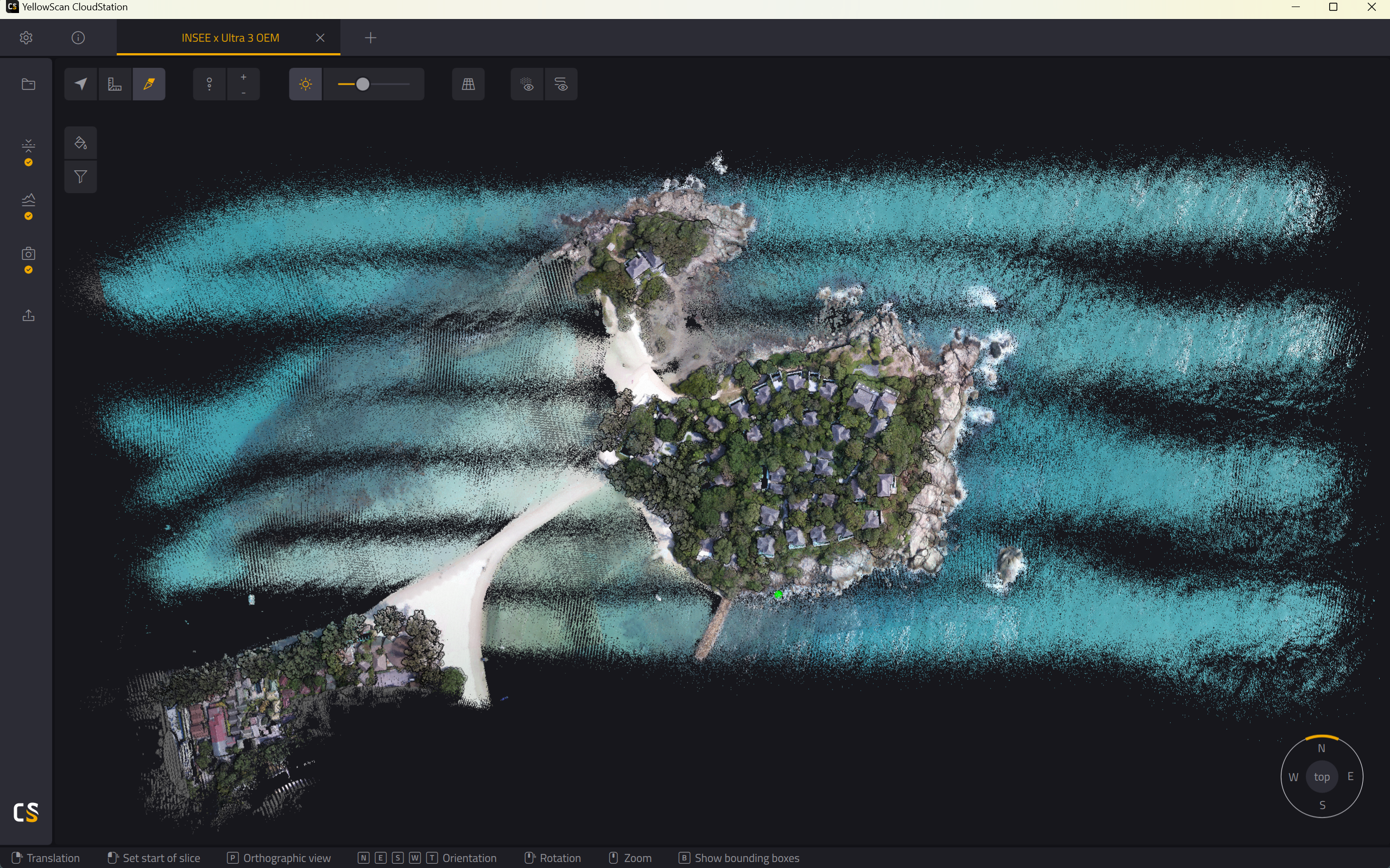
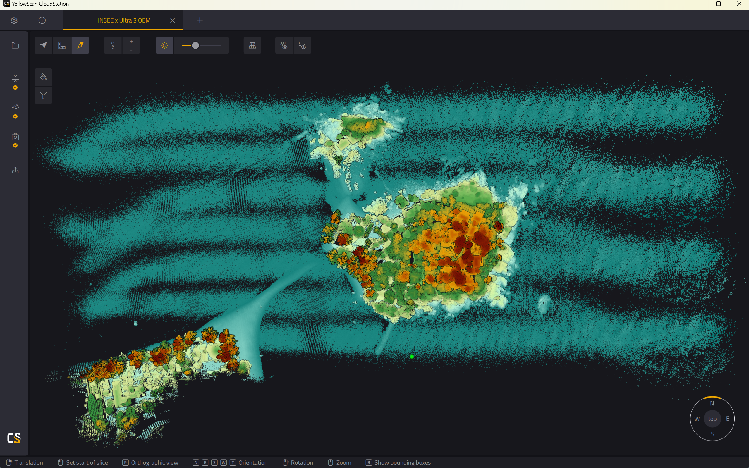
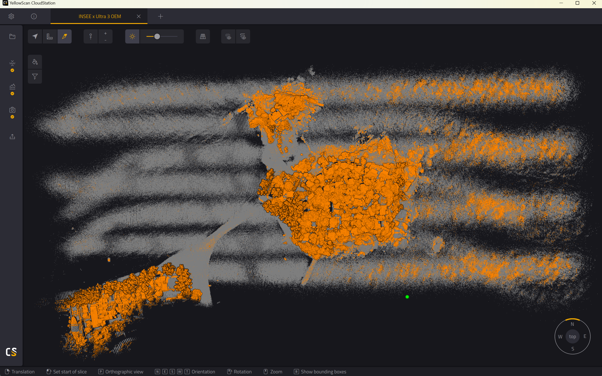
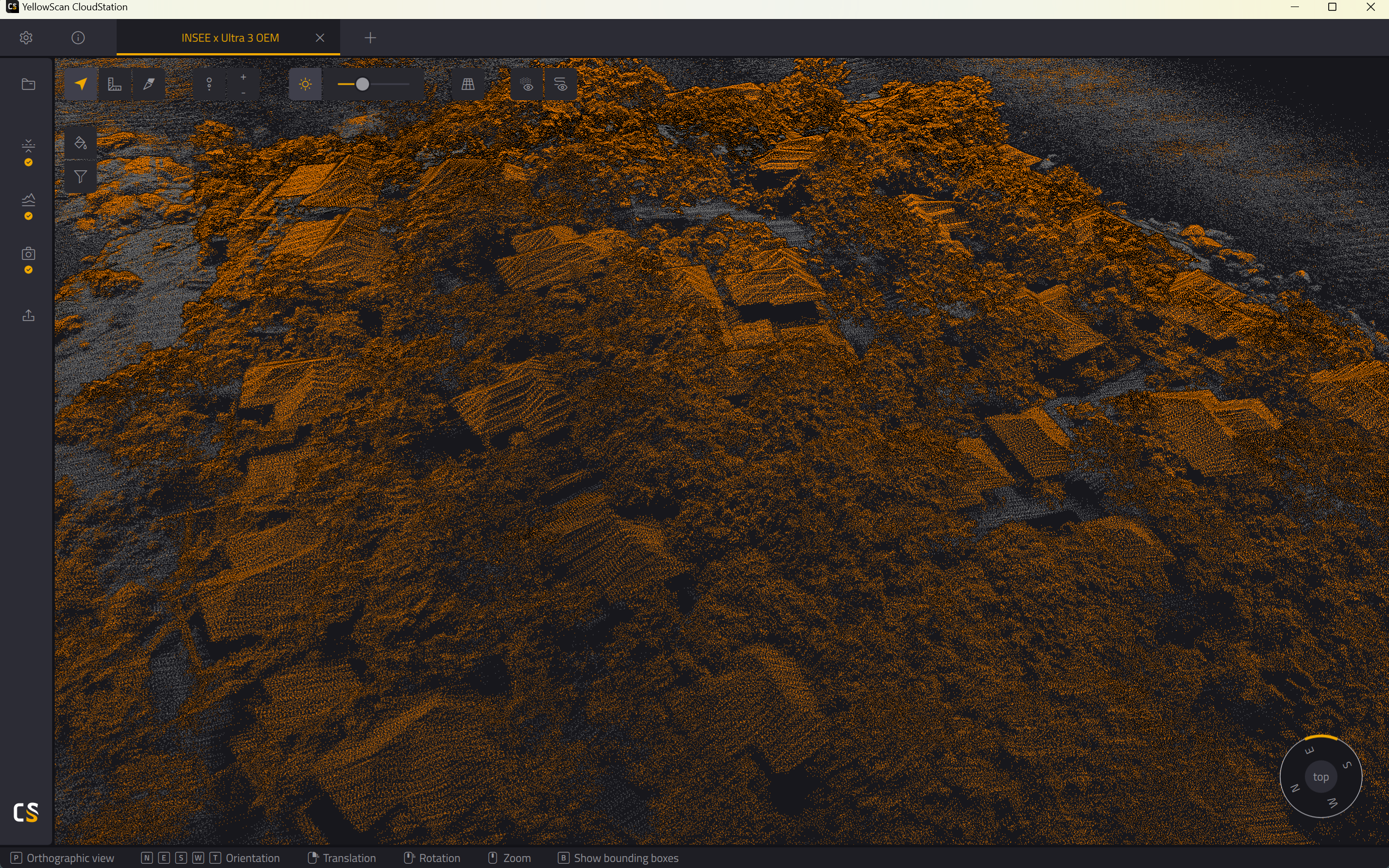
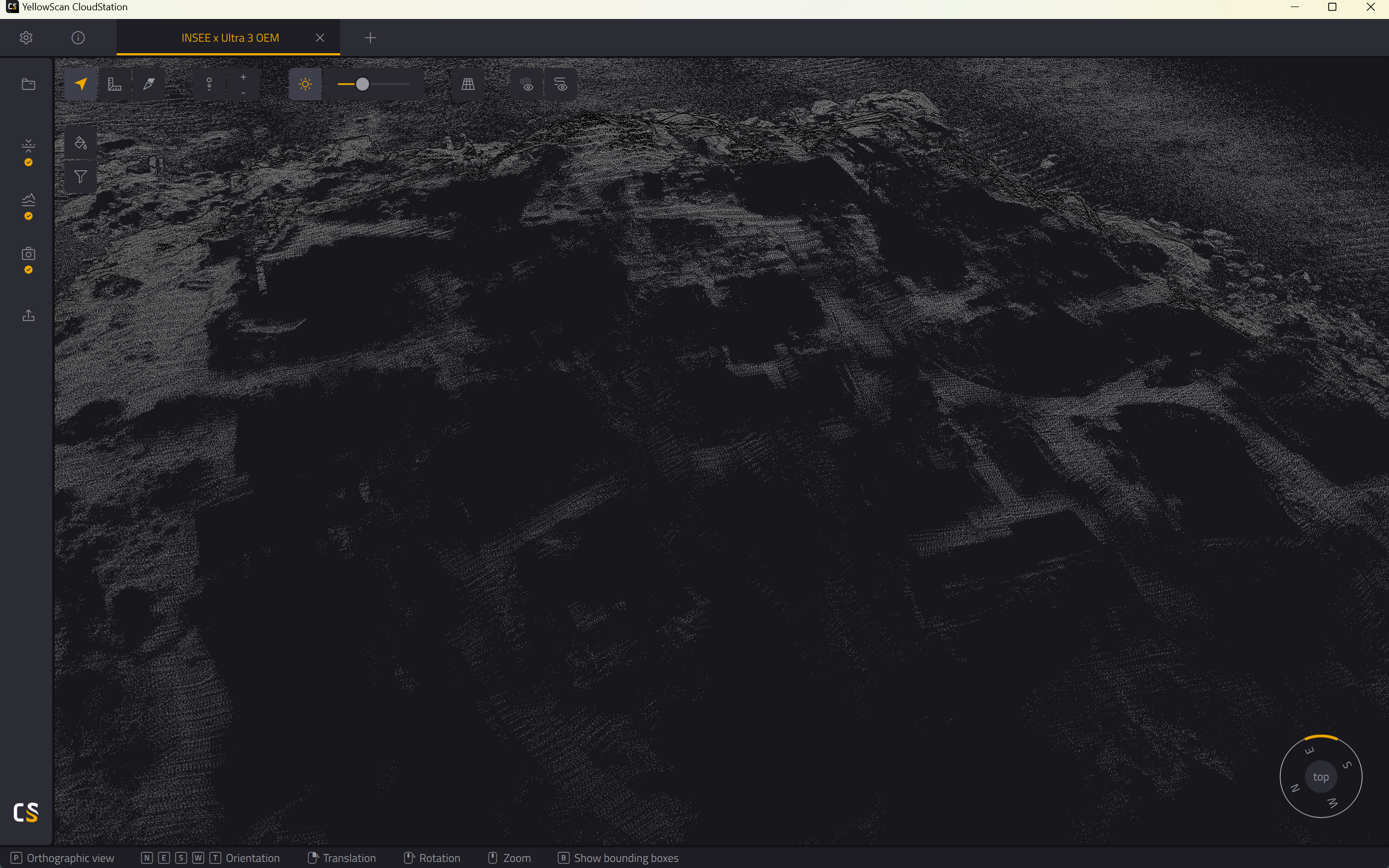
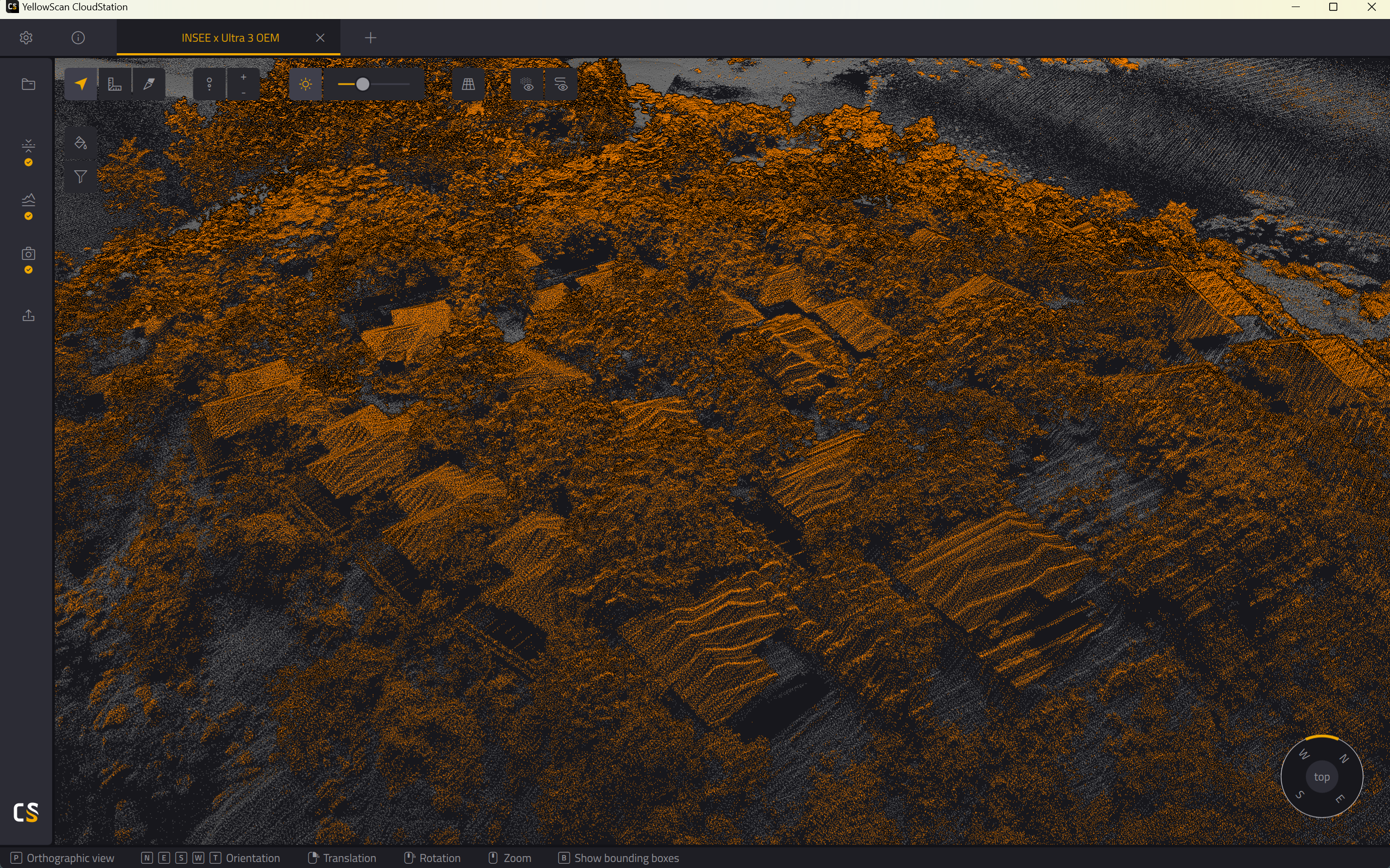
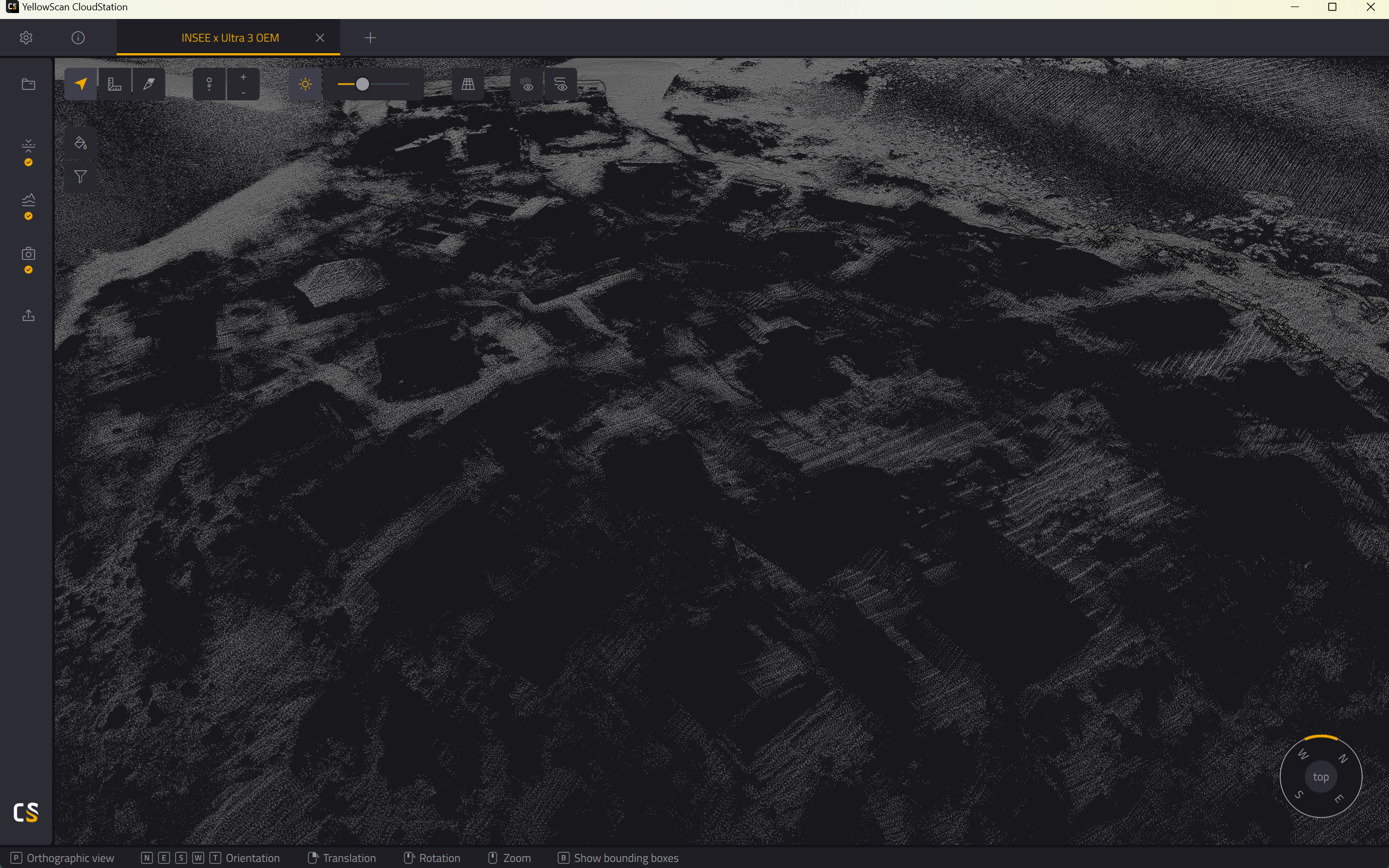
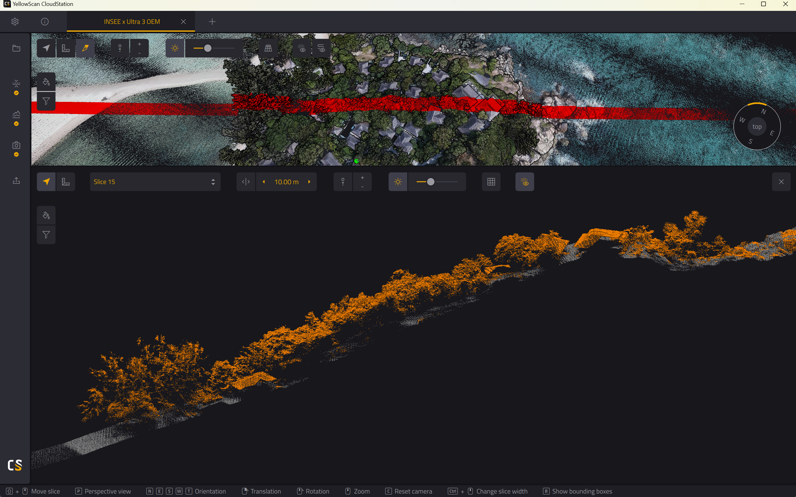
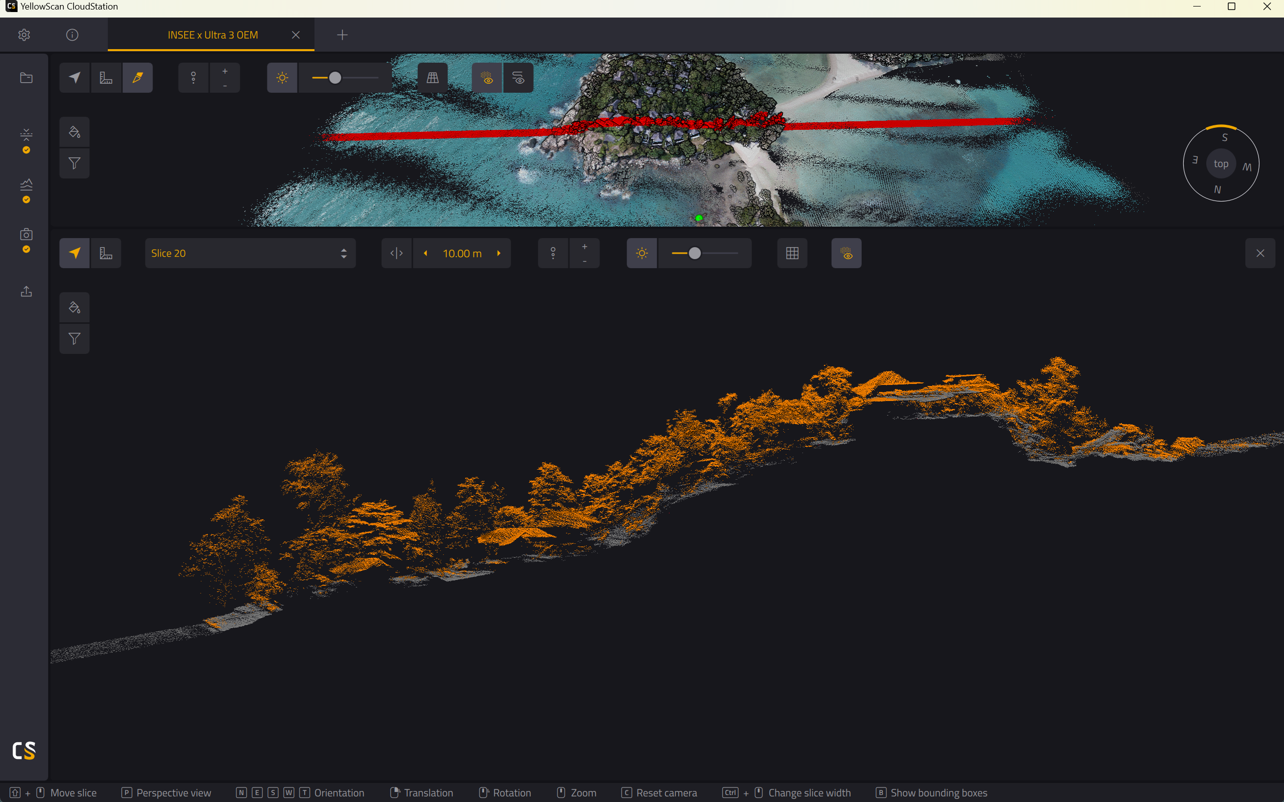
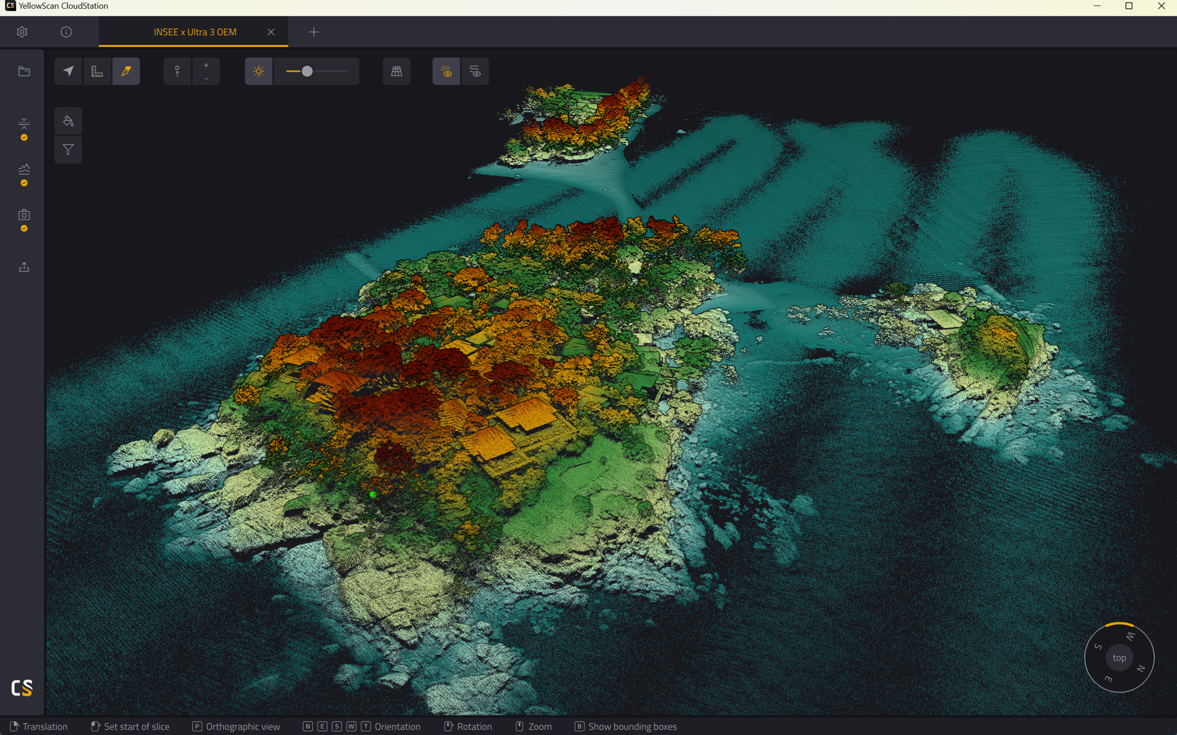
Featured work: Point Cloud imagery from real survey missions with INSEE-250 + YellowScan Surveyor Ultra III OEM.
Ready to mount 360° LiDAR on your UAV
with Surveyor Ultra III OEM?
Contact Thai Sky Vision, Official YellowScan Distributor in Thailand — for OEM Integration consultation and full After-Sales Support.
Thai Sky Vision Co., Ltd. — Official YellowScan Distributor in Thailand